Travelogue, September 4 to 24, 2021Newfoundland, Labrador, Nova Scotia, New Brunswick, Prince Edward Island and Cape BretonFriday/Saturday, September 3-4, 2021: Vancouver, B.C. to Corner Brook, Newfoundland
In the summer of 2021, not having travelled since June 2019 due to the pandemic, I was hearing of others going off to foreign parts once again and although I did not think it prudent to travel overseas, I figured I could travel closer to home. Never having been East of Quebec in Canada and things being safe at the time to go there, I opted to combine two bus trips offered by Globus. Not only could I tick Newfoundland and the three Maritime provinces off my bucket list but also an additional two regions, namely Labrador and Cape Breton. By then I had been double vaccinated and as long as I filled out a couple of online forms, namely for Newfoundland and Nova Scotia, I was allowed to travel there. As I would be transiting through the Toronto Pearson airport which had no additional restrictions and as New Brunswick and Prince Edward Island were Covid free, all things looked safe so I booked as a single traveler with my own room some time in August. On September 3, 2021, therefore, I took an overnight Air Canada flight from Vancouver to Toronto which was on time but the Air Canada flight from Toronto to Corner Brook, Newfoundland (Deer Lake airport), where the tour was to start, was delayed for various reasons but at least it flew. Those on our bus trip who had booked to travel with West Jet were not as lucky since their flight was cancelled altogether and they weren't able to fly out until the next day. While waiting at Pearson, I managed to meet three other people on our tour and then, on our arrival in Corner Brook, I realised that about eight of us had taken the same flight. Instead of arriving around 10 a.m. as scheduled we rolled in around 4 p.m. but still in plenty of time for the watered-down meet and greet - really just picking up a map and an itinerary and meeting the tour leader. I skipped the informal dinner with the others as I had brought some cold pizza from home that I ate in my room. It was interesting to me that the place we were staying at in Corner Brook, the Glynmill Inn, used to be the Newfoundland Pulp and Paper Company's executive guesthouse. This mill was later, I believe, taken over by Bowater. There is still a pulp and paper mill in Corner Brook, now called the Corner Brook Pulp & Paper Mill (what an original name!) and owned by Kruger Inc., which is a major employer for the region, and, as I understand, in fact, fairly front and center to the economy of Newfoundland's second largest city.   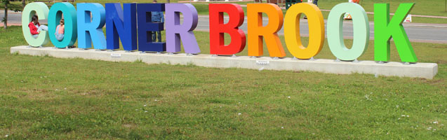 Sunday, September 5, 2021: Corner Brook, Newfoundland - Humber Arm - Bay of Islands - Frenchman's Cove - Lark Harbour - Corner Brook, Newfoundland
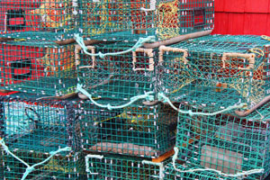
After breakfast in a private dining room at which our tour director Mel Brand (from Halifax, Nova Scotia but originally British and who still retained his British accent) gave us a synopsis of our itinerary and the news that we were a bus tour of 41 passengers (egad!) but that some of us had not yet arrived yet, partly due to the West Jet flight cancellation but also due to some Americans being stuck at the Canada/US border awaiting results of their covid test. Of these 41 passengers, we had representatives from Vancouver (3), Alberta, Manitoba (7), Georgia, Virginia, Colorado, California, two singles from Montreal and the rest were all from Ontario. Before we stepped onto the bus, our temperatures were taken and we had assigned seats which rotated by two rows each day. While on the bus, we were obliged to wear masks, but not while outside in the fresh air (though distancing was encouraged) or at mealtimes. We were also introduced to our bus driver Rod - a Newfoundlander, whose accent was a teeny bit difficult to understand but he was certainly very friendly and helpful. Thus we set off for our first day to visit the region slightly north-west of Corner Brook as we would be coming back to the same hotel for the night, thus giving the others who hadn't made it time to catch up. Our first stop was the Captain James Cook Historic Site on a hill overlooking the city of Corner Brook and the aforementioned pulp and paper mill. From 1763 to 1767 Cook, a cartographer and surveyor, was in charge of the first scientific, large-scale hydrographic survey to establish land outlines of the coast of Newfoundland. It was surprising accurate for the age and remained standard for centuries afterward. At the time, French surveys of the area were a bit sketchy and British ones were unreliable. Although the British had no intention of settling in Newfoundland, it was nevertheless British territory and they wanted to make sure the French were not infringing on British fishing grounds, fishing being Newfoundland's major resource. Cook kept amazingly accurate and detailed records of coastal conditions and the availability of wood, water and supplies. Due to his success in Newfoundland, he was then chosen to lead a voyage to Tahiti and then onward to Australia, New Zealand and Hawaii, etc. 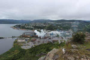  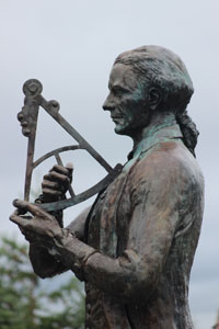 We continued up the Humber Arm towards the Bay of Islands and stopped at our first fishing village, Frenchman's Cove, where we saw our first boats and lobster traps and stretched our legs. Then we carried on west to Bottle Cove, where we were offered our first (and actually only as it happened) walk. I did not follow the crowd of retirees to the headland across a muddy track and instead photographed them on it from the shore along which I walked on my own, happy to breathe fresh salt-tinged air.
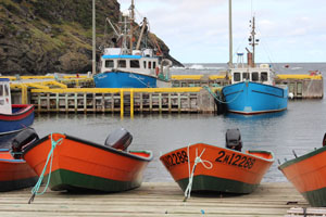
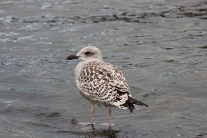
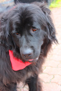
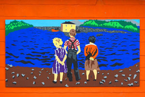
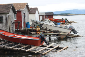  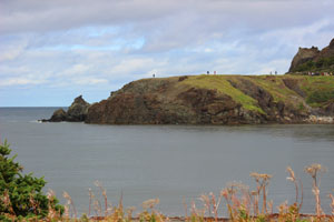 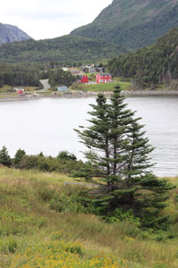 Next we travelled on for a short ride to a little port called “Little Port” (yet another original name) for photos of more boats and seagulls and had a late lunch at Lark Harbour at a restaurant called Myrtle's On the Bay. On our way back to our hotel we made a stop at a store full of this and that where we had the opportunity to photograph a Newfoundland dog. The painting on the side of the store caught my eye - children waiting for the men (as they invariably were) to come back in their boats laden with cod.
      Monday, September 6, 2021: Corner Brook - Gros Morne National Park - Port au Choix - St. Barbe, Newfoundland
Our straggling passengers having arrived at our hotel yesterday, we were able to set off for parts Northern: basically up the west coast of Newfoundland past Deer Lake airport where I think the last two passengers joined us, or perhaps it was just their luggage, and up towards Gros Morne National Park. I was disappointed to find that we would not be exploring the park as it is pretty famous, but I guess that's what you get with a bus trip as opposed to a hiking trip and we had to drive quite a distance today to visit all the things we did. So as we headed toward our lunch stop at Cow Head toward the end of Gros Morne Park, we had an interesting stop about a third of the way into the park at our first lighthouse located at the head of Lobster Cove. The interpretive plaques read as follows: “For more than 100 years this clapboard building was both a home and a workplace. And despite this windy cliff-top setting - not to mention the demands of the big light out back - life for the keeper and his family mirrored what went on up and down this coast. The families who lived here put in gardens and kept chickens and a cow. They hauled water year-round from a well. They hunted caribou - or traded with the neighbours: bullets for meat. They bought some supplies but worked hard to gather, grow or make much of what they needed to get by. And when it was time to be social, well with that light to tend, the party usually came to them. After the first lightkeeper - Robert Lewis - died, two generations of the Young family called this lighthouse home. George Young, the last keeper, and his wife, Mildred Parsons, raised six children here. Some Young family members still live nearby.” It was a cold day despite being September (and my thinking the weather would still be warmish) and I was freezing in my jean jacket. Moreover, as the lighthouse cum museum was small and we were such a large group we had to be divided into two. There was a lot of standing around waiting and shivering (for me at least). On our way to and from this lighthouse from where the bus was parked, we noted some old outhouses so of course we decided we all had to go at once ... and make it a photo opportunity! Other interesting phenomena were the cleanliness and shapes of rocks on the shore. Another house here a little distance from the lighthouse which had also been lived in by generations of families with numerous children, had no windows at the back I noticed but there were still washing lines on which to dry their clothes. A pretty hard life indeed.   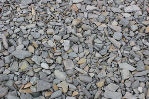  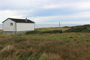  After lunch, we continued north to Port au Choix, a barren limestone area and a National Historic Site of Canada. This community is regarded as one of the richest archaeological finds in North America. From burial sites uncovered in the town in the 1960s & 70s some of its earliest settlers - from the Maritime Archaic Indians to the Groswater and Dorset Paleoeskimos to the Recent Indians (ancestors of the Beothuks) were discovered - representing some 6,000 years of history. Preservation was no doubt aided by the raised shoreline and alkaline soil conditions here. I was particularly interested in some of these prehistoric exhibits as I had spent several weeks of my summer translating about 75,000 words from French into English about the stone tools of Paleoindians and Beothuks in Labrador and Northern Quebec, not to mention the Mi'kmaq and the Innu.
Still our day wasn't quite over yet and on we drove up the coast, stopping for a coffee break at Plum Point (and for some people to shop), finally arriving at our hotel at St. Barbe from where our ferry over to Labrador would leave early tomorrow morning. We finally had a welcome drink offered by Globus and I was able to meet some of the other passengers in a more convivial atmosphere. Tuesday, September 7, 2021: St. Barbe - Blanc Sablon - Red Bay - L'Anse-au-Clair, Labrador It was a wet and rainy day for our ferry ride over to Labrador across the Strait of Belle Isle. The sea wasn't rough mind you but it did mean I didn't go out on the deck to see the whales that were purportedly seen in the distance by some of our group. However, as I am a linguist, I was most intrigued listening to the truck drivers who were ferrying their large trucks over to the mainland and who happened to be sitting around me. I knew they were speaking English, as opposed to another language, but I couldn't for the life of me understand anything. It was partly the way they spoke - hardly opening their mouths. Funny thing, the family behind me were also Newfoundlanders but they I could understand and apparently the two groups could understand each other too because they conversed. In any case, I thought if I were ever asked to interpret (into French, say) for a Newfoundlander, I'd be wise to ask for a conversation with them first to see if I understood their accent before confirming or refusing. On our arrival in Labrador where the rain was pouring down, we were stopped and asked to show our Covid-19 double vaccine cards. This was because the ferry from Newfoundland actually arrives in Quebec (Blanc Sablon) so we were re-entering the province of Newfoundland and Labrador. A couple on our bus had somehow missed having their covid cards verified at the Deer Lake airport on arrival, so there was a bit of a delay as they filled out the forms. Then we carried on driving up to Point Amour the site of another lighthouse - the tallest in Atlantic Canada, and the second tallest one in all of Canada, reaching a height of 109 feet. So of course I had to climb its 132 steps to the top. Its claim to fame is that it was the site of the shipwreck of the HMS Raleigh on August 8, 1922, which due to dense fog had veered off course to avoid an iceberg and ran aground. The ship's remains remained off shore for quite a few years until they were finally dynamited and sunk by the British Admiralty.  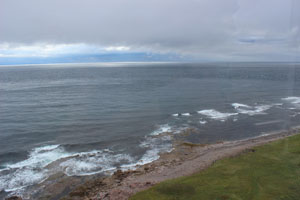   Our lunch stop was in Red Bay right across from the Red Bay Basque Whaling Station museum, a UNESCO World Heritage Site. This was the Northernmost stop we would go to in Labrador. About this site, Parks Canada writes: “Every year from the 1540s to the early 1600s, as many as two thousand Basque men and boys left their home in southern France and northern Spain and sailed across the North Atlantic Ocean. Their lucrative destination was some four thousand kilometres away in eastern Canada, along Labrador's Strait of Belle Isle and Quebec's Lower North Shore. Backed by ship owners and outfitters, the aim of their voyages was to hunt for North Atlantic and Greenland Right whales, render the blubber into oil on site, package it for transport, and bring it back home for market. Whale oil was a commodity highly prized in Europe as a brighter burning lamp oil and as a serviceable lubricant for leather products and an additive for paints, varnishes, and soap.” The UNESCO site adds “The station was used for some 70 years, before the local whale population was depleted.”
I was intrigued by one exhibit on clothing: “Archival Sources indicate that Basque whalers took a good supply of clothing and footwear with them on whaling expeditions to the Labrador coast. The average sailor took the following: 1. An overcoat and cape made of coarse, heavy, untreated woollen cloth; 2. Approximately seven sets of outer clothes consisting of a loose jacket with breeches or trousers; five made of woollen cloth or sailcloth and two made of skin or leather; 3. Five to seven linen shirts; 4. Undergarments; 5. Five or six pairs of stockings made of coarse woollen cloth; 6. Cloth for leggings to be worn round the stockings; 7. A pair of skin or leather boots; 8. Four to six pairs of skin or leather shoes; 9. Gloves; 10. One or more caps or hats. All these items were stored in a chest, barrel and/or bag. The Basque sailor also brought with him blankets and a mattress filled with straw to sleep on. ” On our way back down the coast to our hotel at L'Anse-au-Clair on the Labrador side, we stopped briefly at Anse-Amour, a burial site, basically a mound of rocks that is the “earliest known funeral monument in the new world and marks the burial place of an Indian child who died about 7,500 years ago... The body was covered in red ochre, wrapped in skins or birch bark and placed in a large pit 1.5 metres deep. Fires were lit on either side of the body and several spearheads of stone and bone were placed beside the head. A walrus tusk, harpoon head, paint stones and a bone whistle are also placed with the body.” 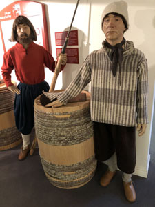 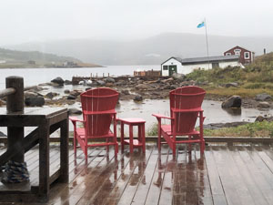 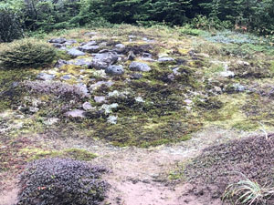 Wednesday, September 8, 2021: L'Anse-au-Clair - L'Anse aux Meadows - St. Anthony, Newfoundland
It was another long day of driving as we had to get from Labrador, across the Strait of Belle Isle again, then turn left at St. Barbe and go to the tip of Newfoundland's to Anse aux Meadows, the site of the first Viking settlement in North America, circa 1000 AD, and another UNESCO World Heritage Site. The plaque reads: “Discovered in 1960, this is the first authenticated Norse site found in North America and could be Leif Ericsson's short-lived Vinland camp. Some time about AD 1000, Norse seafarers established a base here from which they explored southwards. The trees of bog iron found - the first known example of iron smelting in the new world - in conjunction with evidence of carpentry suggest that boat repair was an important activity. The distance from their homelands and conflict with Native people may have led the Norse to abandon the site.” “L'Anse aux Meadows is the only authenticated site of Norse Settlement in North America. The Norse travelled here around 1000 AD. The archaeological remains of their sod buildings are the earliest known European structures in North America: their bloomery, or ironworks, the site of the first known iron working in the new world; the site itself the base from where they launched expeditions resulting in the first contact between aboriginal North Americans and Europeans. “In 1978, L'Anse aux Meadows became the first cultural site in the world to be inscribed upon the World Heritage list of the UNESCO Convention. Inscription on this list confirms the exceptional universal value of a cultural or natural site which deserves protection for the benefit of all humanity. L'Anse aux Meadows ranks among the major archaeological properties of the world.” I do remember we liked the guide who had a lovely, lilting, Newfoundland accent. It supposedly contains the remains of an 11th century Viking base camp (we could see the grass mounds of what we were told used to be buildings). Wikipedia says: “Spanning 7,991 hectares (30.85 sq mi) of land and sea, the site contains the remains of eight buildings constructed with sod over a wood frame. Evidence of iron production and bronze, bone and stone artifacts have been identified. The site was designated a National Historic Site of Canada in 1968 and a World Heritage Site by UNESCO in 1978... It is the only confirmed Norse site in or near North America outside of the settlements found in Greenland.” 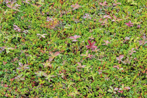 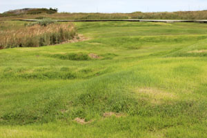 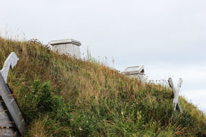 Thursday, September 9, 2021: St. Anthony - Gros Morne Area - Arches Provincial Park, Scenic Cruise on Bonne Bay, Newfoundland
Yet another long day of driving as we had to get across back to the West coast of the Great Northern Peninsula of Newfoundland and back down to Gros Morne National Park. However, it was a dry and sort of sunny day and we had a few stops to stretch our legs. On some of our long drives, the tour director would insert a DVD into the bus audio-visual system and thus we would learn a lot about the history of Newfoundland, including the struggles of cod fishermen to survive, healthcare by a visiting doctor from Ireland in the early 1900s, the whaling business, etc. Our first stop then was at Arches Provincial Park to see, and photograph, the natural rock formations and cairns that had been constructed. “The Arches showcase a geological formation formed over millions of years as a result of glacial action, wind, and water erosion, and other environmental changes. Severe storms continue to slowly change and erode the Arches. In the future, they will probably be reduced to rock pillars or sea stacks.” After a stop for lunch at the same restaurant we had been at two days ago in Cow Head, we had a brief stop in Gros Morne National Park at Western Brook Pond, for which the park plaque reads “During the last Ice Age, glaciers flowed off the Long Range Plateau more than a hundred times. Forging down valleys, each advance removed metres of rock. Over a period of more than two million years, glaciers scoured the river valleys into cliff-walled troughs, such as the ravine of Western Brook Pond.” I include a photo below. One of our passengers was a geologist from Montreal so he was very excited to see this and I suspect it was at his urging that we made this stop. After dropping our bags off at our hotel at Rocky Harbour for the night, we then went on a cruise of Bonne Bay for a couple of hours. Although the day stayed dry and we had an enigmatic (and musical) captain who, as the leader of the musical group, Anchors Aweigh, provided us with a concert of 3 or 4 pieces at the end of the cruise, there wasn't much to see except for a few semi-colourful houses, a lighthouse, a couple of eagles up high in trees, and some more geological rock formations. 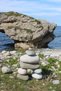 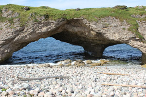  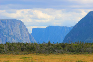 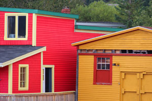  Friday, September 10, 2021: Gros Morne Area - Gander, Newfoundland
Today was perhaps the longest drive of all and I took no photos at all. We were presented with more entertainment of videos including the following song which really described accurately what we were seeing out our bus windows. My country's bigger than most
And if asked I boast 'Cause I'm really proud So I shout it loud Though our numbers are few We will welcome you Although we don't have history Gold medal winning teams Heroes or prisoners World famous volcanoes Still what we've got's glorious 'Cause we've got Rocks and trees And trees and rocks And rocks and trees And trees and rocks And rocks and trees And trees and rocks And rocks and trees And trees and rocks And water All right, everyone! We've got Rocks and trees And trees and rocks And rocks and trees And trees and rocks And rocks and trees And trees and rocks And rocks and trees And trees and rocks And water In Canada, Canada, Canada, Canada, Canada, Canada, Canada, Canada Canada, Canada, Canada, Canada, Canada, Canada, Canada, Canada song by Arrogant Worms After a lunch stop in Grand Falls-Windsor, we arrived in Gander in the afternoon and visited the aviation museum of old planes and stories of people who had travelled through Gander, including the more recent events of 9/11/2001: 38 commercial planes and four military aircraft were forced to land at Gander International Airport diverted from New York and Washington DC. This meant that some 6,500 passengers descended on several small towns in central Newfoundland to be hosted by locals for up to five days. I have a friend in Belgium who told me she had been one of those passengers so I was thinking of her during my visit to Gander. The show Come From Away is apparently all about this event, though during Covid it was not being shown here, to our regret.
Saturday, September 11, 2021: Gander - Twillingate - Terra Nova National Park - Clarenville, Newfoundland Today we finally started to see some colour in buildings - one of the reasons I had come to Newfoundland actually. From our hotel in Gander we drove north to Twillingate arriving midmorning to visit a fishing museum cum store full of knick-knacks and bits and pieces of information such as its history: “Twillingate was a summer base for hunting and fishing for the Beothuk as it had been for an earlier aboriginal people, the Dorset Eskimos. Twillingate, from the Breton place-name Toulinguet, was a French fishing station until the Treaty of Utrecht, 1713. It was settled principally by migratory fishermen. A strong resident merchant class developed a local fishery and in the 19th century Twillingate became one of Newfoundland's largest centres for the Labrador cod and seal fisheries.” There was also a description of the Provincial flag: “Officially adopted in 1980 - the flag's four blue Union Jack-like triangle reflects its Commonwealth heritage. Two triangles are outlined in red representing the island and the mainland portions of the province. The golden arrow points toward a bright future. A white background symbolizes ice and snow; blue the sea, and red, human effort.” We were given a demonstration of how they gutted a cod, cut out the cod tongues, which were delicacies, and made cod liver oil. There was also a separate building that showed the owner's collection of iceberg photos floating down Iceberg Alley. The tartan you see beneath the cups here with Newfoundland sayings is the official tartan of Newfoundland - apparently all maritime provinces have official tartans. And yes, that is a large cod between the photos of the two boys. After that, we headed to Crow Head, the northern point of Twillingate, site of the Long Point Lighthouse (which was closed to visitors) and gateway to Iceberg Alley, though there were no icebergs, nor any whales for that matter, to be seen. In fact, we were told that due to the earth's warming, no icebergs have been seen there for a while. We then drove South through Glovertown, hometown of Joey Smallwood (long-running premier of Newfoundland & Labrador and the instigator of Canada joining Newfoundland in 1949), and Terra Nova National Park, where we visited a small museum with an aquarium and a stuffed bald eagle, and ended up in Clarenville for the night in a hotel on the side of the highway. It was somewhere between Glovertown and Terra Nova National Park that our bus broke down and we sat on the side of the highway for an hour and a half as we waited for another bus from the Globus group to come and pick us up. We then used this new bus for the rest of the journey. 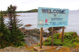 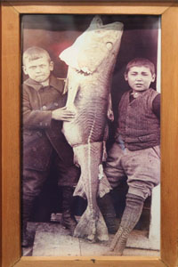 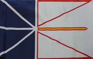 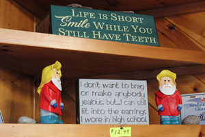   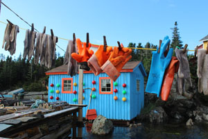 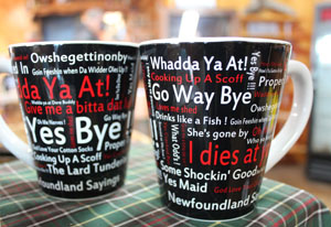 Sunday, September 12, 2021: Clarenville - Trinity - Cape Bonavista - St. John's, Newfoundland
We were now on Bonavista Peninsula and for some reason we were told we would not be going to Ryan Premises National Historic Site (perhaps it was closed due to Covid), where John Cabot had landed in 1497 - five years after Christopher Columbus sailed the ocean blue. More about Cabot later. This meant we arrived early in Trinity, a colourful, historic town on what was a beautiful sunny day, so I headed off for a walk on my own to photograph before lunch. The wooden barrel you see in one of the photographs below is a garbage bin. Prevalent throughout the Maritimes, it is where inhabitants put their garbage for the garbage men to pick up. Unlike our plastic government bins in Vancouver, Maritimers sometimes decorate them - painting them with various, bright colours or making them into whimsical shapes. After lunch, we were offered a tour of Trinity, but I soon became bored and explored a bit more on my own consequently finding these cod drying in the sun. We finally headed off to St. John's, Newfoundland and Labrador's capital city located on Avalon Peninsula, had a brief reconnoitre of the streets around our hotel by bus, then were checked into the Delta Hotel, where we would stay for two nights, and were left to our own devices (and by devices, I don't mean cell phones!) for dinner. 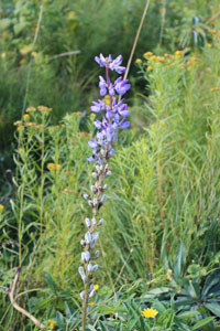 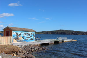  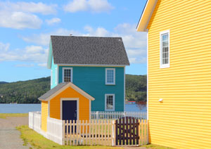 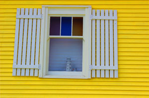 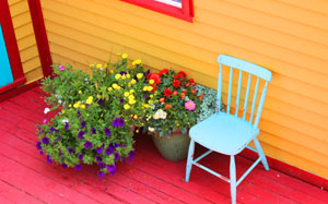  Monday, September 13, 2021: St. John's - Bay Bulls - Petty Harbour - Cape Spear National Historic Site - St. John's, Newfoundland
We had another boat cruise this morning with an outfit called Gatheralls in Bay Bulls where we were promised sightings of puffins and maybe some whales. No whales, but plenty of puffins, though we were told it was the end of their season and thousands had already left for warmer climes. However, instead of staying still and visible like they were in Iceland, they were flittering all over the place and very hard therefore to photograph even with a long lens. However, I have managed to put one photograph below, although it is cropped. We also saw an ocean sunfish (common mola) beneath us in the waves, which is one of the two heaviest bony fish in the world where adults typically weigh between 247 and 2,000 kg. I had never heard of this species before. Other sightings were a lone bald eagle, and a lighthouse with a rescue helicopter. After the cruise we drove to Petty Harbour - another small port with plenty of fishing boats and other paraphernalia including nets and traps to photograph.   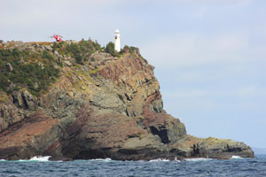  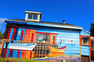 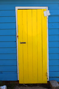 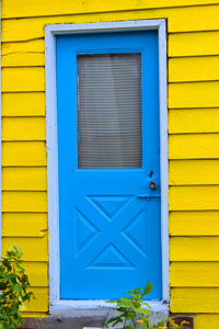 After this, we drove on to the Eastern-most point of Canada, Cape Spear, also Point 0 of the Trans Canada Trail and Cape Spear Lighthouse National Historic Site. This was a vast expanse of land overlooking the Atlantic ocean and I climbed from the lowest to the highest spots. There were in fact two lighthouses, an old one (the oldest surviving lighthouse in Newfoundland and Labrador), built in 1836, and a new one built in 1955, using the original light.
In case you were wondering, the other extremities of Canada's National Parks are as follows: North - Quttinirpaaq National Park in Inuktituk, 4,000 km away; West - Kluane National Park and Reserve, 5,500 km away; South - Point Pelee National Park in Ontario, 2,400 km away. We were then driven back to our hotel in central St. John's and had some time to explore the city on our own. I was particularly wanting to photograph the so-called “Jelly Bean Houses,” which I thought were located on a particular street or two but when I asked a resident I passed on the street, I was told that they were really all over these hilly streets: jelly bean because they were brightly coloured and no two of these side-by-side attached houses were painted the same colour. I would have loved to have shown more of them below but I was a frustrated photographer due to the cars parked along these streets in front of the houses which detracted from the houses.     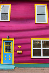  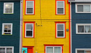 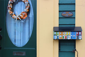 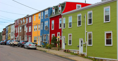 Tuesday, September 14, 2021: St. John's, Newfoundland
For our last full day in St. John's and thus in Newfoundland (the rock) and in the Province of Newfoundland and Labrador, we had one last bus tour that took in St. John's Harbour, Mile 0 of Terry Fox's famous Marathon of Hope in 1980, the Citadel on Signal Hill and the picturesque port of Quidi Vidi. St. John's Harbour, which is 2 km long by 0.8 km wide and 9 to 27.4 metres deep, has 37 docking berths and receives 1,000 to 1,200 ships per year, was windy but where we were located, faced the town itself and we could note its incline - anyone living here could get a good daily workout if they went everywhere on foot - and the colourful houses. The Terry Fox memorial next, had a couple of sculptures of Terry running with his prosthetic leg as well as a number of explanatory plaques. On one of them I read “On a cool, overcast morning, April 12, 1980, Terry Fox went to a nearby cove and collected a bottle of sea water. Later that day he came to this spot on the shores of St. John's Harbour. Here he dipped his artificial leg in the Atlantic Ocean and began his marathon of Hope.” 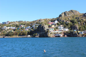 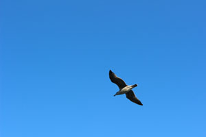 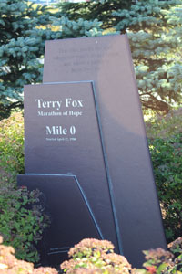 A somewhat more official Canadian government plaque reads as follows: “Terry Fox (1958-1981). While in remission from cancer, Terry Fox set out to run across Canada to raise money for cancer research. Despite having lost his right leg to the disease, this determined athlete ran 5,373 kilometres - nearly a marathon a day for 143 straight days - before being forced to stop when his cancer returned. His “Marathon of Hope,” which began in St. John's on April 12, 1980, captivated Canadians with its bold humanitarianism, transformed our vocabulary about personal courage, and revolutionized fund-raising. To date, hundreds of millions of dollars have been raised by Fox and in his name to the benefit of cancer sufferers around the world. The heroic nature and tragic interruption of his run have made Terry Fox an enduring Canadian icon.”
From there, our bus climbed up to the highest point of St. John's, Signal Hill, another National Historic Site from where we could look down on the harbour again. At its top was Cabot Tower, the cornerstone of which was laid on June 23, 1897 to mark the 400th anniversary of John Cabot's North American Landfall and the 60th year of Queen Victoria's reign. It took three years to build using private donations. The tower remained an active signal station until 1958. 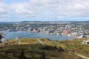 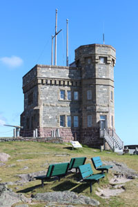 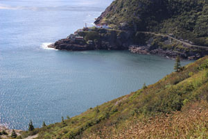 We then walked down the hill to reach our bus which was parked outside the geological interpretation centre, closed I believe for covid, but outside of which were statues of two dogs - a Labrador and a Newfoundland. Again I quote their plaques: “Nobody can confirm the origins of the Newfoundland Dog. Various theories say he descended from the Tiberan Mastiff, Norse Black Bear Dog, Great Pyrenees or the French Boathound. Possibly a number of these were involved but it is clearly certain that our first dogs came over with fishermen. We do know that our Newfoundland Dog is a very splendid, distinctive animal.”
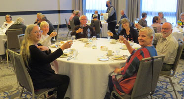
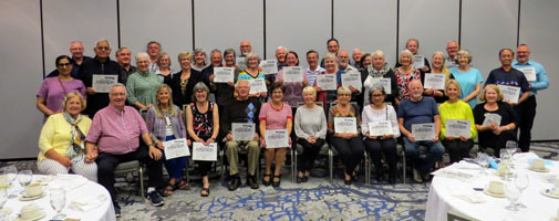
“Our Labrador (Retriever) is descended from the Newfoundland but was mated with English Setters and Pointers, which strengthened the Labrador's gaming capabilities. These matings produced a smaller animal, still possessing the main characteristics of the Newfoundland Dog... At home on either land or water, the Lab is the finest retriever in the world. It is easily trained, eager to please and has a wonderful friendly disposition. A full-grown Labrador weighs 68 to 80 pounds, which is about half the weight of a Newfoundland Dog. Both dogs have webbed toes, large tails and a double-layered waterproof coat. Both love the water and are strong swimmers. The Labrador, being smaller, is very suitable for smaller boats and around the home. Compared to the giant Newfoundland, the Labrador is much more economical to feed, and requires a lot less grooming. The Labrador is a gentle and loyal companion, and an excellent family dog. The Lab comes in black, chocolate and yellow colours. After the year 2000, the Labrador became the most popular breed in America.” Then we had time for ourselves which I used to do my laundry. I had done some research and had found that there was a self-serve laundromat in the district of the jellybean houses I had visited yesterday. So I brought a large bag of the last ten days of laundry with me but found when I arrived that due to covid it was no longer a self-serve. Instead I had to drop my laundry off and they would do it for me and I would pick it up later. Of course as I was limited with my time, I agreed to pay an extra fee to get it back within I think it was 2 hours and went off to find some lunch at Tim Horton's and read a book while I waited as there was no other place to sit and it wasn't all that warm to sit outside waiting all that time despite the sunny weather. However, luckily everything was actually ready when I returned and all I had to do was hike it home and fold it all into my suitcases as I packed for my plane tomorrow morning. We met up for our final dinner at our hotel which was musically accompanied by a musician/entertainer called Sheila Williams who subsequently toward the end of the meal hosted a screech-in ceremony, something quite unique to Newfoundland. Apparently, after people, known to Newfoundlanders as a “come from away” or “mainlander” are asked “Are ye a screecher?” or “Is you a Newfoundlander?” they are taught the proper response: “Indeed I is, me ol' cock! And long may yer big jib draw!” Translated, it means “Yes I am, my old friend, and may your sails always catch wind.” Then you must drink a tote of screech, which they say is rum from Jamaica - traded with Newfoundland throughout history for cod - although to me it tasted more like whisky or cognac - and kiss a cod. It was a raw cod yes, but it had come out of the freezer, and luckily, being covid times, we were permitted to wear our masks when we kissed it. Having done all that, we were presented with a certificate granting us the status of honorary Newfoundlander, which I see is issued by the Newfoundland Labrador Liquor Corporation!   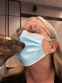 Finally, before saying goodbye to everyone, we had a group photo taken. It appears to contain everyone except our tour director who was taking the photo and one of the women who did not wish to be photographed. You may note that the woman sitting on the far right - Carol from Ontario who was the first person I had met on the tour and who was travelling solo like I was - is holding up a ripped certificate. As she had refused to drink the liqueur, the hostess had ripped up her certificate as she did not have the right to one not having fulfilled all the requirements! Our driver, Rod, is standing at the far right back.
   Wednesday, September 15, 2021: St. John's Newfoundland - Halifax, Nova Scotia
Today I transited from St. John's to Halifax and thus have no specific memory of anything, apart from getting a taxi to one airport, being in the air for an hour or two, and getting a taxi at the other end to my hotel on the Halifax Harbour. I do remember having a nice meal on my own at the hotel restaurant in Halifax, which I had booked using Aeroplan points. It was lovely to be on my own - not just eating a Subway sandwich in my room for instance - and not having to socialize with others.   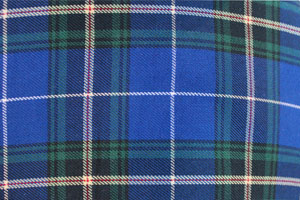 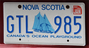 Today I had a nice, healthy breakfast for once having noted that meals in Newfoundland - the breakfasts in any case were not all that healthy. Every day we were served scrambled eggs, sausages, bacon, hashbrown potatoes - and only white bread toast. The excuse we were given when I asked whether they had never heard of yoghurt or fruit for breakfast was that it was difficult to get since Quebec - the province next door - tended to keep their dairy products for themselves. It was true we never did see any cows or sheep on our long bus rides through Newfoundland. But we didn't see any other wildlife either - no moose, for example. Only once were we offered cereal - and not cereal I am fond of. So here in Halifax, offered a breakfast of granola, berries and yoghurt, I was in a heaven of sorts.
Then grabbing my backpack and my camera, I left the hotel to explore Halifax harbour's board walk and photograph the art. I visited Pier 21 and bought printouts from their archives of my parents' arrivals in Halifax from England in Cunard-line ships in the 1950s. I also walked into town and visited the public gardens and came back via the foot of the citadel, which we would visit later as a group. I had arranged to meet up with a couple of translation/interpretation colleagues in the late afternoon so we walked back along the boardwalk again and had an ice cream. The meeting went well so we arranged to meet again on my return to Halifax next week. They walked me back to my hotel in time for me to meet up with the bus tour group, under our tour director Scott McEown, share some bubbly, and introduce ourselves. We were a smaller group of 24, if I remember correctly, from B.C., Alberta, Saskatchewan, Manitoba and Ontario as well as Louisiana and perhaps a few other U.S. states. After this, one of the other single travelers, Marilyn, a retired children's teacher from Northern Manitoba, and I went out to have dinner at a nearby pub. 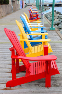 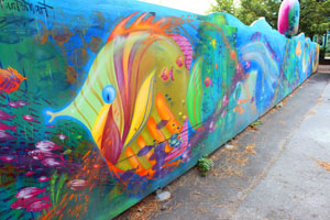   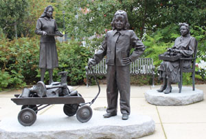 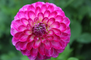 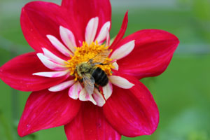   Friday, September 17, 2021: Halifax - Peggy's Cove - Lunenberg - Halifax, Nova Scotia
We set off early this morning in order to have breakfast at Peggy's Cove - rather than at the hotel - at the restaurant at the top of the hill next to the lighthouse. After breakfast at the Sou'Wester, we had a good two hours to walk around the village, photograph and explore. A plaque found by the visitor's centre says: “This picturesque village and lighthouse are among the most photographed places in Canada. A romantic folk tale is told about how the Cove got its name. Young Peggy was travelling to Halifax to meet her fiancée (sic) when the ship she was in foundered on the rocks. She was rescued by local folk and when visitors went to see her, they would say they were going to see “Peggy of the Cove.”” 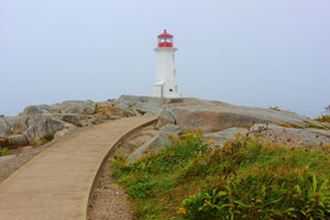 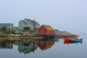 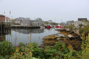 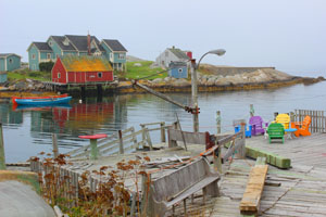 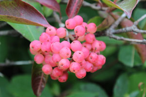  Next we drove on to Lunenberg, famous for being the home of the Blue Nose Schooner which is on the Canadian dime (10 cent piece), where we had time again to walk around, explore, photograph and grab lunch somewhere. The forty-four fish sculptures displayed on Lincoln and Montague Streets honour the top twenty fish and shellfish species landed by the area's commercial fishery.
On our way back to our hotel, we made one last stop at the Halifax Citadel, a National Historic Site, where we were given a tour by local guides dressed in army garb, complete with kilts, representing the British troops who lived there in 1869 during the reign of Queen Victoria, when Canada was only two years old. It was actually founded in 1749 as a strategic base for the Royal Navy. In 1867, British North America became the Dominion of Canada but British troops remained here until 1906. After that, the Citadel was occupied by the Canadian military and remained active through two world wars until 1951 when it was transferred to Parks Canada. 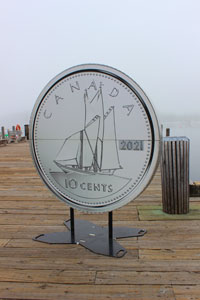 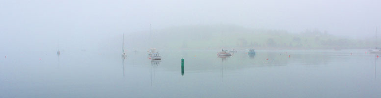 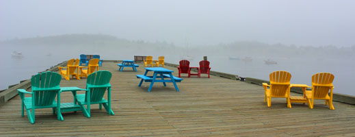       Saturday, September 18, 2021: Halifax - Sugar Moon Farm, Nova Scotia - Moncton, New Brunswick
On our way out of Halifax, we visited the public gardens that I had visited two days ago and the cemetery where the victims of the Titanic were buried. The plaque reads: “Here, in Halifax, lie the remains of 150 victims of one of history's most tragic maritime disasters. Just before midnight on April 14, 1912, the White Star liner RMS Titanic struck an iceberg in the North Atlantic. The majestic ship sank in two hours and 40 minutes with the loss of close to 1,500 lives. Seven hundred and five survivors in lifeboats were rescued by the Carpathia and taken to New York. In the aftermath of the sinking, White Star chartered three ships from Halifax and one from St. John's to search for the dead. Of the 328 recovered, many were buried at sea. The remaining bodies were returned to Halifax where some were claimed by their families and the rest interred at the Fairview Lawn, Mount Olivet and Baron de Hirsch cemeteries.” As the Titanic sank at 2:20 a.m. on April 15, 1912, the graves are marked with this date. Given the freezing temperatures, it was believed that most of the victims died of exposure soon after the sinking. The number on the gravestone is the number assigned when the body was found. James McGrady, victim 330, was the last victim to be found. His body was recovered in mid-May, 1912. In many cases, there were no distinguishing marks or personal belongings that enabled a positive identification of the body. There were over three times as many men (including the crew) on board the Titanic as there were women. However, the percentage of women who survived was much greater because Titanic's crew gave preference to women and children for the lifeboats so over half of the 705 survivors were women and children. Some of the victims have been identified in more recent years thanks to DNA and clues like initials sewn into their clothing. Also buried in this cemetery are victims of the 1917 Explosion in Halifax Harbour. 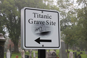 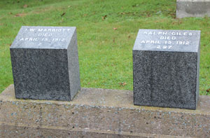  Then we had a lunch of breakfast - blueberry pancakes - at the Sugar Moon Farm in Earltown, Nova Scotia, on our way to Moncton in New Brunswick which was our destination for the evening. After lunch we were offered a tour of the facilities which was basically just an explanation of how maple syrup was made and then there were some trails around that we were invited to explore. Not a fan of maple syrup myself, I refused the maple syrup taffy they offered after lunch which basically entailed the cook dripping heated maple syrup onto a pack of ice and one dipping a tongue depressor into it, wrapping it onto the stick and licking it. Of course this site was also a store of maple syrup and maple sugar products as well as a book “Curious George makes pancakes” and other sundries.
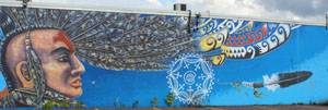
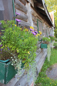   We arrived in New Brunswick and Moncton early afternoon and after checking into our rooms, had time to explore the town. I spent most of my time walking along the Riverfront trail along the muddy Petitcodiac river up which the tidal bore came around 8:30 p.m. that night. It was indeed an interesting natural phenomenon but as it was at night, it was dark, and filming it was impossible, so I'll just have to rely on my memory of the sound. The art work was pretty impressive, there was a lot to photograph, and I definitely got my exercise for the day.
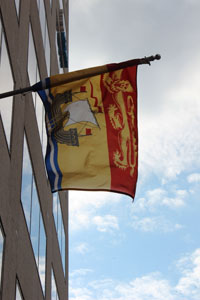 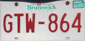 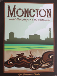 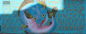   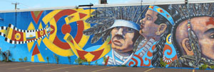   “Powered by the high tides of the Bay of Fundy, the tidal bore was considered one of the top tidal phenomena in the world until the construction of a causeway in the late 1960s transformed the Petitcodiac into one of Canada's most endangered rivers. Thanks to the success of a long environmental battle, the fish are returning, as is the strength of the tidal bore.”
“Twice a day, the tidal bore makes its way up the Petitcodiac River...reaching speeds of up to 13 km/hr and more than two metres in height... The tidal bore emerges as the saltwater tide of the Bay of Fundy pushes upstream against the freshwater current of the Petitcodiac River. The height and speed of the wave vary according to certain conditions, including the size and shape of the river basin, moon phases, winds, currents and water levels.”      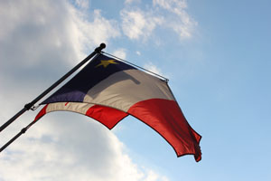 Sunday, September 19, 2021: Moncton - Hopewell Rocks, New Brunswick - Charlottetown, Prince Edward Island
“Imagine 160 billion tons of water moving in and out of the Bay of Fundy twice every 25 hours. Powered by the gravitational pull of the moon and the sun, Fundy's tides are among the highest in the world and vary daily with the changing positions of these celestial bodies...The tides start rising slowly but speed up until they are approximately half-way in. At their fastest, the tide can be rising straight upward at a rate of 13 feet (4 metres) per hour at the Hopewell Rocks. “Not only does the tide rise 46 feet (14 metres) vertically, it also recedes almost two football fields horizontally. Lover's Arch is situated relatively high on the beach. The tide needs to rise 28 feet straight up before it touches the base of the archway. The Fundy tides can then continue to rise another 18 feet (5.5 metres) before starting to recede.” “The story of the [Hopewell Rocks began] approximately 330 million years ago when fast-flowing streams deposited thick layers of sand and gravel at Hopewell Cape from the nearby Caledonia Mountains. Over time, the sand and gravel compacted into layers of conglomerate rock and sandstone. Forces from within the earth thrust and tilted the rock layers, creating large, vertical and horizontal fractures. These cracks were further sculpted by erosion to create the works of art now found upon our shoreline...Larger flowerpots may stand for thousands of years while others may last only hundreds. As the lower portion becomes thinner due to tidal erosion, the seastacks become unbalanced and eventually collapse. “Rain from above trickles down into the cracks in the stone, widening the fractures. Tides continue to erode the base of the formations making them top heavy and unbalanced. Water between the fractured conglomerate expands and contracts as it freezes and thaws. This puts great pressure on the cracks, forcing large chunks to calve and separating flowerpots from the cliff line.” The photos below show the amount of beach the in-coming tide covered in the few minutes we visited this morning. In the photo of one rock on its own, this is supposed to look like the head of an indigenous man. We then drove across the 13-kilometre-long Centennial Bridge that leads to Prince Edward Island (P.E.I.), stopping for a view of it first from the lighthouse at Cape Jourimain. When we arrived in P.E.I., we were all asked to get out of the bus and have our noses swabbed for covid. As none of us received a phone call that evening at our hotel, it was assumed we were still all covid-free.  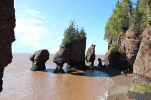 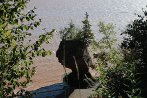  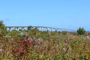 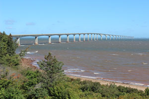 Our first stop in this province was at Cow's ice-cream where we were offered a free one-scoop cone (or probably it was included in our bus tour fare). It was purported to be the best ice-cream in Canada according to their signs - or indeed, according to another, in the world - but at 16 percent butterfat it was certainly not recommended for people on diets or with dairy intolerances. I forget what flavour I ordered. In the evening, after arriving in Charlottetown and checking into our hotel near the convention centre, we drove out to a restaurant called New Glasgow for a lobster supper. Those at my table of six who chose the lobster were disappointed as it was difficult to eat and they eventually gave up. Luckily, there were other courses like soup, three types of salad and dessert. I believe I ordered the fish, which was quite good. It's funny that I remember the fish but not the ice-cream. I don't even remember what flavour I ordered! Reflecting on this, I think it's because to eat the ice cream we had to be outside (in rather cool air) standing up - there were no places to sit - and we had to get back to the bus by a certain time so I felt rushed. I mean, you can't enjoy ice-cream when you are rushed.
As our place mats at dinner, we had a sheet of information on 1) how lobsters are caught and 2) how to eat them. I took several photos of lobster traps over my journey - some of which I have displayed on this page. They are generally made of wood, or metal with a rounded top and cord netting inserted into the side of the trap with a round hoop. The traps are set between 5 and 50 fathoms (30 to 300 feet) below sea level, connected to a line that falls from a buoyant toggle, which then is attached by another line to a main buoy. The traps are set from 50 ft to miles apart (sic) and the lobsters enter the trap through the hoops in the nets. As for how to eat lobster, well according to the place mat, the order is as follows: “1) Twist off the claws. 2) Crack each claw with a nutcracker, pliers, knife, hammer, rock or whatever you have. 3) Separate the tail-piece from the body by arching the back until it cracks. 4) Bend back and break the flippers off the tail-piece. 5) Insert a fork where the flippers broke off and push. 6) Unhinge the back from the body. Don't forget that this contains the 'tomalley' or liver of the lobster which turns green when it is cooked and which many people consider the best eating of all. 7) Open the remaining part of the body by cracking [it] apart sideways... 8) The small claws are excellent eating and may be placed in the mouth and the meat sucked out by chewing on the shell.” My own experience of eating lobster is on various cruise ships. You are served the tail only in an opened shell (minus the liver) and the waiter comes over and removes the main section of meat from the shell so you don't have to worry about all the mess.   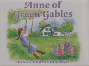  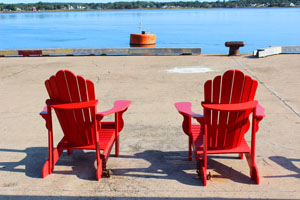 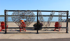 Monday, September 20, 2021: Charlottetown - Green Gables Heritage Site - Charlottetown, Prince Edward Island
Our first visit was to Brackley Beach, part of Prince Edward Island National Park, almost directly north of Charlottetown. We had time to walk on this empty brown (some might say golden I suppose) sand beach and photograph the sea birds (sea gulls and Piping Plovers) and dip our toes into the Atlantic if we so wished. We also stopped briefly in a fishing village (I did not record its name) and a place on the coast over looking some nesting cormorants. 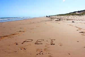 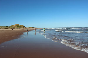 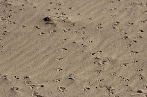 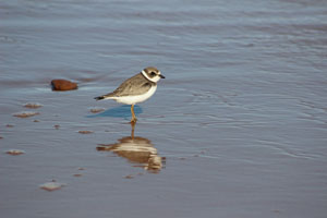 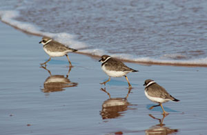 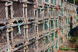 So what is the number one tourist attraction in all of Prince Edward Island? Yes, that's right: Anne of Green Gables, a children's book written by P.E.I. native, Lucy Maud Montgomery. The tourist draw, called a Heritage Site, contains the house Green Gables on which the story was based, which has been decorated as though it were Anne Shirley's Aunt and Uncle's place where she lived. In fact the house now known (I read) as “Green Gables” was once the home of Montgomery's cousins. Montgomery sent her manuscript of Anne of Green Gables to several publishers one after the other until finally the sixth accepted it. And now Montgomery is a Canadian literary icon. Just goes to show: if at first you don't succeed, try, try, try, try and try again.
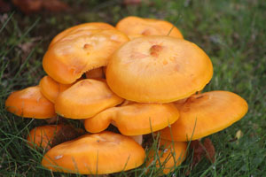
After exploring the inside of the house and the barn, I took the path into the woods (Lovers' Lane), part of the Acadian Forest (next to a golf course), featuring plaques with excerpts of Montgomery's journals and where I found this unusual fungus specimen. I certainly heard birds and saw a chipmunk scurry across the path. And naturally there was a shop as part of the complex selling P.E.I. souvenirs including various dolls depicting Anne, and, of course, various publications of her books in English and French: Anne of Green Gables, Anne of Avonlea, Anne of the Island, Anne of Windy Poplar, Anne Leaves the Island (the latter in French only). After a good two hours, here we went on to our lunch venue (which was almost across the street from the place at which we had had dinner last night), called the Prince Edward Island Preserve Co. It offered a very good musical entertainer and as dessert, pie made of berries. In fact, I should add here that many of the desserts we were offered throughout the Atlantic provinces were made of berries - tiny wild blueberries, yellow berries called by the locals bakeapples but in essence cloud berries, and these redder berries (in the photo of the pie below) called partridge berries. This restaurant also had some marvellous gardens to stroll through after lunch - hence the photos of the flowers and the chairs. I did want to make a further comment about Prince Edward Island, in that it looked like a very nice province to live in. Everything was so clean and tidy. Despite being told that the average annual income in PEI was around $31.5K, what struck me especially, was how tidy they kept all their lawns - and huge lawns they were too. Surely the richest person in P.E.I. must be the guy or gal who either sells lawn mowers, or rents them out, or has a lawn mowing business! We were then driven back to our hotel in Charlottetown for a second night and spent time strolling around town, taking photos, having a cider with my fellow travelers and exploring another book shop with even more Anne of Green Gable books, the titles of which are too numerous to list here. We also passed by the Confederation Arts Centre which in pre-covid times had the long-running Anne of Green Gables - The Musical though it was clearly not on offer when we were there, unfortunately. Otherwise I would have bought a ticket to see it. 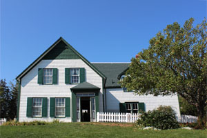 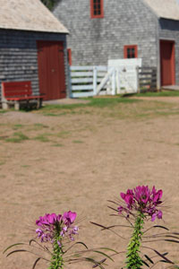 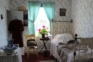 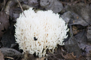  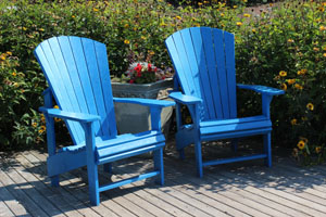 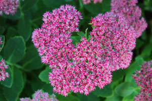 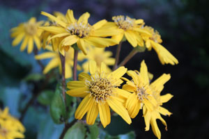 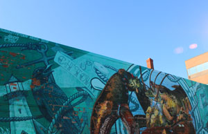  Tuesday, September 21, 2021: Charlottetown, Prince Edward Island - Baddeck, Cape Breton, Nova Scotia
This morning, we drove up to the Wood Island ferry terminal to take a car ferry back across the Northumberland Strait to Nova Scotia, and then eastwards to the top section of Nova Scotia known as Cape Breton Island, passing by yet another lighthouse and a sunning of cormorants (yup that's the name for a group of cormorants, I looked it up). I have no particular memory of lunch except that it was in another restaurant. In the early afternoon we reached Baddeck, located plum in the middle of Cape Breton, to spend some time at the Alexander Graham Bell museum. Quite the inventor, not only is Bell the father of the modern telephone, but he also made planes, hydrofoils and kites, and contributed to deaf education and artificial respiration. As with most museums, there was a lot of information to read and I soon tired, so I took a walk back to our hotel along the shoreline where there were some sculptures - a pirate on a wharf and then Alexander Graham himself sitting comfortably on a bench with his wife Mabel. After dinner our entire bus group walked over to St. Michael's Parish Hall to experience a Ceilidh (pronounced Kay-leed) touted as “Cape Breton fiddle music, song and dance.” Each evening is different and you don't know what you're going to get. Our entertainment was provided by a couple of young - and not so young - ladies, a fiddler and a pianist respectively, neither of whom had had any formal training on how to play their instruments. Even to my well-trained ears, each piece sounded the same. They had no printed music and basically the fiddler played what she wanted and the pianist accompanied her, but the latter used the exact same accompaniment for each piece, based on specific chord progressions sure, but I think it was the sameness of her accompaniment that made it rather monotonous for me. There was an intermission halfway through during which we were offered tea or coffee and an oat cake, but when we came back for the second half only about a third of the audience was left. So, yes, there was “fiddle music,” but no “song.” During the question period, I asked to see some dancing and the fiddler got up and did some clog hopping to piano accompaniment. While she was fiddling, she was tapping both her feet in rhythm, which I dare say required a great deal of concentration. An interesting experience in any case. Photos of the audience and of the two ladies are below. (Another bus group was also in the audience and they are in the back. Our group basically got there first so were seated in the first two rows.)     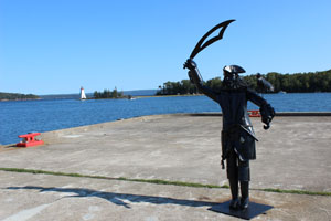 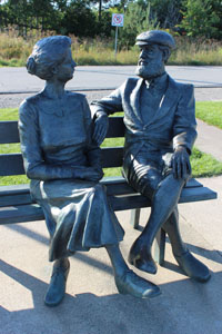 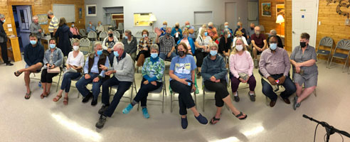 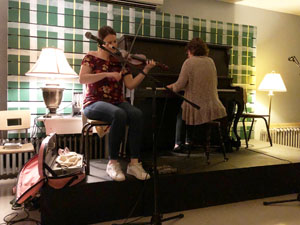 Wednesday, September 22, 2021: Baddeck - Cape Breton Highlands National Park (Cabot Trail) - Baddeck
We were teased that we would be visiting the famous “Hookers of Cheticamp,” Cheticamp being located in the Western shore in a French - or rather - Acadian part of Nova Scotia, a town where French was spoken. Eager to try out my comprehension of Acadian French, I was delighted when we made a stop here - despite it being just a shop for souvenirs - and yes the hookers - well they were nothing to get excited about - women indeed, they were rug hookers - famous, perhaps, but well... I did end up buying a sweater and spoke French to the owner, as she took my credit card at the cash register, who told me ours was the first bus tour to come through the entire year. (Note she did not answer my questions in English so I guess my French accent passed muster.) In pre-covid times, they'd have at least one bus tour a week visit - representing, if I remember correctly, about 30,000 tourists - and thus 30,000 potential customers. I would have liked to have had more time in this place, to walk around the town and soak up the francophone atmosphere - not to mention speak even more French with the Acadians - but that was not in the cards, or rather, on our schedule. However, our main goal today was to discover the Cabot Trail. Erroneously, I thought we would be hiking the trail, i.e. that it was actually a path through the woods, so you can imagine my disappointment when I learned it was a loop road along which the bus would drive us that basically travelled up the western shoreline before crossing through the woods to the eastern shore (at Neil's Harbour, see below) and down again back to Baddeck. We never got over to Sydney for instance, Cape Breton's largest town. I was reminded of the story I heard once of a tourist who had booked a trip to visit the capital of New South Wales (a place she had been dreaming of visiting for years) in Australia and her travel agent had made an error and sent her to the airport of the same name in Cape Breton instead! John Cabot trail, named after the Italian explorer, Giovanni Caboto, already mentioned a couple of times on this page, travels through Cape Breton National Park, an area of 950 square kilometres containing Acadian, Boreal and Taiga forests. We did make a few stops; otherwise of course it was a case of trees - some of which were starting to turn autumnal colours - and ocean views, except when there weren't any ocean views. No wildlife once again - not even eagles. And hiking trails do exist in the park, 26 of them in fact. We had a stop at a view point overlooking Fishing Cove where we had a group photo taken but I do not have a copy of it. Our stop for lunch in Pleasant Bay was memorable in the fact that I had pre-ordered a lobster sandwich - my choice for the way I wanted to taste lobster in the Atlantic provinces (having eschewed the lobster dinner in P.E.I.), but when we arrived, we were told the lobster was off the menu because a large party had booked the entire restaurant that evening and they needed all their lobster for them. So I chose an extremely disappointing turkey sandwich instead. The other thing about this place is that they had an extremely large Adirondack chair - though I think they call them Muskoka chairs here in Canada - and we all had to have a seat and a photo. I was reminded of Lily Tomlin's huge chair in her comedy sketches. Next we stopped at Neil's Harbour, another picturesque fishing village with a lighthouse (surprise, surprise) and then at its extremely, stony and steep beach at Black Brook Cove that I dared not venture down for fear of falling. Our final stop was at Keltic Lodge, a golf and spa luxury resort at the end of Cabot Trail near Ingonish. Here I met some bicyclists, who had just completed the trail on their bikes having started from Baddeck that morning - a feat indeed due to it being extremely hilly. They had nice weather for it in any case. The last photo in this set is an example of some of the many, many reflections in still lakes or ponds that I managed to get (finally) at a gas-refuelling stop. There were so many beautiful examples of reflections in water throughout my trip, but as we were in a fast moving bus with reflective windows, I never had the chance to photograph any of them, or at least not in a way that would do them justice. We returned to our hotel in Baddeck for a second night. 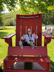 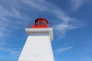 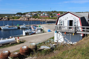 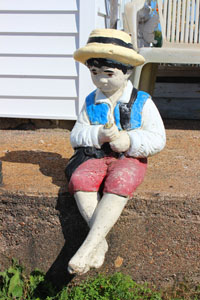 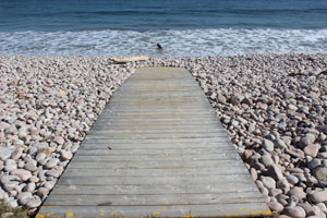 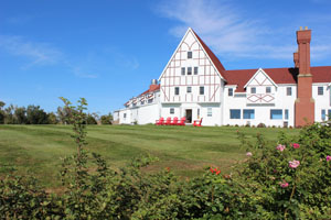 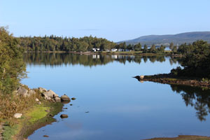 Thursday, September 23, 2021: Baddeck - Halifax, Nova Scotia
After all that driving yesterday, it seemed to take us no time at all to get back to Halifax. Perhaps this was aided by the entertainment that Scott, our tour guide, provided to us now and then through the bus audio-visual system. Most memorable for me were a CD of songs sung by Anne Murray (a Nova Scotian and another Anne with an “e” like the one at Green Gables) as well as several Rick Mercer Reports. Rick is a Canadian comedy icon from Newfoundland who visits different parts of Canada to provide amusing information and conversations with locals. I remember one report on a visit he made to the Blue Nose II that we viewed after our visit to Lunenberg and another on lobster fishing but there were three or four more interspersed throughout our journey. We were also very interested to learn from Scott that when he is not in a tour bus guiding more sedentary people around Canada, he helps other perhaps more adventurous (at least more risk-addicted) people to leap out of planes as a skydiving instructor! We did stop for lunch at our bus driver's home town of Stewiack, site of a mastodon statue, which I read later is a life-size replica of a male mastodon unearthed at a gypsum quarry near Milford, Nova Scotia in 1991. The bones, studied by archaeologists at the Nova Scotia Museum of Natural History are said to be about 79,000 years old! Apparently, this site (or somewhere fairly close to it) is halfway between the Equator and the North pole, a 4,985-kilometre (3,097-mile) distance to either. As we had a bit of time left before we could check into our hotel on Halifax's harbour front again, we had a last stop at (what is that you say? ... a lighthouse?) no, a shopping area called Fisherman's Cove across a bridge from Halifax proper. What I did between returning to the hotel and dinner escapes me - probably e-mails etc. but we had a fairly nice but unmemorable last dinner. To honour our trip, we were also given certificates - there was no fanfare, or the need to repeat an unintelligible phrase or drink alcohol like we had to for the screech ceremony in Newfoundland, but these certificates proclaimed us members of the “Order of the good time.” It sounds like a direct mistranslation from the French (which on the certificate is written “L'Ordre du Bon Temps”) doesn't it? Well, of course, curious, I looked it up and read as follows: “Order of Good Cheer (better) (French: L'Ordre de Bon Temps) was originally a French Colonial order founded in 1606 at the suggestion of Samuel de Champlain.” The certificate contains photos of “Samuel de Champlain, Explorer, Colonizer, Writer 1606,” its first grand master, and the Honourable Arthur J. Leblanc, Lieutenant Governor of Nova Scotia, honorary grand master. It also contains the signatures of the Nova Scotia government Minister of Business (though I should think the Minister of Tourism would have been the likelier choice), and the Premier of Nova Scotia. I asked our guide, Scott, why we hadn't received certificates from all of the provinces we had visited on the trip, but he said New Brunswick and Prince Edward Island don't offer them. Oh well, two out of four ain't bad, eh! 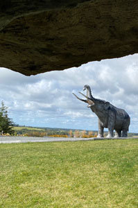 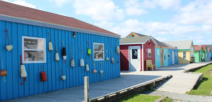     Friday, September 24, 2021: Halifax - Toronto - Vancouver, B.C
I mentioned above during my previous days in Halifax that I had met up with some translation and interpretation colleagues and we had enjoyed our meeting so much we had decided to meet up again on my return. So we had breakfast this morning together at a café in downtown Halifax and afterwards I was taken by one of them to visit Halifax's library building. I was then dropped off at my hotel to pack, ate lunch in my room that had been provided by the hotel concierge, and then took a taxi to the airport and had an uneventful flight to Toronto and thence on to Vancouver. |
All rights reserved. Website © Angela Fairbank 2005-2026.
|