Travel Blog June 20 to August 3, 2025An Eastern Around-the-World Trip Encompassing Svalbard, Mongolia, and South KoreaVancouver, B.C., Canada to Seoul, South Korea via the Svalbard Archipelago (Norway), Mongolia, and the DMZFriday-Sunday, June 20-22, 2025: Vancouver, B.C., Canada to Oslo, Norway (59.9139° N, 10.7522° E) via Frankfurt, Germany
My two flights with Air Canada and Lufthansa respectively went smoothly and my hotel was actually within walking distance and across from the airport terminal building this time. I was able to enter my room immediately and then spent the rest of my hotel stay basically trying to sleep off my jet lag with the added complication of the sun never setting, despite the black-out curtains in my room doing an excellent job of keeping out the evening light. Breakfast at the hotel was included both nights and food for my other meals was provided by snacks I had brought with me from Canada. I also used the remainder of my time at my hotel in Oslo to complete my previous trip notes (from May 11 to June 14, 2025) so as to be able to start this travelogue in earnest. Monday, June 23: Oslo to Longyearbyen, Spitzbergen Island, Svalbard Archipelago, Norway (78.2253° N, 15.6256° E)
 As my flight to the Svalbard Archipelago in Northern Norway to join HX's tour called 'Circumnavigating Svalbard; The Ultimate Expedition' wasn't until early this afternoon, I checked out of my hotel mid morning and walked over to the airport building, which I discovered is also the bus terminal and the train terminal. To my surprise, I was asked to go through passport control where I received an exit stamp. I asked the Norwegian immigration officer why this was necessary. After all, wasn't Svalbard part of Norway? He said yes it was, but it was not part of the Schengen Agreement given the fact that Svalbard mainly consists of scientists from about fifty countries, including non-EU nations, and had consequently decided not to partake in said agreement. My flight was on SAS, aka Scandinavian Airlines, which is the national airline of Denmark, Norway, and Sweden. As we were flying within Norway, I assumed the safety briefing and the captain's speech were delivered in Norwegian (in addition to English). I took a year of beginner's Swedish at university several decades ago and some of it is still in my head as I was able to identify some of the words I saw here and there to find my way around, since Swedish, Danish, and Norwegian are all very similar, I find. I assumed also that some of the people I boarded the flight with would be my fellow ship passengers on HX's the MS Fram starting from tomorrow. After a roughly two-hour flight, we started descending into snow-capped mountains and then bare, brown valleys and finally over a section of water into an area of colourful buildings. Upon deplaning, we were not required to go through immigration, hence no passport stamp for Svalbard, to my disappointment. On arriving at the baggage area of Longyearbyen airport, we saw our first polar bear (Ursus maritimus)! Stuffed, it was standing on top of the baggage carousel and looked very welcoming.
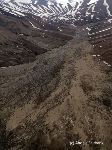  My bags arrived very quickly for once, and I was ushered onto a bus headed to my hotel at the top of the town, which was full of very modern-looking buildings. There were patches of snow here and there, but otherwise the land was mostly shades of brown from the earth, tundra, and permafrost. Arriving at our hotel, we were assigned rooms, notified as to when dinner tonight--as well as breakfast and lunch tomorrow--would be served, at what time we should have our big bags outside our rooms to be carried off and onto the ship, at what time we were expected to check out of the hotel, and finally, at what time we should meet our bus and guide for our town tour tomorrow afternoon, after which we would be delivered to our ship. As there was less than an hour before our next meal, I decided I would explore the town after dinner. After all, it would still be light, and it looked quite safe to wander around on my own.
   With 1,753 (2020) inhabitants, Longyearbyen is the world's northernmost settlement containing a population greater than 1,000. It is also the capital and the largest inhabited area of Svalbard. Up until a week ago, it relied on coal mining, but now the mines have been closed and the King of Norway, Harald V, now age 88, came personally to Longyearbyen last week for the official closing. My own story about him is that in 2010, I was sitting on the other side of an Air Canada plane from him and his wife, Queen Sonja. They were on their way to Vancouver to attend the Winter Olympic Games. In fact, I was asked by airline staff if I would kindly vacate my original seat across from the royal couple, so that one of their bodyguards could sit there instead. I was happy to move to another business class seat, from where I could still see them! They seemed very down to earth. Some time before landing, the Queen went into the tiny toilet and came out in a completely different outfit. Kudos to her. The space in plane toilets is small enough to start with; changing clothes and keeping them clean is quite a feat in my mind.
      The hotel dinner was excellent with two glasses of beer or wine included. We watched as the sun peaked through the mountains into the restaurant window and warmed us up considerably. Dinner over, it was now 10:00 p.m. and still as bright as day. I donned a warm hat and gloves, gathered up my camera, and headed out down the hill, my goal being to reach the oceanside, hence from top to bottom of a gentle slope. The town seemed almost asleep: no cars on the roads, although there were other people walking like me, a couple of bike riders, and lots of singing birds, which I figured out later were snow buntings (Plectrophenax nivalis) shown in one of my photos below in flight. I photographed the coal mining buildings on another hill, the red church, a disk golf course sign (whatever disk golf is) and finally arrived at the bottom of a melting-ice-fed brook where a lone Svalbard reindeer (Rangifer tarandus platyrhynchus) with short, fuzzy, felt-covered antlers was feeding. I also noted the 'be aware of snowmobilers' sign and when I reached the marine area, started seeing some arctic terns (Sterna paradisaea). Arriving then at the edge of the rocky beach, where someone was fishing with a fishing rod and another person was walking a dog, I noticed numbers of common eider ducks (Somateria mollissima), male and female, as well as a purple sandpiper (Calidris maritima). On my way back, I photographed a glaucous gull (Larus hyperboreus) standing in water beneath residential buildings. As I was returning to my hotel around 11:15 p.m. with the warm sun on my back, I met a German couple who had been on the MS Roald Amundsen with me on our Pole-to-Pole trip with HX. They were lodging at the other hotel arranged by the ship for tonight. They told me that another couple from the Pole-to-Pole trip, from the UK, was also staying at their hotel. I would see them tomorrow.
      Tuesday, June 24: Longyearbyen, Nortenskiöld Land, Spitzbergen Island, Svalbard Archipelago, Norway (78.2253° N, 15.6256° E)
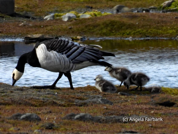
I didn't sleep well last night, despite the long walk, but I imagine it will still take me a while to get used to the long daylight hours. After breakfast, I went to the meeting room to check into the ship and receive my cabin key. Then, I put my suitcase outside my door for pick up, stored my other bags in the hotel locker, and then headed out to have another look at the town during the hours when things were open. I walked along streets I had not used last night and found the main shopping street--such as it was--with its one souvenir shop, tourist office, and outdoor clothing stores, and then found a magnet in their mega shopping store containing food, hardware, and everything else. I then continued on down past a field of Barnacle geese (Branta leucopsis) to the marina and looked for more birdlife, but apart from the geese, they were less prolific this morning than they'd been last night, although I still photographed a few more arctic terns, female eiders, and snow buntings.      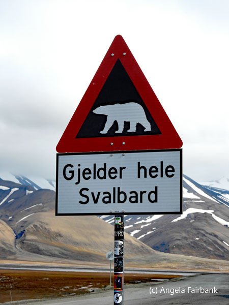   I was back at the hotel in good time for lunch and took a catnap in an armchair in the hotel lounge as I waited. Lunch too was good and included one glass of beer and/or wine. We then gathered up our hand luggage and got into a large bus where we were joined by our guide, a geology student from France, who'd been living in Longyearbyen for just under a year. We passed by more fields of Barnacle geese and kennels of sled dogs as we drove out past the 'beware of polar bears' sign to a sled dog camp called Camp Barentz, where a young 16-year-old musher explained about the sleds and the dogs. We were then invited into their warming hut to partake in pancakes and a hot drink, but as I had just had lunch (as had everybody else), I declined their offerings. I managed to get a better and closer photograph of a snow bunting here, however. We then drove in the bus the same way back into town and this time stopped at the museum, which contained a great number of stuffed local fauna as well as numerous panels about the history of the town, and the history of the coal mining industry. I also had a quick look at the museum store but bought nothing. Back on the bus, we were delivered to the ship finally, but as it was tied up to another vessel in the harbour, we had to take tenders to get there, for which we picked up lifejackets. On board, I found my cabin on deck 5. It did not have a balcony but there was a large window to look through and a large bed. I unpacked and went to have dinner, at which I shared a table with the aforementioned British couple from the Pole-to-Pole trip along with three other people. I then turned in and watched the latest Bridget Jones movie on my cabin tv.
      Wednesday, June 25: Ny Ålesund, Oskar II Land, Spitzbergen Island, Svalbard Archipelago, Norway (78.9235° N, 11.9099° E)
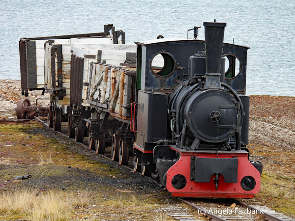
Ny Ålesund, a green research community and the world's northernmost permanent settlement, is located 1,231 kilometers from the North Pole, 114 km from Longyearbyen, and 2,117 km from Oslo. Situated at almost 79° North, Ny Ålesund was originally a mining community established in 1916 but today is a center for international arctic scientific research and environmental monitoring. The buildings and infrastructure in Ny Ålesund are owned and operated by the Norwegian state-owned company, Kings Bay AS. Twelve research stations exist in Ny Ålesund, representing ten different countries: Norway, Germany, Japan, Great Britain, the Netherlands, Italy, France, South Korea, China, and India. Almost 40 people live here all year round, even in winter, and stay from one to six years. Most workers have fixed contracts, while others don't work here continuously. All meals are eaten together in the dining hall. The shop is open twice a week, except during the summer season when it also opens for tourists who arrive by boat. Summertime also brings researchers and the community's population can increase to 180. Residents' houses are owned by the Kings Bay Company. Each has a fast internet connection, TV signal, telephone, and central heating. Everyone has access to a kitchenette. Electricity comes from a power plant here, which runs on diesel. Water comes from Tvillingvann, southwest of the town. All goods required by the community are sent by boat. There are also twice-weekly flights from Ny Ålesund to Longyearbyen.       We docked here in the afternoon, but having a cabin on the opposite side of the ship, I had not noticed this fact, assuming that we would be transported to land via zodiacs. The community tour for my group was one of the last so I did not in fact walk off the ship until about 15 minutes prior to our meeting time. A large sailing vessel called SV Rembrandt van Rijn, a Vanuatu-flagged three-masted schooner currently used by Oceanwide Expeditions, had just arrived and was tying up on the wharf perpendicular to our ship. Its passengers all appeared to be young people of various nationalities. Our small group from the MS Fram complete, we set off on our community visit with two expedition members, the German-English simultaneous interpreter (who, I later found out, was, like me, a certified member of the ATA (American Translators Association)) and a Norwegian scientist, who alternated in providing us with descriptions and explanations about the place and the various buildings we would find there. A coupld of Svalbard reindeer were wandering about town, the more mature of the two wearing an ear tag. They ended up being much photographed. Our first view was of a small train with five wooden wagons, in front of which stood a trilingual explanatory panel: The “locomotive was built in Berlin in 1909 and came to Ny Ålesund in 1917. ... Coal was hauled out of the mines and down to the wharf [using] large trains, and this small light train brought the coal out onto the quay. From here, the coal was transported to the mainland by boat.”
      We next passed the community post office, ”built during the first mining years and used as a general post office in the summertime and as a schoolroom in the winter. After 1958, it became family housing. Today this building contains the world's northernmost post office. It is the oldest house in Ny Ålesund, dating potentially back to 1909, and was built by the Green Harbour Coal Company, which had the mining rights in the area at the time. When Kings Bay took over the coalmining rights, the ... structure was moved from the mining area to where it stands today. The building has been used for housing, as a mess hall, a paint shop, and a post office.”
      Our short tour ended at Amundsen Square, containing a bust of Roald Amundsen. This is the third bust of the famous Norwegian polar explorer that I have seen and photographed. You may remember from reading my Pole-to-Pole travelogue that the first was in Nome, Alaska, USA, and the second, in Gjoa Haven, Nunavut, Canada. There is a fourth bust in Hobart, Australia, and a full statue of the man in Tromsø, Norway, neither of which I have yet seen. I then wandered down to the shore where there was a large pilon erected to commemorate a number of hot air balloon exploration attempts to reach the North Pole, none of which succeeded. However, I did not actually reach the pylon because there was a pair of arctic terns, the female on the nest and her male partner protecting her by dive bombing on fellow passengers' heads as they passed by. The male looked utterly exhausted, so I decided instead not to approach and only photographed the pair and then returned to the main street to visit the shop, where I picked up their smallest but still fairly expensive fridge magnet, and the museum, where I read the following: “Health Care in Ny Ålesund. It was dangerous work in the mines and there were frequent accidents. In the mining era, Ny Ålesund was a family community, The doctor not only took care of births and childhood illnesses, but ... also had the equipment needed to be a dentist. Spending the winter here in complete darkness in a small community could be a strain, and the doctor ... had to treat people for mental problems [as well].”
      I then wandered back slowly toward the pier photographing purple saxifrage (Saxifraga oppositifolia), quite a few Barnacle geese with chicks, common eider, a purple sandpiper, a Red Phalarope (Phalaropus fulicarius)--although the photographs I took of the latter were not successful--a Northern fulmar (Fulmarus glacialis), and a snow bunting.
  Thursday, June 26: Magdalenafjorden - Bjørnfjorden, Albert I Land - Virgohamna, Danskoya, Svalbard Archipelago, Norway (79.7206° N 10.9069° E)
Although a landing had been planned in Magdelenafjorden this morning, we were awoken in our cabins by our Expedition leader informing us that two polar bears were visible outside and that we should wrap up warmly and come out on the decks with our cameras. Due to new restrictions, our ship had to be a distance away of 500 meters, I believe, so it was really only possible to see them through binoculars, a monocular, or long-lens cameras. Although estimating that they were just as far away as those we saw in Greenland or Nunavut, I was able to follow the path of the mother and year-old cub with my camera-lens-enhanced eye and obtain a few disappointing pixelated shots. Due to the presence of these bears in the area, our planned landing was cancelled and the ship moved away to another destination. After my shower and breakfast, however, we were encouraged again to come out on deck. This time there was one polar bear on its own lying in the snow on a rocky island. It did not move from its position except by raising its head from time to time or getting up slightly like you see here to check us out. The shots were still not as I would have hoped due to the distance but much better the ones for the first bears. When I returned to my cabin after lunch, and after my cabin had been cleaned, I found a small white chocolate polar bear on my table (which I am now using as a desk) to celebrate the event. I decided that it was far too pretty to eat. An hour or so later, the ship was positioned in Bjørnfjorden, and our groups consecutively got into zodiacs and took a short ride around the fjord. We photographed a glacier, various types of ice formations, a few kayakers from our ship, and the black guillemots (Cepphus grylle)--with their distinctive red feet--seen here. Due to the delay caused by the polar bear sightings, our planned afternoon landing was so late I became tired of waiting and decided in the end not to go. I had asked people from a few groups coming back from their landings what they had thought of the place. One French couple complained of the rocks underfoot and that there was only historical garbage to see (in fact historical artefacts from failed hot air balloon attempts to reach the North Pole.) They saw no wildlife and found it fairly boring. I decided to eat my dinner at a normal speed and not rush through it as the other people in my group were forced to do. However, in hindsight, I probably should have gone with my group, which was the last to arrive on land, as they saw an Arctic fox!      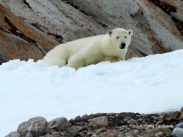              Friday, June 27: Monacobreen, (79.3976° N 12.6069° E), Texas Bar, Liefdefjorden (79.7389° N 12.0797° E), and Moffen Island (80.0300° N, 14.4833° E), Haakon VII Land, Spitzbergen Island, Svalbard Archipelago, Norway
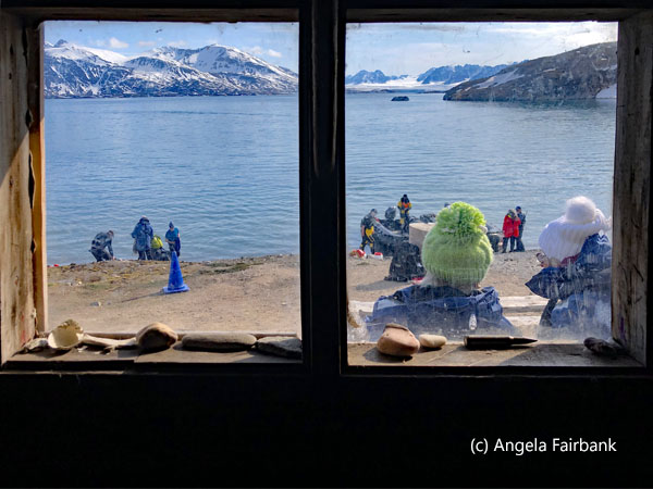
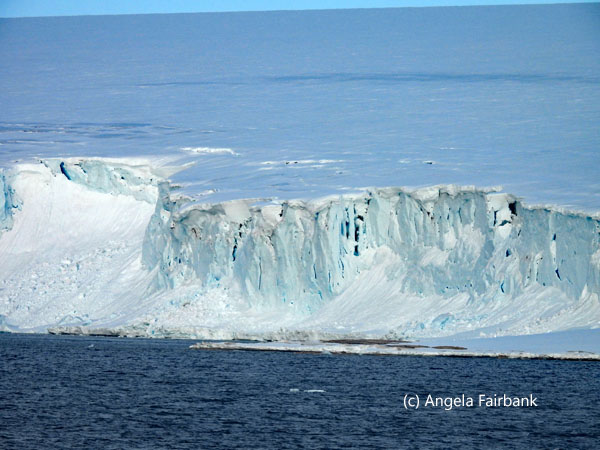
Our first visit outside the ship this morning was via zodiac to Monacobreen, aka the Monaco glacier, one of about 1,598 glaciers in Spitsbergen. These glaciers cover a total of 21,767 square kilometers out of Spitsbergen's 38,612 square kilometers. Monacobreen is among the largest glaciers in this area and owes its name to Prince Albert I of Monaco (1848-1922), one of the pioneers of oceanography. At its foot, it is about 7 km wide, and 60 meters high. There wasn't much wildlife to see apart from black-legged kittiwakes (Rissa tridactyla). At one point, our driver, a glaciologist, lifted a chunk of ice out of the water to show us its beautiful, diamond-like design.       In the afternoon, we made a landing at Texas Bar, not actually a bar at all but an old trappers' hut. Built in 1927 by a couple of Norwegian trappers, who erected several other such huts in the surrounding region, it has been dedicated to hunting and science for most of its existence. Inside, apart from the usual bed and stove, etc., it contains several bottles of spirits, which we were forbidden to try. Once again, I was in one of the last groups on land and by the time I arrived, the path that led partially over snow to the lookout spot was so muddy and slippery, I decided instead to stay by the cozy hut on the shore and successfully attempt an Arctic swim (or plunge) in 4.1° C water and an outside temperature of 4.0° C, so as to earn a certificate.
      Back on board, I read a book in the comfort of the lounge on deck 7 so as to remain awake until 10:30 p.m. when we were invited to go out on deck and take a look at Moffen, a small, low island north of the mouth of Wijdefjorden, and lying just north of 80° on the northern coast of Spitsbergen, the largest island of the Svalbard archipelago. It is inhabited--at this time of year at least--by a few dozen Atlantic walruses (Odobenus rosmarus rosmarus), which are known for their distinctive tusks, and were heavily hunted in the past. We were able to photograph them with long lenses, both on land and in the sea, although once again, the ship was required to remain at a respectful distance (somewhere around 500 meters from the shore) so as not to disturb them.
    Saturday, June 28: Pack Ice Edge, North of Svalbard Archipelago, Norway (80.7610° N, 13.4511° E)
Our goal today was to go as far north as possible so that we could reach pack ice. We ended up just below 81° N. In the morning, I attended a lecture on ice by the glaciologist so as to learn about various different types for identification purposes, such as fast ice, pack ice, brash ice, and pancake ice. When our group finally travelled to the ice edge in a zodiac driven by the ship's historian, we were disappointed to find only Brünnich's Guillemots (Uria lomvia) and little auks (Alle alle) (the most numerous seabird in Svalbard at 30 million or more, we were told) as examples of wildlife. Later in the afternoon, we were offered the opportunity to experience what they called a hard-core polar plunge off the ship via a zodiac in 0.5°C water and an air temperature of 3°C at 80°53.41' N, 13°00.43' E. As a result, I received a second certificate! At our evening meeting, it was confirmed that we had reached 80°59.939' N and 13°01.901' E, which means we were approximately only 9 degrees or 600 miles (approximately 965 kilometers) away from the North Pole. This is because the distance between each degree of latitude, I read, is roughly 69 miles, and the difference in latitude between 80°59'09” N and the North Pole (90°00'00” N) is 9°00'51”.       Sunday, June 29: Eolusneset, Sorgfjorden, Ny Friesland, Spitsbergen Island, Svalbard Archipelago, Norway (79.9451° N, 16.7409°)
This morning after breakfast, I attended an interesting lecture by our ship's Italian historian on the original polar exploration sailing vessel called Fram after which the vessel we are currently traveling on is named. Then I attended an advanced photography lecture by the ship's Czech photographer. The place we were hoping to land this morning, called Depotodden (80.3894° N, 19.4978° E) in Gustav V Land, wasn't possible due to the presence of ice, so we were merely invited to photograph the spot as we motored away from it. After lunch, I attended a lecture on polar bears, and we were told we were heading to an alternate landing spot. Once again, however, the plan was foiled due to the sighting of a male polar bear nearby. After dinner, I met with the kayak team leader for an individual briefing on kayaking and signed up for a trip that should take place in the next few days, as long as the weather, wind, and sea conditions are favourable. As we had no landings and no zodiac cruising today, I have no photos to show you. Monday, June 30: Phippsøya (80.7094° N, 20.7931° E), Sjuøyane archipelago north of Nordaustlandet - Chermsideøya (80.5056° N, 19.9214° E), Gustav V Land, Nordaustlandet, Svalbard Archipelago, Norway
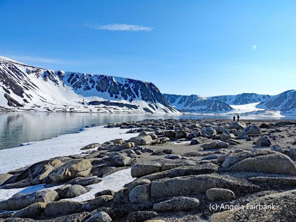
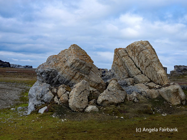
Phippsøya is the largest island in Sjuøyane, an archipelago north of Nordaustlandet, Svalbard, located about 22 km north of Nordkapp on Svalbard proper and 8.5 km south of Rossøya, the northernmost island of the Svalbard archipelago, while Chermsideøya is a 14 km2 island north of Nordaustlandet, Svalbard yet separate from Nordaustlandet. Although Nordkapp on its northern coast is considered to be the northernmost tip of Svalbard proper, both Sjuølyane (seven islands), located 1040 km south of the North Pole, and Karl XII-øya to the east are situated further to the north. Our morning visit was to Phippsøya, but to get there, our zodiac captain had a difficult time driving through the ice that had formed between our ship and the land due to the tide moving it around. By the time we set out on our return from the land, the wind and tide had pushed the ice away and we had a smooth path over the water to the ship.     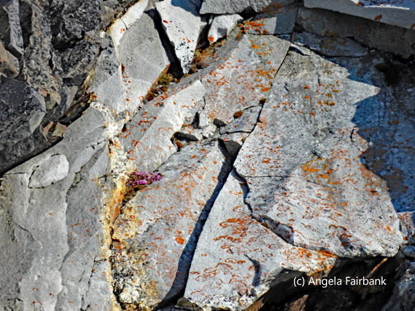   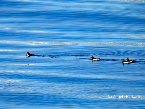  In the late afternoon, we visited Chermsideøya, whose claim to fame, if you will, is the fact that a couple of expeditions in the late 19th and 20th centuries stopped here and created geological graffiti by laying out letters and numbers using rocks: 'Jäderin 1898' after a Swedish expedition leader and 'Krassin' in Cyrillic letters, the name of a Russian icebreaker. A third geoglyph is a swastika, which is reported to have been destroyed and recreated a few times. You will see photographs of these here as well as a few more geological and natural oddities I photographed. There was no wildlife at either visit though we did hear snow buntings singing and what one passenger thought might have been a ptarmigan calling. Another polar swim was offered here off a lovely sandy beach, but as the air and water temperatures were warmer than the other two times I had done it and the coordinates were definitely not as impressive as the plunge off the zodiac on Saturday, I decided not to partake. The weather was gorgeous, however, and warm, so weatherwise and beachwise the conditions were perfect.
            Tuesday, July 1: Storøya (80.1385° N, 28.0004° E) - Kvitøya (80.2081° N, 32.4410° E), Svalbard Archipelago, Norway
Storøya (Big Island), measuring approximately 11 kilometers in length by 7 kilometers in width, is located east of Nordaustlandet, yet separated from Nordaustlandet by the strait of Storøysundet. The southern part of the island is covered by the glacier Storøyjøkulen. It is included in the Nordaust-Svalbard Nature Reserve. As landings are currently not permitted on this island, we were offered a zodiac cruise to its edge and were told we would probably see a lot of wildlife. In fact, in the 45 minutes we were allocated, we saw two red phalaropes swimming, a flock of eider ducks on the shore, several large polar bear tracks in the snow, and this lone baby ringed seal (Pusa hispida), which our driver/marine biologist guide said had probably lost its mother and would look delicious to a polar bear given that it contained a lot of blubber.    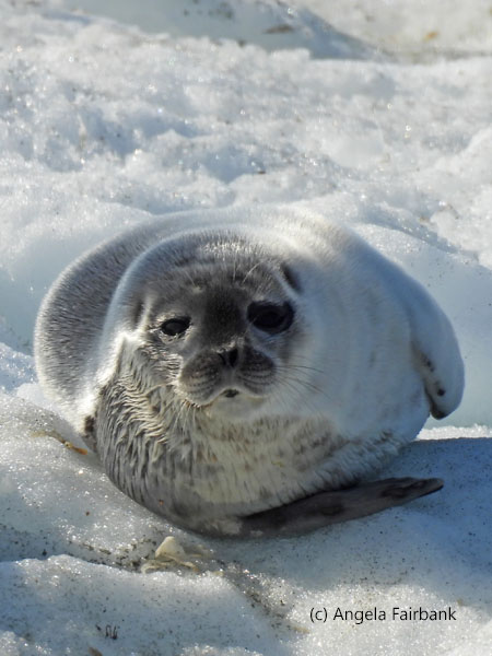      Kvitøya (White Island) has an area of 682 square kilometers (263 sq mi) and is the easternmost part of the Kingdom of Norway. The closest Russian Arctic possession, Victoria Island, lies only 62 kilometers (39 mi) to its east. Kvitøya is also part of the Nordaust-Svalbard Nature Reserve. The island was the resting place of S.A. Andrée's Arctic balloon expedition of 1897. This expedition attempted to fly over the North Pole in a hydrogen balloon but was forced down on the pack ice about 300 kilometers (190 mi) north of Kvitøya on July 14, 1897, less than three days after launch. They reached the island on foot by October 6 and settled on the only ice-free part of the island, on what is now called Andréeneset. The fate of the expedition was one of the great mysteries of the Arctic for over three decades until its remains were discovered by the ship Bratvaag in 1930, and diaries, logs of scientific observations, and photographs--glass negative plates, which had been deep frozen and could be developed--were recovered at the site. Modern researchers believe that the three members of the expedition died within two weeks of reaching the island. A monument commemorating the three men, S. A. Andrée, Nils Strindberg, and Knut Frænkel, is erected on the island. Another monument, put there by the Stockholm expedition in 1997 to commemorate the 100-year anniversary of the tragic event, was later deliberately destroyed by the Svalbard authority on the grounds that it was illegally erected. We travelled through fog to get to this island and, as you will surmise, we could not take the zodiacs out to it as three polar bears were sighted on the beach ... although I was only able to see and photograph one of them from the ship and not very well as we were about a mile away from shore unable to approach any closer. As we finally moved away from Kvitøya in a southerly direction, I noticed something dark on an iceberg and decided to photograph it in the hope that it was a polar bear, but it was five, and then four, and then three Atlantic walruses, as, disturbed by our closeness, they gradually slipped into the sea.
      When I arrived back at my cabin after lunch today, I found that my duvet had been shaped into a heart and that a colour print-out of a Canadian flag had been laid on top. This was from the housekeeping staff to wish me Happy Canada Day! In the afternoon, I attended a presentation of HX's Antarctica trips and then met with the Future Cruises Salesperson to find out the cost of one I was interested in. I then looked up the cost of comparative Antarctic cruises with HX's competitors. Later at dinner, I and my three random tablemates were offered some pink sparkling wine from the dining room staff, again to celebrate Canada Day. When I asked the maître d' how many guests this voyage were from Canada, he replied that I was the only one!
   Wednesday, July 2: Sundneset, Barentsøya, Svalbard Archipelago, Norway (78.2008° N, 21.0522° E)
This morning after breakfast, I attended two lectures, one on ocean acoustics presented by a German-origin PhD student, studying this subject at Aarhus University in Denmark, and the other on rocks presented by a geologist from Scotland. The rest of the time, I mostly read a book as we waited to go out on land at Sundneset on Barentsøya, a large island to the east of Spitsbergen and south of Nordaustlandet, the two largest land masses of Svalbard. Here there was less snow, and we saw green again, made up of spongy moss, filled with purple and yellow saxifrage. Here too was evidence of multitudes of Svalbard reindeer, given the copious droppings and two reindeer carcasses, probable ones that polar bears had killed and partially eaten. There were also drying reindeer antlers, a great deal of reindeer hair tufts ... and a few live reindeer in the middle-to-far distance. Once on land, we were given about four hours--our longest time on land this voyage--to visit a hut and climb up to a look out. There was also a four-hour hike offered to the top of a mountain, but I did not feel inclined to do that, despite the tolerable temperature and low cloud conditions. I did walk to the promontory beside a lake on which there were barnacle geese, eight king eider ducks (Somateria spectabilis), red phalaropes, a single long-tailed duck (Clangula hyemalis), a purple sandpiper, and a snow bunting, but the best find today was a couple of young arctic foxes (Vulpes lagopus) on the other side of the promontory, which you will see among my photos below.           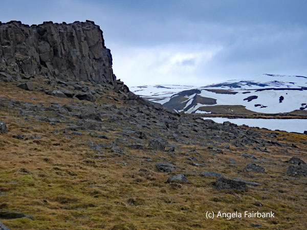 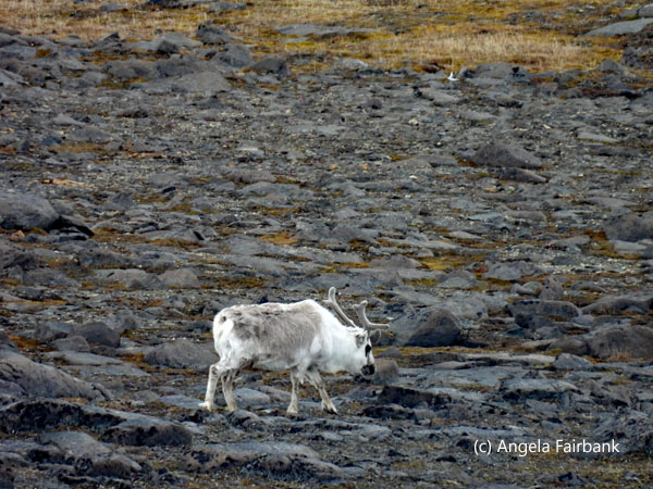      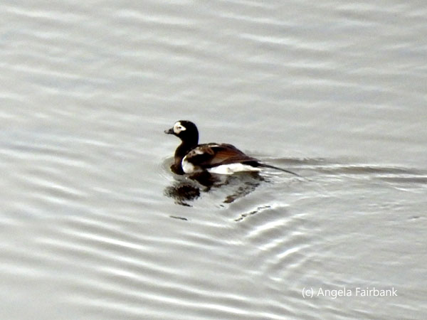    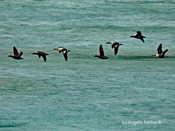   Thursday, July 3: Negribreen, Olav V Land (78.8372° N, 19.5396° E), Boltodden (77.4997° N, 18.1842° E), and Strongbreen (77.5333° N, 17.6667° E), Heerland, Spitsbergen Island, Svalbard Archipelago, Norway
I had an early start and arrived down at the expedition pit before breakfast to learn that the kayak trip I had signed up for had been cancelled due to the ocean swell and limited visibility caused by fog. Once again, I was relieved (a kayak trip had been cancelled on me in Antarctica due to ocean swell as well) as I personally wanted conditions to be ideal for such an experience and changed out of my thermal underwear and into cooler clothing before going down to breakfast. There was a brief view of a gorgeous, white glacier (Negribreen) but it, too, was soon consumed by fog and the zodiac cruising was consequently cancelled as well. The ship then proceeded southward on a nine-hour journey towards Boltodden, but it too was partially covered in fog, and the swell of the ocean had not improved so the planned landing too was cancelled. Although this meant another relaxing day where I managed to get a lot of reading done, I did attend two lectures in the afternoon, one on the geological history of Svalbard by the resident geologist, and the other on feathers by the resident ornithologist. Both presentations were excellent, although the first was a bit soporific as it meant squeezing some 570 million years into 45 minutes! Then, at the end of the day after dinner, the fog cleared, the sun shone, and we were able to complete a zodiac cruise of Strongbreen, a very large but rather sediment-stained glacier.           Friday, July 4: Gnålodden (77.0166° N, 15.8666° E) - Burgerbukta (77.0666° N, 15.9833° E), Sørkapp Land, Spitsbergen, Svalbard Archipelago, Norway
The name Gnålodden is derived from the adjacent bird cliff Gnålberget, which is home to thousands of nesting black-legged kittiwakes and Brünnich's guillemots. These birds are responsible for constant noise during the nesting season, which is now. We were the second group of 39 people on land at a time, as per the regulations, and on our arrival were able to watch an arctic fox walk to the hut and disappear behind it. We then walked as a group with two expedition team members as guides around the curved seashore to a resting site of an unknown whaler. On our way back, we passed a nesting glaucous gull with at least one chick and then proceeded over to a trappers' cabin, used for many years by Anders Sæterdal and his wife Wanny Woldstad, famous for being the first female trapper in Svalbard. All along the way, there was an abundance of purple and yellow saxifrage, moss, grass, and dead adult bird carcases, as well as impressive rocks that our geologist became quite excited about. As we were getting ready to climb aboard our zodiacs and return to the ship after too short a time on land, in my opinion, we heard through the walky-talkies of the expedition team that a polar bear had been sighted swimming in the water near the MS Fram, so our zodiac was told to stay in a holding position in the water until it was declared safe to return to the ship.             People on board the ship had been the first to sight the animal swimming outside the ship's window during a lecture and had all rushed outside to take a better look. They could then follow its swimming pattern due to the glitter of the sun on the water reflecting where it had disturbed the ocean. Although, for the most part, only its snout could be seen above the water, one of my fellow passengers told me she had seen its entire head lift out of the water twice as it tried unsuccessfully to climb onto an iceberg. However, by the time I arrived back on board and onto the top deck at the bow, the creature was no longer visible. About an hour later, we were told that the fifth group of five to go on shore had had their landing cancelled because the polar bear was now on land in the snow, not all that far from the landing sight. Meanwhile, those in group four on shore were evacuated and brought back to the ship just as we had been. As our expedition team leader, Tomsky, put it, “We are not allowed to feed the wildlife ... especially not our furry friends.” He was also wont to call the Arctic Walruses 'sausages', and we could understand why.
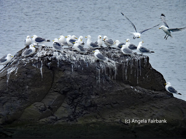
    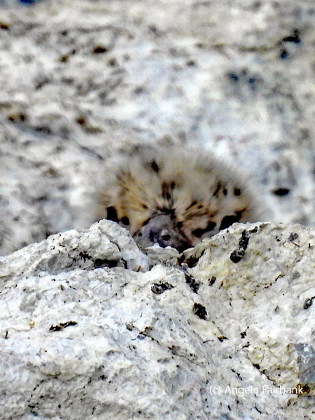        In the afternoon, we had a second landing, this time at Burgerbukta, farther up the fjord but not all that far away from this morning's landing ... this time sans polar bear. We were able to spend about four hours walking around here and although the sky was overcast, we achieved some good climbs to various promontories in the vicinity of about three different glaciers. The first series of photos shows flocks of kittiwakes, squawking and interacting on guano-splashed rocks in the bay. As we climbed our first promontory, we noticed these tiny white poppies in among the rocks. Then, tracing our steps back across the moraine, and its glacier-water-filled ponds reflecting the mountains in almost-perfect mirror images, I noted these side-by-side footprints of a webbed-footed duck and a non-webbed-footed wader. Then turning toward the other side of a glacier, we noticed this seal--possibly a Harbour Seal (Phoca vitulina)--lying with its tummy on a rock that was almost the length of its body. It eventually managed to get off the rock, and that is its head you can see sticking out of the water in a later photo. The last image is of two Atlantic walruses lying on their backs on an iceberg near the ship.
                          Saturday, July 5: Bamsebu, Ahlstrandhalvøya, Nathorst Land, Spitsbergen, Svalbard Archipelago, Norway (77.5517° N, 14.9800° E)
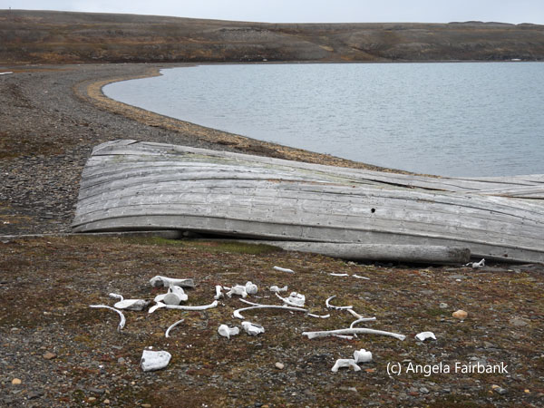
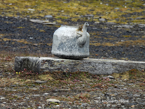
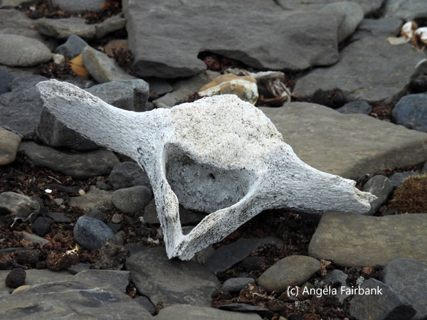
Our zodiac group was the first off the ship today to visit Bamsebu (Bear cabin), its hut and land just inside the Van Mijenfjorden, the third-longest fjord in Svalbard at 83 km, running between Nortenskiöld Land and Nathorst Land in Spitsbergen. The only live animals we saw here were quite far away (barnacle geese and reindeer) with the exception of one black guillemot and three female eider ducks swimming in the fjord with their ducklings. However, we saw lots of remains of dead birds, dead reindeer, dead whales (from ancient whaling times), and what we were told was a dead polar bear, although I have doubts about that. The hut you see here has a story behind it. In 2019, two women (Hilde Fålun Strøm from Svalbard and Sunniva Sorby from Squamish, British Columbia, Canada) spent nine months here, 140 km away from civilization (Longyearbyen), without electricity or running water, collecting data on climate change through the wildlife they saw and the environment around them. Apparently, due to the COVID-19 pandemic, those nine months turned into eighteen! We were given the opportunity to walk both ways along the shoreline in about a two-hour period of time.          Back on board, after lunch we were told how disembarkation would pan out tomorrow morning, then we returned the muck boots we'd been issued for the trip and attended a summary of all the science experiments carried out on board and the lists of various birds and animals seen these past two weeks. Before dinner, we attended the captain's farewell cocktail, at which the expedition team sang a sea shanty, and we were invited to join in the choruses. I sat and talked to two of the pole-to-polers for a while and then we all headed down for dinner and were seated at the same table. After dinner, we were invited to watch the slideshow/video of the voyage, which I have added below. I then completed my packing and got my large bag out to the elevators so that the crew could take it down to the storage area and offload it tomorrow morning onto the pier. The last photo below probably deserves an explanation. I was hoping to get a photograph of the aforementioned black guillemot in the fjord and released the shutter just as it dove into the water, hence the red feet you see with the trail of water droplets!
      Sunday, July 6: Longyearbyen, Spitzbergen, Svalbard Archipelago, to Oslo, Norway
I had set my alarm for 4:45 a.m., but given the fact that the sun had never set, it wasn't too difficult to get up at that hour. There was time for a full breakfast before being called off the ship and onto the pier, where three consecutive buses were waiting to drive us to the airport, only a short ride away, so we could check in to our 7:40 a.m. flight, go through security, and finally take our Scandinavian Airlines flight back to Oslo. At the latter airport, we were obliged to go through passport control again since we were re-entering the Schengen area. As all this took so long, my large suitcase was waiting for me on a stopped carousel in the baggage reclaim area. I then said good-bye to some of my fellow passengers before walking about 500 steps to my airport hotel. After entering my room and checking into tomorrow's flight online, I decided I was hungry. Since the hotel restaurant was closed on weekends at lunchtime (although open for dinner), I walked back to the airport and checked out a number of food places to stock up on snacks for today's lunch and dinner. After eating lunch in my room, I updated this travelogue, deciding I would spend the day in the hotel and not try to venture downtown to visit museums. They will have to be postponed until a future visit to Oslo. Monday, July 7: Oslo, Norway to Frankfurt, Germany As my flight to Frankfurt was scheduled for mid-morning, I ate the hotel breakfast and walked over to the airport with my suitcases in the rain (luckily most of my path was covered), checked in to my Lufthansa flight and napped as I flew. On my arrival at Frankfurt, I picked up my bags and caught a taxi to my hotel in the center near the central train station. My taxi driver asked if I was French, so I replied that I was from Canada. He insisted then that I was probably from Quebec, so I told him I was from the English side. It was then that he told me my German had a slight French accent. I told him then that I did indeed speak French, but my first German teacher--one that I had had for four years in high school--had actually been Hungarian, although she had also taught me French (as one of several French teachers). He seemed to accept that explanation. Checking into my hotel, I learned that the receptionist was originally from Mongolia. We struggled to speak in German together, but I couldn't make out her accent, so we then switched to English. I told her that my main goal in Frankfurt was to wash my clothes between two long trips, but that I found the price list for the hotel laundry much too expensive. I told her I could buy a t-shirt for the price they were asking to wash a t-shirt. She was puzzled so I said, “well, perhaps not in Germany but in many other countries.” I then enquired about a coin-operated laundry nearby that I had looked up before arriving in Germany. On learning its location, she advised me not to go there as it was in the red-light district! Instead, she recommended a laundry around the corner from the hotel. I went there and had another conversation in German from the probably middle eastern proprietress. Although their prices were slightly better than the hotel's, she finally confessed that she only washed and ironed dress shirts in her establishment. She would have to send out any other clothing needing to be washed, and it would take three days before I would have it back. So, I told her that unfortunately, I would not be able to do business with her as I would not be here in three days' time. I then popped into another hotel opposite and asked what they recommended. As I had guessed, they were not willing to have their own laundry department wash the clothing of people who were not staying at their hotel, so when I mentioned the coin-operated laundry (all this mind you was done in German), the receptionist turned to her boss and asked him in English, then returned to me, speaking German, and said the coin-operated laundry would be safe to go to during the day time, just not at night. (I consequently gathered from her action that this time, in her eyes, I must have appeared to be a German speaker, or, in any case, not an English speaker ... unless of course she thought I was a francophone like the taxi driver yesterday!) Thus convinced that I would be fine walking through the red-light district during the daytime, I then toddled off to the coin-operated laundry a few streets away, had a look at their operation, and told the proprietor that I would be back tomorrow to wash my clothes there. Had I wanted to have him wash my items of clothing, his price was at least lower than what I had seen so far and he said it would take him three hours (not three days), but I figured he'd probably just bung my things into his machines, and I would be far better off doing everything myself. They had a bench to sit on, and I could bring a book. So, sorted for tomorrow, I wandered around a few more streets noting the numerous girly clubs en route and ended up at a large grocery store where I bought some food for dinner, and popped into a couple of dollar stores, looking for a replacement label for my suitcase as it had broken off during one of its rides on a conveyor belt in an airport. I have not found one yet but will take another look in the airport on Wednesday. I then returned to my hotel and had a very late lunch/early dinner. I tried to watch the hotel room TV, but of its 25 channels, only three were in English, of which two were news stations and one was popular music. I tried the one French station, but it was sports. I then looked at the other non-German stations (five in Arabic and three in Russian) but found no joy there either, so I ended up reading a book instead. I should probably explain that German TV dubs all its foreign shows into German, unlike Norway, which shows British Crime shows (Britisk Krim), such as Lewis or Vera in English with Norwegian subtitles--a much better way to learn a language, I find. Tuesday, July 8: Frankfurt, Germany I slept in a bit given the fact that I'd had to rise early the last two days and turned in earlyish last night. After the hotel breakfast, I washed my smaller clothing items in the hotel sink and then took my larger ones to the coin-operated laundry I mentioned yesterday. I met a couple from England there who had retired to Malaga, Spain, where they owned an apartment, but were for the moment escaping Spain, due to the 40-plus-degree temperatures, and were travelling around Germany, Austria, and Switzerland. They were about ten years older than me. After returning to the hotel with my clean clothes and rearranging my suitcases for my next trip, I took a break for lunch at the hotel restaurant, pointing out an incorrect translation in their menu: Seelachs Burger had been translated as 'Salmon Burger' so naturally, I was expecting a healthy meal of pink-fleshed fish, but it ended up being fish and chips in a bun and the fish was white. The English translation should have been pollock or black cod. The meal was fine but contained many more calories than I had expected or would have wished to consume. Wednesday, July 9: Frankfurt, Germany to Ulaanbaatar, Mongolia After the hotel breakfast, I answered a few emails and then checked out mid-morning and got into a taxi standing outside the hotel's front door, not without first asking the Mongolian receptionist how to say thank you in Mongolian. Pronounced bayarlaa, the 'rl' mixture sounds suspiciously like the double l in Welsh, strangely enough. I was driven to Terminal 1 at Frankfurt airport by the driver, who then patted me on the back and said Tchüß, which I find I'm hearing more and more in Germany now, while in the past I would notice it only in Switzerland and Austria. However, I then found out my flight via Mongolian Airlines was departing from Terminal 2, which meant a further walk and then up and down various elevators and then a train between terminals. Although I had arrived three hours before my flight as advised, I ended up at the back of a very long line to check in, which seemed to take an age. We were then advised to go straight to the gate (although first through passport control and, of course, security control) as they would open it up at 1:00 p.m. for a 2:20 p.m. flight. Once we were on the airplane--a Boeing 787 Dreamliner--it wasn't all that full, and I had three seats all to myself! I spent the eight hours or so watching Ocean's 11, 12, and 13 and eating an OK chicken meal followed several hours later by a small breakfast and arrived around 4:00 a.m. in Ulaanbaatar. Thursday, July 10: Ulaanbaatar, Mongolia (47°55'12”N, 106°55'12” E)  Mongolian word or phrase of the day: San ban u. Hello. The largest city of Mongolia (formerly Outer Mongolia as opposed to Inner Mongolia, which is currently part of China) with a population of 1.6 million, Ulaanbaatar, at 1,350 m above sea level, was founded as Urguu or Urga in 1639. It changed location 29 times and was given different names during its history. Once a Buddhist monastic center, Ulaanbaatar has grown into a major center for culture, education, economy, and politics. Mongolia's territory encompasses 1,564,116 km2 or about 1 percent of the Earth's surface area and shares borders with Russia (3,543 km) and China (4,709.7 km.) Made up of 21 provinces, Mongolia is the seventh largest country in Asia and the 19th in the world. The official language is ... Mongolian, which belongs to the Altaic language family and consists of four dialects. The central Khalkha dialect is spoken by 84 percent of the population and is the official language written in both Cyrillic and traditional script. In addition to some 100,000 Kazakh national minority members speaking Kazakh in Mongolia, words from Tibet, Sanskrit, Uigur, Chinese, Russian and English have been adopted into Mongolian.
My suitcase was one of the last to arrive on the carousel in Mongolia (country number 167, UN country 132) and when I emerged from baggage claims, I saw a sign saying G Adventures (although frankly I was expecting it to say 'National Geographic Journeys: Mongolia & The Naadam Festival', the name of my tour.) The local who greeted me told me he had three other people to collect from the same flight--all of them German speakers--and that we were on different G Adventures trips and staying at different hotels. I asked if I was booked at the 4-star hotel I had seen on the G Adventures app, which looked quite nice, but was told that I would be in a 3-star and that rooms were hard to get given the Naadam Festival we had all come to see. This seemed odd because I had booked this trip back in January and had chosen the more expensive option thinking I would have a bit more comfort. When I was dropped off at the hotel, the young receptionist told me I would be sharing a room, and did I mind? I figured, given the lack of space at the hotel due to the aforementioned festival, I had no choice, so I acquiesced, and he said I would be sharing the largest room in the hotel with a Japanese woman. He then came up with me (it was now 6:00 a.m. as the drive from the airport had taken a good hour) and gently knocked on the door until my roommate awoke, surprised, too, that she would be sharing a room as she had specifically asked for a room on her own. Ah well. In fact, although she has the main bedroom with the double bed, there is a single bedroom off of hers and we share a large living room and a bathroom. All I wanted to do was sleep and she too wanted to get back to sleep so that is what we did. Unfortunately, I must have picked up a cold on a recent flight and am now suffering as a consequence. Nevertheless, when I got up at 11:00 a.m. to take a heavy-duty head-cold-and-sinus pill, I found my roommate up and dressed and about to go out and explore the town. She pointed out the breakfast the hotel had delivered, which did not look at all appetizing, so it's a good thing I have no appetite. I still have a couple of whole wheat brötchen from Germany, which will do me for today until a group dinner after our meeting at 6:00 p.m. I then returned to bed and didn't get up again until 4:00 p.m. to take another pill and have a hot shower. I phoned reception to find out the time and place of the group meeting and then started working on my travelogue. My roommate turned up around 5:00 p.m. and told me about her visit to a temple where she had met a very knowledgeable tour guide who runs a tour guiding school here. When I asked her about access to local currency, she told me she had exchanged some in the airport. I personally hadn't noticed any booths for the purposes, but after all, when I'd arrived, it had been 5 a.m.-ish, and they may not have been open at that time. I hoped our guide would be able to steer me towards some legitimate exchange bureaus in the city this evening. We met in the meeting room as planned and I found out that we were a group of 13, one other Canadian besides myself (a woman from Winnipeg), two married couples from the USA, three singles from Australia, one British woman, my roommate (a Japanese-American), and two more single ladies from the USA. We then left the hotel on foot for the promised group dinner, but the restaurant our guide Bukhbat had booked cancelled on him because it was in a part of the town with no electricity that night. So, we took our chances on another restaurant fairly near the hotel, a Belgian restaurant. However, service was so slow, I was the last one to be served, and in fact everyone had already finished their meals and were leaving so I cancelled my order and just paid for my sparkling water. Our guide took me to the State Department Store after everyone else had sat down so I could change some Euros into local currency, and then given that I had received no dinner, took me to a convenience store so I could buy some cheese, bananas, bread, and yoghurt and a 5-litre bottle of water. By now it was 10 p.m. and I didn't really feel like eating. Friday, July 11: Ulaanbaatar, Mongolia Mongolian word or phrase of the day: Zugeer ee. You're welcome. After an early start and another disappointing breakfast at the hotel, where I ate only half of a cooked tomato and drank a small cup of tea (the hotel did not serve coffee), I then had some of the yoghurt I'd bought yesterday. We then got onto a nicely decorated Chinese bus, which we were told would be our private transport for the next two days, and drove off to the stadium for the opening ceremony of the Naadam Festival, an event that happens in Ulaanbaatar every year on July 11 and 12, to celebrate Mongolia, Chinggis Kahn (aka Genghis Kahn), and the start of a national 11-day holiday for Mongolians. We had seats in the shade thankfully as it was a hot sunny day but before we went into the stadium we took a look around at all the people, their traditional clothing, and the animals they had brought: horses, two-hump camels, a couple of large dogs, and a pair of oxen. We learned later that these were all involved in the opening ceremony.          When we were finally allowed to enter the stadium and find our seats, there was still quite a wait until things began. Meanwhile, we watched as many persons involved in the ceremony filed onto the field, men, women, and children alike, in their groups and all in various costumes. When things started, the stage lit up, music was played, and an MC spoke through the loudspeaker. The Emperor of Japan was in attendance as a special invited guest: I gather Mongolia and Japan are involved in some joint developments. It all started with a military band entering and a fire being lit. One thing that probably went on too long was a speech by the President of Mongolia, yet he seemed to be saying what his audience wanted to hear for the Mongolians cheered him at the end. It's difficult to explain, let alone remember, everything we saw as so many things were going on at the same time, but it was certainly a thrilling experience. At various times, men--and some women--on horseback galloped around the track holding flags, bows and arrows, or swords.
         Near the end of the show, these riders became more acrobatic, jumping over their horses, riding two horses at a time, forming a pyramid on horseback, etc.--rather like they do at stampedes in Canada. Perhaps you will need to look at the photos to get a small idea of what I mean. I learned afterwards that the Japanese Emperor also played a part in the ceremony. Literally. He played one of the pieces of music on the classical viola together with the festival musicians on their own Mongolian stringed instruments. Many pieces of music were played and sung, some of them recognizable to me--perhaps the theme from Frozen(?)--and at one stage a man came out on to the field riding and playing a piano on wheels, which I supposed was moved remotely.
         After the opening ceremony was over, we filed out of the stadium, walked to a hot pot restaurant, and ate a delicious lunch of individual hot pots, fried vegetable rice, sweet and sour vegetables, and ice creams. There was far too much food for us, but the effort was much appreciated. We then returned to the fairgrounds and first attended an archery competition, among men and then among women, who alternated as competitors were eliminated. The targets were surprisingly on the ground at the end of a very long field. There were far too many tourists there, so photographic opportunities were limited. We were told that the youngest competitor was eight and the oldest, 84. Next, we wandered over to the knucklebone-shooting competition, a very odd game that I couldn't see very well, but all the players of various ages appeared to be male and were flicking a small bone with their middle finger towards a goal I am guessing. I asked our guide why there was such a noise of what seemed to be like moaning, and he told me it was singing: other men singing to the players to encourage them and congratulate them.
            The final competition we watched was wrestling, held in the large stadium again at the far end of the field from where our seats were so that one really needed binoculars or a long lens to see these young men at their sport. I and others of our group did not stay long. We were hot and tired and just wanted to get back to the hotel by then. We finally met up at 5:00-ish, walked back to the bus, and were driven to our hotel. I was literally exhausted and after consuming another banana and some yoghurt and transferring my photos from today's events, went straight to bed.
            Saturday, July 12: Ulaanbaatar, Mongolia
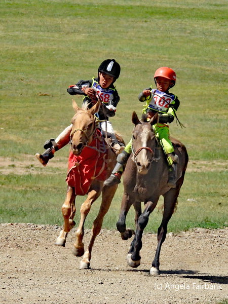
Mongolian word of the day: Bi oilgoj baina. I understand. Unfortunately, I had what the French call une nuit blanche and hardly slept a wink. At midnight there were bangs of fireworks, but I couldn't be bothered to look out the window to see if they were visible from my hotel room. We had been told by our guide to meet in the lobby before breakfast because G Adventures finally realized their mistake about the hotel and its unsatisfactory breakfast, caused, we learned, by the hotel we were in not being fully staffed due to the holidays, and changed us to the Novotel Hotel--but just for breakfast. Taken there by our bus and given a private dining room, we fetched our coffees and food from their buffet. I found some satisfying yoghurt and fresh fruit to fulfill my own needs.    Then we travelled outside the city to a large field on the steppes, known as Khui Doloon Khudag, or Q7 to the locals, where people--locals and tourists alike--had gathered to watch horse racing. This was the Soyolon Race for 5-year-old horses, considered to be the fastest and strongest, and whose jockeys were all small boys. I'd guess the oldest of these children were about ten. We were seated on stands again but there was no shade here, so we were forced to put up umbrellas to ward off the hot sun--the temperature was forecasted to go up to 31 degrees Celsius today. The first boys on horses we saw coming down the racetrack were ones, we were told, who had been eliminated for not being the correct weight or because their horse did not match the required measurements. Police were standing at various intervals along the end of the track facing the audience with their backs to the horses and their young riders. A water truck drove down the track several times to spray water on the grassy field to keep down the dust factor, and in some cases sprayed down the audience members as well! We were advised to stand behind the back row of the stands for better photos but were frustrated as we waited for the umbrellas people were holding up to be lowered or due to the height of some of the tourists. I finally initiated a move closer to the action and managed to get a few good shots, although I also had to delete a great many that contained heads of audience members. One horse arrived at the finish line sans rider.
   The two (out of a total of five) adults on horseback you will see in some of the photos near the beginning of this series were the judges who were there to watch and award prizes to the first five horses with riders. The boys and their 5-year-old steeds had run a race of 25 km but we were told that they'd had to ride all the way to the starting line too, which meant they'd completed a total of 50 km all on horseback and without saddles yet with whips to coax their mounts. Some of the horses walked to the finish line because they were so exhausted and nothing the little boys did could convince them to go any faster.
   We returned to the bus photographing more people at the event on the way. We then sat in the bus for a while enjoying the air conditioning until a table was ready at a make-shift open-air restaurant, called a Khuushuur stand, where we were served Mongolian fried dumplings, called khuushuur--filled with lamb meat balls for meat eaters and potato for vegetarians--after which they brought us ice creams on sticks.
   We were then given the choice of going back in the afternoon to watch the race for 2-year-old horses, called Daaga, but not only aware of just how the heat was affecting me, and of the fact that these would be the hottest hours of the day, but also hearing that we would have no seats this time, I opted to stay in the bus and read. Those who went, ended up, I was told, waiting a good two hours under the hot sun, standing at the fence, with about a hundred of the rejected horses behind them breathing on them. The most poignant moment was when one boy, who must have fallen off his horse during the race, ran after it and managed to catch up to it and then ran ahead of it, pulling it by the reins, and in this way succeeded in getting over the finishing line. Another photo I saw provided by our guide and uploaded to our WhatsApp group shows a couple of the two-year-old horses jumping over the white finishing line. Another video he shared was of a winning 2-year-old horse being led by its owner to its mother to nurse!
   Finally, back at our hotel, after a slow bus ride though busy, festival traffic, I was directed toward the center of the city, just a few blocks away. My goal was to photograph the Ulaanbaatar sign in red letters that I'd seen from our bus yesterday. On the way, I photographed some small birds--sparrows I surmised--and a few large statues. After coming to the general post office and still not seeing what I was looking for, I asked a couple, who looked like they might be tourists and therefore speak English, if they'd seen the sign. They answered with a smile and a Slavic accent that no they hadn't seen it but perhaps it was a couple of blocks further on. I carried on and seeming to be getting farther away from the center, I asked a young local girl this time, and she directed me two traffic lights back the way I had come. As I arrived at those second traffic lights, I saw the Slavic couple again and they asked me if I'd found the sign yet. I said no but I had been directed back this way by a local. Then I suddenly saw it on a street parallel to the main street. I pointed it out to them and then went over to it to photograph it.
   In the same square, some musical activity was going on which I discovered was a Korean K-pop concert. I stayed to watch one act then realised I should be getting back to my hotel, so I returned to the Ulaanbaatar sign once again, wondering who among the persons around I might ask to photograph me with my iPhone in front of the sign, when I saw the male of the Slavic couple photographing the sign. So, I asked him, and he kindly agreed. I arrived back at the hotel to find that my roommate had completed her laundry by hand, and it was now drying very quickly around the room.
 Sunday, July 13: Ulaanbaatar - Baga Gazrïn Chuluu Natural Reserve, Mongolia
Mongolian word or phrase of the day: Tiim/Ugui. Yes/No. Leaving our hotel with our bags, we climbed into our five four-by-four Lexus LX470s and left for the Novotel Hotel for the buffet breakfast, where this time we sat in the general dining room rather than a private room. And then finally we were off, stopping initially at Gandan Monastery, one of the most important temple complexes in all of Mongolia, and famous for its chanting monks. The history behind it is that when the communists arrived in 1924, they destroyed all things religious i.e. Buddhist--or at least most of them--so the great majority of religious temples you see now in Mongolia are newly built.       We first waited outside to see the monks gathering. Then two people carrying green hats ran out, climbed a tower, and blew conch shells tuned a major third apart to call the head monk. The latter then appeared, and the monks all proceeded into the temple. We were invited to follow and enter, but no photos were allowed inside. The chanting was interesting as there was a younger cantor on the left while the remaining monks together with the head man were on the right. They chanted a tone apart. After a short while, I had to get out of there because the smoke from the incense was getting to me, worsening my cough. We then moved over to a larger collection of more modern religious buildings, one of which contained the giant Buddha you'll see below. Our final visit was to the largest and the most modern temple, at which a funeral was going on to one side, and which thankfully had bathrooms in the basement we could use.
      Back in our Lexus L470s, we left the city, driving past the airport, the highway towards which was lined with policemen. We surmised that this was because the Emperor of Japan was on his way to the airport to fly back to his country. Our first stop was in a field where a number of vultures had gathered. We took photos of them and of the flora here. The landscape had changed dramatically, and we started seeing groups of yurts, or gers as they call them in Mongolia. I was trying to remember which trip I'd been on where I'd stayed in a yurt. I believe in was during my western China trip and our entire group--males and females alike--had all slept in the same large yurt, the floor of which had been covered with carpets. We'd had to make do with bush toilets, and I remember feeling glad it was only for the one night. I'm hoping that our ger experience in Mongolia will be a bit more sophisticated, more sanitary, more private, and more comfortable.
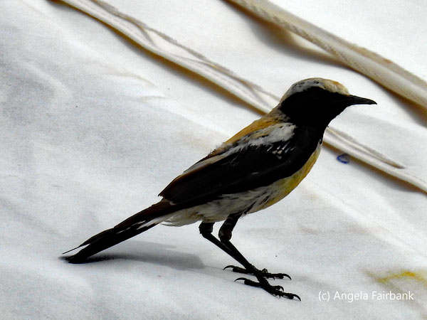
     Around 1:00 p.m., after passing through many kilometers of countryside, we arrived at our picnic lunch spot, Zorgol Khaikhan, a sacred mountain considered to be the most beautiful in central Mongolia with some interesting geological formations, horses, and cattle in the distance. The cattle were being herded by a man on a motorcycle. We were served sandwiches and salad as well as tea, coffee, and oranges. The sandwich itself was copious, so I managed only that and some coffee. The rest of the group then went to climb the small hill of rocks, while I wandered on the flat lands along the dirt roads for a bit, photographing what I saw: birds, discarded wool, manure, crickets--or perhaps they were grasshoppers--and livestock in the distance. At some point, I photographed the silver-headed pied wheatear (Oenanthe pleschanka) below.
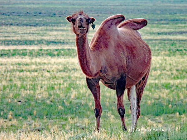
      Driving further in the afternoon, we came across a few lakes or perhaps ponds at which herds of horses and cows, and even Bactrian camels were gathering for the water. The camels I photographed here look very mangy and unhealthy to me. When we arrived at the Erdene-Ukhaa Ger Camp in Adaazag village, it had come on to shower and was getting dark. We waited to be assigned gers and to have our luggage collected from our vehicles and delivered to our accommodations. After being told that since there were other tourists here and the kitchen/eating area was small, we would be eating in shifts and were to meet at the restaurant at 8:30.
      My roommate and I settled into our ger, amused at its quaint low door and careful not to hit our heads but pleasantly surprised that it contained an ensuite toilet and shower as well as mosquito screens on the windows. Then, while my roommate went off to the bar, I transferred my photos from the day. Dinner was full of vegetarian dishes, but unfortunately only the fried potatoes were actually hot, the rest being rather disappointingly lukewarm. Ending with some green tea and feeling rather tired, we went to bed, unsure of the state of mosquitos, or how we would cope getting enough air or surviving the slippery steps down into the ensuite bathroom.
   Monday, July 14: Baga Gazrïn Chuluu National Park to Bulgan, Mongolia
Mongolian word or phrase of the day: Zogs. Stop. Unfortunately, I spent most of the night still experiencing the effects of my cold and cough and feeling sorry for my roommate who'd had to put up with the coughing. I finished my cold tablets this morning and was waiting 24 hours before beginning my cough medicine. When I took it this morning, however, the cough became instantly quelled. (In case you were wondering, the mosquitos were practically non-existent last night.) After a scant breakfast of a boiled egg, cold peas, a small piece of brown bread, and coffee, we packed up our bags so they could be picked up by a couple of kids in a golf cart and transported to our vehicles. We drove to the Dungobi Aimag region, aka Middle Gobi, full of granite formations, where our guide showed us some petroglyphs and ruins of stone buildings, and then took the others on a hike or two, once again up steep rocky paths, while I opted out. I wasn't feeling great in general yet, so I stayed with the cars and drivers, wrote a bit of travelogue on my laptop, and photographed birds when I saw them.       When we continued our drive and I was in the front seat, I asked the driver to stop when I saw a large whitish bird sitting by the roadside. Unfortunately, when we approached and as I was struggling to release my camera from my seatbelt surrounding it, it flew higher up the hill before landing again, so my photos aren't quite as good as they might have been. We were informed later that it was a long-legged buzzard (Buteo rufinus). Then on another part of our journey south, we came to a drove of cows and a herd of horses crossing the road very slowly and drinking at the puddles of water they found there. The driver stopped and let me photograph for a while, then, I gather, he was very happy to speed along the tracks in the plains to catch up to the other four vehicles.
     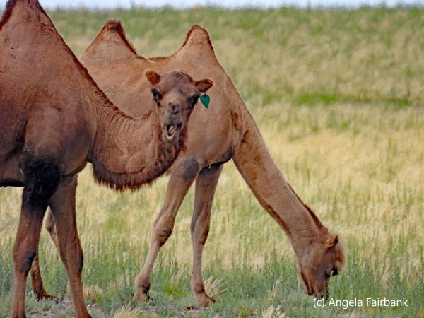 Once we reached the paved highway, we passed a couple of police controls, one of which was displaying the stop sign you see in a photo. In Cyrillic letters, it is pronounced 'zogs'. At some point, we stopped to have lunch in a restaurant. The paved road I mentioned had started again suddenly and lasted for a good 200 kilometers until we arrived, after passing and photographing some more Bactrian camels, at the gateway to a new province, Southern Gobi, where we found these statues to represent three mountains we couldn't see behind the clouds. We then stopped at a large grocery store in this large city and picked up some more 5-litre bottles or water and other sundries.
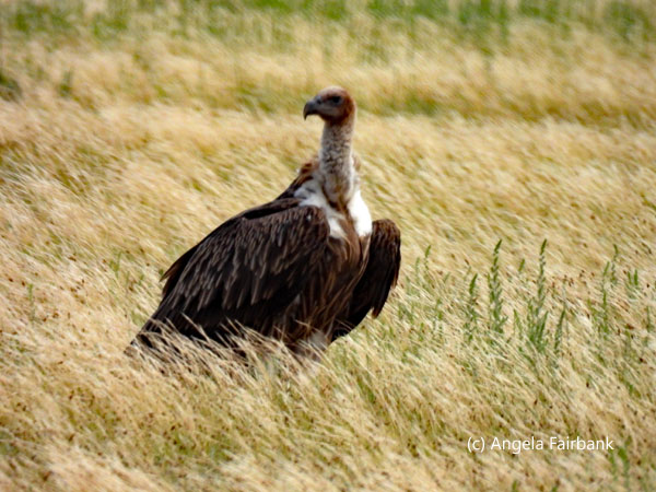
   After this, we turned off-road once again and drove into early evening as the sun descended in the sky, during which we spied a Himalayan griffon vulture (Gyps himalayensis). In the end, we arrived at our more luxurious ger, Dream Gobi Lodge, in Ömnögivi, where we will be spending the next three nights. Luckily, they had a spare ger, so in light of my cough, my roommate and I were each provided with our own gers, which were more luxurious than last night's. Unfortunately, I discovered later that I was not alone because I ended up sharing my ger and my bed with dozens of small beetles. Although harmless as they neither bite nor sting, they are apparently a species that inhabit gers annually in July during their migration across the Gobi Desert.
   We met for dinner almost immediately and I had a delicious dish of roast pumpkin and other vegetables preceded by a salade niçoise. We also viewed a wonderful sunset out the back of the restaurant.
   Tuesday, July 15: Bulgan, Mongolia
Mongolian word or phrase of the day: Uuchlaarai. I'm sorry/Excuse me. After breakfast, leaving the ger complex in a vehicle together with my roommate, and thrilled at seeing these children milking goats en route, we drove to Yolin Am gorge in Altay Mountains in Gurvan Saikhan National Park, where we saw Siberian ibexes (Capra siberica) and the below birds of prey, which from my research may possibly be Oriental Honey Buzzards (Pernis ptilorhynchus). Then, while the others took a hike into the gorge itself, I photographed horses, whistling pallid ground squirrels (Spermophilus pallidicauda), various birds, and a Small Tortoiseshell butterfly (Aglais urticae), and bought a Mongolia fridge magnet at the souvenir stalls there. I then spent some time working on my laptop. The hikers returned almost an hour later than foreseen. Nevertheless, there was apparently still time for our guide to take us to the natural history museum just inside the park gate where we saw dinosaur fossils and stuffed representatives of all sorts of animals and birds endemic to Mongolia. Did you know that there's a type of bear here called a Gobi bear (Ursus arctos gobiensis)? I didn't. We then enjoyed a 3-course lunch of salad, soup, and omelette at the Khanbogd Tourist Camp, which, having been established in 1991, advertises itself as the only “Khanbogd tourist camp located in the Gobi Gurvan Siakhan national park of the South Gobi, at 1900m - 2000m above sea level.” Jumping into the 4x4s again, our ride back to our gers seemed short. We met after a few minutes to learn how a ger is made. Our guide talked of there being five walls, which I would describe as simlar to foldable trellises for plants to climb up in the gardening world, of an area of 18 square meters, wooden structures made of larch, a layer of felt made from sheep's wool, and a cotton outer layer all tied on using goat hair and camel skin. To keep it waterproof, they spread a layer of goat fat on top of the felt, and the cooking fire beneath the roof causes the felt to absorb said fat. 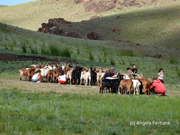         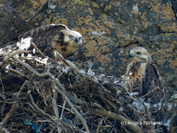   That is a very succinct version of how a ger is constructed. We all had a turn fixing one of the wooden roof poles to the tops of the walls. During the explanation, two youths came by in the luggage trolley golf cart with a baby rabbit they had no doubt found in the fields. It looked pretty scared and I gather just wanted to be released. I was also curious about a machine resembling a robot vacuum cleaner floating around in the pool. Apparently it's a pool vacuum, cleaning up all the debris. Who knew such a thing existed? Clearly not me, since I'm not a pool owner. We had some down time before dinner, which was excellent again, and then watched a video together about archery in Mongolia presented by an award-winning female archer filmed in her Mongolian traditional dress out in the open air. Having turned my light off before going to dinner this time, there were fewer beetles in my bed, but I still spent some time collecting them up in a cup. One of them managed to climb up the side of the cup and get out ... twice, so I added a bit of water to the bottom of the cup so it wouldn't be able to do that a third time.
         Wednesday, July 16: Bulgan, Mongolia
Mongolian word or phrase of the day: Bi dajgui/sain baina. I'm fine/good. We had another early start and after a 7:00 a.m. breakfast, we headed out in the 4x4s. This time, I was in the lead jeep with our tour guide only, which made for a nice, quiet trip, as well as a rest for him, I hope. On the way to our destination, to visit a local nomad family at the Moltsog Els Sand Dune, I saw a couple of Passan's Sandgrouse but did not get a photo. However, several sparrows and other passerines flew out from the fields in front of the vehicle as we passed. Our destination ended up being a family with a couple of ger buildings and a green outhouse with saddled and bridled Bactrian camels sitting, waiting patiently. Our hostess invited us inside the main ger, which was a living room cum two-bed room cum Buddhist altar cum workroom. Her 9-year-old daughter showed up with a 1-week-old white kid in her arms but not her 7-year-old brother, or her father, who, we were told, made up the rest of the family.       After being welcomed, we were invited to sit on the two beds and a few other stools and chairs, served warm goats' milk and then what was described as cookies. To be polite, I took the smallest of these latter items, but that was a big mistake. It was not a cookie. It was not even sweet, and it tasted, well, of goat meat. Had I been outside or in my own home, I'd have spat it out immediately, but I could not do that, so I hurriedly swallowed it and then excused myself to go to the jeep, fetch my water, and swirl my mouth out with it twice in an effort to get rid of the unpleasant taste.
      When I returned to the ger and resumed my seat, the woman was describing how camel wool was used to make rope and then how lamb's wool, which she carded in front of our eyes, was made into felt. She chose one of our group at random and asked to see her phone. She sized it up against a piece of cardboard and then started taking strips of the carded lambs' wool and a bucket of soapy water and started pressing it together. Meanwhile, she asked other members of the group to wash bits of the lambs' wool in the soapy water and roll them into tiny balls. After she had made a bag for the telephone, she cut off one end, removed the cardboard inside, and then sewed up the edge with camel wool using a blanket stitch, and finally made a handle for it also with camel wool and decorated it with the pompoms made by the others.
 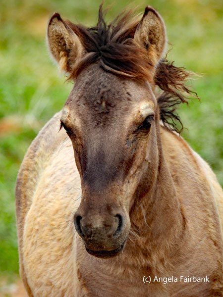  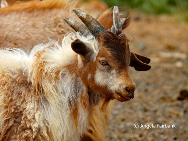   After that was done, 11 of our group of 13 rode the Bactrian camels, while we other two walked behind as they preceded over nearby sand dunes and photographed them. By the time we got back to the vehicles, I was running out of water for once so was happy to hear that we were leaving. As we drove back to our ger, we passed a livestock-watering station where we saw large numbers of animals gathered, and not only sheep and goats, but also horses, cattle, and camels. It was quite the convention. We were able to approach the gathering quite closely and photograph to our hearts' content.
      And then, as an added bonus, on the way back to the vehicles, we spied some tiny lizards (likely Tuva Toad-headed Agamas (Phrynocephalus versicolor)) in the scrub brush. We had an hour before lunch, so I transferred my photos and sent some to our WhatsApp group. Lunch was a vegetarian pizza and a salad followed by a dish of vanilla ice cream. Almost immediately, we then went out to an empty roofed shed for livestock with open walls so as to try Mongolian archery. I don't think I've shot an arrow since I was at a children's summer camp some decades ago, but I was willing to give it a try and shot six arrows in all although none actually hit the intended target. I received some tuition from both our guide and the young driver I'd had on the first day, who'd placed 8th in archery at the Naadam Games last Saturday.
  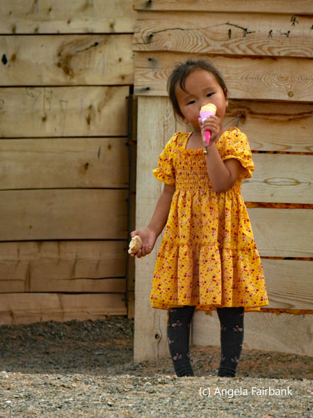 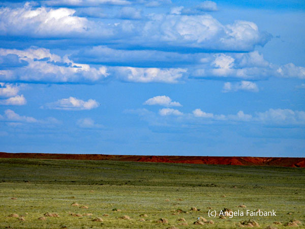   In the late afternoon, we drove over to a museum, essentially to watch a video about an expedition about 100 years ago to this area to look for the origin of mankind, but instead they'd discovered dinosaur eggs and remains. A panel reads: “Over a history of almost 100 years of dinosaur research in the Mongolian Gobi Desert, more than 80 genera of dinosaurs have been found so far from over 60 fossil sites distributed across the Gobi region. It all began in 1922, when a group of explorers from the American Museum of Natural History arrived in search of the origin of man. Instead, at this location, they found the first dinosaur eggs the world had ever seen. Roy Chapman Andrews, the expedition leader, named the site 'Flaming Cliffs', for the glowing orange colour it emits at sunrise and sunset. Today, it is one of the most popular paleontological sites in the world and continues to yield some of the most rare and complete Cretaceous fossils of the Gobi Desert.” We then had a look at other displays and drove over to some sandstone cliffs, where the others took another hike and I stayed around looking at the souvenir stalls, photographing, and walking into the desert to look at the flora and fauna there. After I'd done that, I sat in the vehicle and worked a bit on my laptop. As I did so, I spied this grasshopper sitting on the windshield, carrying what looked like another insect but I suspect the latter insect was deceased as it did not struggle.
  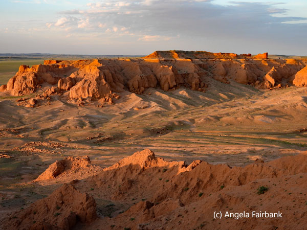 When the hikers returned, we drove over to a nearby restaurant for dinner. It was hot and dry, so we were very thirsty, but the restaurant meal did not include drinks, so I bought a beer to wash down my not-very-exciting-nor-very-well-cooked chicken. We then drove over to what is called the Tea Road. “In the period between [the] 18th [and the] early 20th centur[ies], East Asia offered a safe passage for Chinese, Russian, [and] Middle Eastern merchants in their export of various luxurious commodities from China to Europe. The trade route was called [the] 'Tea Road.' Starting from the modern-day Fuzhou of southern China and ending at Saint Petersburg, Russia, it covered some 12,000 km. Thousands of camels, along with their herders, were deployed, creating lines of camel caravans stretching over the endless steppe of Mongolia. [The] 'Tea Road' was the route [that] the Central Asiatic Expedition of Roy Chapman Andrews took for their camel caravan for camp provisions, including gasoline for their cars. Today, the legacy of the 'Tea Road' continues, as it opened a passage ... for trains and trucks, carrying daily provisions of Mongolians.” We then drove over to the red cliffs again and watched the sunset as it turned them to so-called flames.
    Thursday, July 17: Bulgan to Ongïn Khïd, Mongolia
Mongolian word or phrase of the day: Muu. Bad. Today was a half day of travel. We left our luxury gers soon after 8:00 a.m. and drove out of the grassy lands we'd become used to and into what I would consider a desert. Yet, it was a changing desert: sometimes brown-coloured steppes against grey pebbles, sometimes clumps of bushes, and sometimes water-filled patches of mud. We saw a few camels, a few herds of sheep and goats with their herders on motorcycles, and a gasoline station in a town where we used an outhouse, which was basically four walls and a roof over a wooden floor with one slat missing. At another stop, we photographed tiny lizards. We made a stop at a town so that people could buy snacks and drinks, as well as at a Buddhist prayer-offering site dedicated to drivers, where there were some cute children to photograph. We finally arrived at our next ger complex, called Secret of Ongi, where the gers had no indoor plumbing, so we had to share communal toilets and showers. Our lunch, which we ate after moving our luggage into our gers, wasn't great. Afterwards, we went for a short stroll to local monastery and university ruins called Ongiin Khiid. Unfortunately destroyed during communist purges, they were once among the largest temples in the country and housed over 1,000 monks. As we visited a well, a museum, and a small temple here, our guide offered explanations. He also found us a new bird to photograph, a crested lark (Galerida cristata). We then walked down to a river and back around ending up at our ger complex again. At the river I saw a blue damson fly. I don't remember seeing damson flies since I was a child. We then had some hours on our own, so I spent them sitting in our ger with the door wide open as there is no air conditioning and no fan--it wouldn't have been possible otherwise with the heat--and worked on my photos. Dinner once again wasn't great, but afterwards we were given a short presentation of traditional clothing worn by about eight or nine Mongolian ethnic groups, which I photographed. On returning to the ger, I continued working on my photos and then wrote up this report for today. Our ger contained a medium-sized frog and crickets, which I photographed but have not posted here as the lighting was bad. 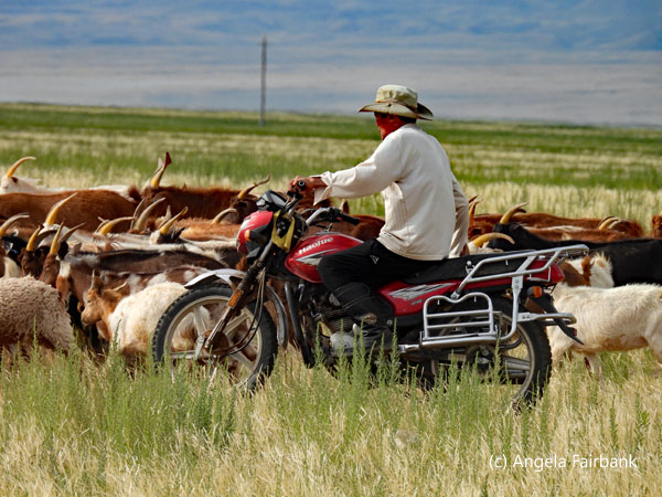    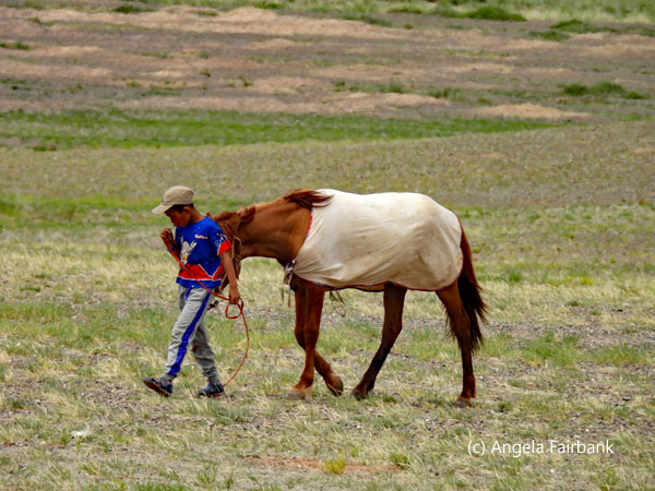         Friday, July 18: Ongïn Khïd to Orkhon Valley, Mongolia
Mongolian word or phrase of the day: Za. OK. We had a long, all-day drive northward to the beautiful Orkhon Valley (the Orkhon River is Mongolia's longest, stretching 1,124 km) with stops en route for gas, toilets, and lunch in a town that contained a candy store and a market. As you will gather from my photos, I photographed a number of raptors this morning, many of which were sitting on promontories above a major road construction, but I couldn't begin to guess what they were. They were all beautiful to me. In the afternoon, we exited our vehicles to visit a horse monument/cemetery that celebrated winning racehorses. The route contained a long series of twists and turns, as well as a great deal of water and puddles, so we had to go slowly. After spying our first yaks, which looked smaller than we were expecting and really just hairy cows, we finally arrived at our ger camp for the night, where we were accommodated in very comfortable log cabins with indoor plumbing. The meals we had today were quite good. In the evening, my roommate and I watched our youngest driver and our guide practice archery as a couple of small boys, who apparently lived on site, ran eagerly to fetch their arrows for them.       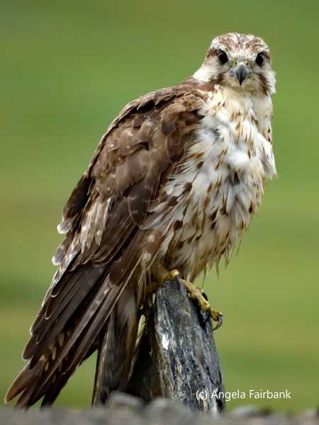                         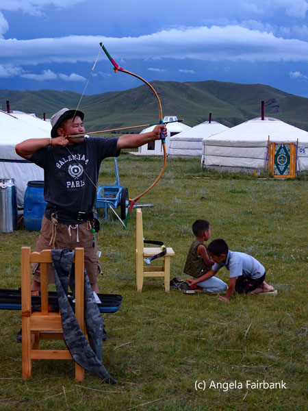  Saturday, July 19: Orkhon Valley, Mongolia
Mongolian word or phrase of the day: Goy. Nice. I have a large number of photos from today so will keep my text short. We were up early to consume a quick cup of coffee and then walk over to a couple of gers just outside the accommodation's fence to photograph, admire, and milk yaks.                                  After returning to the dining room briefly for breakfast, we then revisited the yak-owning family (now changed out of their traditional dress) to try various products made from yak milk: tea, butter, curds, and fermented milk; and then watch our hostess as she made yoghurt, cheese, butter, and distilled vodka from the fermented milk. We had a short break, during which I transferred my photos, and then participated in a cooking lesson to make Mongolian steamed dumplings, called buuz. We then had a second break, during which I transferred photos from my phone and used the accommodation's Wi-Fi, followed by a lunch of salad, dumplings, and a tiny chocolate bar.
         As it had started raining, I decided not to go horseback riding. Instead, I followed the group by vehicle and then on foot to the 20-meter-high Ulaan Tsutgalan Waterfalls, the largest in Mongolia, where I filmed ziplining enjoyed by two of our group. I then walked over to the gorge to watch the two zipliners climb up precarious rocks. I and some others then returned to the ger camp by foot and vehicle and waited for the horse riders to come back in. I then returned to our cabin to write up this travelogue. Tonight's dinner was a Khorkhog or Mongolian Traditional BBQ, made in a container of hot stones and water, where lamb, potatoes, and carrots had been cooked together, which meant that, unfortunately, the latter two vegetables both tasted strongly of meat. Luckily, our guide had thought of this, so I was provided with a separate vegetarian meal.
          Sunday, July 20: Orkhon Valley to Elsen Tasarkhai, Mongolia
Mongolian word or phrase of the day: Bi. I. After breakfast, we headed back the way we'd come into the Orkhon Valley, leaving behind the yaks, for another long day of driving, stopping for a bush toilet break by the river and then at a spot over a valley with the river running through it to view the site of a battle between the Manchurians and the Mongols centuries ago, although it looks very peaceful now. On that part of our journey, I was able to photograph a ruddy shelduck. We finally arrived at Kharkhorin, Mongolia's ancient capital, and the Karakorum Museum to learn about the history of this area, including Genghis (Chinggis) Khan and his descendants who ruled Mongolia in the 13th century. The museum contains artifacts from the 13th and 14th centuries as well as a scale model of the ancient capital. We then visited an exhibition of local games next door--puzzles for the most part--and had our given names inked in Mongolian calligraphy by a teenage student. Then it was off to lunch where we had miso soup, vegetarian noodles, and vanilla ice cream in a berry sauce.  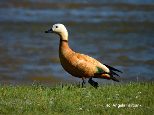  Next, we drove over to the remains of the Erdene Zuu Monastery, considered Mongolia's earliest center of Buddhism, and had a private meeting with the head monk to learn about the Communist purges that decimated much of the country's Buddhist heritage. One of our group asked him what the meaning of life was and why we were here, and his answer was a description of reincarnation and that by being born human we had clearly been good souls in previous lives and that as long as we continued to lead good lives, we would reach nirvana. We then visited a stone turtle whose explanatory reads: “This turtle is 10tn weight, 1.25 meters wide and 2.6 meters long. It is the largest ...stone turtle and depicts the body more vividly with muscular legs, long claws, big mouth with sharp teeth and flame-like patterns in the legs and shell... [A] Mongolian inscription in the front side ... [says] that 'Genghis Khan gave a decree to build Kharkhorin City in 1220 and his son Uguudei Khan built his palace. Munkh Khan built [a] 90 m-[high], 5-[floor] Buddhist Temple with [a] golden roof. The temple was later rebuilt by Togoontumur, the last emperor of the Yuan Dynasty.' ...Stone turtles have been placed on four sides of ... ancient Kharkhorin with [the] aim of keeping off floods [and] acting as protectors of the city... The animal of the spirit of water, [the turtle is] considered [a] symbol ... of longevity and eternity.” Another panel on the grounds says, “The Erdene Zuu monastery complex was built in 1586 on the site of the ancient city of Karakorum, the first capital of the Mongol Empire. According to legend, the city was founded in 1220 by Genghis Khan and expanded from 1235 under his successor, Ögedei Khan.” A third says, “In 1220, the construction of Kharakhorum city, the capital of [the] Mongolian Empire, was [carried out] on the orders of Chinggis Khaan and [completed] during the period of Uguidei Khaan. Kharakhorum city was not only the administrative, trade, and cultural center of the Mongolian Empire, but also served as a link between East and West. During the 13th century, Kharakhorum city was one of the biggest cities in the world, [encompassing] royals, ministers, noblemen, military leaders, craftsmen, traders, priests, and inns for foreign missionaries and visitors. Kharakhorum was surrounded by solid walls with a gate on each side. It consisted of royal palaces, monasteries, trading markets, administrative and military buildings, and residential areas.”
   Leaving the complex, we came to a circle of convenience stores, souvenir shops, markets, and coffee shops, and I spied a Golden Eagle (Aquila chrysaetos) chained to a stand. So, I asked if one of the others of the group would come with me and photograph me. The eagle's owner, a young man, sensed immediately what I wanted and had me wear a very long, thick leather glove over my left hand and arm with a separated thumb, then had me make a fist, and perched his eagle on my hand. Boy was it heavy! I couldn't gauge exactly but at least 10 to 15 pounds. I had to hold up my left hand with my right to take the weight. I must say, the eagle was very well behaved. It did not struggle and did not peck me or my face. Its owner instructed me to move my arm about--so as to cause its wings to flap, I suppose.
   By doing this, we lost sight of our group for a moment and had to WhatsApp them to find out where they and the cars were. However, I gather there was no panic that we were missing, as people had been busy using the toilets at one of the coffee shops, buying cold drinks, etc. Next, the vehicles took us to a pharmacy and a grocery store so that people could buy various necessities such as water, and then to an ATM so that cash could be withdrawn. Finally, it was another 75 or so kilometers, mostly by paved highway, to our best gers yet of the trip. Apparently, they are brand new--they even smell new--with a porch to watch the sunset, and wooden tongue-and-groove flooring, which squeaks rather. We checked it out and oohed and ahed at all the mod cons and then went over to the dining room for dinner, joining a large group of Koreans who had arrived via a very large bus. I then transferred my photos and edited the rest of those that I could before turning out the lights so as not to attract the insects, including beautiful orange-and-red butterflies, crickets, and thankfully, very few beetles.
 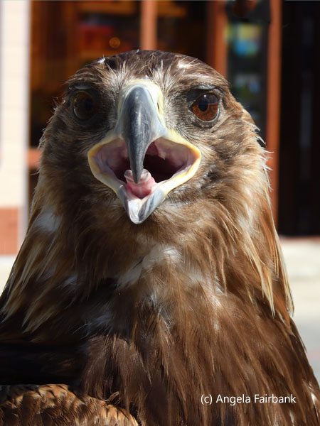 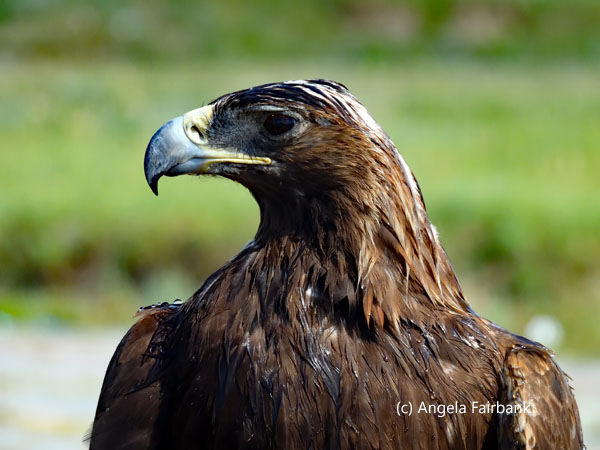    Monday, July 21: Elsen Tasarkhai, Mongolia
Mongolian word or phrase of the day: Ta. You. Right now, I'm sitting on a camp chair in the middle of a valley, with cragged mountains all around, shady trees, which are being eaten by camels, as ground squirrels scurry about, not whistling this time, foraging for food, and occasionally squabbling with each other. Multitudes of crickets are chirping and buzzing their wings as they fly. The drivers are sitting not far away, also on chairs chatting quietly, while the rest of the group has gone for a hike up the mountain to the ruins of Uvgun Monastery, which was decimated and its monks killed by the Manchurians during the 16th century. I still have the vestiges of my cold ... unless of course it' s now the dust that's affecting my lungs, with a cough, and my nose, which I occasional need to blow. I have also managed to photograph a couple of red-billed choughs (Pyrrhocorax pyrrhocorax), which had been elusive to me in Wales.   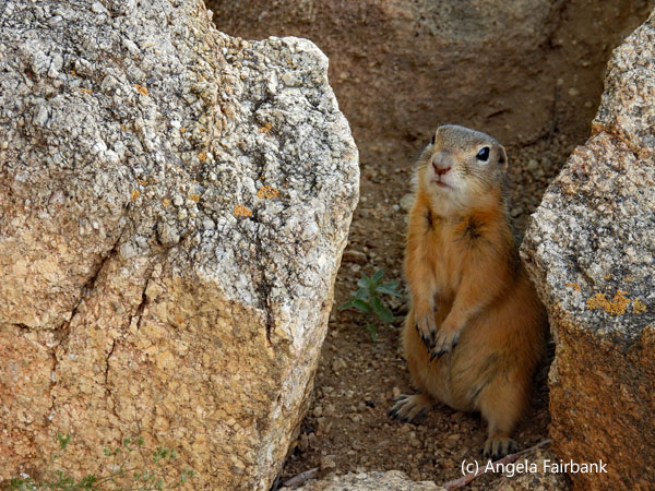  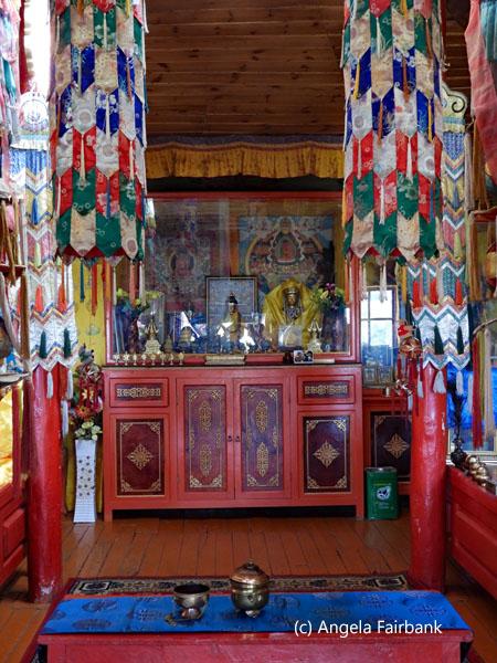  I slept well last night despite my cough and did not hear the wind blowing hard in the night, according to my roommate, who then had to venture outside with her phone flashlight to find her washing, which had blown off the railings of our porch. Breakfast was good, despite the large crowd of Koreans who left en masse just as we got into our own vehicles to travel to this spot. There is a small, very decorative temple here, which we all visited before the hiking group started up the trail. I wandered around the grassy fields for a bit photographing what I could before borrowing this chair and sitting down with my laptop. I actually managed to get a lot of work done as the hikers of Khungu Khan Mountain took about three hours, some going higher than the ruins of Uvgun Monastery and returning via a different path, while others arrived back earlier by coming down the same way they'd gone up. We then returned to our ger camp where I worked on my photos until a lunch of salad, pumpkin soup, spaghetti with vegetables, and melon was ready for us.
      At 3:00 p.m., we left in our vehicles again to visit the nearby Bayangobi sand dune, which, at 18 kilometers long and from 2 to 8 kilometers wide, extends through the middle of Mongolia and at some parts is 80 meters high. We first drove through where all the local and international tourists were. Apparently, since the dune is located not all that far from Ulaanbaatar, the latter's residents come here to escape the city and experience a 'mini Gobi Desert.' We continued past them to a place where we had our own space to climb up the dunes, take photos, and climb back down. We then divided up as seven of us wanted to ride camels again while the rest of us wanted to look at and photograph the wildlife on the lagoon. As part of the latter group, I saw Whooper Swans (Cygnus cygnus), to my surprise, as well as Eurasian coots (Fulica atra)--parents and young--and a few other unidentified species, but perhaps the female duck and ducklings are Mallards (Anas platyrhynchos). There was a tower from which to observe the lagoon from above, but unfortunately the first set of stairs was missing, so climbing it was impossible. A pair of Eurasian magpies (pica pica) was also feeding on the grass by the lagoon. We then went to wait in the local tourist section for the others who had ridden camels. Some of these tourists were renting costumes to ride horses, and I photographed this little boy peeing (clearly he felt no embarrassment whatsoever) behind some kneeling camels.
      When we returned to the gers, I realized I'd left my umbrella and water bottle behind at the gazebo by the lagoon. Dinner was egg salad, a plate of vegetables over mashed potatoes for us vegetarians and watermelon. We heard later that one of our group had heard the pitiful bleatings of a young goat and had gone to see what was wrong. When she found it, it was shivering, wet from a rainstorm, and covered in muck. Thinking it had lost its mother, our fellow passenger lifted it into her arms and carried it into the complex, asking what she should do with it. A local family in the ger complex said they would look after it and washed it and kept it warm in their ger overnight.
      Tuesday, July 22: Elsen Tasarkhai to Khustai National Park, Mongolia
Mongolian word or phrase of the day: Daraa uulzay. See you later. Before leaving Khoyor Zogol Lodge, which wasn't listed in our original itinerary, we visited the little kid that had been rescued last night and which had now been apparently adopted by a young boy, who was holding onto it by a string leash as it happily gamboled about and munched on the plants on the complex's lawn, its trauma from the night before clearly forgotten. I was hoping that the boy wouldn't become too attached since goats are not usually kept as pets in this country but rather seen as providers of milk, meat, and wool. Bright yellow rapeseed added a bright splash of colour to the surrounding fields as we drove toward our next destination. En route, our driver was contacted by phone by a friend who had broken down ahead of us on the same highway. It transpired that he needed water for his engine, so those of us who were willing and able to, donated the drinking water left in our 5-litre water bottles to help him out. We stopped for lunch at a cafeteria-type restaurant, in the rafters of which were several nests of barn swallows, and watched, fascinated, as the parents fed their chirping chicks, who were opening their mouths every time they saw an adult barn swallow fly by. The sight of these and this amazing photo opportunity made my day (or at least my early afternoon as more great moments were to come).             We arrived soon after at our final, yet smaller, complex of gers, called Hustai Lunoba Resort, set in a circle, and spied, after hearing, a pair of magpies, although since they were partially in silhouette, the blue on their wings was not apparent. After moving our suitcases into our gers, we visited the resort's small souvenir shop and checked our emails using its free Wi-Fi. Then we left in the drizzle to visit Hustai National Park, a biosphere reserve, where we first watched an interesting film on Przewalski's (wild) horses (Equus przewalski) or Takhi that live here. Explanations provided in the museum can be summarized as follows. Implementing the Przewalski's horse program was the fundamental reason for establishing the Hustai National Park. In prehistoric times, 22 species of horses existed in the world, but only seven have survived. Of these, three are zebras, three are donkeys, and one is the Przewalski's horse. Contrary to Mustangs, which were domesticated and some of which were able to escape and live on their own in the wild as feral horses, Przewalski's horse has never been domesticated. A brochure from the museum further adds that it was thanks to Dutch and Mongolian NGOs that the first 15 horses were reintroduced to the park, brought from the Netherlands in 1992, in addition to a further 69 between 1992 and 2000, as the result of a successful captive breeding program. As of 2025, they now number more than 310 and over 95 percent were born in the park. The museum also provides information about all of the wildlife that have been found inside the park. In addition, there was a souvenir shop--on the roof of which were several saxaul sparrows (Passer ammodendri)--with some lovely things inside. I bought a purple 'made in Mongolia' leather belt but did not try it on at the time and discovered later that it is far too big so I will have to punch several more holes in it before I can wear it.
            Climbing back into our vehicles, we took a safari through the park, first photographing Siberian marmots (Marmota sibirica), and then a pack of wild horses, consisting of a stallion, three mares, and a small foal. We went off-road to get nearer ... but not too near to frighten them. With our long lenses, I and my roommate were able to capture them quite well, my roommate managing to video the young foal cavorting about, seemingly wanting his mother to play with him, but she was having none of it. These horses, and other packs, which we saw later, were heading off the heights of the mountains for the day to drink at the water holes in the valley, nearby which they would stay for the night before heading up into the hills again in the morning.
            I will interject here with what will seem like a non sequitur but will become obvious as to why: information about Mongolian nomads. I have read that Mongolians are very much a family-oriented nation, and one often sees three generations of a family living peacefully in a 6-diameter ger. Once married, the son or daughter might live next door to their parents. Mongolian herders may need to migrate four times a year--once a season--to find pastures for their herds. This move may be as short as 2 kilometers or as long as 1,000 km. As a result of this constant moving, a Mongolian household will contain fewer and smaller pieces of endurable furniture and belongings to make it simpler to dismantle and load their gers onto horses, camels, or vehicles for the journey. It takes less than an hour to assemble or disassemble a ger and in general Mongolians will come together to help each other for larger tasks as well, such as herding, shearing wool, making felt, branding their livestock, or milking them.
         I will now return to my description of our day. As it would be several hours before the wild horses descended from the hills, our guide invited us to visit his family's summer-location ger, situated inside the Hustai National Park near his wife's parents. His small family would be moving their ger to their winter area near his father's home in the mountains for the other half of the year. As we arrived in our 4x4 convoy, his four-year-old daughter rushed out to meet him. She hadn't seen him for a month. He also commented that his 7-month-old baby boy had grown since he had last seen him. His 10-year-old niece was also living with them for the moment to help his wife with the baby. We were offered warm, native blueberry juice, candies, and soft curd, and invited to meet their cows, which they herded into a corral as we watched. These cows--adults and young alike--are part of a 1,000-strong group of livestock they own, the majority of which are sheep and goats, which at the time were located some meters away and consequently too far away for us to photograph.
         During our visit, some of our group used the family's toilet, which apparently contained an actual toilet seat, and was located quite a walk away from the group of three gers, with one end of the green enclosure open so that the sitter had a great view of the fields. Meanwhile, another of us spied this huge grasshopper measuring about 4 inches from tip of antennae to tip of pointed tail sitting on the side of their main ger. The family actually owns three gers: one for living, another for storage, and a third that they lend out/rent to visitors and are hoping to post its availability on airbnb. They used to have just one ger, but in January of this year, a battery exploded, and their previous ger burned down (no one was harmed). As a result, the community pooled their resources and gave them household stuff, and it resulted in their having these three gers. What a helpful community these nomads are!
         We then returned to the park and found the same group of wild horses, who had now finished their watering and were hanging around nearby feeding. We were so lucky with the light at this moment as the sun was low in the sky at the magic hour (it had stopped raining some hours ago). The light hit the horses in such a way that they turned golden. I also caught images of the mare nursing the foal. There were other groups of horses on the hills around who also turned golden with the setting sunlight. Reluctantly, once again, we had to turn away as dinner was awaiting us back at the ger complex. I photographed the last few horses on the hill in silhouette.
      After dinner, we were entertained by one of the staff, a 16-year-old boy who was a national player of the Morin Khuur (horsehead fiddle). The two strings of this, Mongolia's national musical instrument, popular through the steppes from as early as the 13th century, are made of horse tail but from what I could tell it was played with an ordinary violin bow. Nowadays, the young musician explained, the strings are made of synthetic material and are incidentally tuned from the lower octave F to the 3rd octave F. Apparently, in the Gobi region, this instrument is also used to 'coax' camels. As we listened to his three pieces--interestingly the instrument was very cleverly able to imitate a horse whinnying--we sipped on shot glasses of Chinggis vodka, courtesy of my roommate. We ended our evening back at the complex's coffee shop for some souvenir shopping.
 Wednesday, July 23: Khustai National Park to Ulaanbaatar, Mongolia
Mongolian word or phrase of the day: Bi medehgui. I don't know. After breakfast and packing up, I used the internet at the coffee shop, which the owner had opened up especially for us. We then departed our last ger with some regret, knowing that we would be leaving the peaceful countryside and returning to the big smoke. I was happy to be assigned to vehicle number 4 again with my favorite driver, Pegghee (pronounced Peggy), a thirty-year old with a twenty-five-year-old wife, a daughter of two, and expecting a boy soon. As his English is limited and my Mongolian is non-existent, that was all I managed to learn about him as I sat in the passenger seat this morning. Before we left the country tracks and turned onto the highway, he stopped to let me photograph a couple of demoiselle cranes (Grus virgo) and an endangered Saker Falcon (Falco cherrug), Mongolia's national bird, I learned. (“The saker falcon is the second fastest bird in level flight after the white-throated needletail swift, capable of reaching 150 km/h (93 mph). It is also the third fastest animal in the world overall after the peregrine falcon and the golden eagle, with all three species capable of executing high speed dives known as stooping, approaching 300 km/h (190 mph). The Saker Falcon is the national bird of Hungary, the United Arab Emirates, and Mongolia.”)    It seemed a long drive, partly through suburbia, to our next stop, the behemoth, 40-meter (131 ft) tall, stainless steel statue of Genghis Khan (aka Chinggis Khaan) on horseback and the world's tallest equestrian statue, located 54 km from Ulaanbaatar City, where, according to legend, he found a golden whip that assisted him in many of his conquests. “He is symbolically facing eastward towards his birthplace and situated on top of the Genghis Khan Statue Complex, a visitor center, itself 10 meters (33 ft) tall, with 36 columns representing the 36 khans from Genghis to Ligdan Khan, [Ed. its lobby also contains a humungous Mongolian boot]. It was ... erected and opened in 2008 to honor the 800th anniversary of the founding of the Mongol Empire.” Apparently a modest ruler, this king never wanted to have his portrait created, let alone have a statue of him made. Yet he is still revered today by Mongolians all these centuries later. As we had limited time here, we climbed up to the mane of the horse to have a look over the landscape, but unfortunately never made it to the underground museum as we were more interested in exploring the souvenir shops, where I finally found a t-shirt that said Mongolia on it.
      Our next stop was a short visit to a suburban family, whose yard contained a ger in which they lived. We were served a lunch of delicious pumpkin soup and crackers as well as a bowl of yoghurt. Our retired-nurse hostess, who had two of her grandsons to help her as well as twin grand-daughters, who'd been swimming in a plastic pool in the yard, then played us a couple of lively pieces on her slightly-out-of-tune guitar and we all took group photos with her. Returning to our cars, we travelled our last miles in the 4x4s to the city proper--through rather congested city traffic--and the 4-star Chinggis Khaan Hotel, (where we had expected to be staying when we first arrived in Mongolia, but couldn't due to the Naadam Festival, as a result of which it had already been fully booked), and settled in after saying good-bye to our drivers: Touro, Inke, Miya, Peggy, and Todrag (or at least that's the way their names sounded to me) with hand shakes or hugs all round and a final group photo seen below.
 After settling into our hotel rooms, we then went out on foot for a final dinner together at a steak house, although there was also a vegetarian meal available of pumpkin soup, a plate of veggies, and cheesecake for dessert. Our guide then took us to a nearby genuine-cashmere shop, called Gobi, where some of us made purchases.
   Thursday, July 24: Ulaanbaatar, Mongolia
Mongolian word or phrase of the day: Bi oilgoj baina. I understand. We were first at breakfast today and had to wait for staff to open the door but there was enough to choose from, although the croissants weren't all that fresh. We then met up in the lobby to take a private bus over to the National Museum, where we had an excellent, English-speaking, Mongolian guide with a sense of humour, who took us around the six rooms and explained in great detail some of the artifacts contained therein. In fact, I might even say that although I am not one for museums and usually want to go around on my own as quickly as possible and get out of there, he actually held my attention the entire time. I went up to him afterwards to tell him how much I had enjoyed it--a first for me! We then walked through the main square where a group of Mongolians celebrating their 40th class reunion was gathered in traditional garb and having their photos taken. The huge parliament building at one end of the square contained another statue of Chenggis Khaan outside its front door. Our destination was a G Adventures project of a coffee establishment called Smile Cafe, maintained by individuals with Downs Syndrome and their mothers, who served us our choice of coffees as well as chocolate wafers. A 30-year-old man welcomed us at the door, and a 32-year-old woman handed us our coffees that they'd both made individually from machines. The woman told us (through our guide) that she was a silver medalist in Badminton singles as well as a gold medalist in Badminton doubles at the Paralympic Games. On the way back to our bus, we passed these window washers hanging from one of the tall skyscrapers facing the square. We then walked over to a famous Mongolian restaurant with a lot of decorations and copious servings, a good portion of which we ended packing up and taking back to our hotel with us since we have fridges in our rooms. I then spent some time repacking my suitcases for the airport, transferring my photos, and recharging my electronic devices.    In the evening, we met up again in the lobby to take our bus over to the Cultural Center near the Ulaanbaatar sign to watch a fantastic cultural show, containing throat singers, voice singers, about 10 instrumentalists on traditional instruments, dancers in costume, and a contortionist, who managed to shoot two arrows with a bow that she held with her feet while standing on one hand on a post. I enjoyed the music so much, I bought the group's CD. Here, too, in the Cultural Center's boutique there were some marvelous souvenirs, but I managed to resist buying anything more. We then returned to our hotel and gathered at the bar for an end-of-tour round-up, but while we were waiting for some of our group to arrive, I went to the e-mart around the corner to buy myself an umbrella to replace the one I had left behind at the sand dune. The e-mart was huge and had two floors. I eventually found what I wanted, but when I arrived at the front of the queue to pay at the check-out counter, the cashier refused my purchase as it did not contain a bar code. This meant I had to repeat my long route to find another umbrella that bore a bar code and line up at the check-out counter once again. When I arrived back at the bar, the group had just finished saying what they had enjoyed most about the tour so I missed all that and it was left to me to say what I had enjoyed most so I said all the photographic opportunities: landscapes, people in costume, and wildlife, as you will no doubt agree from looking at the photos I have displayed here for this country. I think Mongolia has to be among the top three countries I have visited in the world along with Ethiopia and Guatemala. We then said our goodbyes and I went up to the room to eat my leftovers from lunch before getting to bed.
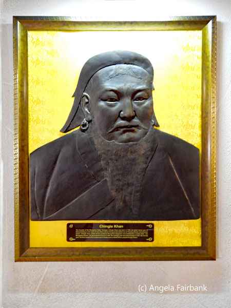   Friday, July 25: Ulaanbaatar, Mongolia to Seoul, South Korea
Mongolian word or phrase of the day: Bayartai. Goodbye. After the hotel buffet breakfast, at which I was mesmerized by a humungous screen showing landscapes of Mongolia, most of which I recognized, I said good bye to my roommate and met two others of my group in the lobby, together with a new driver to take us to the airport, as we were all on the same flight to Seoul. We arrived at the airport in plenty of time, so I had the opportunity to look around the shops and then read my book. The flight was under four hours due to the time difference (Seoul being an hour ahead of Ulaanbaatar) and included a meal as well as a screen on which to watch a movie, despite dozing through most of it. I arrived in Seoul, South Korea (country number 168, UN country number 133), which has a population of 10 million, while a further 16 million live in the area around it out of a country total of almost 52 million. I also learned that the capital was being moved to Saejon, named after a king whose portrait appears on the 10,000 won bill and who was the reining monarch until 1948. After getting another stamp in my passport, I collected my suitcase and maps of Seoul and Incheon from the airport tourist office. I also enquired about a taxi to my hotel and asked about three people which taxi stand I should be at. The first two did not speak English, but the third, who was a young man with a Caucasian wife and mixed-race baby, helped me find the Korean equivalent of my hotel online, which I took a photo of so I could show it to my driver. The driver then took me over to Incheon across a very long bridge called the Incheon bridge, which is 21.380 km. I asked the hotel receptionist later if it was the longest bridge in the world but sadly it is not. That honour belongs to the Lake Pontchartrain Causeway in Louisiana, USA, spanning 23.8 miles (38.39 km), holder of the Guinness World Record for longest continuous span over water in the world. According to the list I found online, the Incheon bridge is about the 37th longest, the majority of lengthy bridges being located in China. I checked into my room, ate some leftovers and some snacks from past purchases in Mongolia, washed some clothes by hand, and settled in for the night. Saturday, July 26: Seoul, South Korea  Korean phrases of the day: Annyeong haseyo. Hello. Kam sa haam ni da. Thank you. After a good night's sleep, I arose in time to wash my hair before ascending to the hotel breakfast buffet. Back in the room, I repacked everything so as to leave my large suitcase behind at the tour's beginning and ending hotel and travel around South Korea with my small one. I then caught up on a few entries of my travelogue. Then, having asked for a late check out at 1:00 p.m. instead of 11:00 a.m., I ordered a taxi. The hotel receptionist had written out the new hotel name and address in Korean so as to make it easier for the driver. When he entered the address into his GPS, it said it would take an hour and a half! Despite the time it took, however, the price I was quoted was respected, and I was driven across a number of bridges and what seemed like even more tunnels. Checking into my new hotel for Intrepid's 'South Korea Highlights,' tour, I learned that we would be eight passengers and that I would be sharing a room with an African American Baptist from outside Chicago who used to be a sign-language interpreter. At 4:00 p.m. I met the entire group plus our Korean tour guide, Yong, who is tall for a Korean and speaks English well. He certainly has a lot to tell us about his country, which he clearly loves, and about Seoul, which is 600 years old but was heavily bombarded in the Korean War. We listened as he described the trip itinerary and then introduced ourselves. We are one Canadian (me), two Americans, one Brit who lives in Luxembourg and is a European Court interpreter--three interpreters on the same tour, how unusual!--and four Australians. After our meeting, we went out with our transit passes provided by the tour company and wound our way through Seoul's metro system to the local food market, called Gwangjang, where we were treated to a dinner of vegetarian dishes but it was far too much food. Yong must have overestimated our appetites. It's a pity Korea does not have a culture of doggy bags as a great deal of food was left behind. We then walked over to the canal, which had formerly been hidden underground, and strolled along it for a bit until we reached one of the four city gates and an ancient fortress wall, up which we climbed for a view of the city (Naksan viewpoint) under the setting sun. We then took a bus on the same transit card and arrived back at our hotel, stopping first at a 7-Eleven store, where I bought a few supplies for tomorrow's breakfast since none is provided by the hotel: cold coffee in a can, bananas, madeleines (thoughts of Proust anyone?), and yoghurt.
       Sunday, July 27: Seoul, South Korea - the DMZ with a view of North Korea - Seoul, South Korea
Although I wasn't physically inside North Korea today, I came as close to it as I could and was definitely able to look over it, although photos of the country itself were unfortunately not allowed. Nonetheless, a few photos of the DMZ (Demilitarized Military Zone located between the two Koreas) were permitted, and you will see them here. I am getting ahead of myself, however. After breakfast in my room, I set out for the day with my cameras and water. It was the second day in a row of 35°C. heat, forecasted to last another two days at least. Our private bus dropped us off near Gwanghwamun Square where there were statues of two famous Koreans: Admiral Yi Sun-sin, a revered naval commander known for his victories against the Japanese navy during the Imjin War (1592-1598), and King Sejong the Great, the fourth and most respected king of the Joseon Dynasty, famous for creating Hangul, the Korean alphabet, whose golden statue depicts him holding a book and displaying Hangul characters with models of ancient Korean scientific instruments at its base. We continued walking in the heat toward the Gyeongbukgung Palace, a former royal building originally established in 1395, the fourth year of King Taejo's reign, and the first royal palace of the Joseon dynasty. Throughout its history, it has been demolished and restored many times. We learned that entrance is free for visitors wearing hanbok (traditional Korean clothing), however, our guide told us that no Koreans actually do this, and all the visitors we saw in traditional dress here were foreigners, including Vietnamese, Chinese, Japanese, and other Asians.    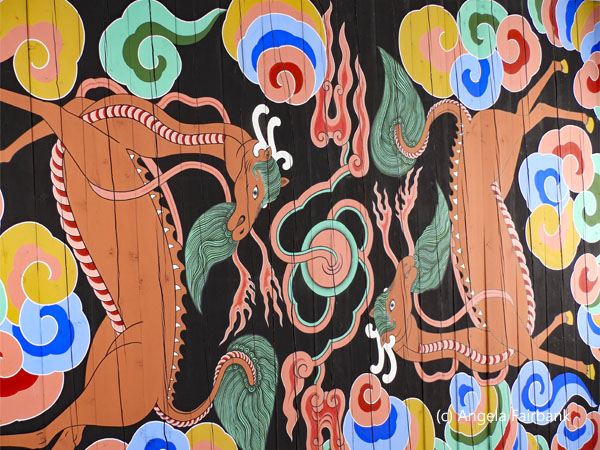   We were also there at the right time to experience the changing of the guard ceremony, photos of which you will see here as well. After that was over, I was exiting when I saw a little girl in hanbok crying in distress. Clearly she had lost her parents. She did not understand English when I tried to help her, and shook her head when I offered her a clean tissue for her tears, but a couple of the palace visitor center staff came over with a smart phone, which was able to provide a translation of the words she recorded for them. It was through this means that they found out she was Vietnamese. They finally got her calmed down and led her to the information center, so I left. I met up with my group again across the street in the Museum of Korean Contemporary History, where we could fill our water bottles for free and use their toilets. Our guide also encouraged us to take the elevator to the roof for an overview of the palace. I then got off at the wrong floor in the elevator and ended up winding my way backward in said museum so as to return to my group.
   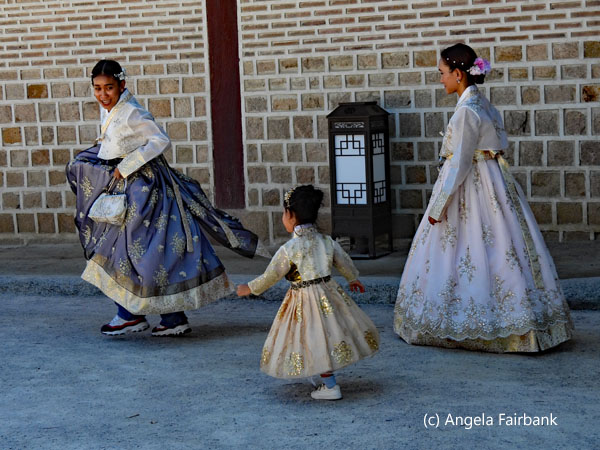 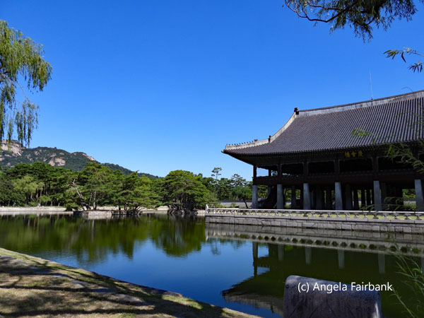  On our bus again, we headed northward to the border with North Korea, aka the Democratic Republic of Korea, at a place called Paju, which has a number of touristic facilities, including historic sites, shrines, tombs, Buddha statues, a gondola ride, and more. We stopped first at the Korean Peninsula Ecological Peace Tourism Information Center, where we watched a film on the history of the DMZ and the demarcation of the 38th parallel (or thereabouts) by the USSR and the USA to signal the end of the Korean War on July 27, 1953, the date when the Korean Armistice Agreement was signed. This allowed for the exchange of prisoners and created a four-kilometer-wide (2.5 mile) Demilitarized Zone along the frontline, with a Joint Security Area (JSA), also called Panmunjeom. After the film had ended, we were encouraged to eat lunch at one of four restaurants. My roommate and I opted for the most Western type of restaurant, which served delicious soup and sandwiches.
     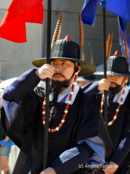 Together with Korean tourists, we then boarded a DMZ shuttle bus, which, after a passport checkpoint, took us first to what is called 'the third tunnel,' one of four tunnels discovered to date (although there are believed to be up to twenty more) that the North Koreans denied having dug toward South Korea beneath the DMZ so as to infiltrate Seoul and initiate a surprise attack. Instead, they claimed this tunnel was part of a coal mine (yet signs in the tunnel claim there is no geological likelihood of coal being in the area and the walls we saw were granite.) An information panel about the 3rd tunnel claims that after a tip off from North Korean defector Kim Bu-seong--a surveyor who measured underground tunnels in South Korea--that there was a tunnel under the DMZ, the South Korean government installed 107 water-filled boreholes 80 meters underground and two meters apart. Due to water erupting from one of the pipes following an explosion on June 10, 1978, the South Korean government found the exact location of the 3rd Tunnel, 4 kilometers south of Panmunjeom and 52 km from Seoul, on October 17, 1978. At 2 meters wide, 2 meters high, and 1,635 meters (1 mile) long, this tunnel is large enough to move 30,000 troops per hour. Among the tunnels discovered to date, it is the largest in scale, running 435 meters under the south side of the Korean Demilitarized Zone, and clearly shows North Korea's intention to infiltrate.”
   Donning hard hats, we were able to descend 73 meters downward into said tunnel via an 11-degree-inclined walkway of 358 meters from the entrance. Once we had reached the end of the inclined walkway, we then entered a section that was level but had a low ceiling, so we had to bend over. This section ended in the third barricade of three, while the second barricade was visible through a small window. The section between the third barricade and the Military Demarcation Line, the border between South and North Korea, is 170 meters. In front of the third blockage was a device showing a digital count of 26,298, which I thought might be the number of visitors who had reached that spot but it I discovered later from my readings that it was the number of days since July 27, 1953, the date of the Korean War Armistice Agreement. In actual fact, the DMZ received its ten millionth tourist on November 8, 2024. No photos were allowed inside the tunnels. In fact, we had to remove all metal and put our belongings in a locker before passing through a metal detector. I was allowed to keep on my belt, glasses, and earrings, however, (as well as of course the rest of my clothes not containing metal). It was outside or inside this building where we were allowed (with or without ourselves) to photograph the DMZ letters, as well as a couple of South Korean army models in uniform, which you will see here among the images.
   Our second stop on the DMZ shuttle bus was the Dora Observatory, which guards the northernmost edge of the western front line, 1.5 km from the Military Demarcation Line and 167 m above sea level. No photos were allowed here either, but we were able to look through floor-to-ceiling windows and see North Korea: its 266-meter Transmission Tower, used to disrupt South Korean GPS signals and block radio waves to prevent North Korean citizens from seeing or hearing broadcasts from the south; flagpoles containing South Korean and North Korean flags (the latter far higher than the former incidentally and on a steel 60-meter tower); and among various mountains, industrial zones, and villages, a spot where two 20-meter statues of Kim Il-Sung and Kim Jong-il have been erected among 35,000 that supposedly exist in that country as part of the 'Kim Il-Sung /Kim Jong-il idolization project.' (The latter two statues may have been visible had I been allowed to use my long lens but not, alas, with the naked eye.)
   Our final stop on the DMZ shuttle bus was a souvenir market where I bought a t-shirt and a fridge magnet as mementos. After another passport check, we were driven past Camp Greaves, which, located 2 km from the southern limit line of the DMZ, served as a camp base for the US Army for about 50 years. It is currently used as a Youth Hostel. Arriving back at the Information Center, we switched back to our private bus and drove about an hour back to Seoul and our hotel. I spent the evening working on my travelogue and my photos as usual.
   Monday, July 28: Seoul to Sokcho, South Korea
Checking out of our Travelodge (after another 7-Eleven-supplied breakfast in my hotel room), we walked to the metro station with our small suitcases and backpacks and travelled 13 stations on the circular line to the express bus station. Our express bus was premium gold class, which meant I had a very comfortable seat on my own by the window as we travelled east through more than 80 tunnels that cut through the Andes-like mountain range, one of which was the longest tunnel in South Korea, the Seoul-Yangyang Expressway Inje-Yangyang Tunnel, with a length of 10.96 kilometers (6.81 miles). After a toilet stop mid route, we arrived a little after 12:00 noon in Sokcho, a seaside city on the East Coast and, according to our guide, host city of the 2018 Winter Olympic Games. However, looking up this information later, I found this was not true and that in fact Pyeongchang was the host city for the 2018 Winter Olympic and Paralympic Games. In any case, I had never heard of Sokcho until I became professionally involved with a French literary work, not as a translator of the actual book, but rather as a transcriber of the original French and its English translation of an interview in French of three French authors about their respective works at the Vancouver Writers Fest in the Fall of 2021. The book I am thinking of was called Winter in Sokcho by Swiss Korean Elisa Shua Dusapin. Her debut novel, it won the Prix Robert-Walser, the Prix Alpha, and the Prix Régine-Deforges and at the time of the interview had been translated into six languages. I don't remember much of the story, which I read in French, I think, or perhaps both French and English, but I do remember wondering why it was thought deserving of so many prizes. If I remember correctly, I was given only a few days to read and become familiar with all three books before the transcription and translation project, and was obliged to work over a long weekend, inevitably. After walking in the heat (32°C. today) from the bus station to our hotel, which was nowhere near the beach, disappointingly, we were told that our rooms weren't ready, so while the others went out again into the heat to find lunch, I sat in the air-conditioned lobby and worked on my travelogue. At 2:30 p.m. I was finally given my room key and continued working on my photos there until my roommate came back. At about 5:00 we went out to the e-mart grocery store to buy food for two breakfasts and then to Subway for take out for tonight's dinner. We then sat on the couch in our room and ate our supper while watching a Jason Bourne movie on TV, the only program we were able to find in English.
Tuesday, July 29: Sokcho, South Korea Given the great heat, I decided not to join the others this morning for a hike up Seoraksan, aka Mount Seorak, the highest mountain in the Taebaek mountain range in Gangwon Province in eastern South Korea, located in Seoraksan National Park, near Sokcho, and the third highest mountain in South Korea, and instead slept in and had my shower and breakfast in my room at leisure. I then spent the time working on my photos and text until I was mostly caught up and until my roommate returned to the room. Apparently, in addition to the mountain, to which access was also provided via a cable car, they visited a giant Buddha and a temple, items I'd generally seen my fill of when I lived eight years in Hong Kong. However, I joined the others in the hotel lobby at 4:30 p.m. and travelled on a public bus with them to a pier where we took a small, short gaetbe ferry ride--during which some of our group helped the ferryman pull a cable set in the floor using a sort of hook--over to a village called Abai, an area to which North Korean refugees had fled in the 1950s. We were met by a woman in her 40s who introduced us to the history of the place, using photos and displays erected beneath a bridge. She then led us between two houses to the seaside, where there was a statue of a revered refugee and an image of the Korean peninsula. Next we walked quite a distance and over a bridge to an 83-year old survivor's house, where we sat on her living room floor and heard her personal story from the age of eight when her family had escaped on a United Nations boat to Busan but had been put in a refugee camp and fed wheat flour but no water. She is spry and has great skin for an 83-year-old--despite her hardship as a child, compounded by losing her husband--a soldier, diplomat, and taekwondo champion--in an explosion in Myanmar. From the compensation she received as a widow of a government worker, she was able to build her house and had raised their three children, who produced various grandchildren and later great grandchildren.    Her sobering story completed, we then walked over to their community center, where we were first taught how to make Korean dumplings, called mandu, and then ate a dinner of these very dumplings in a soup as well as kimchee (which was too spicy for me), a dish of sweet potato noodles with vegetables, some bean sprouts with vegetables, and more. All delicious (machi soy yo). We were also invited to try some fermented rice wine, which I thought might taste like saki, but it was drunk cold and had a sweetness to it. One of our group drank 9 cups of it so he was feeling quite happy as we walked all the way back to our hotel. The aforementioned, spry, great grandmother explained her beauty treatment and then said she woke up every morning, stretched, clapped her hands with a 'ha ha' and a 'ho ho' and then a thumbs up saying 'OK.' What energy and optimism! She also demonstrated her knowledge of self defence just as her taekwondo-champion husband had taught her. I believe she said he was killed in 1983, which means she would have been a widow for 42 years.
    Wednesday, July 30: Sokcho to Andong, South Korea
After consuming another 7-Eleven breakfast in our room, we boarded the same chartered bus driven by the same bus driver we'd had in Seoul, and travelled for a long time through tunnels (the tarmac of one of which, when driven at the correct speed, played the first seven notes of Twinkle Twinkle Little Star). I slept for the most part since the scenery of mostly tunnel walls wasn't all that interesting. When we stopped for an early lunch at Punggi, a town famous for ginseng, my roommate and I wandered around trying to find a restaurant that offered western food but all we found were a few coffee shops with nothing appetizing to eat, and none of the vendors spoke any English either so communication was impossible. We then returned to the ginseng market to sit under air conditioning until the others returned from their Korean lunch. After another hour of driving, we arrived in Andong, and more specifically, Hahoe Village, famous for its mask dance recognized as a UNESCO World Heritage site and an Intangible Cultural Heritage of Korea. This traditional mask dance, performed for centuries, combines dance, music, and drama, and is a significant part of the region's cultural identity.             First we walked up Buyongdae Hill for a bird's eye view of the World Heritage traditional village, a panel about which claims the following: “Hahoe Village is one of Korea's most representative clan villages. The village's tangible heritages, such as its pavilions, study halls, Confucian academies, upper-class residential estates, and thatched-roofed houses of commoners, have been well maintained over the past centuries. The village's intangible heritage, such as traditional rituals and customs of the Joeson period (1392 - 1910), are also still performed by the villagers. For these reasons, Hahoe Village was inscribed on the UNESCO World Heritage List in 2010. This village was established in the middle period of the Gonyeo dynasty (918-1393) when the Gimhae Heo clan and the Gwangju An clan moved to this area. In the late 14th century, the Pungsan Ryu clan also settled here. The village thrived following the success of two brothers born in this village, Ryu Un-ryong and Ryu Seong-ryong, who became esteemed scholar-officials who brought prestige to their family. The name Hahoe means 'encircled by the river' because the Nakdonggang River flows around the village in an S-shape. The village's geographical location has long been regarded as auspicious. The village is also known for its mask dance drama, a musical folk play that satirizes the hypocrisies of society, and its firework boat festival, in which Buyongdae Cliff is lit ablaze under the summer full moon, and people enjoy song, dance, and poetry while riding on boats. Other important village heritages include the masks used during the mask dance drama and Ryu Seong-ryong's record of the Japanese invasions of 1592-1598.”
         We were then dropped off at its center, at which point we took only our backpacks, leaving our main suitcases on the private bus, partly walking and partly traveling by a local shuttle bus to the village theatre to watch the mask dance with English subtitles, but containing some adult content that was rather unpalatable to my taste. We then walked to our hanok or traditional Korean guest houses for the night, where I was assigned a room with my roommate containing double mattresses on the floor, as well as air conditioning, a toilet and shower room, a large TV, which we never watched, and a cold water dispenser in the yard. After a rest, we met the others for a walk around the village, visiting a 600-year-old zelkova tree (Zelkova serrata), considered sacred by the villagers and believed to be inhabited by the goddess of childbirth, as well as some of the same houses that Queen Elizabeth II had visited during her short time here on April 21, 1999, her 73rd birthday. We finished up with a walk along the winding S-shaped river, where we saw a couple of Eurasian Hoopoes (Upupa epops). We then took the shuttle bus to a restaurant for dinner, where there was far too much food again, as well as a barn swallow's nest in the rafters outside. The pop can in the photo here reminds me of the fact that, tired of the occasional beer and noticing that this town, which was full of rice paddies, and fruit trees, was advertising Chilsung cider, I bought some, looking forward to its crisp apple taste, but was seriously disappointed to discover that it was not cider but rather something resembling 7-Up! I wondered if I should contact the manufacturer about their false advertising! After I had bought a souvenir of some fridge magnets with images of masks, we waited for the last bus of the day to take us back to our hanoks. Near where we were waiting, I noticed a sign off the road saying 'No Paking' and wondered whether it had been written by that same famous Bostonian who had paked his cah in the Havad Yad. Arriving at our destination, I noticed a miniature green frog sitting on the washing line. It (or perhaps another) later came into our room, so I photographed both but eventually chased the latter out of our room so that it wouldn't be jumping on us all night.
        Thursday, July 31: Andong to Busan, South Korea
A larger frog with spots appeared at breakfast, which we ate at a picnic table outside (the breakfast, not the frog), containing fresh fruit and banana-flavoured milk along with boiled eggs and instant coffee. It was a nice change from 7-Eleven fare! Our hostess, seen here, agreed to let me photograph her and her small dog. I had noticed her cutting her lawn--an edge of grass really--with a pair of large scissors, which reminded me of when I had cut my much larger lawn with much smaller scissors when I lived in Brussels, Belgium. Perhaps you'll be relieved to learn that after a few back-breaking attempts, I later splurged and bought a hand-push mower for the Belgian lawn! We met our private bus once again and drove about two hours to Busan, South Korea's second largest city with a population of 4 million including its outskirts. We first visited Yonggungsa temple, touted as 'The Most Beautiful Temple in Korea,' according to the sign over its entryway. It contained many paper lanterns and various stone statues of Buddhas, turtles, and rabbits, as well as dragons of various shapes and forms, since the word yong in the temple's name means 'dragon' in Korean (yes, if you remember, Yong is also our tour guide's given name). We then travelled on to central Busan and its large Lotte Department Store, where it was suggested we have lunch, see the view from the top floor, and watch the Aquatique Show ... by which I mean the world's tallest indoor music fountain show, according to the Guinness Book of World Records, at a height of 18.2m (59 ft 8 in), where every hour from 11:00 a.m. a column of water pours down from the ceiling into a pool, from which other jets of water flow upward, all synchronized to music and colour lighting. As we only had time for two of these events, I chose to eat lunch and watch the fountain show.          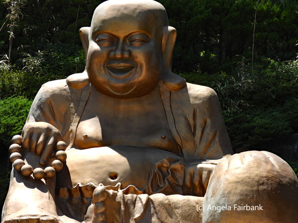     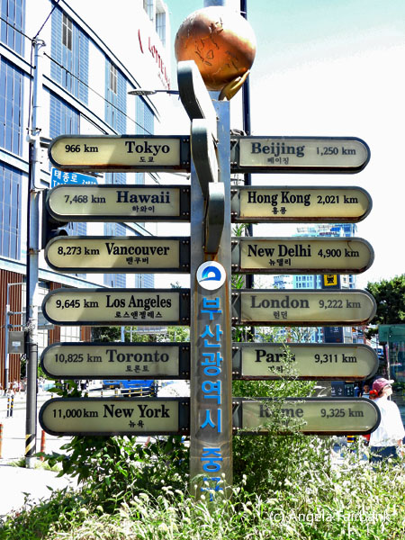 Next we visited the Jagalchi fish market on foot, where the most impressive sight was live eels being skinned and still wriggling afterwards (the poor eels!). We then rejoined our bus which drove us to Gamcheon Culture Village, where I could have stayed longer due to all its quirky art. Its most constant theme was The Little Prince and wondering why this was so, I looked it up and discovered that the town was involved in an urban regeneration event, called the Gamcheon Culture Village Art Project, which transformed a hillside slum into an open-air art museum. Initially a settlement for Korean War refugees, the project utilized art and culture to revitalize the area and attract tourists, many of whom were wearing hanbok and lining up to take photos with the Little Prince statue with his fox, seen here. Why the Little Prince, you ask? The answer I found is that it is also a popular children's book in Korea (as it is around the world), as the Koreans particularly appreciate/identify with its theme of love, friendship, and dreams as well as its philosophy. Pulling ourselves away from this colourful town, we drove to our hotel within walking distance to the beach and checked into our rooms despite the long queues at the elevators as we were on rather high floors. We then met again to take a walk toward the ocean and through the night market, where there was more fish on sale, and my roommate and I eventually picked up sandwiches again from Subway and breakfast from either 7-Eleven, or its Korean equivalent convenient stores, called Nice to CU, GS25, and e-mart. Consuming my sandwich in my room, I then worked on my photos until bedtime.
 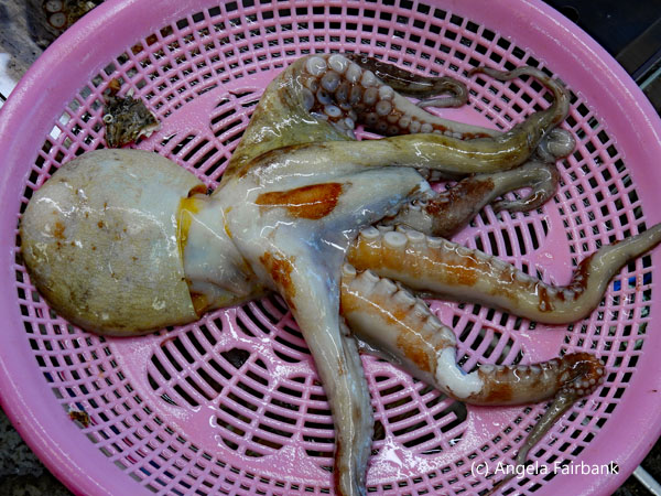    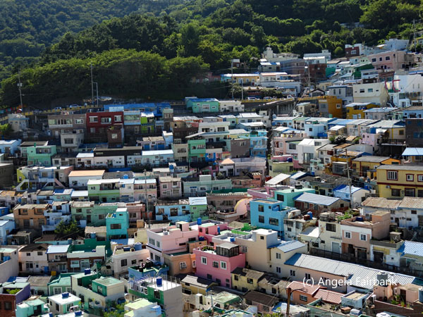 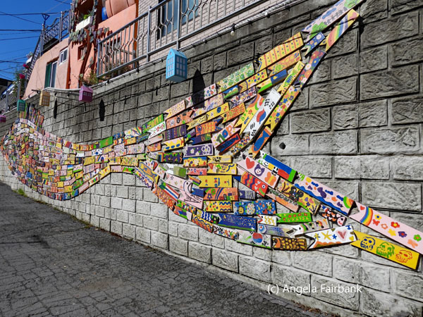             Friday, August 1: Busan, South Korea
After another breakfast in our room, we met the others to take the subway from a station near our hotel to a one that was full of art. As an added feature, it had two staircases decorated like the keys of a piano, one of which was actually programmed to play the tones of a scale when stepped on. We then took a bus and walked a bit to reach YongHo Starlight Park on the sea front, one of Intrepid's partner projects: Cube Farm, a hydroponic agricultural establishment or smart farm, set up in recycled and converted shipping containers. Because I found its air conditioning and mushroom-infused cold water reviving, given that it was yet another hot day in the lower 30s Celsius, I took a needed rest and cool-off session in the office container, while the others went on a short walk along the sea front. We were then provided with a presentation of this Smart Farm located in refrigerated containers, an innovative project founded by a female entrepreneur, where large mushrooms and leafy lettuces were being grown in a hydroponic system. We were then shown the vegetables growing and fed a snack of cooked mushrooms and raw lettuce. Next, we were driven to another market area, through which we walked before branching off to various restaurants. My roommate and I went to a chain bakery called Paris Baguette solely because I liked the sound of it, where we did in fact find sandwiches and croissants but unfortunately no baguettes as I had naively expected, nor anyone speaking Parisian French ... or any French at all, for that matter.    After climbing into yet another private van, we were driven to Yeongdo Island, where we were introduced to the dying practice of Hae-Nyeo, female seafood divers. On researching the subject afterward, I found a documentary called The Last of the Sea Women released on October 11, 2024, whose summary reads as follows: “In The Last of the Sea Women, an extraordinary band of feisty grandmother warriors wage a spirited battle against vast oceanic threats. Often called real-life mermaids, the haenyeo divers of South Korea's Jeju Island are renowned for centuries of diving to the ocean floor--without oxygen--to harvest seafood for their livelihood. Today, with most haenyeo now in their 60s, 70s and 80s, their traditions and way of life are in imminent danger. But these fierce, funny, and hardworking women refuse to give an inch, aided by a younger generation's fight to revive their ancestral lifestyle through social media. Peering into what drives haenyeo young and old, this moving documentary zeroes in on their tight-knit friendships, savvy independence, and infectious sense of empowerment. The story unfolds into an uplifting tale of women taking on world powers to protect their beloved ocean and inspire a new generation.”
     > >  As mentioned earlier, we were not on Jeju Island but rather on Yeongdo Island in Busan. The haenyeo (sea women) we saw--traditional female free divers--were in their 70s and 80s and diving daily in shifts for seafood, including abalone, sea urchins, and seaweed, using traditional tools and techniques but no breathing apparatus. Their practice is a unique cultural tradition but to our eyes it was clearly dying for we were told that even though their grandmothers and mothers had been diving all their lives before them, their daughters (or even sons) were uninterested in the career, despite being offered training. The woman we talked to was 73 and the oldest of the six we met was 82. First we went through a museum dedicated to the tradition, then we were invited downstairs to the restaurant cum seafood sales center where their day's catch of several kilograms was swimming around in large tanks. We interviewed one lady whom you see here and those of us who dared (I was not among them and what's more I had just had lunch) were offered various tastings of raw seafood accompanied by a smooth rice wine to wash them down. This being our last cultural visit for Busan, we were driven back to our hotel across Busan's several impressive bridges. And then while some of our group went on an apparently not-worth-it sunset-but-not-actually-at-sunset yacht cruise around the harbour, where the advertised K-pop dancing was performed nepotistically by the captain's nephew, who wasn't very good I was told, I worked on my photos in my room after consuming yet another Subway sandwich. During the night, the fire alarm went off (though I slept through it). I did awake, however, when a disembodied voice came into our room through a speaker telling us in Korean and then in English that it had been a false alarm and we were not to do anything (and supposedly go back to sleep).
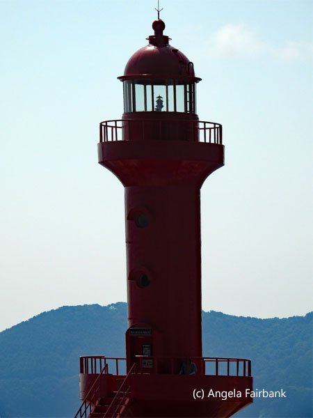  Saturday, August 2: Busan to Seoul, South Korea
After checking out of our hotel, we hand-transported our bags into the subway via elevators, escalators, and on foot to the express train station and took a roughly three-hour high-speed (KTX Bullet) train to Seoul. On our arrival back in South Korea's capital city, we took another subway to the City Hall and the same hotel at which we had started our tour. Our room looked identical to the room we had shared a week ago, yet it was on a floor five stories higher. After a rest and a lunch of left-over snacks for me, my roommate and I went out to buy supplies for tomorrow's breakfast at ... you guessed it ... 7-Eleven. Then we all met up again and took a bus toward the Royal Palace and then behind it to another conglomeration of hanoks called Bukchon Hanok village, traditionally the residential quarters of high-ranking government officials and nobility who could be called to the palace at any moment. Built on a hill, it meant yet more climbing in high temperatures which sapped our energy. As the area is popular with tourists, regulations are in place to manage high volumes. As of November 2024, tourists are only allowed to enter the village from 10 a.m. to 5 p.m., excluding those staying in the guesthouses. We saw various notices asking tourists to respect the privacy of residents, to keep noise levels to a minimum, to avoid littering, and to keep group sizes small (fewer than ten people per group). I wasn't inspired to take any photographs here. When we finally arrived at the bottom of the hill, and although I saw some souvenir shops with seemingly high quality items and was interested in spending some time there, our guide encouraged us instead to follow him to another shopping area, which ended up being about another half hour away on foot. The souvenirs in this later area, called Insadong, did not appear to offer the same quality, so I ended up purchasing nothing, although I did take a few photos. Finally arriving at the bottom of the street where we were to meet and return by bus to our hotel, I saw this woman in costume, supposedly dancing to traditional music, despite not moving much. I was impressed by her elaborate hairstyle (yes, most probably a wig actually). Our final event of the day and of the tour was the group's farewell diner at a (Korean) barbeque restaurant within spitting distance of our hotel. The food (even though I ate totally vegetarian) was excellent and one might even say machi soy yo!       Sunday, August 3: Seoul, South Korea to Vancouver, B.C., Canada
After consuming my breakfast and seeing off my roommate, I repacked my bags and went out to take some final photographs of Seoul at the nearby City Hall square which contained a large library. I then checked out of the hotel and walked over with my bags to the Plaza Hotel facing the aforementioned square to catch the reasonably priced 'airport limousine' bus to the airport, arriving way before I needed to. Nonetheless, I was able to check in, obtain an upgrade to business class using my e-upgrade credits, and buy a small lunch with my remaining won. The flight was comfortable as I was seated in seat 1A on my own. The screen offered me a good selection of never-before-seen-by-me movies, and the flight attendant served me a couple of good but copious meals. I even managed to sleep an hour or two. I arrived in Vancouver under cooler and cloudy skies after about 9 hours, some 6 hours before I had left, feeling content from my visit to three countries that were so different from each other. Tak, bayarlaa, and Kam sa haam ni da to all I met and for all the experiences I enjoyed.    |
All rights reserved. Website © Angela Fairbank 2005-2026.
|