Travel Blog May 11 to June 14, 2025Cape Town to ManchesterVancouver, B.C., Canada to Manchester, UK via Namibia, Angola, São Tome and Principe, Côte d'Ivoire, Senegal, Canary Islands, Spain, Andorra, Switzerland, Liechtenstein, and WalesSunday-Tuesday, May 11-13, 2025: Vancouver, B.C., Canada to Cape Town, South Africa via Washington D.C., U.S.A.
On Sunday morning, not having received an online check-in email from United Airlines for my Monday morning direct flight to Washington D.C. from Vancouver, I started wondering why, and looked online for my flight but could not find it. It was a code share with Air Canada, but I had not received notification from Air Canada either. I decided to phone Air Canada and find out what was going on. I was put in contact with an actual physical agent almost immediately after finding my way through all the annoying AI prompts, and after a great deal of searching on his part, he informed me that that flight had been cancelled by United on January 29, 2025. However, not having had any contact information from me (which I put down to the fault of my travel agent), United were unable to inform me of the cancellation or to offer to change my flight for free. Luckily, I had phoned in good time as there were still sufficient hours (and space) for Air Canada to put me on the red eye tonight to Montreal and, from there, on another Air Canada flight from Montreal to Washington-Dulles airport so that I could still connect to my 7:00 p.m. Monday flight from Dulles to Cape Town. I then had to wait online for another age to speak to a live agent at United to get them to reissue my ticket using the Air Canada flights I had been booked on by the Air Canada agent and to send me a confirmation email. This meant a few hours of layover both in Montreal and in Washington, during which I sat, explored the shops, bought breakfast at Starbucks and lunch at Subway, and had lots of power naps, but otherwise things were uneventful and I arrived after my final 14-hour-plus flight in Cape Town, South Africa as originally planned, passed fairly swiftly through customs and immigration, received a stamp in my passport, picked up my bag fairly quickly, and found an official airport taxi into central Cape Town and my hotel for the night. On my way from the airport on a clear, sunny, and warm afternoon, I noticed we passed by Langa and other townships I had visited on Monday, January 29, 2024, when I was last here. I was struck by how many beautiful artistic murals visible from the highway I had missed that day. I also started seeing large Egyptian geese flying overhead as well as their presence on the golf course I passed, where I read later they tend to be rather a nuisance. I checked into my comfortable yet inexpensive hotel, let family at home know I had arrived safely, had a hot shower, and went straight to bed. Wednesday, May 14, 2025: Cape Town, South Africa and on board NCL's MS Norwegian Sky I woke in time for another shower and breakfast, which was nothing special. The breakfast room was crowded ... likely fellow cruise passengers for the most part. I worked for a while on my computer in my room before checking out noonish and got a taxi to the cruise terminal, where I joined a long line to check into our cruise. We had been asked to choose our check-in time, but nobody seemed to be conforming to those times, least of all the people looking after crowd control. I got chatting in line to a nice Filipino-American couple about my age, who had been following Canada's recent election with interest, had just come off a South African wildlife safari, and are planning to do part of the Camino at the end of the cruise from Saint-Jean-Pied-de-Port in the Pyrenees to Santiago de Compostella. I finally arrived onboard around 1:30 p.m. but was told my stateroom wouldn't be ready for another half hour or more. Meanwhile, we were invited to take lunch at the buffet. Those people who had chosen to check in this morning were in a worse situation as they had been waiting for their staterooms ever since this morning. I was not impressed with NCL's inefficiency in this respect. As for the safety drill, all we had to do was check in individually to our lifeboat stations and pick up a sticker for our cruise cards. My mind was cast back to the early 2000s when we were obliged to stand out on deck in the hot, bright sun and listen to the safety spiel in English over the loudspeaker ... and then it was repeated in French, Spanish, Italian, German, and Portuguese! On my current cruise, the spiel was delivered over the loudspeaker somewhat later and just before our departure (which was supposed to be at 4:00 p.m. but didn't actually happen until 7:30 p.m.) but by then, it was evening, people were chatting (and no doubt cocktailing) during it. I also found a number of crew unable to answer my questions and the excursions manager was quite rude to me when I queried the notifications I had received about my tours. Clearly, NCL cannot be considered to be at the same level as previous cruise lines I have travelled with. But I suppose it is only by trying out various companies that one can sense which ones are serious and worth my loyalty. Like the other American companies, Royal Caribbean and Princess, there is a heavy emphasis on sell, sell, sell; something that had not been present (or at least not as obvious) at British Fred Olsen or Norwegian HX, my latest three cruise experiences. The reason I had chosen this trip was, as usual, for the itinerary. I had become aware of it whilst doing the round Africa Fred Olsen cruise in 2023-2024 as it included three countries Fred Olsen had not: Angola, São Tome and Principe (which had been on their itinerary at first but taken off at the last minute without explanation), and Ivory Coast. I had also been aware of NCL's offer of single cabins for single people, i.e. so that solo travellers like myself were not obliged to pay 200% or at a minimum 150%, for a normal cabin for two. The size of said single cabin (with a balcony) is perfectly adequate, despite being on the port side. There are no balcony single staterooms on the starboard side. The second thing that attracted me to NCL was their policy of freestyle cruising in that one did not have to bring an extra suitcase of elegant formal wear, fancy shoes, and jewelry for all the formal nights. NCL has no formal nights. In fact, you don't even have to dress up for dinner in the more formal dining rooms and can wear shorts to the dining room if you want (just no ball caps, flipflops, or swimwear). So far, however, I have yet to be impressed by their food. There seems to be a dearth of vegetarian options as well, although I admit I've only tried out one restaurant up to now. I was also surprised that no eager stateroom steward ever came to introduce himself yesterday, as has been the case on other cruise lines. I wandered around the ship after unpacking in an effort to orient myself (it is most unfortunate that there is, as on other American ships, a smoky casino and that said smoke also infiltrates into the lounge beneath it. (I'll have to strategize my wanderings to avoid decks 6 and 7 midship). I then attended the first night show (a Jamaican band with a tribute to Bob Marley) after a lackluster dinner in the cafeteria. Friday, May 16, 2025: Walvis Bay, Namibia The Republic of Namibia, with a surface area of 825,615 sq km and a population of just over three million, contains the Namib desert, which is the world's oldest desert at between 55 and 80 million years old as well as one of the driest places on Earth with some parts receiving as little as 2 mm of rain per year. What's more, the country is one of the world's youngest nations. I was last here on February 1, 2024. After immigration today, which took ages because on April 1 this year, Namibia introduced the obligation of a visa for most countries. I joined a tour in 4 x 4s to said desert ostensibly to view the flora and fauna that survives here. Our tour guide, John, introduced it as follows: while Kruger Park has the big five (lion, leopard, buffalo, rhino, and elephant) the Namibian desert has the little five - 1. Namib Web-Footed Gecko (Pachydacylus rangei) also called the Namib sand gecko or palmatogecko; 2. Peringuey's adder (Bitis peringueyi) or the sidewinding adder; 3. Dancing White Lady Spider (Leucorchestris arenicola or Carparachne aureoflava) or cartwheeling spider; 4. Namaqua chameleon (Chamaeleo namaquensis); and 5. Shovel snouted lizard (Melores anchietae). After driving along the coast northward from Walvis Bay, we arrived at a spot that offered camel rides and go-carting. The camels are not native to Namibia, having been brought here from Egypt or Morocco solely for tourists. From this site, we drove into the desert covered in small succulent bushes, which themselves were covered in small orange, black, and white butterflies. Apparently, we were lucky with the weather because the day before, it had been foggy, and tours had been cancelled. These succulents get their moisture from this fog that comes off the sea. The aforementioned butterflies were there because of yesterday's fog, which had provided moisture to the green succulents and were feeding off these green plants, laying eggs, and would probably be dead by tomorrow, we were told.       Almost immediately after our group had exited our four jeeps, John found what looked like a long, grey worm, which he introduced as a legless, blind skink or FitzSimons' Burrowing Skink (Typhlacontias brevipes) (photo 2 for today). The last skink I'd seen (somewhere in Madagascar) had looked more like a lizard than a worm. Soon after that, one of the other guides found a Palmetto gecko, so tiny, it fit in his hand (photo 3). Next John again found a small Namaqua chameleon and fed it some flies he had brought in a small jar, essentially to show us how long the chameleon's tongue was, although, of course, it was far too quick, darting out and back again, for me to catch on film. You can see its tongue protruding in the photo here, nonetheless. We then drove over many sand dunes and the guides looked under many a green succulent bush in search of a sidewinding adder (poisonous) and finally found one. It, too, was smaller than we'd thought it would be. We also saw a few beetles and a rather tame bird called a Tractrac Chat (Emarginata tractrac). We were told Oryxes also lived in Namibia and were the country's national symbol (but different from Qatar's Oryx in that Qatar's Oryx refers to the Arabian oryx (Oryx leucoryx), while the Namib Oryx is a colloquial name for the gemsbok (Oryx gazella), also known as the South African oryx. We were told we would more likely see a jackal here than an oryx, but all we saw today pertaining to jackals were several tracks of footprints.
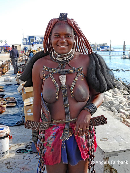
         After driving over the dunes and across the highway to the sea, we were left by a stand manned by a couple of young adults and some portable toilets and were served sweet bubbly, orange juice, and snacks of crackers, cheese cubes, and pitted olives, while the jeeps drove into Swakopmund to re-inflate their tires, which they'd deflated to drive over the dunes. Brought back to our ship after this snack, I asked John, “Where are all the Himba and Herero women I saw last time? They weren't in the place I was expecting them to be.” He told me they were still around but had been moved to a different section of the port. He also agreed that I should be able to see the impressive flocks of birds - pelicans and flamingos among others - that other passengers on the Fred Olsen ship had raved about last time I was here. I then turned in the direction John had pointed to, which was over the train tracks and through a metal fence guarded by two young men, and sure enough, I recognized some of the women I had met, photographed, and had had conversations with last year. Muttering excuses, so as to seek out the birds, I followed directions given by a couple more young men but ended up finding out that due to the fact that it was now May, the birds had moved further away, and I realized they were too far away for me to get there on foot within the time I had left. Giving up that idea then (though I did see gulls, cormorants, and a couple of sparrows ... oh, and unexpectedly a seal splashing about in the bay), I returned to the Himba and Herero (and other indigenous groups not in traditional costume) vendors and managed to get away with buying only a few trinkets in exchange for the few photos you see here.
      Monday, May 19, 2025: Luanda, Angola
Country number 161, U.N. country number 127, Angola, Africa's seventh largest country with a surface area of 1.247 million sq. km. and a population of 38.9 million, was founded in 1576 by the Portuguese and achieved independence in 1975. The affinity I have with this lusophone country, which is experiencing a resurgence after a civil war, is that one of my book authors, for whom I translated two novels in 2021, is originally from Angola, although she writes in French. At our onboard lecture on this country yesterday, we learned that Angola is the world's fourth largest producer of rough diamonds after an exploration of only 40% of the country at a rate of 9.7 million carats per year. Apparently, the largest producer of diamonds is Russia at 37 million carats, followed by Botswana at 25 and (surprise, surprise) Canada at 16. What's more, it has been proven to have 9 billion barrels of crude oil reserves and 11 trillion cubic feet of natural gas reserves. The country currently produces approximately 1 million barrels of oil per day (down from 2 million in 2010) representing 75 percent of the country's revenues. Angola has no capacity to refine this oil, however, and therefore still spends about 2 billion dollars per year on imports. The country exports 1.6 million barrels of oil each year, representing almost 90% of total export earnings and 64% of the total government revenue. Twenty-one billion dollars of this crude oil is purchased by China (yet Angola still has a seventeen-billion-dollar debt to China, representing 40 percent of its total debt.) Another $3.5 billion of crude is purchased by India and $2 billion is purchased by France. Oil and diamonds are not its only resources, however. Other minerals include manganese, copper, gold, phosphates, granite, marble, uranium, quartz, lead, zinc, wolfram, tin, fluorite, sulfur, feldspar, kaolin, mica, asphalt, gypsum, and talc. On a different subject, the national animal of Angola is the giant sable antelope (Hippotragus niger variani), which looks similar to Namibia's national animal, the Oryx, but its horns, which are blue, are slight curved back on both sexes and can measure up to 65 inches long. They are critically endangered as it is estimated that only 300 individuals exist currently.    Our guide to Southern Luanda today, Jacinto, who speaks nine languages, told us he was former U.S. President Joe Biden's interpreter during his recent visit to Angola. He also started out the bus tour telling us that he was an orphan and had seen his mother and father shot dead at the site of our first stop, the Military Museum, which is contained within the Portuguese-built San Miguel Fort, Luanda's oldest relic, renovated into its star shape in 1664 to improve its defensive capability. Apparently, the rule was (and perhaps still is) that you are not allowed to point at the president. His mother did so to indicate to her daughter who it was in the big car in an official cavalcade, and she (the mother) was shot on sight. As his father leant forward to help her up, it was thought that he was coming toward the president in protest, so he too was shot. The bullet that went through his father's body then went through Jacinto's sister's leg as she had started forward to help both her parents. His sister, thanks to British and American tourists, he told us, is now undergoing an operation on her leg in the U.K., although clearly this is several years - if not decades - later. Jacinto and his sister were both children at the time of their parents' deaths and a friend of his parents managed to get them out of Angola and into South Africa and placed with a family. Jacinto was thus raised in South Africa and consequently learned both Afrikaans and Zulu. He has also been to the U.K. and France, learned French ... as well as Danish and Chinese and is now learning Japanese. I'm not sure what the ninth language was - perhaps Spanish, which would make sense since it is very similar to Portuguese, Angola's official tongue. I learned that Angola has 46 Indigenous languages and that Angolan Portuguese is a bit different from both European and Brazilian Portuguese, owing to the influence of the country's Indigenous languages. It is true that sometimes when the various Angolans I met conversed with me in Portuguese, they sometimes spoke too quickly for me to understand, and I had to ask them to slow down. Once they did that, I understood better and was able to respond.
   Jacinto also told us that after China, Angola was the country with the largest population of Chinese people. China, Russia, and America seemed to be the nations most invested in Angola, no doubt due to the recent finds of offshore oil, not to forget its important natural resources such as gold, and diamonds, and clearly many locals are involved in construction today. However, the civil war that raged in this country only ended in 2002, and it has only opened its doors to tourism recently (providing visa-free entry in 2024). Clearly, tourism should help the struggling middle and lower classes more directly through sales of souvenirs, hotel rooms, transportation, and more. Yet, like many other African countries, the rich only get richer while the poor get poorer. Jacinto commented that only government employees are considered rich. Moreover, with Luanda being one of the most expensive cities in the world, it's a struggle for the poor to survive. Jacinto told us there is a 75% unemployment rate (though I'm not sure if that was based on fact or whether he merely pulled a number out of the air. I asked Google what it was, and AI came back with the response of 29.4% a rate that is still considered high). When Jacinto was asked directly how he personally survived when there were no tourists, he told us some days he eats and other days he doesn't. Talking of eating, when we passed the huge, beautiful, pink Parliament building with its landscaped gardens, he mentioned that there used to be monkeys, chickens, and “what are those big chickens called, oh yes peacocks” but the poor caught them and ate them all! Coming out of the port, we drove along the crescent-shaped sea front called the Marginal. Isabel dos Santos, the daughter of Angola's second president, José Eduardo dos Santos, is known as Africa's richest woman and has been the subject of controversy due to allegations of corruption and embezzlement. She is facing international sanctions and asset freezes, and Angola is pursuing legal action against her. It was she who was in charge of developing the area of the Marginal as well as a new section that would help young people. We were told that she simply took the billions invested in the project and left the country. She is now banned from Angola and will be arrested on sight should she ever attempt to return. The other mention made to Angola's second president was a treed hill where we were told this man's 14-room residence was located, though it was on several acres and heavily fenced. We were told nobody lived there now except his mother-in-law. It was interesting to me that the other side of this hill seemed to have been used as a garbage dump as clearly garbage (plastic bottles and soda cans included) had been poured down the hill in at least three places. I wondered whether this was garbage that had been produced by the household of the second president.
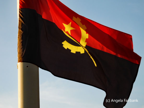
   I realize I haven't said much about the fort and military museum, but hating war and everything it represents, I tend to close my ears when it comes to military exploits. However, if you are interested in that aspect of Angola's history, I am sure you can look it up. I did take a photo of this peaceful butterfly when it landed on a piece (or should I say peace) of war machinery displayed in the outdoor area of the fort. The above-mentioned second president and his infamous daughter notwithstanding, it was the (seemingly very much loved) first president, Antonio Agostinho Neto, (see the bust of the male in glasses) to whom we were introduced to today, not only at the military museum cum fort, but also at his very own mausoleum, a tall building in the shape of a rocket, seen in the photos here. Born in 1922, he died in 1979 in Russia, where he had been seeking treatment, from pancreatic cancer and chronic hepatitis. The building in the middle of which his coffin had been laid to rest, surrounded by hundreds of (silk) flowers, was filled with memorabilia - photos, his desk, his house furniture, a large plaque with his signature, an enlargement of his ID card, and more. I was interested to note one photo, among many, of his meetings with other Africa presidents, in which he was sitting on the very same sofa I had sat on (many years later) to meet the current long-serving President of Equatorial Guinea, Teodoro Obiang Nguema Mbasogo, currently age 82, a former military officer and dictator, who has served as the second president of Equatorial Guinea since 1982. Interestingly, President Paul Biya of Cameroon, who is 92, came into his presidency the same year (1982), but looking them both up on Wikipedia I learned that as of 2025, Biya is the second-longest-ruling president in Africa (after Teodoro Obiang Nguema Mbasogo in Equatorial Guinea), although he is also the longest consecutively serving current non-royal national leader in the world and the oldest head of state in the world. But getting back to Angola ... whilst in the mausoleum building (and previously in the bus) we had been told several times that we were not to photograph the room with Neto's coffin, under threat of our phones and cameras being confiscated by the mausoleum staff (and not merely the deletion of the forbidden photos), yet still, as we circumnavigated the interior of the circular room around the coffin, we noticed at least two people taking photos - with flash to boot! It seems they got away with it for we neither heard nor saw any consequences of their actions. But what would they gain from it, I wondered. It was just a closed box after all. Clearly people do not listen to instructions! Even our excursion descriptions contained a warning: “Some ... buildings may fall under the umbrella of military or state defense objects, whereby you may not take pictures and might run into serious problems by ignoring these rules.” Inside this building, we were given an explanation about the colours and symbols on the Angolan flag, seen here. Black is for the continent of Africa, red is for the blood shed, and yellow is for the gold and other minerals, while the cogwheel represents industry, the machete, agriculture, and the star, solidarity and progress. I also wanted to explain why I took the photo of the workers in front of the mausoleum. It's because I found curious the fact that three of them were wearing headgear that were clearly made from (recycled) paper bags. Well, why not? Paper's ecological after all! And it wasn't raining.
   Our next stop was at the National Museum of Slavery, located somewhat outside Luanda, on land, I read, belonging to Álvaro de Carvalho Matoso, one of the biggest slave traders, whose family continued the practice until it was outlawed in 1836. The slaves, brought there from the city (through underground tunnels) during colonial times, were processed on this spot before being baptised and loaded onto ships sailing to the Americas. One plaque inside the museum (which I have translated from Portuguese) says as follows: “Throughout evolution, all human societies have known the practice of slavery, a process whereby a slave becomes the principal agent of production. In the fifteenth century in general, slavery in Africa was different from what was practiced in Europe. Slaves were acquired above all from war or when social conditions degraded. ... Under these circumstances, men and women were forced to become dependent on others and were even integrated into the family structure ... [and] designated as family slaves. According to the prevailing system, which was complex, there was flexibility where the condition of slavery was concerned, whereby some were able to reacquire their freedom. ... Under various African contexts, some slaves came to occupy ... high political office.” Another plaque provides statistical data on the traffic of slaves, which I will attempt to summarize. Countries participating in the traffic of African slaves between 1501 and 1867 were Spain/Uruguay, Portugal/Brazil, England, Holland, USA, France, and Denmark. From 1501 to 1525, only the first two country groups were active, exporting 6,400 and 7,000 souls each for a total of 13,400 persons. This grew to 25,000 each for these two countries in the next 25 years. From 1550-1575 England joined with 1,700 as did France with 70. By the years 1626-1650, all of the above countries were involved, with Portugal being the worst offender with 202,000 souls. From 1701 to 1750, Spain/Uruguay stopped altogether but started again in the period of 1751 - 1775, during which years England was at its peak with 832,000 souls. By the period 1801 to 1825, Portugal was exporting 1,161,000, reaching its peak in 1826-1850 with 1,300,000, the period when England stopped, as did France. The total from all these countries for all these years (1501 to 1867) was 12,522,570, the top three trading countries being Portugal/Brazil with 5,849,300, England with 3,259,900 and France with 1,380,970. Listed by embarkation ports, Luanda (Angola) comes in first with 2,826,000 slaves out of a total of 20 ports in Africa. Compared to the two former slave centers I visited last year, Elmina records 255,000 souls, while Cape Coast records 318,000.
   Perhaps more telling are the statistics for the disembarkation ports. The top three are: Rio de Janeiro (1,839,000), Salvador (Brazil): 1,550,000, and Kingston, Jamaica (886,000), followed by many of the other countries I have visited in the Caribbean and South America: Barbados, Cuba, Haiti, Suriname, Martinique, Charleston (South Carolina, U.S.A.), Cartagena (Colombia), Antigua, St. Kits, Grenada, Curaçao, Dominica, and Guadalupe. Yet other ports were of course involved in the trade including Liverpool, London, Bristol, Nantes, Lisbon, La Rochelle, Le Havre, Bordeaux, Rhode Island, St. Malo, and Cadiz. Last but not least, these statistics list the main regions in Africa where slaves were embarked on ships between 1501 and 1867, and I'll list only the totals for the 367-year period: Central Africa/Angola (5,693,900), Benin (1,999,600), Biafra/Nigeria (1,595,400), Guinea (1,479,800), Gold Coast/Ghana: (1,208,670), and South West Africa (542,800). A final tableau from my visit to this museum can be found in another photo wherein two lines of slaves are depicted followed by a man with a stick. This shows how they tied slaves together. Mother and father with their children tied between them and the other line of five where the one in front, we were told, was always a man and if the first fell (or was tossed) overboard then the rest of them would go overboard too since they were all chained together. Mind-boggling. Little did I know that my travels these past few years would open my eyes so widely to the slave trade and this terribly sad and heart-wrenching period of humanity's history.
   To bring us out of the doldrums, we were invited to visit an open market, which was bigger than I had imagined and would need a lot longer than we were given to visit properly (We were told we had 20 minutes!) Well, first there was a huge section of paintings, a couple of which I managed to photograph, then there was a section of women's clothing, where I photographed some girls, a separate section for men's clothing and yet another section elsewhere for children's clothing, where I photographed a mother and baby. But I was on a mission to find a magnet and a bracelet, so I was directed to yet another section filled with wood carvings and ceremonial masks. There were dozens and dozens of stalls and lots to peruse and vendors to say hello to. I went round once to see what there was and then seeing the 20 minutes were up, ran back to the bus and spoke to the bus driver to tell him I needed more time. He said no worries you can have 10 more minutes, so I ran back and found the two items I wanted but then had to haggle a bit. Then, finally settling on a price for the two items from two different vendors, I then found they only offered change in Kwanza the local currency. I accepted it, realizing I could use it for tips to the driver and tour guide. As I was pulling away, a third vendor wanted to show me something but of course I had to tell him my bus was leaving and I literally ran back to it and was the last on board. It was lucky I had talked to the bus driver, I think, because I forgot to mention earlier, not only was it our bus of 30 passengers, but we were in fact three buses of about 30 each ... and two small cars ... and two motorcycles filled with policemen with their sirens blaring ... making up a convoy so that we could get quickly through Luanda's weekday traffic, we were told.
   We then drove quite a way past thousands of baobab trees to a site called Miradouro da Lua, so that we could admire its jagged cliffs, sharp pinnacles, and deep gullies formed by limestone karst - similar to what I'd seen in Madagascar. Having taken the prescribed photo to frame the scene - reminiscent of the one on Robbens Island framing Table Mountain in Cape Town, I glanced at the baskets and other souvenirs being sold at that spot but was not tempted. Perhaps it would be appropriate here to talk about baobab trees, which in many African countries are sacred and symbols of good fortune, containing ancestral spirits and visited for blessings or spiritual guidance. Various parts of the baobab tree, including the bark, leaves and fruit, known as monkey bread, have medicinal uses. The bark is used to treat fever, while the fruit is used to make juices or powder for various ailments. The fruit, leaves, and bark are also used for food and clothing. The trees are known for their remarkable longevity with some living for more than 6,000 years. They also play an important role in the ecosystem as they provide shelter and food for wildlife.
After getting back on our buses again, we drove our final distance southward, past herds of goats and cows, and more baobab and palm trees, to a place where the Kwanza River, which, with its impressive 960 km, is the longest river in Angola and has the largest hydroelectric potential, estimated at 7,000 MW with only 610 MW currently installed, meets the ocean. A lodge, imaginatively called the Kwanza Lodge, was our buffet lunch venue, where luckily, they had a vegetarian option and complimentary local beer: a choice of Cuca and Eka varieties, the latter advertised as cerveja premium. I tried the former, which was fine, although I eventually brought half of it back in the bus with me as the time to eat and drink was short since there were, after all, 90 plus of us. We had a good hour and a half ride back to Luanda and were taken straight back to our ship. However, on our way out, during our drive along the Marginal, I had noticed a sign saying in Portuguese 'I love Luanda,' so of course I wanted to photograph it to match other similar signs I've photographed around the world. I asked our bus driver and guide at lunch if we could stop there but was told no, first of all because it was on the wrong side of the road, but secondly, and likely more importantly, we weren't just one bus on our own able to do what we liked, we were in the previously mentioned convoy. The tour guide didn't in fact know what sign I was talking about but luckily the bus driver did. They both agreed that I would have time if I took the shuttle bus out of the port and walked along the Marginal, but in retrospect, given the hour I had left, I would never have been able to do that. When I asked the shuttle bus driver if he knew where it was, he said he didn't but would ask once we were outside of the port area. After dropping his only other passenger off at the Presidente Hotel so that she could buy a T-shirt with her credit card, he took me to the main shuttle bus drop off and asked one of the locals looking after the cruise ship passengers if she could direct me to the 'I love Luanda' sign on the Marginal. Well, she did one better than that. She grabbed two fellows in hi-vis vests and asked them to drive me there. The driver parked the car right in front of the sign, explaining to the two policemen there that I just wanted to photograph the sign. The policemen smiled and said sure go ahead. I did so, then, happy, and seeing I still had some time, asked the two hi-vis-vest guys to drop me off at the souvenir market in front of the shuttle drop off area. Eager to please, they had no trouble doing that either.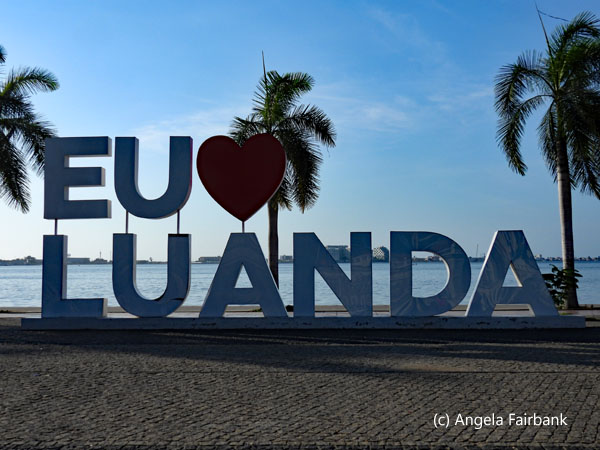   I then walked through this market, saw nothing I wanted to buy, but took a few pictures of some more ladies in their traditional hats and one vendor who wanted to sell me some kind of hair decoration and modelled it for me and then agreed to a photograph. So, all in all, I can say I found all the Angolans I met very friendly. Just as I read they would be. I was chatting to another vendor, when, suddenly, the two hi-vis-vest men came up to me and told me it was time to go. I looked up, realizing who they were, and protested that I wasn't due back on the ship for another half hour. However, they were anxious to get me back to the shuttle bus and, well, I must say I was grateful they were so solicitous about my well-being. When I arrived back at the shuttle bus, after photographing the gold figure on the pedestal in front of the market, which is apparently a symbol of Angola and appears on their paper money, although I was told by one vendor I asked that it meant pensador (thinker), I heard a honk and saw that the shuttle bus driver was the same guy who had driven me there. And as soon as I got back on board, he asked me if I had found the 'I love Luanda' sign I had been wanting to photograph. So kind of him to ask me that. On our arrival back at the ship, I was greeted by one of the officers who, to my surprise, told me I was the last passenger to return to the ship.
   Wednesday, May 21, 2025: São Tomé, São Tomé and Principe
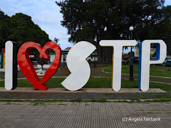
Country number 162, and U.N. country number 128, São Tomé and Principe, Africa's second smallest state after the Seychelles, with a population of about 250,000 is made up of two volcanic islands, São Tomé ... and Principe, formed 30 million years ago and belonging to the same volcanic chain as Bioko, the island on which the original capital of Equatorial Guinea, Malabo, is located, although I read that the capital may be changing to a new city on the mainland, Rio Muni. São Tomé was named after Saint Thomas as it was discovered by the Portuguese on December 21 (Saint Thomas' Day) in 1470, while Principe, used to be called São António (Saint Anthony) and São António is in fact the name of its main town. São Tomé is 50 km long and 30 km wide and the more mountainous of the two islands. Its highest point, Pico de São Tomé, has an elevation of 2,024 m. Principe is about 30 km long and 6 km wide. Its highest point, Pico de Principe, reaches 948 m. History records that the islands were uninhabited before the Portuguese colonized them. The first settlement in São Tomé was established by the Portuguese in 1493, while the first in Principe was established in 1500, when 2,000 Jewish children were relocated there. In 1908, they were the world's largest producer of cacao (chocolate), which is still its main product and still keeps winning awards. In the 16th century, the country produced sugar cane, but in the mid 1600s, this production declined as there was competition with the New World. As a consequence, the Portuguese moved the cultivation to Brazil since the weather and soil proved to be better there.    STP, as it is called locally (see the below sign and also noted on the country's vehicle licence plates), was also a major hub for the export of slaves to the Caribbean and Brazil beginning in 1525, although from 1530 to 1595 there were a number of slave rebellions and reforms. It was explained by our onboard lecturer yesterday that the Slave Trade was part of a triangular route: European goods (guns, ammunition, and alcohol) were shipped to African rulers, while enslaved Africans were shipped to America, and American goods produced with the labour of these slaves (cotton, sugar, tobacco, and rum) were shipped to Europe. In the 1800s, the islands produced large crops of coffee and cacao. In 1876, slavery was officially abolished. The country obtained independence from Portugal on July 12, 1975, the same year as other African lusophone countries (Mozambique (June 25, 1975), Cape Verde (July 5, 1975), and Angola (November 11, 1975), Guinea-Bissau having achieved its independence on September 10, 1974). Nevertheless, our guide (who had a difficult name to remember) told us they don't feel independent because they still rely heavily on Portugal as well as various UN agencies to survive. They've had free democratic elections since 1991. In 2003, there was a coup, but it only lasted a week and was very peaceful; diplomatic discussions bringing about a satisfactory resolution. Healthcare is free in STP; doctors from Europe are flown in for periods of two months at a time to make the rounds of various clinics but they can't offer citizens difficult operations or haemodialysis because the necessary equipment just doesn't exist in the country. People with serious medical issues need to be flown to Portugal .... and rarely come back. As for education, it is free for elementary and high school, although in same cases uniforms and books have to be purchased by the parents. And due to the ratio of schools and teachers to children, they learn in shifts: a morning shift, an afternoon shift, and an evening shift, which is usually reserved for pregnant teenagers and adults unable to finish their education earlier and who now have the chance to catch up. Apparently, the country's rate of literacy is one of the highest in Africa (93.75% in 2022). For students who wish to go to university, they are usually sent to other countries - in Africa or in Europe. Our guide said he studied at a university in Portugal.
   One tour I was interested in, but unfortunately it sold out quickly, was called Bird Watching and São Nicolau Waterfall. It claims to be one of the best places for seeing up to 135 species of birds from STP and migrating species from West Africa. When I checked with our guide if it was really possible to see these birds, he seemed to think it was only possible if you went early in the day i.e. between 7:00 and 9:00 a.m. Since the local clearance team took their time coming on board to clear the ship (no doubt due to the leve leve (easy easy) attitude of the locals), I highly doubt the people on that tour were very lucky. Our guide did clarify that there were 27 endemic bird species in STP, twenty endemic to São Tomé and seven to Principe. In this respect, the country's emblem incudes two large birds facing each other, a peregrine falcon on the left to represent São Tomé and a grey parrot on the right to represent Principe. Talking of wildlife, the national animal is a tiny shrew (Crocidura thomensis), which is hard to see, and there are three types of snake: the very dangerous black cobra, which the people living in the mountains like to eat so our guide said this snake is more afraid of people than people are of it, and then two harmless wood snakes, a green variety and a brown. The only fauna we saw on our tour were goats, chickens, swallows, and kites.
      We first drove through the town, passing the yellow cathedral, Nossa Senhora da Graça, with its twin spires/belfries, and followed the east coast of the island southward. Our first stop was the side of the road to photograph women washing their laundry in the river, or, in my case to photograph a couple of young men who'd stopped to watch us out of interest, but also to be shown various wild crops growing at the side of the road, such as jackfruit, breadfruit, cacao, and coffee, and to watch the aforementioned kites gliding over the trees. While washing is being mentioned, practically every creek we passed was being used to wash clothes, and we often saw clothing drying in the sun, not only laid on rocks, bushes or grass, but also on the side of the road in the dirt. Once might think they would need washing again after that! And not only creeks, and rivers, but at one spot on our drive, I saw a number of women and girls washing their clothes in a narrow gunnel running down the side of the road. It could not have been more than four inches wide, but it had water flowing down it. Next, we visited Roça Aqua Ize, a working cacao-processing plant, where the process was explained and I photographed pre-fermented cacao beans drying on racks beneath plastic sheeting. Lots of children were hanging around, perhaps returning from their morning classes. Since our minibus was parked right beside the water-filling station belonging to the plantation village, we were able to watch the women and children gathered there as they filled old plastic bottles, buckets, pails, and recycled vegetable oil containers, among others, and then carried their filled containers back to their homes on their head. One woman was also carrying sticks on her head - perhaps for firewood - and others had babies attached to their backs with cloth. Of course, I have seen all this before on various road trips through Africa, but I don't believe I have ever been given the chance previously to stop, chat to them personally, and photograph them ... after asking nicely in Portuguese, of course. There were some very clean-looking goats and chickens in the village too, and the one man I photographed appeared to be fixing a window.
      Next, we drove up the hill in the same village and came to the former hospital, which now was abandoned, and its roof was missing. We had a good view of the sea from there and many of the children gathered there followed us in, including this one boy in a blue shirt and red trousers, Sergiu. Another quartet of little boys was playing cards in the main corridor. Then, we stopped at a restaurant to use their toilets, and it took a while to get everyone processed through. This painting of the girl was inside, and you will no doubt note that her hair is in the shape of the African continent. The painting on the outside of the building with the green and yellow stripes, the red triangle, and the two black starts is São Tomé and Principe's flag. Not far from this restaurant we stopped again at a blowhole called Boca de Inferno (The Mouth of Hell), at a kiosk above which we were offered coconut water fresh from the coconut. The blowhole was not so impressive today but legend says that a Portuguese landowner or perhaps he was a nobleman, drove on a white horse into the blowhole, thinking that Portugal would be on the other side (like a type of portal, similar to Harry Potter's Platform 9 3/4 at King's Cross Station, I suppose.) Legend aside, I was more interested in having a look at the half dozen or so souvenir shacks set up here, all manned by young men, but unfortunately, they all had roughly the same items for sale: masks, which were a mixture of wood, paint, and glued-on sand, bracelets (but no inscription of the country on them), a few wooden objects, and not very well-made fridge magnets, all of which you will see in one of these photos together with a young vendor. When I asked our guide, he said there would be two more places where we would have the opportunity to shop for STP souvenirs, so I decided to wait on the chance that I would eventually find something more sophisticated.
      Our subsequent stop was at Praia das Sete Ondas (Seven Waves Beach), known for surfing, where we were invited to walk along the sand and breathe in the fresh sea air. Here, too, were a couple of vendors, one selling protea flowers. I told him that, unfortunately, we weren't allowed to bring any flowers, or any produce at all onto the ship, as lovely as they were. I also expressed my surprise that they grew on this island (having seen them in South Africa) and asked him if he'd found them in the woods, but he told me he cultivated them, i.e. grew them himself on his land. Another young man in orange here offered me a small sand dollar (about the size of a Canadian loony) in such an odd shape, I thought he'd carved it himself, but apparently, they are shaped that way naturally. He said they just washed up on the beach. But knowing that these, too, are animals, I refused his offer, saying I could not take them on board. I then wondered if they had washed up on the beach because they were dead or if he had in fact found them in the water waiting to be washed out again to sea, but I never had the chance to ask. Other passengers accepted his gifts, perhaps unaware that they were animals.
      Finally, after passing through the towns of Ribeira Afonso and São João de Angolares, the site centuries ago of slave revolts, and whose population is made up of the descendants of Angolan enslaved people, we arrived at our lunch place at the top of a hill, which we were told had been an abandoned cacao plantation called Roça São João. The owner had bought the land as is and had converted it to an ecotourism plantation cum culinary school cum art museum cum art studio cum library, although I never had the chance to peruse any of the books. According to our tour description, we were also supposed to have had a walking tour of the plantation, which also raises cattle, but we were the last minibus to arrive and consequently, were hurried into the dining room to join the others for the meal, the first course of which was already waiting on the table. The meal (mostly fish and vegetables) was served in several courses on small plates, works of art in themselves, accompanied by a selection of Portuguese white wine, which I chose for a change, or local beer, which unfortunately came in brown glass bottles without labels, so I didn't bother photographing one. At the end of the meal, there was some entertainment on the lawn consisting of Bulawe drumming and some older women singing. Our minibus was also the last to leave the plantation/lunch spot and, as explained earlier, the other minibuses of our tour abandoned us at that point, and although we tried to hurry too, we got caught behind a couple of large slow-moving trucks. Our tour description also mentions a stop at Pantufa fishing village to watch a dance performance. Well, we had an extremely brief stop, just long enough to take a couple of snaps from the minibus of the crowds of locals and their boats. We had clearly missed any dance performance, which was a disappointment. Arriving back in the town of São Tomé at last, we stopped briefly at a chocolate shop called Diogo Vaz, so I popped in briefly and made my purchase under two minutes, but then we had to wait at least ten further minutes for the other five or so who had also entered the store to complete their shopping. How was the chocolate, you ask? Bof. Nothing special but perhaps it just wasn't sweet enough for my taste.
      Our final brief stop was at the I love STP sign that I had noticed on our way out this morning. As a result of the time, the only item we were unable to accomplish on my wish list was the in-town souvenir shopping (chocolate, notwithstanding). Yet, all was not lost. I had noted two vendors selling souvenirs on the pier on my way between the tender boat and the minibus this morning, and as luck would have it, they were still there. So, I rushed over after exiting the minibus and thanking the guide, and, sure enough, the girl whose stall it was still had magnets, so a purchase was rapidly made. Once again, I was among the last passengers on board!
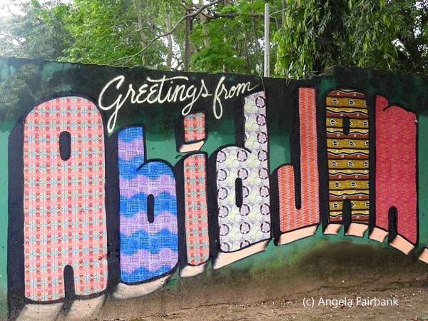
   Friday, May 23, 2025: Abidjan, Côte d'Ivoire (Ivory Coast)
Country number 163 and U.N. country number 129, Côte d'Ivoire, bordered from West to East by Liberia, Guinea-Conakry, Mali, and Ghana, is a former French colony where slavery wasn't abolished until 1905. With a surface area of 322,462 sq. km. and a population of 32,711,547, it is another country I have long been curious about as I have had a long friendship with an Ivorian I met back when I was living in Belgium. I believe he told me he was Baoulé, ethnically speaking, and came from the current capital, Yamoussoukro. This is the same native city as the country's first President, Félix Houphouët-Boigny, who between 1985 and 1990 built the $300 million Basilique Notre-Dame de la Paix (well not personally of course), listed in the Guinness Book of World Records as the largest church in the world at 30,000 square metres. With a capacity for 18,000 worshippers, it is based on the Basilica of St. Peter in the Vatican and was built using Italian marble and 7,000 sq. metres of stained-glass windows imported from France. The Presidential Palace in Yamoussoukro is also impressive, apparently, and is surrounded by a moat containing about 300 caimans and crocodiles! Sadly, as this capital city is located 240 km northwest of Abidjan, the location of our port, we were not able to visit it. Abidjan is, however, Côte d'Ivoire's largest city with a population of about six million. Like São Tomé and Principe, Côte d'Ivoire is famous for its chocolate and, I believe I heard, the origin of 45% of this commodity in the world. Unfortunately, the chocolate industry, our onboard lecturer informed us, is reported to involve child labour and human trafficking where women perform 70% of the work and earn only 20% of the profits. One slide in his presentation states as follows: “In 2023, Côte d'Ivoire made moderate advancement in efforts to eliminate the worst forms of child labour. The government increased the Ministry of Education's budget by 13 percent or $240 million, leading to an increase in the number of teachers and classrooms available for students, and launched a new action plan to address human trafficking and the smuggling of migrants. The Ministry of Employment and Social Protection also created 111 departmental child labour monitoring committees and 304 committees at the village level across the country. However, the government does not have a mechanism to assess civil penalties for labour law violations, and the lack of financial resources and personnel may have hindered labour law enforcement efforts. In addition, accessibility issues for students make it difficult for them to attend school, making them more susceptible to child labour.”        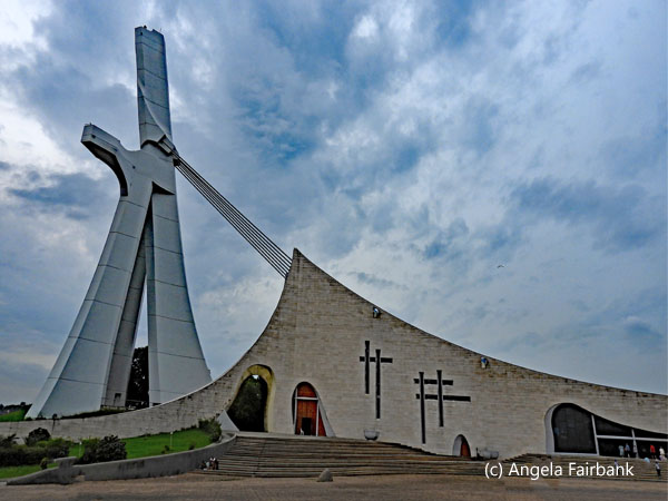  Since we were docking after breakfast today, I was able to watch us enter the bay and port, an event, which as usual, was fascinating. In addition to people in small boats, I photographed some of the outlying bits of land, containing lots of garbage that had no doubt floated onto their shores, including plastic bottles and more. The water, too, was polluted and a few garbage islands had accumulated upon which sat egrets as you will see here. Of course, it is possible that the other ports we arrived in previously suffer from the same problem, but as we arrived before sunrise and left after sunset on these other days, I never got to see if it was the case. After we had docked, we gathered for our tours and awaited clearance once again. The ship's excursion office was offering only three tours from this port today, which meant that we travelled in large convoys of coaches with police escort to control the traffic. Our convoy consisted of eight large coaches! and three policemen on motorcycles with sirens wailing. They did a good job though, and we were able to visit all the sites we were promised. Our guide was a young man called Socrates, whose English could have been better, but he struggled through admirably. And that's no fault of the education system as the country contains a total of six universities, Abidjan University, of which we were given a glimpse as we drove by, being by far the largest. Our first stop was to the Italian-designed Cathédrale Saint-Paul with its impressive stained-glass windows, a small selection of which you will see here. Next was the small Musée des Civilisations, containing masks from various ethnic groups around the country, in the courtyard of which was a presentation by musicians and drummers and a sole dancer in costume from one ethnic group. At various spots during our drive, I kept seeing signs saying, 'no pipi' (reminding me of the same problem - or worse - in Suriname) and threatening that they would be filmed urinating and that these films would be shown on YouTube. A bit of an exaggeration, I think. I also kept seeing what looked like crows but with white breasts. When I finally got around asking, I was told that they were indeed crows but Pied Crows (Corvus albus).
         We then drove in a convoy to Bingerville, a capital of Côte d'Ivoire for 25 years in the early 1900s and named after a former governor called Louis-Gustave Binger. Our itinerary says we visited the Combes Museum but, in any case, it was another small museum featuring large, wooden heads with different hairstyles and headdresses. The compound in which it was located also contained an art school for males it would seem for I only saw boys and young men from ages 15 to early twenties. I asked one young man in the group that, on seeing us visiting, had poured out of two classrooms, in which they were in the midst of drawing in charcoal, what the percentage of graduates who managed to make a living from art was here and he replied 60%, which seemed a rather high expectation to me. Outside on the street, as we waited for the others to return to the buses, we photographed some locals, including these two peanut sellers, who, it appeared, considered it all a bit of a laugh since all of us with cameras in hand probably looked a bit like paparazzi to them. We then turned up a hill toward the old governor's house on quite a bit of acreage, now a boy's orphanage (Orphelinat de Garçons de Bingerville). It had first been home to mulattos born of local women and white colonialists/soldiers, who then returned to their countries and legal wives and children and left these mulatto children behind. Now, however, it houses, feeds, and educates only orphaned boys, because it was discovered that when it housed both boys and girls together, the girls tended to get pregnant! The girls are now housed in another orphanage in Abidjan. When I asked the director of the orphanage who the older girls were that we were seeing with the male children here, I was told they were locals from Bingerville who came to play with the orphans. At the end of his speech, the director requested donations, but he made no mention of how one might adopt these orphans, or what their fate was once they became old enough to leave the orphanage.
         A short drive away was the Botanical Garden of Bingerville, through part of which we had a walking tour, during which we were introduced to a number of trees, including bamboo, and mango ... as it sprinkled with rain. The gardens are also known as a venue for weddings and were clearly being visited by groups of school children. We ended up at a large tree several hundred years old, which he called a cheese tree, because its wood would have been used by the colonialists to make boxes in which cheese was shipped. It had grown in such a way that one could walk right through the middle of it via a gap. There were no flowers as such to speak about and there was no time to walk the entire gardens. At one point, just as we were about to cross a path, a small boy came galloping down the path on horseback followed by a second. Seeing us, they stopped and agreed to be photographed. This egret was also in these gardens. We then returned to Abidjan over a toll bridge next to which a former presidential palace lay, we were told, though it was hidden from our view. Our final stop was at the Centre Artisanal de la Ville d'Abidjan, or CAVA for short, in the neighbourhood of Marcory. We were told we had 20 minutes and asked for 30, but even then, it wasn't enough. There were some lovely things, but my complaint was that the loveliest were painted on glass, or behind glass, and were therefore susceptible to breakage. Finally, forced to choose, as time was running out, I decided on a small glass fridge magnet and a bracelet that contained the colours of the national flag, because no one in the entire market had a bracelet with the words Côte d'Ivoire on it. I must have asked everywhere. The eight-bus-and-three-police-motorcycle convoy arrived back at the pier safely after a tour of about six hours. Consequently, I never got to try a local Ivorian beer, although I understand they make a few kinds at their brewery located beside the port. To sum up, the tour covered a number of different aspects and gave us a good view of a large part of Abidjan and its various neighbourhoods, so was satisfactory in that respect.
            Monday, May 26, 2025: Dakar, Senegal
I was last in Senegal, the westernmost country in Africa and said to be one of the safest and stablest, on February 11, 2024, and at the time I recorded a country population of 18 million and a city population of 4 million. The official language is French yet only 26% of the population speaks it while 36 other languages are also spoken here. Ninety-seven point two percent practise Islam, the majority of which is Sufi, and religious tolerance is guaranteed by law. Our onboard lecturer, who advised us not to go swimming in Dakar's sewage water as it contained the polio virus(!), also told us that wrestling is the most popular sport in Senegal - even more so than football/soccer. Senegalese wrestling involves traditional rituals known as gris-gris, including shamans (shamen?), marabouts, amulets, dancing in a trance, drumming, releasing pigeons, washing with milk, inhaling sacred smoke, and sacrificing animals. Like Angolans, the Senegalese also revere the baobab tree, and its symbol appears on their policemen's uniforms. The oldest and largest baobab tree in Senegal has a circumference of 33 metres. One can also zipline between baobab trees at a Senegalese adventure park.          Just as I had mentioned child labour in Côte d'Ivoire above, Senegal too has a dire problem. The lecturer's notes (which I have edited below to cut out redundancy or poor English) say as follows: “[Currently] in Dakar, Senegal, there is a growing crisis. Senegal has a growing population of youth under the age of 18, representing 42% of the country's population. Senegalese youth have very few options for education and employment. It is estimated that 49% of Senegal's population is crowded into the urban cities, and almost 8 million people live in the Capital City of Dakar alone [Ed. which refutes the earlier mention of Dakar's population of 4 million]. All throughout ... Dakar, there are countless youth wandering the streets looking for work with no hope in sight. These youth are essentially left behind by society. One of the most vulnerable groups of Senegalese youth ... are young women ages 15 to 24. Young women in Senegal are at great risk of being exploited. Eight dangers facing young Senegalese women are 1) being forced into early marriage; 2) being forced into underpaid domestic work contracts; 3) being the victims of domestic violence; 4) ... teenage pregnancy; 5) ... human trafficking; 6) ... prostitution, 7) ... illiteracy or undereducation from not attending school, and 8) ... involvement in illegal drug use. Another great danger facing young Senegalese women is ... dying in the ocean due to European migration by boat. As many as 400 Senegalese youth died from drowning in the ocean in 2020 while making the difficult choice to leave their families in search for educational and employment opportunities in Europe. These youth, often ... living in squalor, are left to irrational and unsafe choices because there are no other opportunities to get themselves and their families out of abject poverty.” Although, unfortunately, the lecturer did not cite the origin of this text, he did mention orally that it was something to do with an academy to train chefs.
         As we neared Dakar on the ship today, I noticed a plethora of Yellow-billed Black Kites (Milvus migrans), I am guessing, once again flying overhead and I continued seeing them throughout the day. The sea did not appear polluted as it had been in Abidjan, but there were definitely a lot of jellyfish in the water, as seen in my photos. For me, today was all about Gorée Island, a car-free, UNESCO World Heritage Site, located 3.5 km off Dakar's south-eastern coast. Since I had seen some infamous slave prisons in Ghana and Angola, although this one in Dakar is perhaps the most well-known, despite fewer slaves having passed through it, at first I had believed it redundant to visit this one, and had initially chosen to take a bus tour through the city to visit a market, various government buildings, a $30 million, North-Korean-made bronze African Renaissance Monument, Africa's tallest at 52 metres, unveiled in 2010 to commemorate Senegal's 50 years of independence from France, and a mosque. However, on seeing photos of pastel-coloured buildings and bougainvillea, and learning that people actually still lived and worked on the island, the location of restaurants and hotels, I decided that even though it meant hearing once again of the gruesome facts of slavery, it might be quite photogenic to photograph. In actual fact, things were rather disorganized in general, and we were pestered the entire time by vendors because we were on foot. Due to both of these disadvantages, we ended up having little or no time to visit the slave house and the historic museum, which were the two most important buildings on the island. Our tour description says that the slave trade flourished here for more than 350 years, beginning in the 15th century. My book says it was ruled in succession by the Portuguese, Dutch, English, and French, and that between the 15th and 19th centuries, an estimated 35,000 African men, woman and children were captured and transported from here to the Americas.
         As per the itinerary, after taking about a twenty-minute ferry ride over to the island from the cruise ship pier, we did visit the 18th century House of Slaves, where the curator gave an excellent introduction in French, interpreted somewhat hesitatingly by the chief guide, Adana, who told us he was an English teacher, guide, and translator/interpreter by profession and had being exercising all three professions for 30 years. He told us his languages were French, English, Portuguese, and Arabic, but he also spoke Wolof, the most widely spoken Indigenous language in Senegal. He had first given us an introduction to the island via loudspeaker in the ferry, a well-written piece of prose he had no doubt memorized and presented countless times. Like the castles in Ghana I had visited last year, the upper floor of the slave house was formerly occupied by slave traders, while the lower floor was reserved for the slaves, who were separated by sex and age; children being packed in like sardines, we were told, men chained hand and foot, virgin girls kept for the traders' pleasure, but all in one room, and rebellious slaves shoved into a room all together with no light. This building too had a Door of No Return through which the slaves passed to be loaded onto ships for the Americas.
         We then visited a Christian church still in use and climbed to the top of the island's hill at its southern end (past many handicraft stalls), containing a rusting canon and a modern towerlike monument memorializing Africans who were brutalized and dehumanized during the slave trade. We were taken to the workshop of a sand painter and were given a demonstration of his art using various colours of sand originating from different areas. We then descended some very precarious stairs and walked through the pier area and onward to the northern tip of the island, the location of the Historic Museum, where we were finally offered a drink and were given another presentation by a speaker who ended his spiel by singing Michael Jackson's We Are the World a capella. As we were then told we had to be back at the ferry in fifteen minutes, it left us no time to visit the museum itself. The statue of a man and a woman outside this museum commemorates the Liberation of Slavery. We were on a very crowded ferry back and I asked the security men who were helping passengers onto the ferry, if it were not at its capacity already and was told “Non, loin de là” (far from it), yet all the seats were full, and a few people had to stand. Luckily, we made it back to the pier safely, and luckily, too, we had not missed our opportunity to shop for handicrafts in all this confusion and harassment, as there were about twelve vendors (curiously all male) with their wares on the pier, unlike last year where only a single wood carver had visited. I asked one vendor why this was so, and he explained that during Covid, their ability to come and to sell handicrafts on the pier had been curtailed and it had only been reintroduced this year. These vendors did not pester us (as much) so we were able to look and/or shop in peace, though still had to bargain hard.
         Thursday, May 29, 2025: Santa Cruz, La Orotava, and La Laguna, Tenerife, Canary Islands, Spain
I had been to the Canary Islands twice before, also on cruise ships, in 2023 and 2024, but so far had visited only four of the eight inhabited islands. First, let me tell you more about the Canary Islands in general. Officially part of Spain, they are located closer to the African continent (100 km from the southern coast of Morocco) than to Europe. They contain active volcanoes, are subtropical, and the majority of the islands have a desert climate. Their name comes not from small yellow birds, but from the Latin Canariae Insulae, islands of the dogs, confirmed by Pliny the Elder, who reported seeing “vast multitudes of dogs of very large size.”       The main islands from largest to smallest are: Tenerife with 785 sq. mi. and 900,000 inhabitants; Fuerteventura with 640 sq. mi. and 124,000 inhabitants; Gran Canaria with 600 sq. mi. and 850,000 inhabitants; Lanzarote, the easternmost island, at 325 sq. mi. and 150,000 inhabitants; La Palma, which, with 272 sq. mi. and 81,000 inhabitants, has a volcano that erupted in 2021 for three months. Houses and livestock were lost but no people died; La Gomera with 142.77 sq. mi. and 21,136 inhabitants, famous for its whistled language (which is a compulsory subject at school on this island); El Hierro, the westernmost island with 103.75 sq. mi. and 10,798 inhabitants, was seen by Ptolemy as the prime meridian of longitude but in the 19th century this was replaced by Greenwich in the U.K. In 2018, an eighth island, with an area of 11.25 sq. mi., was declared part of the major islands as it was also inhabited (700 people). It is located off the island of Lanzarote and is called La Graciosa. There are five more islands or rocks, but they are uninhabited. During Churchill's time, Britain planned to seize the Canary Islands should Gibraltar be invaded (Operation Pilgrim). The Canary Islands were declared autonomous in 1982 and held their first autonomous elections in 1983.
      Our guide today was called Laura, and she did an excellent job. Basically, we visited two towns in Tenerife. The first was Orotava, southeast of its port city of Santa Cruz, whose old town with its steep streets has been declared a monument of artistic national interest. We visited Concepcion Church from the outside and I photographed its amusing gargoyles. Around the corner from it was the Casa de los Balcones, completed in 1632. As part of her tour here, Laura demonstrated the whistling language of La Gomera. She says she can tell whether a whistler, whose whistle can typically be heard up to three kilometres away, is a man or woman, young or old. She then took us to the city hall across from which artists were creating a floor made of different colours of sand, much like flower carpets are constructed in other cities in Europe and elsewhere. She also explained the significance of the Canary Island flag. Tenerife and Grand Canaria, being the two most important island of the archipelago, each have a flag. One flag (I forget which) is blue and white and the other is yellow and white. They were merged together for the Canary Islands flag and if you look at the photograph I took of it, you will see a dog standing on its hind legs on either side of the emblem (hence the story about the dogs above). These two islands are also football/soccer rivals. Tomorrow is the Canary Islands' National Day and many people, young and old, typically wear national costumes on that day. Whilst in the bus, Laura played us a number of clips on her iPad to demonstrate the music, folklore, carnival, etc. She also talked about mummies that had been found in Tenerife.
      Our second visit was to San Cristobal de la Laguna to the northeast of Santa Cruz, the first capital city of the Canary Islands, a UNESCO World Heritage Site (1999), and the location of the oldest university in the Canary Islands, the University of La Laguna. The city was founded in the late 15th century, 550 m above sea level, next to an insalubrious lagoon, which has now disappeared. It has an upper town and a lower town, the latter being designed on a grid system. This grid system was seen by Christopher Columbus, who brought it to the New World, and it can be seen in many cities today such as Havana, Cuba; Lima, Peru; Cartagena, Colombia; and San Juan, Puerto Rico. Many of the buildings in La Laguna were built with wealth gained by the island's growing trade with the New World. The buildings here date from 1470 up to the 20th century. Mount Teide behind it at 12,188 feet is the highest peak in Spain, the highest volcano in the world, and also a UNESCO World Heritage Site. As it is typically covered with snow year-round, the first explorers called it Nivaria from the Latin for snow. It last erupted in 1798, but it also erupted in 1492, supposedly just as Christopher Columbus was sailing past!
         Among my photos today you will see one or two Canarian canaries, as confirmed by our Canarian tour guide and later by a post card I saw in a shop. I was happy about this because I hadn't seen any canaries the other two times I'd been here and had been asked about them. The bird is native to the islands. I was also lucky to see and photograph a couple of colourful parrots, somewhat more successfully than I had done in Sucre, Bolivia recently. When I checked with our tour guide here, however, she informed me that these parrots are not native to the Canary Islands.
       Friday, May 30, 2025: Las Palmas, Gran Canaria, Canary Islands, Spain
Today is Día de Canarias, which means it's a bank holiday, and I spied a few locals walking around in national costume. It seems there was a parade near the pier this morning as well as some dancing, but we clearly missed it. Patricia, today's tour guide, refuted the story given to us by yesterday's guide on Tenerife about the origin of the name of Canary Islands. She told us instead that it was a name used for the Berbers, who were the first inhabitants of these islands.    We hopped onto our bus and were driven to Arucas, which is apparently known as the banana capital of the island. As a result of our visit to La Rekompensa banana plantation, I can perhaps now tell you a small part of all you ever wanted to know about bananas but were afraid to ask. Bananas are the most widely consumed fruit on Earth as well as one of the most nutritious and delicious. (By the by, I learned in a trivia game recently that a banana will wake you up better than caffeine will.) Although the fruit originally came from South-East Asia, it is now cultivated on five continents. Apparently, it was first domesticated in the Kuk Valley in the higher-altitude jungles of Papua New Guinea. The word 'banana' comes from the Guinean banema, which is also an African name that spread with this plant to other parts of the world. From Papua New Guinea, it expanded to the Philippines, India, Indonesia, Australia, and Malaysia. A couple of millennia later, it arrived on the East African coast and after another two thousand years, it reached Madagascar. It then spread across the African continent. Alexander the Great came into contact with it for the first time in 327 BC in India. His troops brought banana plants to Greece and Persia and thus it was introduced to the Mediterranean. In the 11th century, Islamic traders brought it to Europe and the Iberian Peninsula in particular. In the 13th century, Japanese farmers were growing bananas to make fabric for clothing and footwear. The banana arrived in the Canary Islands in the 15th century, introduced by Portuguese slaves of African origin. From the Canary Islands, it reached the New World in 1516. I could go on with the history, but I won't. The variety grown in the Canary Islands is Cavendish and, believe it or not, the world's largest producer of bananas is India.
   Each banana plant produces one bunch of fruit. The plant's production life cycle ends with its cutting or harvesting. Bunches that are ready to be cut are marked, based on the plant's situation and how full the banana plant's fingers are. At least two people are required for harvesting. A scythe is used to separate the spike from the plant. The other person catches the bunch on his shoulder, often on protective padding to help absorb the impact and weight of the fruit and also to prevent bruising so that the fruit can remain in the best possible condition. The fruit is loaded onto a truck where the bunches are lined up vertically. They are then driven to the packaging facility. Transportation does not affect the quality or flavour of the fruit during its journey but presentation at the market is everything. Bananas are handled by experts at the packaging facility to undergo 1) cleaning to eliminate any residue on the fruit from the field or transportation; 2) de-handing, which is the process of separating individual hands (bundles) of bananas from the central bunch stalk. Each bunch contains two rows of fingers and an average of twenty bananas per hand. There are usually about three hundred bananas per bunch; 3) classification and packaging, where the fingers are arranged by size and appearance. These are then put into boxes and sent to points of sale.
   Our banana guide, who took us into the plantation proper, introduced some of the types being grown there and explained that banana plants are hermaphrodite, regenerating from grandmother, to mother, and then to daughter. He told us that Canarian bananas are the sweetest variety, contain less starch, and take about three months longer to ripen than most other varieties due to the volcanic soil and Canarian weather. Banana plants are also sustainable as the residue is used for natural fibres, cellulose material, and as fertilizer, while other (less well-known) products of this waste material are vegan leather and 3D printing filament. According to data from the Food and Agriculture Organization of the United Nations (FAO), the Canary Islands are the ninth largest producer of bananas in the world, with an annual production of around 1.4 million tons. The vast majority of this production is exported, with the European Union being the primary destination for Canary Islands bananas. In 2019, the value of banana exports from the Canary Islands was approximately 938 million euros, making it the third largest agricultural export for the region. We were then offered samples of various jams and sauces made with bananas, a white wine called Platé, a sparkling wine, which was a combination of banana and passion fruit, and a liqueur called Juanita at 20% alcohol, which they compared to limoncello in Italy, but it wasn't anything nearly as rich ... or as nice. There was also an onsite shop, where, interestingly enough, you could buy mini banana plants containing instructions on how to grow them at home. I somehow doubt the climate of Vancouver would be propitious. In fact, when I moved into my current address, there were two banana trees in the garden but sadly they did not survive for long.
   We then drove further into the island to Arucas, where I realised, on seeing the old-looking but modern gothic church, that I'd visited this particular town two years ago. We did not stop for photos here but instead continued on to the Jardin de la Marquesa, which we hadn't been able to visit two years ago because it had been closed. Originally, this location was the summer residence of the Marquisate of Arucas, built in 1880 by the first Marquis of Arucas, Ramón Madam y Uriondo and his wife Maria del Rosario González y Fernández del Campo. The botanical garden is said to contain one of the most complete collections of (2,500 species of) tropical and subtropical flora, or so the official plaque states, with turtles in a pond and lots of peacocks ... who far outnumbered the peahens. We were also offered samples of honey rum at the gardens.
  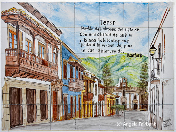 Our final visit on the tour was to the village of Teror, famous for its colonial buildings with balconies and a church housing la Virgen del Pino but also containing colourful shops and inexpensive souvenirs (it's too bad I wasn't aware of this as I already bought my magnets yesterday on the pier in Tenerife.) The plaque from Teror photographed here says “Balconied town from the 15th century with an altitude of 589 m and 12,500 inhabitants, who, along with the Virgin of the Pine Tree, welcome you.” We were lucky to see the actual be-silvered statue of the virgin in the church (seen here) because tomorrow, for the first time in about 11 years, she is to be moved in a parade of pilgrims to the cathedral in Las Palmas, and then on to visit other churches for the next two weeks, before being brought back to Las Palmas and then finally back to the church in Teror. Wikipedia describes her as follows: “The Virgen del Pino or Virgin of the Pine is a Marian dedication venerated in Teror, Spain. At the site of the present-day Basilica, the image of the virgin herself is said to have appeared in a pine tree on September 8, 1492, to the first Bishop of Gran Canaria, Juan Frías. Said to possess healing qualities, Nuestra Señora del Pino has become the patron saint of the island. On the steps outside the Basilica, it is possible to buy wax models of every part of the human body that can be offered for healing. The figure itself is extraordinary. It is said that one side of [her] face is smiling, [while] the other side is sad. The figure is bedecked with jewels, although not as many as there were before the robbery in 1975.”
      After having some free time in Teror, we returned to Las Palmas and our ship. Before getting back on board, I walked over to a square across from the pier where I found this sign of the city to photograph. I seem to remember it being filled with plants last time. Finally, on my walk back to the pier, I saw a couple of small, very tame sparrows with beautiful plumage very near to me. Along with the peacocks, they made my day.
      Saturday, May 31, 2025: Arrecife, Lanzarote, Canary Islands, Spain
Not having visited Lanzarote, my fifth Canary Island, before, I wasn't sure which tour would be the most representative. A fellow passenger on another ship had told me about all the art on this island by a local man who died in a car accident in 1992 called Cesar Manrique, so I was looking forward to seeing it and photographing it. The Best of Lanzarote trip description seemed to concentrate on volcanos (this island is called the volcanic island; one of its volcanos last erupted in 1824 and the lava resulting from it took up most of the landscape we drove through) so I decided it was not for me, but it did mention Cesar Manrique's art present at two of its stops, as did two of the three gourmet trips that included lunch. Then, although I noticed it too late, I finally discovered there was a tour called 'Art & Nature of Arrecife' which is all about Manrique, who believed, the description says, that architecture and art must be created in harmony with the natural environment. Said tour visits a Cactus Garden, a former landfill he transformed into a landscape of fantastical art and thousands of exotic cacti (again as per the description). Here there would be a demonstration on how cochineal insects, particularly associated with prickly pear cactus, are cultivated to make a red dye for textiles, cosmetics, and food. Manrique was also the visionary behind Jameos de Agua, a cultural centre he created in the lava tubes left after the eruption of La Corona volcano. Within this natural space, Manrique designed an auditorium, an aquatic habitat, and a restaurant with a hardened black lava floor. Some of his artwork can also be seen in the Castle of San Jose, an 18th century fortress converted into a museum of contemporary art and includes work by Picasso and Miró. However, the tour I ended up choosing, which was actually free for me due to discounts I was offered for this trip, was called 'Let's Take a Selfie' and I innocently thought there would be few people. I was wrong. There were four buses of us! However, we visited four spots, and each bus did them in a different order, which meant that each site was less busy than it certainly could have been.    I was also led to believe from this tour's description that we would have free Wi-Fi at each site (to upload the selfies taken and send them to family and friends, the description read) and I was also anxious to take advantage of such an opportunity to retrieve my emails, but there was none - not even at the cruise terminal. The description also said that our tour guide would help us choose the best spot for a selfie, including composition, posing, light etc. That too was not the case as she was too busy counting us to make sure we all got back on the bus. In my opinion, we were given far too much time for each stop. Instead, we could have visited many more spots on this four-hour tour, including one or two with Manrique art. However, I kept on reminding myself, it was a free tour so I shouldn't expect too much.
 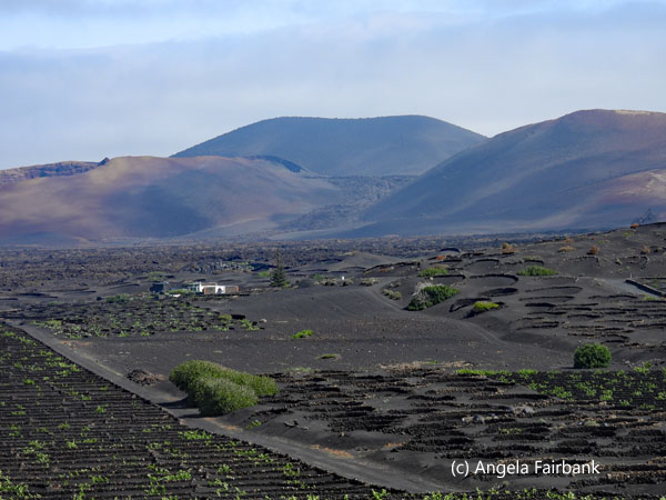  To be honest, I didn't think much of this arid, black island and would never personally choose to holiday here. Its scenery was bleak, there wasn't much shade, merely lots of obsidian-coloured lava, although it did contrast nicely with the white flat-roofed houses, limited to two stories inland and six stories on the coast. The only bits of colour were the doors and window frames, which were permitted to be blue on the coast to match the sea, and either brown or green inland to match the vegetation. The two beaches we saw - at Los Posillos in Puerto del Carmen and at El Golfito - were definitely not my idea of beach perfection as the sand was volcanic, although the Green Lake at the latter site was striking. Between Puerto del Carmen, which was our first stop on the tour, and El Golfito, which was our last, we visited La Geria vineyard and colourful salt flats at Janubio, operating since the 19th century.
   Perhaps the most (or do I mean only) interesting part of our day for me was visiting La Geria, a 525-hectare vineyard located on the outskirts of the Timanfaya National Park, covered (again) by black volcanic ash formed by the Timanfaya volcanic eruptions between 1730 and 1736. Instead of growing vines on top of the soil like most vineyards around the world do, Lanzarote grape growers dig a 3-metre-deep and 8-metre-diameter pit into the fertile ground buried beneath the volcanic ash. Each pit is surrounded by a semicircular stone wall called a zoco to protect the vines from rough trade winds. The volcanic ash retains the humidity, which falls at night. The very porous gravel allows water to pass through rapidly yet prevents evaporation during the heat of the day. The grape harvest begins at the end of July, earlier than everywhere else in Europe, and all work is done by hand. The types of grapes grown on Lanzarote are Malvasia and Moscatel and the yield per hectare is the lowest in Spain (1,500 kg) while per vine production can be as much as 25 kg. In this region, normally two vines are planted in each pit. The vineyard we visited, dating from the end of the 19th century, currently produces 300,000 bottles annually, while approximately 400,000 kg of grapes are harvested from over 160 vineyards on the island. All the grapes are handpicked to produce young white, red, rosé, and sweet wines.
   In my humble opinion, Lanzarote has little to offer tourists, unless they come for the sun and beaches ... or are volcanophiles, although I did see people riding bikes and horses as well as a running club or two jogging along the beach. I was also surprised by the lack of birds, apart from a few seagulls, sparrows, and doves. The only animals raised for food here are goats. The last photo here is of a lacewing insect that landed on the bus window beside my seat.
     Monday, June 2, 2025: Motril - Granada - Motril, Spain
It was nice not to be guided around today for a change, (despite the supposedly 38-degree-Celsius weather, which strangely enough didn't feel oppressive, so I wonder if the thermostat I saw in town was actually wrong and should have been indicating 28 degrees), as I chose the 'Granada on Your Own' tour. This meant we were bussed into Granada from Motril port and up the hill to the Alhambra but then were left to our own devices until we had to meet about in about five hours back at the bus again: a simple half-hour-or-so walk downhill to a nearby shopping centre. The only problem was that, being a Monday, many of the otherwise free-entry buildings and museums were closed, while some places that were open cost money, but those that did were sold out months ago so, unless you'd bought a ticket online ages ago, you couldn't get into them either. These pre-paid tickets included entry into most of the Alhambra itself, the Generalife Gardens, and the Royal Chapel in the centre of the old town containing the tombs of Ferdinand and Isabela. A very small section of the Alhambra was free, and I visited what I could, but the museums and the Carlos V palace inside this free section were closed for Monday, although the Palacio Nazaries was open.             The cathedral in the centre of the old town was accessible for a fee, but I have a thing about paying to go into a church. I think all houses of worship should be free. I did go into one church located beside the cathedral, which did not charge a fee, but I didn't stay long once I realized it wasn't the royal chapel and didn't therefore have any royal tombs. Also, I'd been given a map of Granada by the Tourist Office and on examining said map was expecting the Cathedral to be on the main street. Consequently, I walked right past its hidden entrance and had to retrace my steps after asking more locals where it might be. In the end, I had to walk through a series of shops to get to it and then, as I said, I discovered they were charging a fee to enter. How frustrating. Feeling peckish about this time, I entered a Starbucks, asking first if they offered free Wi-Fi to their customers. They said they did, so I bought a coffee and then tried to access their Wi-Fi, but it wasn't possible. After finishing my coffee, I went next door to the McDonald's where I had more success. Then, with no specific plans to visit anything more, I wandered back through the shopping area toward our meeting place, arriving a good hour and a half before I needed to and got chatting to a retired Glaswegian cattle, sheep, and grain farmer and his wife as we waited for our bus ride back to the pier. With no sons to hand his business over to (only two daughter who weren't interested in farming), he had ended up selling his farm to a neighbour but had retired due mainly, it transpired, to his frustration with all the paperwork required by the European Union prior to Brexit and then by the Scottish government post Brexit. The lucky photograph of today was this Eurasian Jay (Garrulus glandarius) with an unusual blue wing which momentarily flew into a tree, but this was the only photo I got as it flew off again very quickly. La Puerta del Vino (the wine gate) was the traditional meeting place of the Romani people of Granada and one of the entrances to the Alhambra Palace. Debussy gave this title to the third piece in his second book of Préludes. The mosaic in green says, 'Give him alms, woman, because there's nothing worse in life than being blind in Granada' and is attributed to Francisco Alarcón de Icaza.
  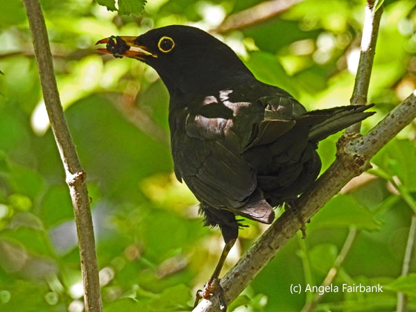 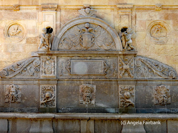         Tuesday, June 3, 2025: Alicante - Villa Joyosa and Altea - Alicante, Spain
I had been to Alicante for business back in the early 2000s but had really only seen the airport, the customer's factory, and my hotel, I suppose, so I was anxious to see it from a tourist's point of view. I ended up booking an excursion to visit two small towns outside of Alicante, promoted for their beauty, as well as their long history. The first was Villa Joyosa and it was here I learned that we were in the region of Valencia besides being in the province of Alicante and that the region of Valencia has its own language - although I must have been aware of this when I studied Spanish in Valencia back when I was at university - called Valenciano. It is used in administration and, in fact, anyone wanting to work for the Valencian regional government must learn and pass an exam in Valencian and this includes doctors and nurses, lawyers, teachers, etc.      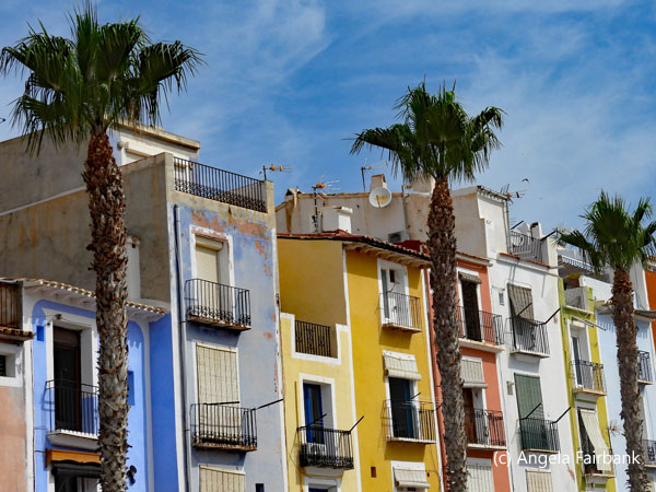 Our guide, who was actually originally Polish, although she spoke both Spanish and English well, told us Spain had four official regional languages besides Castilian - the official language of Madrid and its region. Apart from Valencian and Castilian, Spain also has Galician in the region North of Portugal and, of course, Catalan in Catalonia around Barcelona. I was trying to think of the fifth language but had forgotten about the Basque country, which, too, is part of Spain, near the Pyrenees. I have often been asked to translate into English official bilingual documents written in Castilian and Galician or Castilian and Catalan, but Basque is so very different. Some of the photos you see here are examples of Castilian versus Valencian (and English for the tourists). I also learned from our tour guide, whose name I did not retain, that Madrid has 3 million inhabitants, Barcelona, 2 million and Valencia, 1 million. They seem like such small populations compared to some of the cities we have been visiting recently.
      In any case, our first stop was the town of Villa Joyosa, famous for its colourful houses facing the beach. They are now officially part of Spain's heritage as this was originally a fishing village, and the houses were painted different colours so that fishermen could recognize them when out on the water (this is the same story I heard in Burano near Venice in Italy.) It was a nice beach in any case, and swallows, pigeons, and sparrows were flitting about among the palm trees and the people lying on the beach. There wasn't much time to do much more than photograph the beach and houses, however.
    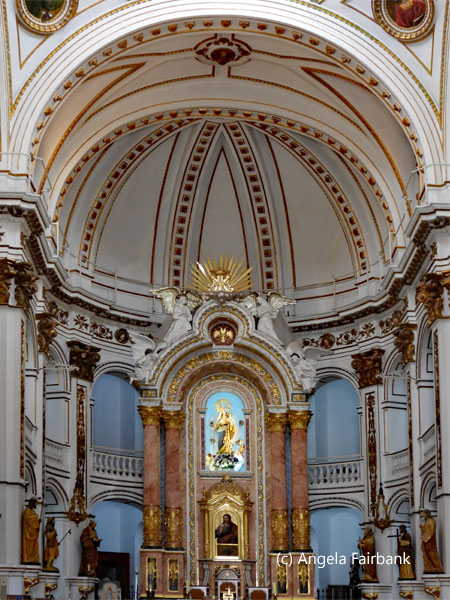 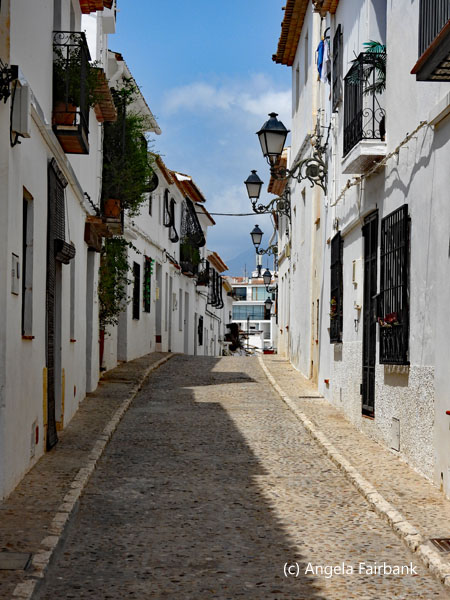 We returned to our bus and drove past the eyesore that was Benidorm, which has more skyscrapers per inhabitant than Manhattan Island, although Manhattan has more skyscrapers per square meter. I wonder how it compared to Hong Kong, so I posed the question to Google and here is the result: “Hong Kong is widely recognized as having the most skyscrapers globally, with some sources claiming over 1,200 structures exceeding 100 meters in height. While Manhattan was once the city with the most skyscrapers, Hong Kong has surpassed it in recent years. [According to sources,] Hong Kong has around 480 skyscrapers, while Manhattan has 287. Benidorm is a popular tourist destination in Spain, known for its high concentration of skyscrapers relative to its population. It's sometimes referred to as the New York of the Mediterranean due to its skyline. [It has been stated] that Benidorm has over 60 skyscrapers, with many over 100 meters tall.” We were told that even today, foreigners still flock to Benidorm to buy property, and new condos are being built on the outskirts for foreigners. (We could see them being constructed.) Two major skyscrapers were pointed out to us: the tallest hotel in Europe, the 52-floor Gran Hotel Bali & Spa, 186 meters high and Intempo, the tallest residential building, 187-metre-high, with 47 floors built in 2021, in the shape of two number ones facing each other and a diamond shape between. Said diamond shape contains a restaurant and a spa and there's also a swimming pool on the roof. We were told two-bedroom apartments here started at just under a million Euros. Apparently, Julio Iglesias won the International Festival of Song in Benidorm back in 1968. The mayor who got Benidorm going presented his idea to Generalissimo Francisco Franco, Spain's extremely conservative dictator at the time, and the latter surprisingly agreed with the idea and let it go ahead, agreeing that it would bring tourists to the area (despite their wearing bikinis) and would help Spain's economy, which desperately needed boosting after the civil war.
      Our second stop then was Altea, an old village on a hill crowned by a church with two blue mosaic cupolas and pedestrian streets with white-washed buildings, which our guide compared this time to Santorini in Greece. It was certainly picturesque, as well as being an artist colony with lots of art on various walls. I peeked into all the shops that were open just to make sure there wasn't anything I wanted to buy. A metal bull, called Gernikabou, was prominent at a place overlooking the coast, but instead of Joan Miró, as I was expecting, I noticed its signature said Antoni Miró. How confusing. Julio Iglesias was mentioned once more by our guide as he was one of the investors in one of the two 5-star hotels in Altea and also had something to do with naming Altea Hills, the area where the wealthy in this area live. We then returned to Alicante in the knowledge that this was our last port before arriving in Barcelona tomorrow, terminating our cruise. The large head you see in one of the final photographs for this port was found inside the cruise terminal at Alicante. I took the final photo as we were sailing away. The large castle visible on the hill above Alicante is Castillo de Santa Barbara, a medieval fortress.
    Wednesday, June 4, 2025: Barcelona, Spain
As I had chosen to take my own bags off the ship and not require the crew to do it the night before, which is the usual case, I was able to get up, eat breakfast, and leave my room basically when I wanted to, as long as it was by 9:30 a.m. This cruise company does not kick their guests out of their cabins at 8:00 a.m. like others I have experienced. We all went through border control inside the cruise terminal building, so I received a nice stamp from Spain in my passport. I then caught a taxi to my hotel, located quite a distance outside of central Barcelona as hotel prices in the city hotel were preposterous! Luckily, it is only a 15-minute walk to the nearest train station, which then takes me into Barcelona proper and its large network of trains, trams, metros, and buses, for which I had bought a 72-hour ticket back in Canada. At the same time as I had purchased my transportation pass, I acquired an online bus ticket for Andorra with Flixbus for tomorrow and online tickets to visit the Basilica de la Sagrada Familia and Park Güell on Friday. I was then curious to find out how to get to these places, so today was set aside for a dry run, from my hotel by train to Sant Estació bus station, then by metro from there to Sagrada Familia, and then from there by metro to Park Güell. The first two stops were easy enough, with a few initial enquiries put to locals as to where I would find the train station near my hotel, but for Park Güell I ended up having to walk about an hour uphill from the metro station before arriving at the park gate. When I got there, I asked one of the attendants if there was a quicker way to get there without walking an hour uphill and he suggested a bus that stopped nearby that entrance. I then took the bus in question downhill (past the very streets I had climbed up) to its terminus, Plaza Catalunya, which is quite central for Barcelona, and decided I would take this same bus up to the park on Friday from that Plaza. I then went to a tourist office on the square to ask where I might find a Subway. She misunderstood me and thought I meant the metro but finally directed me to the correct sandwich place on Las Ramblas where I had a late lunch, fascinated to observe that the common language used by the sandwich makers and their customers was English, despite the former being Catalonians and the latter originating from various countries, including Italy, Germany, etc. Although I did take out my camera a couple of times to photograph the outside of La Sagrada Familia (still under construction) and some parakeets at Park Güell, they are not great. I will undoubtedly capture better images on Friday so will not include any photos for today. Then, feeling exhausted, I retraced my steps back to the metro, to the central train station, to the local train station, and my hotel. Knowing I would have an early start tomorrow, I went to bed somewhat early after replying to emails, foregoing any dinner, apart from an energy bar I had brought from Canada for such an eventuality. Thursday, June 5, 2025: Barcelona, Spain - Andorra - Barcelona, Spain
First, a few interesting facts about the Principality of Andorra. It is the fifth smallest state in Europe with an area of 468 km2 (181 sq. mi.) and a population of 87,097, is located in the eastern Pyrenees mountains and is bordered by Spain to the south and France to the north. It is believed to have been created by Charlemagne in 805 to thank the inhabitants of these lands for their help in the fight against the Moors and was ruled by the Count of Urgell until 988, when it was transferred to the Roman Catholic Diocese of Urgell. The current principality was formed by a charter in 1278 and is today headed by two co-princes, the Bishop of Urgell and ... Prince Emmanuel, aka the current President of France, Emmanuel Macron. Its capital and largest city is Andorra la Vella, the highest capital in Europe at an elevation of 1,023 metres (3,356 feet) above sea level. The official language is Catalan, but I got by with speaking Spanish, although I believe I also might have been able to communicate in French (or Portuguese). It is not a European Union member state but has been a member of the United Nations since 1993 and the Council of Europe since 1994, as well as the International Monetary Fund since 2020. It has a fascinating history which I won't go into here, but you can read about it on Wikipedia if you are interested. Tourism is its main economy, accounting for 80% of GDP because an estimated 8 million tourists visit annually due to its duty-free status and its ski resorts. Its currency is the Euro, and it has been issuing its own Euro coins since 2015. Historically, it has had one of the world's lowest unemployment rates: in 2023, it was 1.5%!       As mentioned in an earlier entry, I had bought a round-trip ticket for the day from Barcelona's central bus station with Flixbus. Able to grab an early breakfast from my hotel, I headed out on foot to the aforementioned train station and arrived at Barcelona's Sants and walked outside and around the station to the bus depot where I waited about an hour enjoying the sounds of chirping bird song. After boarding my bus, which was on time, we headed out of Barcelona in a northwesterly direction, finally crossing the border into Andorra (country number 164, UN country number 130) just under three hours later, where a very friendly border policeman entered the bus to have a look at all our passports. He asked me in English how long I was staying in his country and looked very disappointed on hearing I'd be there for only a few hours. He said I must come back another time. He carried with him no ink stamp to stamp my passport so I thought maybe I could get it done at the tourist office or post office in town. A few minutes later, we arrived in the capital city of Andorra la Vella and after using the facilities in the bus station, I headed out to take a look. I started by visiting a giant, colourful coffee pot I'd seen slightly outside the bus station and then followed signs to the tourist office where I picked up a map and asked what sights in the town would be the most photogenic to capture in digital form. The friendly office attendant suggested a few options and I think I did the day justice by visiting most of them. I started with the greatly renovated historic centre, such as it was, which included some odd sculptures seen here, (the Consell General as I understand it is the country's parliament) and a church (whose door bore a sign saying no dogs allowed) and then wandered along what seemed to be the main shopping street, where I purchased a magnet, and toward the river rushing through the centre of the city, crossed by a number of bridges. The bridge you see here with the name of the city on it is the 'Pont de París' and the sculpture of the melting clock is La noblesse du temps by Salvador Dalí (1904 - 1989). I then wandered across a small park with its statue of two modern children looking at their smart phones. Then, in search of lunch by now, I walked uphill along a pedestrian shopping street, not finding any restaurants that appealed to me, although I did find some more art to photograph. Coming to the top of the hill, I now discovered I was in the next town called Escaldes-Engordany, the second most-populated town in Andorra. As it was quieter and less busy, I thought perhaps I might have more luck finding a place to eat. The rushing river was also featured here as well as a lovely stone church, and an art gallery, outside of which was a colourful, long mural probably full of great local significance.
      I continued wandering along the downhill running river until I came to a more populated centre of town and finally found a restaurant that appealed. Called La Mafia se sienta a la mesa (a long name for a restaurant I thought), it served Italian food. Not attracted by the too-large pizzas it offered, I finally settled on a healthier salmon dish without any starch, and it was absolutely delicious. I ordered a beer called Estrella to accompany it and together with the waitress we discovered that, although all the writing on the bottle and the glass was in Catalan, its was actually manufactured in Galicia, in the city of A Coruña, which I had visited on January 3, 2023. After a satisfying lunch, I walked back up the hill to the recommended art museum called Museu Carmen Thyssen, a small premises with only one gallery inside. It was showing part of its original collection of Catalan artists matched with paintings by a local artist called Modest Cuixart (1925-2007). I was allowed to take as many photos as I wished and at least one of his oeuvres appears among my photos. However, disappointed that the gallery was not larger or provided more artwork to see and admire, I left and retraced my steps back over to Andorra la Vella and the pedestrian shopping street that linked the two towns. Out of curiosity, I dropped into a camera shop and asked if they had the size of battery I had been searching for as a spare ever since I'd bought my new camera last year. Both Amazon and my local camera store in Vancouver had insisted on sending me the wrong battery, which was too thick for my camera. However, this Andorra shop had it and it was duty free! That made my day! I arrived back at the bus station to catch my return bus in plenty of time and before stepping aboard asked my driver if he could stop at the border so I could get the Andorra entry stamp, and he said yes yes, but in actual fact, when we got there, the bus was waved through and it was a Spanish border policeman who came onboard to check our passports this time, although he only glanced at the cover of mine. I had asked at the Tourist Office back in Andorra la Vella about a stamp, but the woman there had told me she only had a stamp saying Andorra Tourist Office and wasn't about to stamp my passport with it. I suppose she thought it would not be legal for her to do so. It was she who had suggested I ask my driver to stop at the border on the way back. So, regretfully, I have no Andorran stamp in my passport. The return bus ride was another three hours, and I just about made it back--including my local train trip and the walk from the station to my hotel--in daylight, although it was almost 9:30 p.m. by then.
         Friday, June 6, 2025: Barcelona, Spain
Today was dedicated to Antoni Gaudí i Cornet (1852 - 1926), a Catalan architect and designer who is widely known as the greatest exponent of Catalan Modernisme with Barcelona's still unfinished Sagrada Família church being considered his greatest work and currently the most-visited monument in Spain. Between 1984 and 2005, seven of his works were declared UNESCO World Heritage Sites. He died on June 10, 1926, at Hospital de la Santa Creu, three days after being run over by a tram on his way to the Sant Felip Neri chapel of prayer. He was buried in the crypt of Sagrada Familia on June 12, 1926, after a final farewell from multitudes of Barcelona residents, who filled the streets in recognition of his work. His health was always delicate, however. Before the age of six, he started having attacks of rheumatism, which flared up again at various points in his life. This disease had a significant impact on his development as a boy and fostered his spirit of observation.       Not only was Gaudí involved with the architecture of Sagrada Familia, but he also designed pieces of furniture and other objects for preaching inside the church. The outside of the church is still under construction and is currently scheduled to be completed in 2026, more than 140 years after construction started, coinciding with the centenary of his death. However, although the main structure should be finished by then, some of the decorative details and an entranceway are projected to continue until 2034. The Tower of Jesus Christ, the tallest tower, will be completed in 2026, making the Sagrada Familia the tallest church in the world--at 172.5 meters (566 feet) tall, and will be finished with a 17-meter-tall (56-foot) four-armed cross--overtaking Ulm Minster in Germany. Around the Christ tower at 135 metres are the towers of the Evangelists, represented by their traditional symbols: a man for Matthew, a lion for Mark, an ox for Luke, and an eagle for John. The second tallest tower at 138 metres and topped with a bright star is dedicated to the Virgin Mary. Each tower is crowned with a pinnacle that stands out for the colours of its polychrome Venetian-glass mosaics and the geometric shapes Gaudí used (sphere, octahedron, cube, and triangular pyramid). The pinnacles of the towers reference the four insignias that represent bishops: the mitre, the cross, the crosier and the ring.
  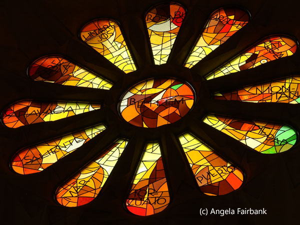    The apse is full of references to nature and its wall features many gargoyles in the form of snails, serpents, lizards, geckos, salamanders, and frogs: animals from the Mediterranean world. Gaudí conceived the inside of the Basilica as a huge forest, where the columns would be tree trunks branching out from the capitals and into the vaults, through which the sunlight would filter in, representing foliage. In 1984, the building was designated a UNESCO World Heritage site, and it was consecrated by Pope Benedict XVI for religious worship in 2010. The church's construction was carried out illegally for 137 years, until 2019, when a building permit was finally issued by Barcelona's city council. The anomaly that it had never been granted planning permission wasn't discovered by the authorities until 2016! The stained-glass windows you see in my photos were designed by Joan Vila i Grau (1932 - 2022), based on instructions left by Gaudí.
      As mentioned above, I had bought a ticket to visit this architectural masterpiece online in Canada before leaving for my trip. On previous trips to Barcelona, I had seen it from the outside but had never been inside. Thus, on my arrival at the pre-programmed time, I was quickly allowed in and was then subjected to a full search of my bag and clothing--like they do at the airport. I was under the impression that I would also be required to leave my backpack in a locker, but they told me that this was only required of people who had bought a ticket to climb the tower (or perhaps towers). Thus, welcomed in with luggage intact, I stood in awe of the building's magnificence, especially impressed by the stained glass, but noting that my photos couldn't really do them justice. Despite our timings being planned, the basilica was full of tourists, and I eventually found my way to the cloisters to admire some of the furniture that Gaudi had designed. Next, I went outside again to admire the far door and its somewhat more modern statues by Josep Maria Subirachs (1927 - 2014) depicting the life of Jesus from birth to death, again according to instructions left by Gaudí.
 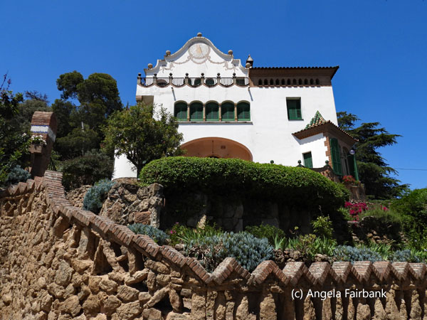     Finally, I discovered the museum beneath the basilica and ended up spending most of my time here, although I did manage successfully not to buy anything at the museum shop. A great deal of the descriptions I have written here above are from displays in the museum. Then, ready to emerge around two hours later, I decided I had seen enough and that I should grab something to eat before I tackled Park Güell. I thus headed back down into the metro system and returned to Plaza Catalunya and the Subway sandwich store on Las Ramblas where I had eaten my lunch two days ago. Then I caught the number 24 bus from the Plaza up to the top of Park Guell. Although my visitation slot was for 4:00 p.m., it was only 3:00 p.m., so I enquired as to when I could actually enter the Park and was told I could enter now so I did. But before I continue with my visit, some background for you. “Park Güell [originated as] an urban development project awarded to Gaudí by Eusebi Güell, a prominent Catalan industrialist whose plan was to build 61 houses for well-to-do families along with a network of roads, viaducts, and stairs to make it easier to get around the hilly terrain. Güell wanted to recreate British residential parks and locate homes close to nature ... Work began in 1900 and finished in 1914 with the construction of the pillared hall and the bench. The Park is organized around a central core of monuments: the staircase, the pillared hall, and the square. Work came to an end in 1922 following the failure of the urban development projects. Güell sold the Park to the City Council, which opened it to the city as a public park.” In 1969, it was declared an historical-artistic monument by the Spanish government; in 1984, it was declared a World Heritage Site by UNESCO; and in 1993, it was declared a Cultural Asset of National Interest by Catalonia's autonomous government.
     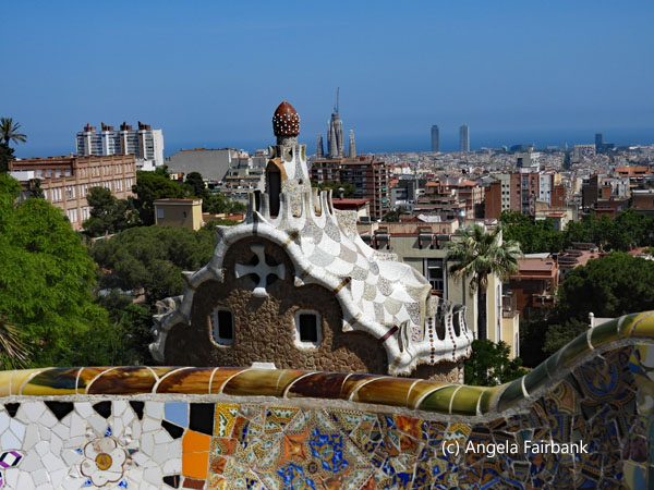 I spent a disappointing first hour because unaware that there were several entrances to the park, I had unwittingly landed up at the highest point on the right side of the hill and all there was to see were a few uninteresting viaducts (Els Tres Viaductes). I kept on wandering down several stone paths, my umbrella overhead as it was a hot sunny day, passing a number of entrances/exit spots until I finally arrived at the bottom of the hill, yet still hadn't seen anything of the colourful Gaudí architecture I was expecting to see. Then, I suddenly started seeing some towers and a platform full of people. Ok. Finally. So how could I get over there? I finally had to ask and was steered over to the platform I had seen previously from above, which was surrounded by the amazing wall built of mosaics. Again, as it was so full of people, I had to practice patience to wait for a space or two where no one was taking selfies. I also visited the two small houses--the Pavellons de la Porta--at what I considered to be the main entrance of the park, both Gaudi designs, one of which had been converted to a souvenir shop and the other, a museum that I had to wait in a short line to visit as it only had capacity for a few tourists at a time. That done, I visited the aforementioned pillared hall with mosaic discs on the ceiling called the Sala Hipòstila, and some stone covered pathways with a wave design (Pòrtic de la Bugadera = Portico of the Washerwoman). I never did find the Greek Theatre or the Jardins d'Àustria, but I did enjoy hearing and seeing the Monk Parakeets (Myiopsitta monachus) also known as Quaker Parrots. They are not native to Spain, but feral populations clearly enjoy hanging out in the palm trees. My final photo was taken upon my exit of the park, to show you a sample of the colours of the bougainvillea and jacaranda trees all over Barcelona. I then waited for a number 24 bus to take me back to Plaza Catalunya, but after waiting a long time and seeing nothing coming, I decided to walk to the nearest subway station instead and got back to my train station and eventually my hotel.
  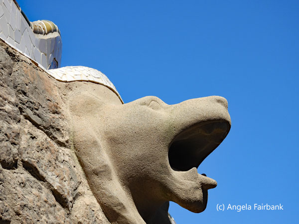   > >   Saturday, June 7, 2025: Barcelona, Spain to Zurich, Switzerland
Today was a travel day. I was up early enough to grab an early breakfast but even though I had ordered a taxi 24 hours earlier, I learned from my chatty taxi driver from Uruguay that in fact it had never been ordered despite my having told the hotel receptionist twice around breakfast time that I was expecting a taxi at 7:30. When it was 7:35, I asked her to check whether it was on its way, and it appears that it was only at that time that it was ordered. OK ... so I should have checked to make sure it had been ordered for 7:30 when I came down to breakfast at 7:00 and not just assumed that someone had done as I had asked yesterday. In any case, I arrived at the Barcelona airport in plenty of time to check in, obtain my baggage tag (the longest line up), breeze through security, and arrive at the gate. There was no passport control to leave Spain, and the flight was delayed about 40 minutes anyway. I arrived in somewhat cooler weather in Zurich (again no passport control though I discovered later that this is because both Spain and Switzerland are part of the Schengen agreement) beneath cloudy skies and it even rained slightly in the afternoon. Switching my brain to German and after grabbing a free shuttle from the airport to my airport hotel (although they charge their guests 10 Swiss francs to take it back to the airport again!), I was able to check in and enter my room right away (an advantage of airport hotels, I have found). On arriving at my room, I immediately looked online at a Zurich tourism website, after picking up their brochure at the airport, and booked two bus tours for Sunday and Monday, respectively. On paying for them, I was surprised to discover that the Swiss franc, which, back in the day, used to be worth less than the Canadian dollar, is now worth not only more than the Canadian dollar but also more than the US dollar and even more than the Euro! The only world currency I am used to that's worth even more than the Swiss franc is the UK pound. Since my research told me that the cheapest way to get to the bus station in the city centre, where I would pick up these bus tours, was by train from a train station a few minutes' walk from my hotel, I grabbed a not very healthy late lunch at the McDonald's at my hotel, which I chose because I had no Swiss francs and they were willing to take my Euros and gave me a fairish rate (I looked on Google to check), I then walked to the local train station to see where it was, how long it took to walk there, how much a return ticket to the main city train station would cost me, and how I could purchase it. As there was no physical person representing the train station to help me figure out the ticket machine, I went to the convenience store in the same building and asked the owner there for her help, which she gave me willingly. That done, I bought a few snacks for the next couple of days at her shop so as not to be stuck without meals, since the tour descriptions don't tell you whether you will have time for lunch or not (they only mention free time but not how much free time). I then returned to my hotel and tried to catch up on my travelogue from the past few days. Sunday, June 8, 2025: Zurich - Rapperswil - Meinfeld - Liechtenstein - Zurich, Switzerland
As I wasn't required to meet my bus at the bus station behind Zurich's Hauptbahnhof today until 10:45, I did not for once need to get up early. For breakfast, I ate some of the food I'd bought at the convenience store yesterday, the hotel dining room only offering an expensive buffet, which I didn't think worth the price. As it was, I arrived at the main train station in plenty of time and was able to change some Euros into Swiss francs. At my request, the man who changed my money directed me to the bus station, which was located a block or two behind the train station after following along to the end of track number 18. I checked into my bus tour and then had a bit of a wait and when I finally got on board realised it was a large group of about 50 or so. In fact, it meant I shared my seat with a German-speaking young mother whose husband and daughter were seated in front of us. Our tour guide's English was good, although it was not her first language, which was Chinese. She gave us a mini tour of Zurich from the bus to start with and then we headed to the town of Rapperswil, located on the northern shore of Lake Zurich in the canton of St. Gallen, also interestingly the terminus of the line the train station closest to my hotel was on. Raperswil's draw is its old town, including an ancient castle dating back to 1229 and which since 1870 has been home to the Polish National Museum created by Polish émigrés, including the castle's lessee and restorer, Count Wladyslaw Broel-Plater, in the grounds of which were wild deer. We also visited the adjacent Roman Catholic St. John's Church, built in the early 13th century; and a small, medieval chapel. After admiring the view over the lake from the grounds of the castle, we then climbed down some stairs, past a small crop of grape vines, to visit a couple of the town's rose gardens. Our last stop here was in front of an old house, its walls containing paintings and the dates M CCC L (1350) and M CCCC LVIII (1458). As it was now lunch time, we were given an hour and three quarters of free time and were recommended the cheesecake (really a thin quiche) at the Rosenstaedter Restaurant. As it was a reasonable price and came with a very healthy salad, I decided why not and was able to have a table to myself to eat my slice of Spargel-Käsekuchen mit gemischtem Salat along with a refreshing glass of local Herrgöttli beer on tap. Quite the meal but I was unable to get the recipe as I was told it was a family secret handed down by the current owner's grandmother. 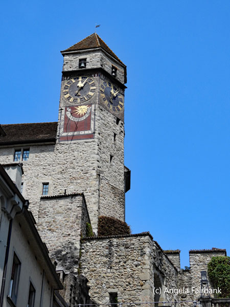  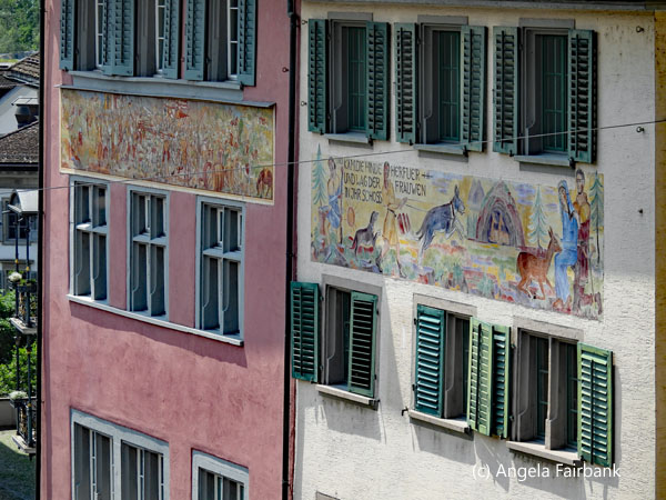             Our next stop, after driving through some beautiful countryside, was at the town of Meinfeld located in the canton of Graubünden, also known as Grisons, and Switzerland's only trilingual canton. The official languages here are German, Romansh, and Italian. I also learned that there are five different Romansh dialects: Sursilvan, Sutsilvan, Surmiran, Puter, and Vallader! The attraction here was Heididorf, originally a film set for one of the about 25 film or television productions of Johanna Spyri's original children's story, Heidi, but more catered to children in my view. I nevertheless took a few photos of goats and chickens and figs growing on fig trees, noting that the post office in the gift shop was the smallest post office in Switzerland, and used their toilets, but had forgotten the story that I had probably read decades ago at the age of five or six perhaps. My entire reason for this bus trip was about to arrive and it was to be our last visit of the day before returning to Zurich. After a few more kilometres, we finally crossed over the Rhine River to the Principality of Liechtenstein, my 165th country and 131st UN country, a doubly landlocked German-speaking microstate in the Central European Alps between Austria in the east and north and Switzerland in the west and south. Liechtenstein is a semi-constitutional monarchy currently headed by Hans-Adam II, Prince of Liechtenstein of the House of Liechtenstein. It is the world's six smallest country but Europe's fourth-smallest country with an area of just over 160 square kilometres (62 sq. mi.) and a population of 40,023. It is also the world's smallest country to border two other states and one of the few nations with no debt. With Vaduz as its capital (which we visited), it has been a member of the Council of Europe since 1978, the United Nations since 1990, the European Free Trade Association since 1991, and the International Monetary Fund since 2024. It is not a member state of the European Union but participates in both the Schengen Area and the European Economic Area. It has a customs union and a monetary union with Switzerland and uses the Swiss franc.
    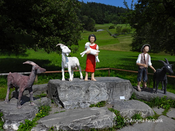           There was no immigration or customs here but we were invited to have our passports stamped at either the Post Office (although it was a Sunday and therefore closed) or a particular souvenir shop which possessed a stamp of the Tourist Office, for which we could pay a token sum in either Swiss francs or Euros. While I was at this souvenir shop, I also bought a magnet to add to my collection. It is probably the most I have paid for a magnet anywhere in the world. There was a model of Vaduz Castle on the main street beneath the hill upon which the real one sits and a plaque which states: “Castle Vaduz lies on a hillside 120 metres above Vaduz. It is the symbol of the capital and can be seen from far away. It is thought that the castle was constructed as a fortress as early as the 12th century before living quarters were added in 1287. Vaduz Castle is first mentioned in documents dating back to 1322. The castle came into the ownership of the Princely Family in 1712, and the west wing served as the family's official residence until 1732. However, after that the building became increasingly dilapidated and fell into disrepair before being rebuilt and renovated between 1905 and 1912. Under Prince Franz Josef II, the castle was extended and once again made fit for living. In 1939, the Prince moved in with his family and adopted Vaduz Castle as his official residence.” I walked down the main pedestrian street, which was paved with images of stamps, collection items we were told, and past the town hall (Rathaus) on which there was a plaque saying that Johann Wolfgang von Goethe (Germany's most famous polymath: a poet, playwright, novelist, scientist, statesman, theatre director, critic, and amateur artist, and considered the greatest German literary figure of the modern era) had been in Vaduz from June 1 to 2, 1788. I looked into the windows of the art museum (Kunstmuseum), outside of which the Reclining Woman bronze statue by Fernando Botero (1932 - 2023) was reclining, and wandered as far as the Parliament building and the Kathedrale St. Florin, into which I did not go. I finally found the welcome to Liechtenstein sign in front of which I asked another tourist to photograph me. Our return bus ride back to Zurich was uneventful and I traced my way back to my hotel, arriving before dusk.
  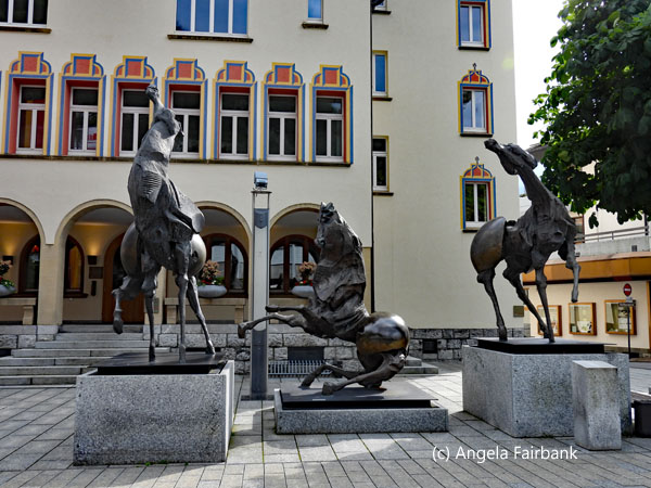 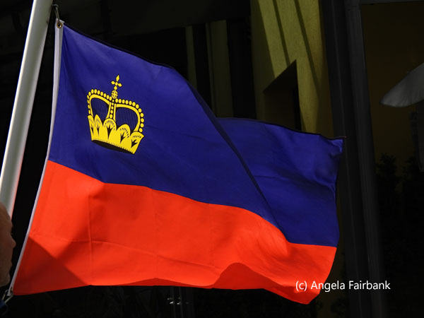      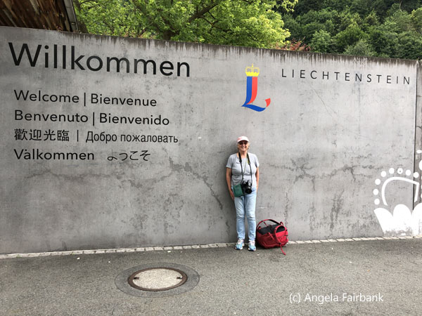 Monday, June 9, 2025: Zurich - Interlaken - Grindelwald - Zurich, Switzerland
Today was my second day of Swiss Grayline-equivalent bus travel. My tour into the Bernese Oberland started at 8:30 a.m., so I was up early, my breakfast consisting of hotel room instant coffee and some of the remaining snacks I'd bought the other day. I then walked to the local train station and took the same route as yesterday morning back to the bus station behind the Hauptbahnhof in downtown Zurich. The tour guide we had today was not as good as yesterday's: his proficiency with English was compromised by a stutter. Although the bus was less crowded, it consisted of three different tour groups all under the same guide: my tour, which was the simplest and least expensive; a second one, which was about 150% the price of mine and would be going into the mountains after leaving the first group at our first stop; and a third about three times the price of mine doing the whole shebang and visiting a glacier after a gondola and possibly a mountain train ride as well. I was rather perturbed by the tour guide trying to upsell tours 1 and 2 to tour 3 and suspected he was making a personal deal as he would only take the difference in cash. One family of five fell for his offer, however, and the father went to a cash machine to withdraw the necessary funds.       Our first stop of two was Interlaken, which I had last visited some decades ago. With a population of 23,300, it is a large resort town in the mountainous Bernese Oberland region of central Switzerland in the canton of Bern. It is built on a narrow stretch of valley between Lakes Thun and Brienz. After our arrival, we were given two hours of free time to wander and photograph on a sunny morning, while the other two groups were asked to be back in an hour to continue their tour. I walked east, past souvenir shops, to the Interlaken Ost railway station, then west to the Interlaken West railway station. Next, still in search of a lake view, I kept on going east and found myself in another town called Unterseen. Resolved that I would not have enough time to reach either lake, I walked back to the centre and watched paragliders arriving in a huge park called Höhematte, through which a beautifully coloured river was flowing. I supposed it was flowing from one of the lakes into the other. The water was the aquamarine colour you see in my water photos here, proving it had originated from glaciers. I photographed a few oddities in the town, noting that one of their old telephone boxes had been converted into a lending library. I also photographed an old pillar by the park containing on each of its four sides respectively, a hygrometer, a thermometer, a barometer, and its coordinates and altitude. There was also a tourist marker like the one I'd seen in Heididorf yesterday. Apparently, it was supposed to be framing the Jungfrau Mountain. Not knowing this fact at the time, my view is off slightly, but you can just about see the snow-covered mountain in the distance intersected by the right-hand side of the red frame.
     Our smaller group, without our guide, met back at the bus and our bus driver drove us to and dropped us off at Grindelwald. No, not the wizard of Harry Potter lore but the original Grindelwald, a picturesque Swiss village known for its charming wooden chalets and vibrant summer flower displays, located in the Bernese Alps, offering stunning views of the Eiger north face, and the base point for visiting the Jungfrau Mountain. I had been here as a child when the Swiss franc was worth about twenty cents Canadian and now, as mentioned previously, it was worth CAD1.67, a huge and significant leap of 835%, meaning I would definitely not get as much bang for my buck. When I asked the bus driver in German where the tourist office was, he pointed up the hill and I eventually found it and obtained a map. I then looked for the hotel we had stayed in all those decades ago and it still exists under its original name, so my first priority was to head there to see if I recognized it. On the way, I photographed the aforementioned wooden chalets and flowers as well as impressive views of the Eiger north face, which was omnipresent, although slightly covered in haze, which I kept waiting to clear. I tried to identify the other peaks it was standing majestically next to, trying my best to identify the Jungfrau. Google told me that the Jungfrau (maiden) is about 5.3 km (3.3 miles) from the Eiger (ogre) and the Mönch (monk) sits between them. It also says “at 4,158 meters (13,642 ft) [the Jungfrau] is one of the main summits of the Bernese Alps, located between the northern canton of Bern and the southern canton of Valais, halfway between Interlaken and Fiesch. Together with the Eiger and Mönch, the Jungfrau forms a massive wall of mountains overlooking the Bernese Oberland and the Swiss Plateau, one of the most distinctive sights of the Swiss Alps.
      As I climbed the hill toward the Fiescherblick Hotel, I looked at eating places and souvenir shops on the way, also noting the huge volume of mountain clothing shops. The town was crawling with tourists, many of them biking down the hill, paragliding over the mountains, or taking funiculars and cable cars up the mountains. After photographing the hotel of my childhood memories from the outside, I entered and spoke to the receptionist. I told him the year I had last been there and enquired as to whether they would have kept the guest registry ledger from that time. He shook his head and informed me that everything was digitalized now and that perhaps I might find the records at the Gemeindeverwaltung (the local name for the town hall) but it was closed today. I told him that sadly I was only in Grindelwald for three hours so that wouldn't be possible. He then said that the hotel restaurant, which I remembered so fondly, as well as our three alternating waiters, whom my younger brother and I had nicknamed Curly, Smiley, and Mr. R***** (because he resembled the father of friends), had been fully renovated two years ago, so it was unrecognizable to me of course. He also told me that the original owners, whom we would have met back in 19**, had sold the hotel to the family who owned the establishment next door, the Gletschergarten. I read on the latter's website that they had “reopened the long empty Hotel Fiescherblick next to the Gletschergarten on December 22, 2022. The hotel has 19 rooms and offers space for a small public restaurant with a seasonally changing Chef's Choice menu with 3/4/6 courses and optional wine pairing and a beautiful garden terrace.” Sounds very expensive! However, the receptionist handed me his card and promised that whenever I did come back to stay in Grindelwald for a night or two, he would give me a discount on my room price, based on the fact that I'd been a former guest!
      Happy that I'd checked out the hotel and seen what had become of it over the years, although I did not get the opportunity to ask for any water (internal family joke), I walked a bit further on and then, deciding I needed to eat, turned back down the hill past the church and found a sandwich place that I thought might do. However, they announced they were out of sandwiches and were only offering crepes. I ordered my crepe although I had to share one of the very few, small tables belonging to the restaurant with another tourist (from Colombia as it happens, also on a bus trip for the day) and enjoyed the vegetarian stuffed pancake although it was very, very salty. This meant I now had to go in search of drink and ended up at another hotel further down the street where I ordered an apple cider called Suure Moscht by a producer called Ramseier. It was delicious at 4.0% alcohol and fulfilled my need to get rid of the salty taste in my mouth. I then decided to travel back to Zurich by train for the experience, unaware that in fact it was a holiday Monday for Pfingsten (Whitsunday or Pentecost) and that this was why there were such crowds in Grindelwald. I was on the train platform just as the train to Interlaken drove up to load passengers a good fifteen minutes before it was scheduled to leave and was consequently able to grab a seat. Later-comers were not so fortunate, and the Bernese Oberland Railway (BOB) train left on time at over-capacity with people standing and holding on to each other in the aisle, knocking against us every time it shuddered, jolted, or turned a corner on the rails. Although it was supposed to take around 34 minutes to cover a distance of approximately 15 kilometres, there were several stops at stations, some of them request stops. I then changed trains in Interlaken Ost, this time heading towards Bern, the capital city of Switzerland, and had a somewhat more comfortable journey as it was a bigger train, though there were still a few stops. In Bern I then caught a rapid direct train straight to Zurich Hauptbahnhof. The annoyance here was that once again there were few empty seats, and I sat next to a businessman who had his laptop out and was reading business reports and well let's just say he took up more than the space he was supposed to take up. I was wishing during the train ride that I had gone back on the bus as originally planned, as it would have been faster, quieter, and more comfortable. As it was, I arrived back in my local train station at dusk although I felt safe enough walking back to my hotel.
      Tuesday, June 10, 2025: Zurich, Switzerland to Manchester, England, U.K.
As my flight to Manchester wasn't until the afternoon, I went down to reception first thing to request a late check out, which was granted, and then went over to the McDonald's next door for breakfast. I then worked in my room on this travelogue, checked out just before the requested time, and caught the airport hotel shuttle bus to the airport for the aforementioned fee of 10 Swiss francs. I checked into my flight but was told my large suitcase was too heavy, so I removed a few things and put them in my smaller suitcase so as to achieve the weight they wanted. Then, as I had some time, I bought a not very hot vegetarian panini and a banana for lunch and ate them there before going through security. At security, I failed the x-ray of my smaller suitcase and was asked to open it up because the young woman at the x-ray machine was unable to recognize one of my metal-based objects. She tested it and then called over a young man to have a look. He started speaking to me in Swiss German, but I told him in high German that I did not speak the local dialect, so we switched to English. The object of their enquiry was an iPod player. The young man unplugged the cord attached to it and opened up both battery cases but found nothing inside and decided I was good to go. When I arrived in Manchester, switching my brain back into English, I saw a sign saying Airport Holiday Inn, so I followed the signs, dragging my suitcases behind me, since it was within walking distance. When I arrived at reception to check in, they told me I had no reservation with them. When I pulled out my iPhone to show them their email, they pointed out that my reservation was at the Holiday Inn Express and that the only way to get there was by taxi as it was somewhat outside the actual airport area. Sighing, I asked them to order me a taxi and very quickly a nice young man came to take me to the smaller hotel. I then asked reception there about storing my large suitcase with them for a couple of nights because due to space restrictions, I wouldn't be allowed to take my large suitcase on the minibus that would transport me during my tour for the next three days. The hotel receptionists protested saying it was no longer allowed, but then finally admitted that they could, in fact, store it in their Lost and Found cupboard for the duration. I was happy with that suggestion and went up to my room to rearrange my luggage so I could get by with a few changes of clothes over the next few days in my small suitcase, while my backpack would suffice for a few extra yet necessary things such as my laptop and camera. OK I admit, the entry for today is not very exciting, but it does give examples of a few of the frustrations I encounter when traveling. Wednesday, June 11, 2025: Manchester, England to Conwy - Anglesey Island - South Stack Nature Reserve - Aberffraw - Llanfairpwllgwyngyllgogerychwyrndrobwllllantysiliogogogoch - Llandudno, Wales, U.K. After eating breakfast at the hotel, and leaving my large suitcase with reception to be stored in their Lost and Found, I was picked up by a very nice taxi driver originally from Ghana. We talked about my recentish trip to Ghana as well as politics in Canada, the USA, and the UK. He brought me to a car parking lot around the corner-ish from Manchester's Picadilly train station and let me use his phone to call the tour operator to make sure I was in the correct spot to meet my minibus and driver in about 30 minutes. Hearing the reassuring message that I was in the correct place, and that the minibus and driver were about 15 minutes away, my taxi driver gave me a hug when we parted (I think that's the first time I've ever received a welcome hug from a taxi driver), and then waved at me as he drove away. I then saw other people arriving but somehow didn't think they were on the same tour as me because they were all youth, dressed in punk-like attire, and carrying instruments and chairs. I realised they were probably on their way to a music festival. As I waited, this group grew. Then a little white van drove up with the words Rabbie's on the side and I knew I was in the right place. A young man hopped out and he asked if I was on his tour to Wales, I introduced myself and he checked his list of passengers. He then took my small suitcase and stored it in the back. Then I saw another woman approaching with a suitcase and she told me she was from Banbury near Oxford. And then a male optometrist from Chicago joined us. We were all approximately the same age and travelling on our own and it ended up that we got on very well. The tour driver cum guide, called James, said he was expecting two more passengers (we would be a small group of five) but after waiting 20 minutes and exchanging messages with his head office, he told us that the two young ladies from China who were supposed to be joining us at that point would not actually make it to the meeting point on time. We were eventually informed that they would be joining us at the town in Wales where we would be overnighting instead. As we then took the highway to Wales, James gave us a spiel all about Manchester. Although the city itself has an estimated population of 568,996, Greater Manchester is the third-most populous metropolitan area in the United Kingdom with a population of 2.92 million and is the largest city in Northern England. The history of England's 'Northern Capital' began with the civilian settlement associated with the Roman fort of Mancunium, (which is why its citizens are still referred to as Mancunians) established c. 79 AD on a sandstone bluff near the confluence of the rivers Medlock and Irwell. Throughout the Middle Ages, Manchester remained a manorial township but began to expand rapidly around the turn of the 19th century due to a boom in textile manufacture during the Industrial Revolution and resulted in becoming the world's first industrialized city. I felt I had come full circle in my exposure to the slave trade mentioned quite extensively in my entry for Angola above: Manchester's textile industry was involved because it imported cotton grown in the USA and the Caribbean and harvested by African slaves, making up the third part of the triangle that includes the slave castles in Ghana and Senegal, the cotton and sugar cane fields in the Caribbean and South Carolina, and Manchester, via the port of Liverpool, through which the commodities arrived, in exchange for the guns, ammunition, and alcohol that were shipped to Africa.   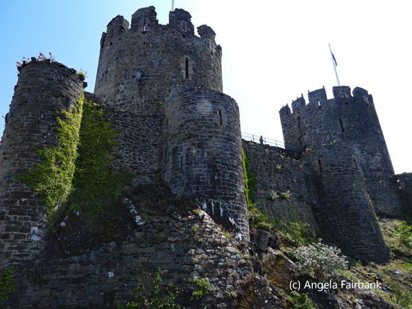  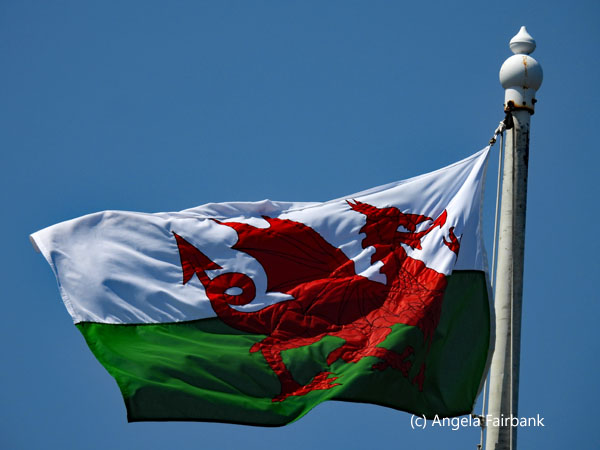     We were eventually welcomed to Wales (country number 166) by the road sign seen in my photo above, the land of dragons, more than 600 castles, and exaggerated legends and lore that include dragons, knights in armour, and giants. As James presented Wales while simultaneously driving along the highway, we learned many things, most of which I have forgotten by now, but I did retain the fact that Wales was greatly influenced by three particular kings: Gruffydd ap Llywelyn (c. 1010 - 1063), a Prince of Gwynedd who was King of Wales from 1055 to 1063; Owain Glyndwr (c. 1354 - 1415) the final Welsh ruler stemming from royalty in Wales; and King Edward I of England (1239 - 1307), who was responsible for the construction of four UNESCO World Heritage Site castles, namely Beaumaris, Conwy, Harlech, and Caernarfon (where King Charles III was invested as Prince of Wales on July 1, 1969), the latter three of which we were scheduled to see and two of them to visit. In fact, our first stop today was Conwy Castle, which workers under King Edward I's orders took four years to build starting in 1283. The castle and walls, which were built so that Edward I could conquer Wales and cost fifteen thousand pounds at the time (equivalent to 45 million pounds today), are testament to his military and architectural vision. Various English Kings throughout history have lived or stayed at this castle. One section of wall has the unusual feature of a row of 12 toilets, which were built sticking out of the outer facade, an arrangement usually only found in a medieval monastery. To get to the castle, we walked from the car park through a colourfully decorated tunnel, photos of which you will see here. After a tour of the castle given to us by James, we were left to explore the town on our own and I wandered down to the seafront, where I saw this seagull chick, and photographed the smallest house in Great Britain. This tiny one-up-and-one-down residence located at the end of a row of white houses facing the sea is in the Guiness Book of Records. At one time, it was incongruously the home of a fisherman who was over six-foot tall! I also photographed a jackdaw, with its grey head and bright blue eyes, picking away at a fish-and-chips wrapper on the ground. James suggested we grab lunch here, but I was more interested in exploring and trying to find somewhere to exchange my Euros into British pounds. I had tried yesterday at the airport in Zurich, but they would have had to exchange them first into Swiss francs and then into British sterling, so I decided to wait until I was in the UK to do it. Meanwhile, of course, I could pay for things with my credit card but that too entailed losing money, given my bank's foreign exchange rate. Unfortunately, I did not find any bank in town ... or rather, I did find the Bank of Conwy, but it ended up being a pub! I was finally recommended the Post Office, but I never managed to get that far in the town before having to head back to the minibus.
      We then drove over a bridge and onward to Holy Island on the northwest coast of Anglesey, to visit South Stack Nature Reserve, which included the lighthouse you see in my photos. It's a nature reserve because it's a breeding ground for birds such as razorbills (Alca torda), puffins, guillemots (Uria aalge), and peregrine falcons, among other breeds. There was a descending path and steps to explore leading down to the lighthouse, on the way down to which I noticed this sand lizard (Lacerta agilis), one of the rarest native reptiles in the UK, on a wall. As we had been told by James it was 268 steps, I took it on as a challenge and was able to photograph several colonies of guillemots (inclusive of their noisy excitement and the distinct smell of guano) on the rocks, seen here. We were also told there were a few puffins but as they were smaller and hidden among the grassy sections of the rocks, they were too far away to photograph, even with my long lens. I then climbed back up counting the steps along the way and found that James had been wrong and that there were in fact 461 steps(!) which I was pleased to find I was able to ascend with ease. I also saw a magpie here and lots of seagulls though I do not know which kind.
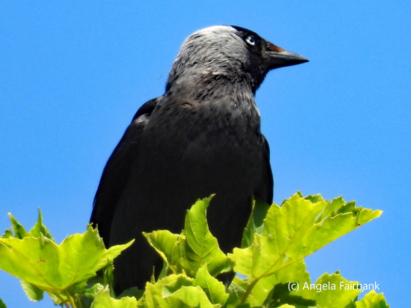      We spent some more time on Anglesey Island, which, devoid of tourists, was absolutely beautiful. I might even go further by saying it is one of the most beautiful residential areas I have ever seen. Unfortunately, we were traveling in the minibus at the time, so it was not conducive to taking photos of these houses and gardens. Instead, our aim was to take a country walk, during which I spotted this pair of linnets (Linaria cannabina) on telephone wires, toward the coast to visit St. Cwyfan's Church in Aberffraw, set on a small island offshore. At high tide, it is completely cut off from the mainland, but we were able to wander over the sand and potentially ankle-twisting rocks for a closer look because the tide was low. Founded in the 12th century, much of the building today dates from the 14th century. I was able to take a photo of the interior through a rather dirty window at the back, but the church itself was closed. I was also fascinated by the one or two oystercatchers (Haematopus ostralegus) wandering through the rocks and up on the grassy island outside the church and managed to get a close up of one as it was calling to its partner in the vicinity.
      Finally, we were at the end of today's wanderings after some satisfying exercise and on our way to the town that had attracted me to this tour in the first place. I had been trying to figure out how to get there under my own stream when I first started researching Wales. Known as the town with longest name in Europe with 58 characters split into 18 syllables, Llanfairpwllgwyngyllgogerychwyrndrobwllllantysiliogogogoch, often shortened to Llanfairpwll and sometimes to Llanfair PG, is a village and community, which at the 2011 Census had a population of 3,107, of whom 71% could speak Welsh, and who welcome about 200,000 visitors per year. The most popular attraction is the Llanfairpwll railway station that features a sign displaying the full name of the village. One sign I photographed provides the translation of this name in English as 'the Church of Mary in the Hollow of the White Hazel near the Fierce Whirlpool and the Church of Tysilio by the Red Cave.' Another sign on the train station platform spells out the pronunciation. In fact, James played us a song that teaches children how to pronounce it, which can be found on YouTube if you are really interested in hearing it or learning about Welsh pronunciation: Llan-vire-pooll-guin-gill-go-ger-u-queern-drob-ooll-llandus-ilio-gogo-goch. I found it interesting that the four consecutive 'l's are split in half for pronunciation purposes. As a linguist, I had been wondering about that! Unfortunately, it can't be said to be the town with the longest name in the world because that is claimed by a hill in New Zealand called Taumatawhakatangihangakoauauotamateaturipukakapikimaungahoronukupokaiwhenuakitanatahu with 85 letters. The name, often shortened to Taumata or Te Taumata, roughly translates to 'The summit where Tamatea, the man with the big knees, the slider, climber of mountains, the land-swallower who travelled about, played his koauau to his loved one.' When I looked that up on Wikipedia, I was surprised to find even more long place names from around the world of which I had been totally unaware.
      We finally arrived at our destination for our two-night stay, the seaside resort of Llandudno, which as early as 1861 was being called 'the Queen of the Welsh Watering Places' and famous for its promenade and pier. In fact, Lladudno Pier claims to be the finest in Wales (a pier without peer, a nearby plaque states). At 700 metres, it is also the longest. It opened on August 1, 1877, when piers were at the height of fashion. It used to have landing stages for steam-powered ferries serving Liverpool and the Isle of Man. Scenes from the Forsythe Saga, a television series in 2002, staring Damian Lewis and Gina McGee, were filmed in Llandudno, according to a green disk on Llandudno's Grand Hotel. The almost two-mile seafront promenade was looking quite splendid when I walked out of my hotel that evening in search of sustenance. The tide was out, the pier was in action with arcades and a ferris wheel, but I was not in the mood for fish and chips that could potentially be snatched by the constantly raucous and prolific seagulls. Instead, I walked down the high street in search of Horlicks that a girlfriend back home had requested in exchange for looking after my place. I visited mini versions of both Tesco's and Sainsbury's but neither had the product. I also looked for a bank to exchange my Euros into pounds and found about five of them almost next to each other, but none was open at the time, of course, and wouldn't be open until 9:30 a.m., the time I had arranged with James to be picked up outside one of them. I finally found one that would open at 9:00 a.m. further down the street so decided to go there tomorrow morning to try my luck. I then bought some food at one of the two aforementioned grocery stores (I forget which) and ate it in my room as I transferred today's photos from my camera to my laptop.
       Thursday, June 12, 2025: Llandudno - Snowdonia National Park - Beddgelert - Harlech Castle - Portmeirion - Caernarfon Castle - Aber Falls Whisky Distillery, Abergwyngregyn - Llandudno, Wales, U.K.
I was up early, so after the hotel breakfast, I decided to take a walk around the back of the Grand Hotel as recommended by James and photograph the Gorsedd Stone Circle, alas not originating from pre-historic times but erected in 1963 for the Llandudno National Eisteddfod, a Welsh festival of literature, music, and performance. There, too, I found the Mad Hatter's Tea Party Table, said to be stop number 12 on the Alice Trail, a self-guided walking route inspired by Alice Liddell, a girl who vacationed in Llandudno and whose family's connection to the town inspired Lewis Carroll to write Alice's Adventures in Wonderland. I then walked a good length of the promenade, and found stop number 6, a model of the Mad Hatter himself. As it was early, there were few people about, but I was surprised to see a running man in Muslim traditional dress. Whether he was running because he was practicing the sport or because he was late for an appointment, I wasn't sure.       I then decided it was time to visit the bank, so I returned to my hotel, gathered up my backpack, and headed out to the high street once again. I was there waiting for the bank to open along with two other customers just before 9:00 a.m. When the bank opened and asked me what I wanted, they informed me they could only exchange currency for customers who had an account with them and directed me (once again) to the Post Office. So, note to self: if you are visiting the UK and need to exchange currency, go to the Post Office. This is where it all happens. Mind you, they didn't give me a great rate--i.e. the rate I found online--but at least I now had cash and wasn't obliged to use my credit card for things like fridge magnets and food. I then waited outside the original bank James and I had agreed to meet outside of and was picked up on time and met the two new travelers, two girls from China who were studying English in Manchester but who never said much and merely giggled (a lot) when answering our questions about them. Unfortunately, it came on to drizzle, which was not conducive anyway but certainly not for our visit to Snowdonia Park although surprisingly we had a clear enough view of Mount Snowdon, which at 1,085 metres (3,560 ft) above sea level, is not only the highest mountain in Wales but also the highest in the British Isles south of the Scottish Highlands. Despite the clouds, the views here were beautiful: vast spreads of green hills and valleys dotted with white sheep tagged with red and blue paint and purple foxgloves as well as stone fences. On one sign, Snowdonia National Park boasts of being 'one of Britain's breathing spaces.' The park also contained dark brown cows, a few lakes, and mounds of slate waste.
      We next stopped for a toilet (hence the bilingual signs in my photos) and a walk (and, for one of us, award-winning artisan ice cream) at Beddgelert, (Gelert's Grave) where we saw this Grey Wagtail (Motacilla cinerea). During our walk, James told us the tale of Gelert, which was replicated in both languages on plaques at a grave beneath a tree, which I shall transcribe here with commas and other edits I have added for easier reading. “In the 13th century Llywelyn, Prince of North Wales, had a palace at Beddgelert. One day, he went hunting without Gelert, [his] faithful hound, who was unaccountably absent. On Llywelyn's return, the truant, stained and smeared with blood, joyfully sprang to meet his master. The Prince alarmed, hastened to find his son and saw the infant's cot empty, [and] the bedclothes and floor covered with blood. The frantic father plunged his sword into the hound's side, thinking it had killed his heir. The dog's dying yell was answered by a child's cry. Llywelyn searched and discovered his boy unharmed but nearby lay the body of a mighty wolf, which Gelert had slain. The Prince, filled with remorse, is said never to have smiled again. He buried Gelert here. The spot is called Beddgelert.” James then led us to the ruined palace containing a modern-looking statue of the dog in question. Later on, as we drove away, he confessed that the entire story had been made up by the landowner, who had merely used it to get tourists to visit the place! A modern example of Welsh lore perhaps?
     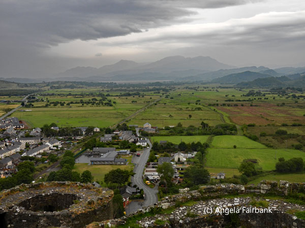 We now headed to Harlech Castle. Built by Edward I in six years (1283 to 1289), it was the last royalist castle to fall during the Civil War in 1647. By having this castle built, Edward I aimed to secure the lands he had won from Llywelyn ap Gruffudd, the Prince of Wales. Throughout its history, Harlech Castle endured five sieges. It fell to four and withstood one. It is said that the siege of 1468 inspired the song Men of Harlech. Having seen Conwy Castle yesterday and left to our own devices this time, I took only a brief visit of it, heeding the signs of danger due to slippery ramparts, and in light of the drizzling rain, decided my short time here could be put to better use by finding and walking up (after walking down) Ffordd Pen Llech, which at approximately 321.87 meters (0.2 miles) is (or at least was) the world's steepest street, for exercise. Wikipedia tells us “Its descent of the rock spur to the north of the castle gives it a tangentially measured gradient at its steepest section of 1:2.73. Whilst this translates to the vertical rise being 36.63% of the horizontal going, it is normal practice for UK highway authorities to round gradients to a nominal figure to avoid confusing road users with excessive precision; hence the warning sign at the top gives a slope of 40%. Previously, in common with all earlier gradient warning signs in the United Kingdom, the sign displayed an arctan ratio of 1:2+1/2 and was subsequently changed to the new standard of the tangent expressed as a percentage. The street is a two-way single-track road for the majority of its length. To avoid problems with vehicles meeting on the steepest part of the slope and being unable to restart, the lower portion of the road is a one-way descent. From 15 July 2019 until 8 April 2020, the street was officially named the 'World's Steepest Street' by Guinness World Records, a title previously given to Baldwin Street in Dunedin, New Zealand. Guinness measures the steepest road based on the steepest 10-metre section of the road (there are no buildings on this 10-metre section of Ffordd Pen Llech). [However,] on 8 April 2020, Guinness announced that Baldwin Street was reinstated as the world's steepest street after determining that the best practice to calculate a street gradient is to take the measurement from the centreline. The new measurements found the street in Dunedin had a gradient of 34.8% while Ffordd Pen Llech's was calculated to be 28.6%.” Apparently, after having ascended this very winding road, making it frankly difficult to photograph to provide any sense at all of its steepness, I had the right to purchase a sticker commemorating the event (although James had told me it was a medal, not a sticker) at the store at the top of said street, which, of course, I did! I do note that next to its claim of being the world's steepest street are the years 2019/2020.
      The other potential highlight of this trip to Wales that had attracted me to this tour was the opportunity of visiting (still under cloudy skies, alas) the rather odd, mediterranean-feel town of Port Meirion, built by Welsh architect Clough Williams-Ellis (1883 - 1978) from 1925 to 1973. However, it was more triggered by my memory of watching the 1960s cult classic series, The Prisoner, starring Patrick McGoohan (1928 - 2009), for which Portmeirion Village provided the backdrop. Patrick McGoohan not only starred as Number Six, the leading role in The Prisoner, he was also the creator and driving force behind the 17-episode series. In preparation for my visit, I had watched the entire series on DVD from my local library back in early March 2025 so that it would be fresh in my mind when I visited. I was therefore disappointed that things in the town didn't look exactly as I had seen them in the series. When I asked one staff member, I was told that the outside of the house in which Number Six had stayed was still there deeply disguised but that its interior had been filmed in a film studio elsewhere as had the main hall where Number Two held office. I was also disappointed to discover that many buildings were inaccessible because the entire town was actually a resort containing guests with access to private entrance ways, etc. James had suggested that we eat our lunch at one of three establishments but when I eventually decided to dine, I found the simplest of the three options, Caffi No. 6, a coffee, sandwiches, and hot pasties shop, had run out of vegetarian options, so I headed to my second choice, Caffi Glas, offering Italian cuisine and ordered a delicious-although-spicy penne dish called Penne alla norma accompanied by half a pint of Somersby Apple Cider. The birds you see among the photos here are a Blackbird (Turdus merula) and an English Robin (Erithacus rubecula) found in the grounds of the resort. Be seeing you!
     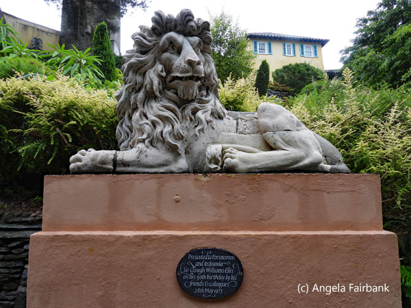 Next we drove on, or rather by, Caernarfon Castle, impossible to photograph from the minibus as it was surrounded by houses, and then to our last visit of the day, Aber Falls Whisky Distillery, located in the village of Abergwyngregyn and lying at the foot of the Aber Falls waterfall, its water source for the distillation. It states on its website that it was previously a slate works in the 19th century, a margarine factory during the world wars, and more recently a drinks wholesaler depot. We were not offered a tour but were encouraged to have a tasting. Not a fan of whisky myself, I was pleased to see that they produced other drinks such as gin and cream liqueurs. I liked the taste of their orange gin and cream liqueurs but their rhubarb gin, although on sale at a discounted price, tasted rather more to me like cough syrup. A group from France (Paris and Versailles I was told by one of them) was also tasting the distillery's products, so I chatted a while with them in French.
   Friday, June 13, 2025: Llandudno - Snowdonia National Park - Llanberis Slate Museum - Betws-y-Coed, Llangollen, Wales to Chester and Manchester, England, U.K.
Today the weather was sunny once again, and based on a suggestion I had heard yesterday, instead of refusing the hot portion of the breakfast menu, I requested their avocado spread on toast with a poached egg and asked them to make it into a sandwich and wrap it up in foil so I could take it with me for lunch. They were happy to do this. I then had a conversation with the receptionist on duty about the Welsh language, wondering why I hadn't heard more of its charming accent whilst here in Northern Wales. Was it only a characteristic of South Wales, I wondered. He explained that he and the hotel's cook were originally from England and Scotland respectively but that he had gone to a school in Wales where Welsh had been taught as a separate language but that everything else had been taught in English. However, he added, there are schools in Wales where everything is taught in Welsh and students are punished for speaking English inside the school grounds. Then, discovering that I spoke Spanish, he wanted to know how best he might learn the language as he had been wanting to for a long time, so I gave him some suggestions based on my own language-learning experience. A few minutes later, I checked out and waited for James and the minibus to pick me up as I sat on the terrace of the hotel enjoying my last views of Lladudno's promenade and various birds flitting through the air and landing on the roofs of neighbouring buildings. Picked up on time and after loading my small suitcase into the minibus once again, I saw I was the last of our group to be collected. We headed off to Snowdonia National Park once again where we stopped to view Llafn y Cewri, or the Blade of Giants, a giant sculpture reminiscent of the Sword in the Stone of King Arthur legends, commemorating the Prince of Gwynedd's contribution to the area's heritage and Welsh history, and based on the type of sword that would have been used by the Princes of Gwynedd in the 13th and 14th centuries. We also photographed ourselves with the view of Mount Snowdon in the background. Here too was Padarn Lake, across which we could see the Quarry Hospital belonging to a closed slate mine, and to our right, Dolbadarn Castle, built by the Welsh Prince Llywelyn ap Iorwerth during the 13th century.    Some of us went to visit the castle while I and the Englishwoman walked over to the Quarry Hospital. On a section of grass in front was a plaque telling us about the history of the slate industry. There were more explanations inside the hospital and I have transcribed some of the more interesting information here: “The original settlement of the area was at Nant Peris but with the development of the slate quarrying industry, a new village grew in Llanberis, and homes were built to accommodate the workforce. Many of the workforce living in Anglesey stayed in barracks at the quarry during the week, returning to their homes for Sunday ... The industry, which started with a number of small workings in the 18th century, was organized into a larger operation and by 1870 had reached its peak employing 3,000 men. After a long, patchy depression caused by a change in building methods and an increase in foreign materials, the workforce dwindled during the 20th century to 300 men, and the quarry was eventually forced to close in 1969 ... The slate industry is still alive today, but modern slate quarries are worked in different ways from the enormous quarry here in Park Padarn. Huge lorries, lifting machines, and laser saws contrast with the simple hand tools used previously. Demonstrations of slate splitting and examples of tools and quarrymen's living accommodation can be seen in the nearby National Slate Museum, [Ed. currently closed for renovation] ... The present Llanberis Lake Railway runs on the track that was built in 1842 to transport slate to Y Felinheli. After the closure of the quarry, the equipment and manpower were available to rebuild it, and the Lake Railway reopened in 1971. It now provides a scenic ride along the shores of Lake Padarn ... This dangerous work, carried out in all weather conditions, meant many accidents occurred, so a quarry hospital was opened to treat the injured men. Now showing displays to the public, it relates a fascinating story of early medicine where some of the treatment, although seemingly primitive by today's standards, was actually at the cutting edge of scientific discovery. The quarry also employed craftsmen such as blacksmiths, carpenters, masons, plate layers, and engine drivers. Some of the equipment that was used in the hospital, such as crutches and splints, would have been made by these craftsmen.”
 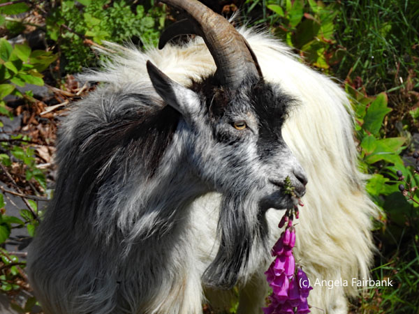  “In the early days, the quarrying was carried out by a common partnership of skilled workmen, who were paid a commission [based] on the number of slates made. The system of payment evolved into what was called a bargain, a complicated way of paying for the work, and the cause of disputes between the workers and the owners. Some workers were labourers and not part of a bargain and as a result had lower status and income. Slate from the quarries in north Wales was exported all over the world for roof slates and slate slabs which were used for gravestones, cisterns, and fireplaces. By the year 1890, half a million tons of slate were produced each year, and the industry employed 17,000 men. By the 1950s, production had declined and the quarry at Dinorwic closed in 1969 ... Dinorwic and Penrhyn were the two biggest slate quarries; each belonged to an aristocratic family. This was different from the other north Wales quarries, which were owned by various landlords and leased to groups of quarry workers and companies. Between 1820 and 1870 there was huge investment in the quarries, a better transport system, and powered saws enabled smooth and fast production. During the two world wars, the quarries were little used. Roof tiles replaced slate as a cheap roofing material and the demand for slate decreased. By the time quarrying ended at Dinorwic, most other slate quarries had closed.”
   “This hospital was built by the quarry owners for their workforce. The men paid contributions each week to the hospital fund, which allowed the cost of injury and sickness to be spread across the whole workforce. The beds in the wards were used for the injured or sick and their ailments were varied: from eye injuries to broken limbs and severe burns as well as workers with multiple injuries after severe accidents. If there was an accident at the quarry, the injured man was placed on a stretcher and carried by a group of eight men. Emyr Jones, writing about the quarry in the 1930s, explained that onlookers could tell from far off if the man was alive, as the dead were carried on the shoulders of his workmates. Unusually, some of the stretchers were designed to run on the quarry railway. Some patients only stayed in the hospital for a few days while others were resident for weeks. The longest recorded stay was Thomas Robert, who had a fractured arm and wounded ankle and remained in the hospital for 52 days.”
   There were two friendly museum staff inside the hospital entrance who greeted us in both Welsh and English, and had lovely Welsh accents when speaking English (finally). They welcomed us in and invited us to wander around and photograph anything we liked. I was interested by the ancient Victorian medical instruments, leg braces, and eye charts, and commented to them that my late father would probably have liked to have visited this hospital museum, although I imagine he had likely seen such items (or slightly more modern versions of them) during his own medical studies in England back in the 1940s and due to the fact that his own grandfather was a Victorian physician. We were also invited to view the morgue in a slate hut on its own in the grounds of the hospital consisting of two slate tables with drainage runnels. As I came out of the hospital grounds and was about to descend the stairs back to the parking lot, I commented that we had not seen the promised wild goats James had mentioned when, lo and behold, there they were below us on the tracks, coming towards us, some of them turning up the hill to feast on the foliage including foxgloves growing there. Of course, this gave me a great excuse to use my camera again. I read later that these distinctively curved horned wild animals are Kashmiri goats (Capra aegagrus hircus), descendants of a pair gifted to Queen Victoria in 1837 by the Shah of Persia, Mohammad Shah Qajar. The goats were later gifted to a local landowner, Major General Sir Savage Lloyd-Mostyn, in the 1890s, and their descendants have lived in parts of Wales ever since. As we pulled out of the parking lot after meeting up again, the steam train passed by, and I was able to get a good shot of it from inside the minibus via the opened passenger side front window.
   Still inside Snowdonia National Park, our next stop was Betws y Coed, located where the rivers Conwy, Lledr, and Llugwy meet. Although there were lots of shops here, my plan was to walk along the path next to one of these three rivers (I'm not sure which of the three it was) and look for birdlife to photograph. There were some near the parking lot, notably the English robin and blackbird seen here but the ones I heard or glimpsed by the river were too quick or too hidden for me to photograph. Just before arriving in the town, I had spied a huge heron standing in a field, so I was hoping to see more on my walk. Aware of the time we had been allocated, at a certain point on the river I stopped, leaned against a tree, and watched the river go by as I consumed my poached egg and avocado sandwich on excellent, quality bread and drank some water. I reluctantly walked back, disappointed not to have seen any large birds, and on crossing the bridge back to the main street again, happened to glance to the left and there was a grey heron (Ardea cinerea) standing on a rock in the middle of the river. I got one shot, another, and then it flew off over my head. I was then anxious to find the toilets as we were told we would have no stops until Chester, which was over an hour's drive away back in England.
   The welcome to England sign on the way back wasn't so easy to photograph and merely flashed by and before we knew it we were in Chester, a cathedral town on the River Dee with a population of 92,760 (in 2021), known for its extensive Roman walls made of local red sandstone and Roman amphitheatre. In the old city, the Rows is a shopping district distinguished by 2-level covered arcades and Tudor-style half-timber buildings. This was where we said good-bye to the optometrist from Chicago as he had to catch a train and then a plane to Barcelona. Once again, James gave us free time to explore the town, recommending the Eastgate clock, completed in 1897 to commemorate Queen Victoria's Diamond Jubilee and one of Chester's most famous landmarks being the second most photographed clock in the UK after Big Ben ... and the Cathedral as must-visit items. The Englishwoman and I walked up the Rows, admired the aforementioned clock and an excellent busker singing to a recorded soundtrack and then turned toward the cathedral, which we found sitting opposite the town hall, opened in 1869 and in Gothic Revival style sporting a tower and a short spire. Visitation of the Cathedral was via donation, but it was worth it with its unique blend of medieval and modern architecture. Founded in 1092 as a Benedictine Abbey by William the Conqueror's nephew, Hugh D'Avranches, its construction came to an end in 1539 (OK so Gaudí's Sagrada Familia hasn't taken quite as long as that, admittedly), when the monastery was dissolved by order of King Henry VIII. In 1541, the old monastery became the Cathedral of the newly created Diocese of Chester. It has gone through a number of restorations, notably in the 1820s, the 1870s, the 1970s, 1997, 2005 and then 2022, as part of Queen Elizabeth II's Platinum Jubilee celebrations. The nave features a model of the cathedral constructed in over 275,000 LEGO bricks. The choir stalls contain masses of unique wood carvings, a few of which you'll see in my photos. The mechanism, loft, and case of the organ (for the benefit of my eldest brother who plays the organ) were designed in 1876 by George Gilbert Scott, while the organ itself was bult by Whitely and Co., a local firm. Rebuilt in 1969 by Rushworth and Dreaper, there are 4,864 pipes, four keyboards, a pedal board, and 76 speaking stops. Weekly organ recitals are heard on Thursdays at 1:10 p.m.
      The inner courtyard contains a small garden enclosed by a cloister and the sculpture in the middle of the water is Stephen Broadbent's 'Water of Life', also seen among my photos. The more modern-looking stained-glass window you'll see photographed here is located in the refectory and was installed in 2001 to commemorate the Millenium. Also in the nave was an exposition of a Phd project on the stories of various immigrants living in Chester. Pulling ourselves away from the Cathedral finally, we headed down the main street in search of Horlicks for my aforementioned friend in Vancouver and finally found some in a Tesco's I think. I ended up asking some friendly policemen and policewomen from Chester and Cheshire where the Tesco's was. With the purchased Horlicks beneath my arm, we headed back to our minibus and drove back to Manchester and said our goodbyes. I then rolled my suitcase over to a nearby hotel and asked them to order me a taxi to the Holiday Inn Express at the airport, but the taxi driver got lost and tried to take me to other Holiday Inn I'd originally gone to on arrival. Finally at my hotel, I retrieved my large suitcase and repacked everything again. I then ate my dinner in the hotel dining room consisting of a jacket potato with tuna and a green salad accompanied by a bottle of Kopparberg Swedish Pear Cider. Oddly enough perhaps, the country I was looking most forward to visiting when I had planned this trip was Wales, and I was not disappointed. I ultimately loved Gymru and would definitely visit again if I get the chance, considering I have only seen the North. I think what added to its charm was the lack of tourists that had been so prevalent in Barcelona, Zurich, and elsewhere (especially the 2,000-passenger cruise ship). It's an undiscovered jewel in Britain's crown, although perhaps it would prefer to remain so when taking everything into consideration rather than be overwhelmed with visitors.
     Saturday, June 14, 2025: Manchester, England, U.K. to Vancouver, B.C., Canada via Munich, Germany My first flight to Munich was at a reasonable hour, so after breakfast at the Holiday Inn Express, I caught a taxi to the airport. The driver charged me five pounds more than the one who'd picked me up from the airport and taken me to the Holiday Inn Express four days ago, claiming an 'airport drop-off fee.' Both of my bags were an acceptable weight, and I had a window seat on my first two-hour flight. The wait in Munich wasn't long and I was given a better Premium Economy seat than the one I had originally been assigned, probably because I was now an Air Canada 25K member after all my recent flights on AC and its partners and was able to enjoy some perks. The flight was otherwise lengthy and uneventful, and I arrived safely in Vancouver about an hour after I'd taken off due to the 9-hour time change. A good trip but ultimately tiring. Nevertheless, I can now look forward to my next trip, which should earn me three new countries. Back to Latest Travelogues page. |
All rights reserved. Website © Angela Fairbank 2005-2026.
|