Travel Blog March 24 to April 27, 2025Finishing Off (Continental) South AmericaVancouver, B.C., Canada to Santiago, Chile via Martinique, French Guiana, Suriname, Guyana, Peru, and BoliviaMonday-Tuesday, March 24-25, 2025: Vancouver, B.C. to Fort-de-France, Martinique via Montreal, Quebec
   My departure flight from Vancouver was the overnight red eye to Montreal, and after flying above the clouds most of the way and watching a fascinating sunrise that started off as a brush stroke of dark orange and gradually dimmed as the sun arrived, I was surprised to see snow still on the ground when we arrived in the morning in Montreal, Canada's second largest city population-wise. It was nice to hear French being spoken all around me as I navigated the airport and ended up at the gate that was surely the farthest away from anywhere else, after spending some down time in the Air Canada business lounge where I was treated to some real coffee (as opposed to the stuff served on the plane), a croissant and a pain au chocolat although I probably should have freshened them up in the microwave first. There were frequent announcements that the YUL airport was experiencing technical difficulties, but little did I suspect what this meant.
   I would only find out once I arrived in Fort-de-France, the capital of Martinique (country 156, but not a UN country as it is part of France), the Southernmost of the French West Indies or les Antillaises françaises. Located between Dominica and Saint Lucia, it is rather larger than I had imagined for an island (seen from a plane) of 1,100 km2 and home to just under 350,000 French citizens. Its most famous inhabitant was born Marie-Josèphe Rose Tascher de la Pagerie (23 June 1763 - 29 May 1814), known as Joséphine, the first wife of Emperor Napoleon I and consequently Empress of France from 18 May 1804 until their marriage was annulled on 10 January 1810. I had read that there was a statue of her in the Savane Park across from my hotel and by the waterfront, so I dutifully set out to find it once I had made it into town but was unable to. When I later asked a shopkeeper where it might be, she told me it had been removed. When I asked why, she replied “On ne l'aimait pas,” which I took to mean it was the person and what she represented that they disliked rather than the statue itself (or perhaps both?) But I digress.
   Yes, technical difficulties meant that on my arrival and glancing at my emails once I had connected to the airport wifi, I discovered that my one checked bag had not made it onto the plane in Montreal. I immediately talked to an airport official to find out how I could get it delivered to me since I would be leaving the next day for a different country and on a different airline, and fate must have been smiling because it was lucky I had been quick about it and, consequently, was the first in line at the lost baggage office, of which the aforementioned woman ended up being an employee. After she had taken down all my particulars and printed out a record of the delayed bag, stamped it, and signed it, I went out to take a look at the luggage carousel just in case they had made a mistake and it was indeed sitting there, but another luggage official told me that in fact none of the luggage had made it onto the Air Canada plane from Montreal to Fort-de-France.
   Yes, you guessed it. This was indeed the result of the technical difficulty mentioned earlier. I noticed then that there was now a long line up to the lost baggage office and I breathed a sigh of relief that I had acted quickly. However, after going out into the main arrival hall, I went to visit the Air France office (taking a number to be served) to find out the exact flight time of my Air France flight tomorrow morning and at what time I should be back at the airport to check in sans luggage. I then asked about transportation to downtown Fort-de-France, very mindful of the fact that it was getting close to 4 p.m. and I would only have about 2 hours of sunlight left to explore the town, photograph what I could of it, and, of course, buy a few necessary items such as a t-shirt, a toothbrush, and toothpaste since these were all in my main bag, which had decided to spend the night in Montreal. I was recommended a cheap bus into town but in view of the limited time heretofore mentioned, I decided to take a taxi, the cost of which was about 10 times the price of the bus but a lot quicker.
  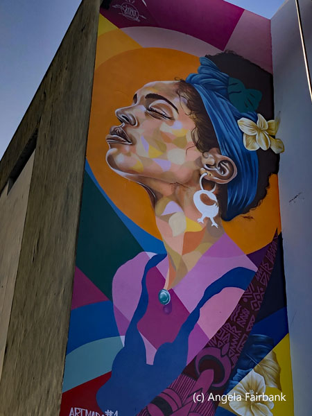 Arriving at my lodgings, described as a business hotel, I checked in, deposited my remaining carry-on bags in my hotel room, stashed a few Euros in my money belt, took my phone for photos, and headed out to a pharmacy and a souvenir shop for a token fridge magnet and a t-shirt for tomorrow. I then wandered up and down the waterfront, photographing buildings and the painted pavement with its creole expressions such as kontan we zot meaning “happy to see you”, noting that a Silversea cruise ship, Silver Ray, was berthed and had likely released its up to 728 passengers into the town (although I reckoned that in light of the late hour they were probably all back on board by now and, sure enough, the departing horn blasts sounded around 6:00 p.m. about a half hour before sunset. I looked in at the booths of a few artists touting their wares for said punters, although I think they must have realized said potential buyers were already back onboard their ship. I had clearly arrived too late in the day to experience any markets of fruits and fish, etc. I also photographed the outsides of Fort-de-France's Roman Catholic Cathedral, Saint-Louis, an historic site and monument with a history of a fire, a cyclone, and an earthquake, as well as the rather elaborate and unique building housing the public library, the Bibliothèque Schoelcher, an architectural mixture of Byzantine, Art Nouveau, Egyptian art, and Western classical inspiration, although I did not enter either, assuming that they would be closed by then. Shops were closing at 5:00 p.m. although the pharmacy was open until 5:30. I sat for a while on a bench on the waterfront waiting for the sun to go down but then decided I was feeling tired after not sleeping much in the plane the night before so retired to my hotel room, had some food I had brought with me, and called it a night around 7:30. The hotel receptionist had knocked at my door just as I had finished dinner to give me a 5-litre plastic bottle of water to wash with as the entire town's water supply had shut off. I decided to shower properly in the morning as I was promised the water would come back on soon after midnight.
   Wednesday, March 26, 2025: Fort-de-France, Martinique to Cayenne and Kourou, French Guiana
I was up for my promised shower, the temperatures in said shower being a choice of cold and ... cold. Refreshing, nonetheless. Yesterday evening, the receptionist had pre-ordered me a taxi for the airport and the vehicle and driver were waiting patiently when I stepped out onto the sidewalk from my hotel, although the price was higher by 10 Euro than yesterday's, the female driver explaining that there was a different price for night time, which lasted until about 7:00 a.m. It was interesting for me to note that on the car's radio as we drove to the airport, there was an announcement regarding the funeral of a woman the same age as me, and listing her children, her grandchildren, and her great-grandchildren! A different lifetime indeed! I was near the front of the line to check into my flight and then climbed the stairs to the departure area and sat and finished the food I had brought from Canada as well as a bottle of water. I then checked the pharmacy and the souvenir store in the airport before going through security and finding my gate. Not having had the choice of seats when I checked in, I saw I had been given an aisle seat so asked at the gate if I could be changed to a window seat. The only window seat left was in the emergency exit row, so I was put in charge of opening the escape door over the wing should the need arise (which luckily it did not). On this two-hour flight with a one-hour time difference between Martinique and French Guyana, Air France served us a typical French petit déjeuner consisting of a small black coffee and a single flaky croissant, wrapped up in a little bag that said le meilleur petit déjeuner certifié, wishing me bon appétit and certifying too that the emballage (the small paper bag) was fabriqué en France. I felt privileged to be receiving the full French effect.    Entering French Guiana (country number 157 but not a UN country as it is part of France), I almost didn't get a stamp in my passport because, just like a sheep, I followed the crowd, and they all went through the nationals' line. It was only on thinking that it would be nice to get a stamp in my passport that I turned back and realized I should have gone into the other line for foreigners. The officials didn't seem to have minded, although it was a good thing I had because getting out of French Guiana, a French overseas department with a population of 292,354 and a surface area of 84,000 square km., without said stamp might have proven to be difficult. I was then greeted at the airport arrivals hall by Glenn K. my Maroon driver/guide for French Guiana and by Maroon, I mean Black and the descendant of escaped slaves. He was originally from Suriname he told me but had lived in French Guiana for the last thirty or so years. I later learned he was only ten years younger than me though he looked thirty years younger. Although he started out in English, I insisted we speak French ... after all we were in a French-speaking country ... and he obliged. He also speaks Dutch and a local Creole or patois, a mixture of French, Spanish, Portuguese, Caribbean-style English and Dutch, from what I could make out.
I explained to him about my luggage not making it out of Montreal and after making enquiries and being told that there was no Air France office in the airport, I was asked to go and make a claim at the head office located on the way to the city centre. I then explained the situation once again to a nice Air France representative at said head office and although he said I should have made the claim at the Air France lost luggage counter before exiting into the arrivals hall, he called up said office and gave them all the particulars, saying that it would be Air Canada's responsibility to send it on to Cayenne as per its original routing, but that any delivery to my hotel would be Air Canada's responsibility as well and not theirs. At my request, to confirm everything, they sent me an email that stated that I would be notified as soon as the luggage arrived. I was led to believe it would be on the Montreal to Fort de France flight tomorrow and then be put on the Fort de France to Cayenne flight on Friday.    So that taken care of, our first stop after leaving the Air France office was in the centre of the capital city of Cayenne, founded by the French in the 1600s. On our way up to the top of the town for its views, crowned by the crumbling remains of the 1643 Fort of Cépérou (named after a Galibi chief aka Sepelu), we passed the Hôtel de Ville (City Hall), outside of which were some giant effigies of people, animals, and insects left over from the recent Carnival celebrations. La Guyane's Carnival is ranked among the top five carnivals in the world with masked balls, costumes, parades, and music galore. The party goes on for two months, I was told. We walked uphill to the fort to photograph the sign in a local language Mo kontant to Cayenne, which means I love Cayenne. Although a brochure I picked up from the airport says that “French Guiana was discovered in January 1500 by Vincent Pinson, it was of course discovered and populated much earlier by the Amerindians ... The 17th century was a period of colonization that saw a succession of French, Spanish, English, and Dutch all filled with the same desire: to find El Dorado.” The explanatory panel by the fort says that in 1654 the Dutch who'd been chased out of Brazil established themselves in Ceperou where they found this fort in a good state complete with a good amount of French artillery. The colony grew in 1659 with the arrival of Jews who had also been chased out of Brazil, and some of these came to live in the area around the fort. The French took over the colony once again in 1664 with the arrival of Antoine Lefèvre de la Barre and 1,200 settlers. They pushed the Amerindians called kali'na out, and these people succumbed to disease and conflicts so that they no longer had the means to fight back. “The difficulty of working in a tropical setting for the European colonizers and the impossibility of enslaving the Amerindians led to the introduction of the slave trade to the colony. The Black population also refused to be enslaved, and slavery was abolished by France in 1848. Later on, and until the second half of the 20th century, French Guiana was above all known for its gold and its penal colony.”
   Today, the Indigenous people represent about 5% of the population or around 10,000 and include the Kali'na, Parikweneh, Lokono, Wayapi, Teko, and Wayana. They practice fishing, hunting, and agriculture and have a symbolic relationship with their environment, considering the trees and animals as part of human beings. They speak six distinct languages, one of which is disappearing in Guyane (French Guiana) but still spoken in Suriname, Guyana, Brazil, and Venezuela. These languages belong to three linguistic families, caribe, tupiguarani, and arawak. There were some lovely murals of amerindian art decorating the building beneath the fort's location. Descending back into the town we saw some colonial houses, many of which had been lost in a large fire in the 1860s, if memory serves. The stripes in blue, yellow, red, green, and orange seen on the road depict the Olympic rings as the Olympic flame was carried along this road prior to the 2024 Paris Olympics. A large statue of Félix Eboué, after which Cayenne's international airport had been named, was located in the main park area. He was the first Black statesman in France and governor of French Guiana as well as Chad at an earlier date. Glenn asked me whether the first two lines beneath his effigy were in Greek. I was able to confirm this and find out its meaning via Google later on. There were some elaborate buildings left over from colonial times, some of which had been restored, such as the restaurant you see among my photos.
We then wandered into the natural history museum, the Musée Alexandre-Franconie, which contained displays of insects and stuffed animals from the region, as well as a history of the country's penal life, from a series of paintings by inmate Francis Lagrange--more about which I would learn tomorrow--and the life of the Maroons. I was also interested to see a display of the variety of wood available in French Guiana's forests, learning that all three Guianas are heavily wooded, although Suriname seems to have been the only country to export its wood in a major fashion. The aforementioned brochure that I picked up at the airport tells me that “half an acre of forest in French Guiana has more species of trees than the whole of Europe put together!” It also says that there are just 1.2 inhabitants per square kilometre and 80% of the population lives on the coast. The country contains 740 species of birds, 480 species of fresh-water fish, and 188 species of mammals, while new species are being discovered in French Guiana all the time. The market was just about wrapping up when we arrived. Glenn told me it usually contains a large number of Hmong vendors. Their ancestors originally arrived from Laos when it was part of French Indochina, and they live in the village of Cacao to the south of Cayenne. He pointed out a few Hmong individuals in the streets. Also, as in many countries in the third world and elsewhere, many of the stores were owned by Chinese entrepreneurs. I was given the chance to buy a few souvenirs at one of these Chinese-owned stores, including a fridge magnet, a bracelet ... and a t-shirt so as to have something clean to wear while my luggage still had not arrived.    Leaving Cayenne, with its garbage-filled streets and canals, after Glenn had bought some water and a bag of peanuts for us to munch on, we drove along the highway to Kourou, a small town where my hotel in French Guiana was located, and out of which my next two days of activities would be based. I settled into my room and transferred my photos from my cameras onto my laptop and then went to the hotel restaurant for dinner, to taste the local beer, seen here, and try their fish brochettes (kebabs). I was the only person in the restaurant and there was one house fly buzzing around but no mosquitos ... not even anything as big as the mosquito I had seen in front of the City Hall in Cayenne.
Thursday, March 27, 2025: Kourou to the Îles du Salut (Salvation Islands) and back to Kourou, French Guiana This morning after breakfast, Glenn picked me up to drive me to a fishermen's jetty a short distance from the hotel so that we could board Guayavoile, le Cata qui met les voiles, a catamaran with sails yet in light of the rainy weather and choppy waves, no sails were raised or unfurled. We were on our way to the notorious penal colony, French Guiana's muggy, oppressive, malaria-ridden, and inhospitable terrain being considered an ideal way to punish criminals, as well as a few prisoners of war from World War II. We joined a party of French adults in a small catamaran with not much room to sit frankly, especially not inside, which we all wanted given that it rained most of the time, but the inside part was basically the captain's and crew's quarters, i.e. where the captain had his office and the crew stored and prepared the food and drink for the passengers. Luckily, I had brought both my rain jacket and my umbrella, but others in the party were in swimsuits and not very sufficiently covered. We were all females with the exception of two men among us passengers, although the crew was all male. The two male passengers had to be supplied with buckets to be sick in since the waves were high and it was at least an hour and a half to get from the mainland to the Îles de Salut, or Salvation Islands in English, 15km off the coast.  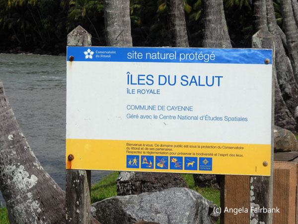  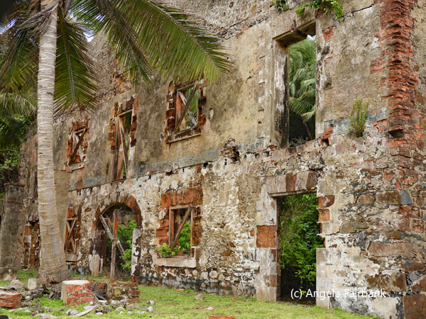   There was interesting birdlife along the banks of the river that we motored down to reach the Atlantic Ocean proper, including bright red ibises and herons, but they were too far away for my small cameras, and I didn't dare take out my main camera in light of the heavy rain. The catamaran supplied French bread and spread as well as coffee and tea for the outward journey, but I had had a very nice and copious breakfast so did not partake. I think the two male passengers probably regretted that they had. The Îles de Salut are France's historic penitentiary, that of Papillon fame. I had tried to land on them some years back in a cruise ship, but it had proven impossible due to the high waves. So going there in a catamaran was probably the only way possible. There was a cruise ship offshore, which had apparently tried to land via zodiacs or tenders this time but had not been able. With my long lens, once the rain had stopped, I was able to see that it was the Villa Vie Odyssey, a perpetual cruise ship which advertises itself as having “the ability to reach parts of the world that larger ships cannot access.”
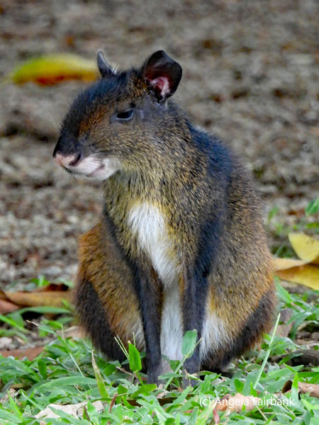
      Despite the sea calming down eventually, i.e. by the time we reached Île Royale, the largest of the three islands, and containing a hotel, the Odyssey had given up trying and left. I suppose they were due elsewhere that day and had another port to berth at. When we finally pulled up to the wharf in the catamaran's dinghy, it was dry and at times sunny, so I was able to pull out my camera and photograph to my heart's content. Among the fauna were agouti, spider monkeys, peacocks, a few domestic cats, two large, colourful iguanas, and a number of smaller birds, including sandpipers, the ubiquitous kiskidies, egrets and hummingbirds, and long lines of leaf-cutter ants with leaves. To one side of Île Royale lies Devil's Island (Île du Diable), which is not visitable and contains the one house I was told the infamous Dreyfus, a French army officer, who was said to have falsified documents for the Nazis during WWII, had been imprisoned. A cable system had been set up to send food etc. over to this island from Île Royale since the waters between them were too treacherous with rocks, high waves, and sharks. To the other side lies Île Saint-Joseph, which we visited by catamaran and dinghy in the afternoon. On a large rock on this latter island is a pictograph of a turtle, said to have been left by Amerindians at some stage in the past before the French arrived. On this island too, a guillotine was used to punish prisoners who wouldn't toe the line. I believe I heard Glenn say that a total of eight prisoners were guillotined here. In all, over 50,000 of the penal colony's 70,000 prisoners died here between 1852 and 1953. Henri Charrière's book, Papillon recounts the horrors of life in the colony and his various attempts to escape. I have not read it, nor have I seen the film starring Gene Hackman, but now perhaps I will when I next get the chance to.
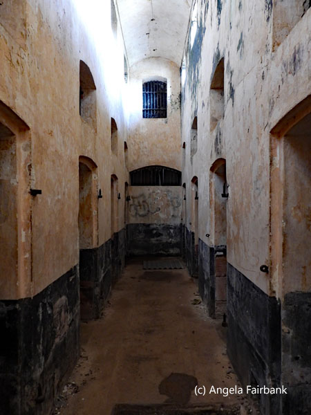
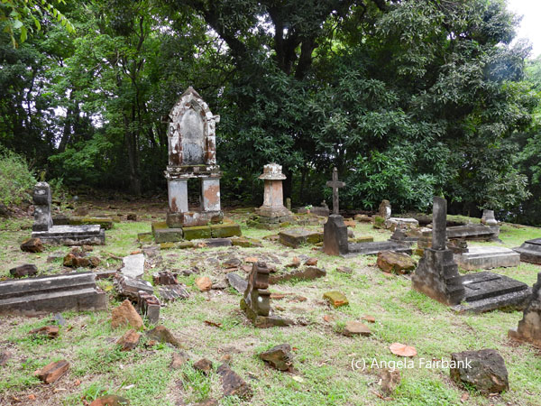
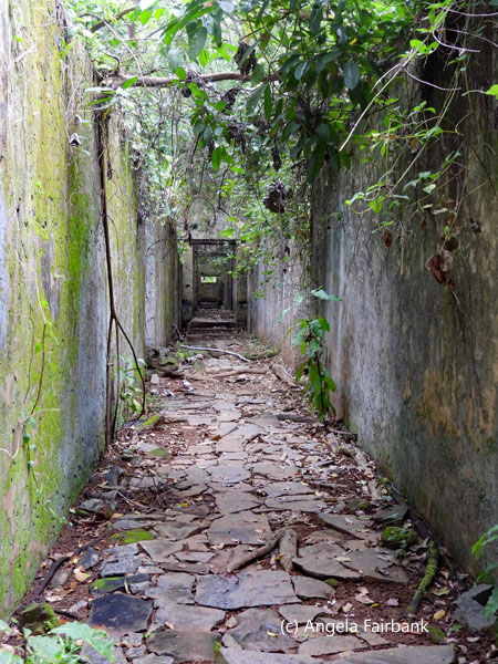
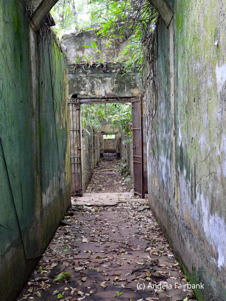
   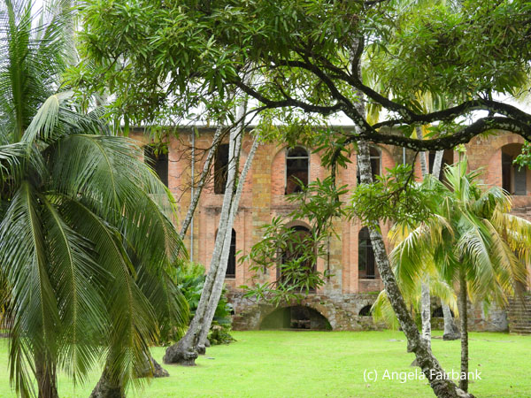   On Îlle Royale, originally used for administration and for housing common criminals, and Îlle de Joseph, for incorrigible convicts and those who had tried to escape, there were a number of buildings, mostly in disrepair, left to rot, and grown over by vegetation, consisting of officers' houses, guards' quarters, a hospital, a church, and blocks for the prisoners, who were called bagnards. Some prisoners were also in dark cells, those on Île de Joseph were forbidden to speak, and many of the nuns brought over to take care of the sick were raped and the graveyards contain some of the administration staff, guards, and their families, as well as priests, nuns, and children resulting from rape. Many of the prisoners, once they died from sickness, from mental health, or just weakness, were thrown into the sea for the sharks. And, of course, many tried to escape as the treatment was pretty inhumane. There was a helicopter pad on Îlle Royale, but it was modern so clearly not a method for prisoners to escape! Those prisoners who were healthy and strong enough were made to work seven days a week, building walls and roads, and cleaning the paths from fallen vegetation using palm fronds, among other tasks. There was continuous patrol by the guards and in some of the cells, prisoners were not allowed to sit, or even to lean against the walls. They were only allowed to lie down at night and were shackled to their metal cots. An inspection made at some stage discovered that the prison's methods were rather cruel, so a number of reforms were introduced, including supplying hammocks for prisoners to lie in. They would be allowed to wash themselves and their clothes perhaps once a week if they were lucky.
      Around noonish, we arrived at the hotel cum restaurant on Île Royale, but they were only offering a rather expensive and copious buffet lunch, so instead, I decided to try another local beer at the bar and eat a banana I had brought with me from breakfast. No sooner had I finished the latter, when a spider monkey jumped down and grabbed the bruised bit I had left behind, dropping the two sections of outer skin leaves on the way. I was about to pick up these skins and throw them in the bin, not liking to be a litter bug, when I noted a peacock had grabbed one section of the skin and ate it whole, so I let it have the other section too. Later, on Saint-Joseph Island, Glenn smashed open a coconut, gave me the half from which to drink the liquid, and then smashed the coconut into smaller pieces for us to gnaw on the flesh.
      Today's weather alternated between dry and rain, but the sun never came out for very long if at all. At least our catamaran ride back was drier and calmer, and quicker as we were no longer battling the waves, although I stayed inside for the most part. An interesting day on the whole. At the hotel restaurant this evening, I tried the chicken brochettes and a French dry white wine for a change.
         Friday, March 28, 2025: Kourou, French Guiana to Paramaribo, Suriname
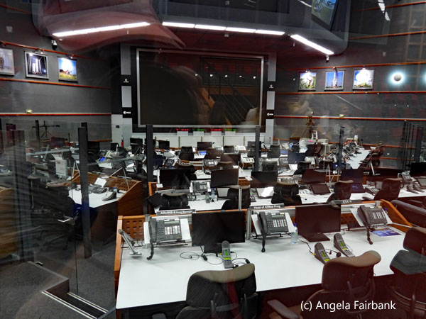
Due the fact that I speak French and would not need Glenn to interpret for me inside the Centre Spatial Guyanais (space centre), the plan today was that Glenn would drop me off at said centre and then drive the hour or so to the Cayenne airport, together with a copy of my passport, on the back of which I had written a letter authorizing him to pick up my bag, which should have arrived - despite my not having received any email from Air Canada saying that it had in fact been sent from Montreal to Fort de France or indeed from Air France confirming it to be on their flight from Fort de France to Cayenne this morning. However, we were optimistic and drop me off Glenn did, and I joined the Space Centre's 3-hour free tour at 9:00 a.m. where we were driven to various sites via a brand new, very large Mercedez Benz bus. The space centre occupies an area of 690 square kilometres along the coast of French Guiana and has sent off more than five hundred rockets carrying satellites, for the most part, into orbit since April 9, 1968. The tour started at the Jupiter Control Centre and introduced us to the various types of rockets that have existed throughout its history. The site was chosen for its favourable geographical position due to its proximity to the equator (5° latitude North) and 3,500km of coastline opening onto the ocean to the north and east, as well as for its seismic and climatic stability. It has launched French Ariane, Russian Souyez, and Italian Vega types of rockets.    France used to launch rockets from Algeria, but when the latter country achieved its independence in 1962, France had to go elsewhere. Now Europe has joined the ranks of the world's space superpowers, although not without challenges. For instance, it was forced to displace 219 families so as to build its new centre in French Guiana, although it did offer compensation and rehoused them. When I asked, the tour guide confirmed that they do have interpreters working for them in all of the languages used by the 22 Eurospace member countries, which include Canada, the UK, and Switzerland, none of which are members of the European Union. There is also exemplary environmental control before and after a rocket is launched to make sure local flora and fauna, water, and insects such as bees are not harmed. Jaguars, tapirs, deer, and peccaries are some of the fauna living and reproducing healthily in the area occupied by the space centre, although we did not see any on our bus tour.
   The return from the space centre tour was delayed slightly because the guides had not done a count of passengers prior to the start of the tour and thought that one passenger might possibly have been left behind in one of the buildings. After three very worried security staff had enquired as to the missing person, the rather new French guide, after calling out each of our names on the list and having us put up our hands when called, discovered that she had added to the official morning tour list a person who in fact was going to be going on the afternoon tour instead. After the end of the tour, I visited the souvenir shop and bought a few things and then Glenn called the centre to talk to me and told me he had not yet been able to find anyone at the Air France office at the airport, and they weren't answering their phones either. Both he and I contacted the travel agency who had organized my entire tour to make them aware and meanwhile I asked Glenn to keep on trying at the airport and decided that since I still had time, I would visit the Musée d'Espace at the centre. Just after I had finally been given a ticket (the young clerk at the desk was having difficulty operating the computer so was a bit slow), I entered the museum and then received a phone call from Glenn via WhatsApp (the clerk in question had kindly lent me her personal wifi so I could send the email to the travel agency) saying that he had finally found the right person at Air France, had shown them my letter authorizing him to pick up my bag on my behalf, now had the bag, and would be back at the space centre in about an hour and 15 minutes. What a relief!
   Having plenty of time then, I made a thorough visit of the museum. All of the displays contained explanations in both French and English, and I took many photos of them, including the parts of the rocket, so as to increase my vocabulary in French. You never know, it could come in handy some day if I ever had work in this subject. At the end of the museum circuit, I had the chance to sign a virtual visitors' book and have a photo of myself taken in front of an image of an actual rocket launch! Once I was safely inside Glenn's car again, I received a call from the travel agency owner saying they had some bad news and some good news. My flight tomorrow morning to Guyana had been cancelled because there had not been enough people, so I had been put on this evening's flight, and they had arranged a hotel room for me in Guyana tonight instead. However, that meant I had to get to Suriname airport by 6:15 p.m. at the latest. Well bless Glenn and his heart for his speedy action. He did try to get me to the ferry on time but my driver in Suriname, who was young and careful, didn't quite do the job so it was back to plan A2, the night in Paramaribo, and a seat on a bigger plane tomorrow morning (very early as it happened). The delay with the bag collection meant that I missed one of the planned activities, which was in Saint Laurent de Maroni, the border town. On our arrival there, Glenn pointed out a statue of a convict with his head in his hands outside the town's tour office. This town had contained a prisoner transportation camp until the middle of the twentieth century, and from my later reading, it seems I missed visiting a museum complex with displays to read and cells to visit. Cell No. 47 here supposedly once held Papillon. Having visited les Îles de Salut, I think I was made aware of this part of history as much as I wanted to be, so I understand that missing yet another museum was no great loss. Instead, as I was entering Suriname, I had to rush to fill out a complicated form online to show at immigration on the Suriname side, despite already having filled out another form with similar information and purchasing an entry voucher for each of my two entries in Suriname before I had left Canada. I will have one to do today and another tomorrow. I also learned I would have to fill out similar forms to exit Suriname both times as well. The Surinamese government certainly doesn't make it easy for foreigners to visit their country. En route to Saint Laurent du Maroni, which is as I mentioned before the town on the river that divides French Guiana and Suriname, and from where I caught a long wooden boat across to the Suriname side at the town of Albina, Glenn made a brief stop in Iracoubu, where he bought snacks for his long drive back to Kourou and suggested I quickly pop into the church across the street called Eglise Saint Joseph d'Icoubou, known for its interior of frescoe paintings by Pierre Huguet, a convict and untrained artist who worked on them between 1892 and 1898, after the completion of which he was released from prison.
In any case, after being excellently hosted by Glenn, I was introduced by him to the boat captain, who then introduced me to my driver in Albina on the other side of the Maroni River, in Suriname (country number 158, UN country number 124), a young medical student called Ranash. I went to open the front right car door as he put my bags in his trunk and was surprised to find the steering wheel there. I had expected it to be thus in Guyana, which used to be British Guiana, but not in Suriname, which used to be Dutch Guiana. We had an interesting but slower ride of some two hours and a bit into Paramaribo, during which we discussed medical studies and local politics, among other things. He also talked about the history of Suriname, its ethnic make-up, and religions, but said he was just a driver not a tour guide and I would hear it all again from my official tour guide when I did the tour of Paramaribo some days hence. At one point during the drive, I heard a thump. Apparently, a sloth had dropped onto the car roof from a tree during our drive on the highway. It was not possible, given traffic and the speed of our ride, to stop the car and help the poor creature or make sure it had survived its fall, unfortunately. I finally arrived at my hotel, Torarica Eco, in Paramaribo, the capital and which the locals call Parbo, (after which their local beer is called). After dumping my bags in my room, having eaten nothing since breakfast, I went to the hotel restaurant for an expensive (for the country) trout dish and a Parbo beer. During dinner, I checked my emails and discovered one from the travel agency telling me that I would be picked up at 2:00 a.m. tomorrow morning and driven to the airport for my flight to Guyana. Apparently, the airport wants passengers there four hours before each flight, although the flight to Guyana, the country next door, only takes 30 minutes. Clearly an over-the-top request and one that means I might get three hours of sleep tonight if I am lucky. What's more, since breakfast isn't available tomorrow morning until 6:00 a.m., I asked reception if they would make me a bagged breakfast, which they were happy to do. Saturday, March 29, 2025: Paramaribo, Suriname to Georgetown, Kaieteur Falls, and Georgetown, Guyana then back to Paramaribo, Suriname I did manage to sleep about three hours, having set my alarm for 1:15, so I had time to take a shower and repack some of my things so as to take the bare minimum with me and leave the bulk in my hotel room. The driver, Rakesh, apparently the head of the agency's transportation hub, picked me up on time and introduced me to another driver Amrish, who would be picking me up from the airport on my return. It was dark and we didn't talk much. I was still fairly tired but did manage to stay awake during the drive. When I arrived at the airport, they still weren't letting passengers in for my flight on Surinam Airways, so I had to wait outside the terminal for a few minutes. After checking in, and producing the online form to leave Suriname, I wandered through the airport and sat and waited for the flight. I think I pretty much slept as I waited as there were several hours to kill. Finally on board, I slept again and woke up in time to see the plane arrive in Guyana, pronounced with a long i sound rather than the long e sound on the first syllable. I also managed to pick up a brochure on my way through customs, happy not to have to collect any bags at baggage claim for once, and learned that Guyana (country number 159, UN country number 125), is a native word meaning “land of many waters.” Like French Guiana and Suriname, Guyana contains dense tropical forests that are some of the oldest and most pristine on earth. Guyana claims to be a rich country active in gold and diamond mining. It is the largest of the three Guianas with a surface area of 214,969 km2, yet the third smallest state by area in South America after Uruguay and Suriname (not counting French Guiana since it is part of France), the second least populated country in South America after Suriname, and one of least densely populated countries on earth with a 2023 population of 826,353. It is said to contain 820 bird, 228 mammal, and 330 reptile species. Malcolm, my Guyanese tour guide cum driver, a young, tall, stocky, bearded Maroon with a Caribbean lilt to his English accent, was in arrivals hall holding an iPad displaying my name. He didn't say much about his country at that stage but invited me to ask any questions I might have. He was saving his spiel for the afternoon tour of the capital city, Georgetown. His task this morning was basically to drive me from the one airport, called Cheddi Jagan International Airport, 41 km from Georgetown to the smaller Eugene F. Coreia International Airport, formerly and still often called Ogle, a twenty-minute drive east of Georgetown.    I do remember asking him about the local beer called Banks Beer (although I never got a chance to try it), because we passed a brewery (I could tell from the smell of hops). Guyana also brews Guiness, and an award-winning rum called El Dorado. I enquired about the one thing Guyana is infamous for, the Jonestown Massacre from November 18, 1978, when 913 members of a sect called The People's Temple died in an apparent mass suicide from drinking cyanide-spiked Kool-Aid as instructed by their leader, Reverend Jim Jones. It came to light because a few sect members managed to escape and write about their experiences. Malcolm told me he had no interest in it (and had been born a long time after it anyway) but that he was aware of some tour companies offering to take tourists there. However, one guide book I read says that the Jonestown site is overrun by bush and there is no monument or any other reminder of its existence.
Arriving then at the smaller airport, Ogle, Malcolm dropped me off at a private building for small planes and said he would keep in touch with the airline, called Roraima Airways, in case the flight was cancelled due to weather or visibility reasons. I sat down in the waiting room and ate my hotel-packed breakfast of a boiled egg, a cheese sandwich, a cookie, and a banana, but threw away the salad as it looked a bit dodgy. I then waited and waited and waited until finally a large group of about 14 Poles I had managed to get a seat on the flight with arrived. They had been on the larger plane from Paramaribo with me but must have meanwhile been delivered to their hotel to freshen up and drop off their luggage. Our combined party was then divided up due to our respective weights into three small planes. I was on the third plane, which was bright yellow, looked smarter than the other two, and had a white British pilot. Once we were strapped in and had placed the headphones over our ears to slightly muffle the sound of the propellor engines, the take off was smooth and we landed safely about an hour later after traveling through clouds and over forests, muddy, chocolate-brown, snaking, meandering rivers, and the occasional gold and diamond (and perhaps other) mine operations.    Just before touching down on an airstrip in the middle of the jungle, we were given a glimpse of the Kaieteur Falls from the air, but they were difficult to photograph given the moisture on the window and the obstruction of the propellor engine. A young Maroon guide called Jeremiah (Jones), who asked us to call him JJ, met us and took us along paths to three different views of the region's most popular attraction: the world's largest single drop waterfall, which at 741 feet (four times taller than Niagara Falls) and containing 30,000 gallons of water per second, crashes down into the valley below. A display in the park hut tells us the following: “The Legend of the Falls: The name of the Falls commemorates Chief Kai, one of the distinguished chieftains (also known as Toshaos) of the once powerful Patamona tribe. Amerindian legend has it that Kaie committed self-sacrifice by paddling his canoe over the Falls in order to appease Makonaima, the Great Spirit. The sacrifice was to bring peace and to save his tribe from being destroyed by a raiding party of Caribs. Teur translates as falls, hence the name Kaieteur. Folklore has it that the old man and his 'wood skin' canoe were turned to stone and now form part of the rocks of Kaieteur. Perhaps he won appeasement for his name still marks the magical curtain of water known as Kaieteur.”
   JJ was an enigmatic young man I enjoyed talking with and appears in one of my photos for today. He told me about one young lady who had decided to leave this earth by jumping from the ledge you see to the right of the falls. He also talked about his training to become a guide in this park and said he would try to find a Guinean Cock of the Rock (Rupicola rupicola), a species of cotinga, a passerine, about 30 cm in length, weighing about 200 to 220 g for me to photograph because they were now in mating season and he knew a spot where all the males tended to gather. And sure enough there were at least three of them a bit of the way into the woods. I crept up quietly, pushed my long lens out to as far as it would go without compromising the pixelation and am very proud of my result given my and his patience. It is the most orange bird I believe I have ever seen. Looking up this species later, I found that another type, called Andean Cock of the Rock (Rupicola peruvianus), is the national bird of Peru with slightly different colouring, the male having black and white feathers in addition to their bright orange. I read, too, that the bird has an interesting mating dance, but unfortunately, we were not able to witness that.
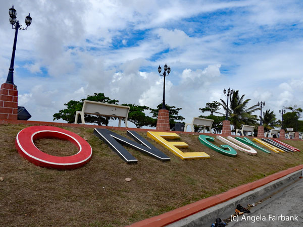   We were lucky with the rain in that during the time we were on land, it held off and only started again once we were in the plane on our way back to Georgetown. This time, I got to sit in the co-pilot seat. Visible from the air were a large cathedral in the shape of a cross and rows upon rows of new house builds, due, I gather, from the recent discovery of offshore oil and gas, although its location and consequent ownership are debated between Guyana and Suriname due to the way the water from the country-dividing Corentyne/Corantijn River flows given the currents and land masses. These new houses have been built on no-longer-used sugar-cane fields. This discovery has caused a 51-percent growth in GNP per annum over the last couple of years. Other crops in Guyana are rice and sugar, although the latter is waning with the world's people choosing sugar substitutes. Arriving back at the Ogle airport, I had a token photo with our British pilot, and Malcolm was on time to pick me up and take me on my tour of Georgetown. Like Cayenne, it too contains many historic buildings. We started off at the Dutch-built seawall, where Malcolm showed me that the town was situated a few metres below sea level, and where I was able to take photos of various 'I love Guyana' statements. He pointed out the Canadian High Commission, a large native hut called Umana Yana, and a giant statue of a turtle emerging from an egg. He mentioned that there were a few other giant sculptures, which I saw later as we were driving: a giant harpy eagle, a giant jaguar, and a giant anteater, all by different artists. We then stopped at St. George Anglican Cathedral, reputed to be the world's tallest freestanding wooden structure/church at 44m, which I was able to photograph inside and out, and passed by the presidential palace, the parliament buildings, and the High Court. He also drove by the Stabroek market, originally the site of the slave market, but stated there was no time to visit this or the promised Botanical Gardens, containing endemic plants, exotic birds, and manatees, among other fauna. One final photo taken from the car and therefore not good enough to publish was of the 1763 Monument, a 5m-high bronze memorial to Cuffy, an African slave who led an unsuccessful slave revolt in that year. At my request, we made a stop for souvenirs, and he took me to a spot where there were a number of side-by-side stalls, all of which I visited very quickly and managed to find a magnet, a bracelet, and a t-shirt. Then, also at my suggestion, we stopped at a cafe to purchase a take-away mid-afternoon meal for me to eat at the larger airport as I awaited my flight back to Suriname. Again, for some reason, I had at least three hours to wait in the airport, three hours that could have been used to visit the botanical gardens, for instance. I had nothing much with me, so security didn't take long, and I had help filling out the Guyana exit form, and the re-entry into Suriname form since luckily there was free airport wifi so that too was less of a bother than before.
   As I contemplated the need for such a quickly growing economy to improve its drinking water, and clean up its streets and canals of garbage, there was another delay as we waited for the plane to arrive from Miami, where it had encountered air traffic-control problems. A half hour flight later, I was back in Suriname, picked up by Amrish, so tired, I told him, I would probably sleep the whole way back to my hotel, which I did so I never got to chat to him either. I gather he and Rakesh are the two most senior members of the aforementioned travel agency driving team and usually did the night drives for tourists.
Sunday, March 30, 2025: Paramaribo to Atjoni and up the Suriname River to Knini Paati, Suriname Suriname is the smallest country in South America by both population and territory with around 612,985 inhabitants (in 2021) and an area of 163,820 square km. After a nice and copious breakfast in an open-to-the-air-and-nature restaurant with birds flitting around, I waited at reception to be picked up though had only been following the time information on my itinerary and did not know who or what kind of transport to expect. I was eventually approached right on time by someone who asked me something in Dutch. Probably the name of the town he was driving to, but I was waiting to hear my name so shook my head. He then went into reception and asked one of the staff to interpret for me and that fellow said my name, so I said yes and climbed into a private bus that already had a family of five from the Netherlands. We picked up three more Dutch people, a young woman, and her parents, at another hotel nearby and then headed off to Atjoni along the highway southward toward what is known as Upper Suriname. The first thing the driver offered us was sandwiches, which I gathered were included in our price, but as I had just had a copious breakfast, I refused. The other passengers seemed glad to have them. After about an hour, we stopped at a place off the highway which offered toilets and two Chinese-operated grocery stores, which had practically identical wares for sale. Luckily, the Dutch passengers all spoke English, even if the driver didn't, and told me, when I asked, that the toilets were paying ones. I had no local coins and luckily did not feel the need, yet, not knowing where I might be getting my next meal from, if at all, I did pay one US dollar for a package of biscuits. Using the exchange rate I was quoted, I calculated it would roughly cost two dollars, but the female Chinese clerk handed me back one of the dollar bills I offered her.    We finally arrived at a river (apparently the Suriname River) and piled into a long wooden boat together with our luggage and were introduced to two Saramaccan Maroon culture guides. They both started out speaking Dutch, but when I asked one of them if he spoke English, he confirmed, clarifying that his name was Kukcy, and said he would be my guide while the others would all have the Dutch-speaking guide. We then drove up the river in said longboat powered by a surprisingly quiet outboard engine through rapids, passing various communities washing things in the river, with colourful birds flying around, including kingfishers, and herons. We eventually arrived at our eco resort called Knini Paati, and once we and our luggage had disembarked, were invited to wash up and enjoy refreshing coconut water straight out of the coconut and then a buffet lunch. Hearing that I was vegetarian, one of the cooks, an older woman, came over to my table and handed me a special metal dish of something vegetarian. I thought that was all I was being offered for lunch. Clearly sympathizing with me for not understanding, she approached again to invite me also to help myself to the buffet, including French beans, and a selection of starches, potato, sweet potato, cassava, and rice, followed by a dessert of vanilla ice-cream with chocolate sauce. Teas and coffee were help-yourself, but alcohol was available at the bar for an extra price for those who wanted it.
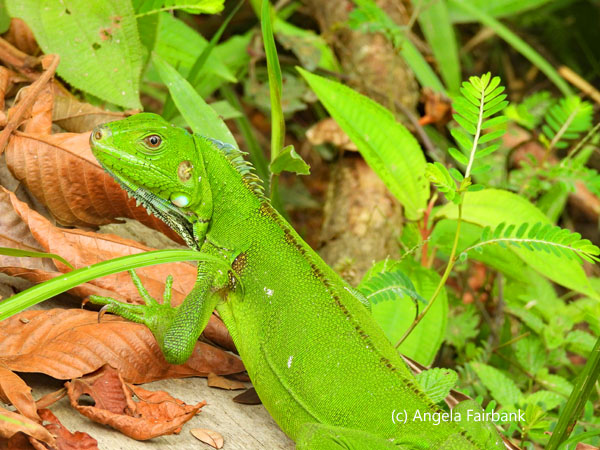
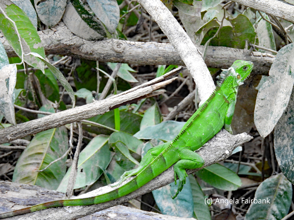
   We were then given our keys to our huts, and I was given hut number 5, with a large bathroom-- with a warning sign on the door that the water came straight from the Suriname River and not to drink it--a double bed and two hammocks on the porch. Hearing and seeing all the birds around, I was eager to get photographing, so while others had a siesta, I walked the grounds, photographing birds and various sizes and colours of iguanas and their ilk. At one stage near the end of my exploration of the grounds, a young Indian came up to me and asked if I was Angela, explaining that he was the son of Dinesh, the owner of the Travel Agency I had booked this entire three Guianas trip and that the entire family was at the resort this weekend as it happened. Apparently, this was only one of several eco resorts they sent their clients to, and, at the invitation of the owner, they were spending their holiday weekend here.
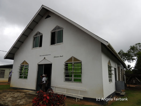
   At 2:00 p.m., we were offered a visit to the local village, led by one of the village captains, called Bernard, and after being transported in the same long boat, or a similar one, we landed at the regional health clinic, Ladoani, which since it was Sunday was closed. The Dutch guests all followed Bernard, and I went around with Kukcy. Of course, I was very eager to photograph the charming children but had to ask before doing so otherwise Kukcy told me he would get in trouble as he knew them all. Some of the children seemed to be related to him. He talked about their houses and how many of the more traditional houses were now being replaced by more modern material such as wood and plaster and with corrugated metal roofs instead of thatched with greenery. We visited two side-by-side villages. One called Tjaikonde, which was animist I think, while the other had a more Christian name and contained a church, which we visited. I was told there were 1,000 inhabitants in one and about 3,000 plus in the other. I think I remember Kukcy saying there were 43 maroon villages in this region of Suriname along the river. I was on the whole rather disappointed in the lack of opportunities to photograph as I learned that it was not simply a matter of asking the children if they wouldn't mind being photographed, something they easily agreed to, wanting to see themselves in the viewfinder afterwards, but rather one of asking the parents of said children if I could photograph them, a request which I was denied by one adult so did not ask again.
   At the end of the visit, we tourists all met back at the bar between the two villages just as it came on to rain. As we waited out the storm, inclusive of thunder and lightening, we talked and sang with a small group of children who had all gathered around Kukcy, who explained then that some of them were his nephews and nieces. One particularly attentive boy--who had a pet parrot seen here apparently called Filip as it kept saying its name over and over--aged 11, wearing trousers with a broken zipper and called Shania, practiced his English out on me, such as what was my name and how old I was and where I was from. I asked him if he swam, as we watched his companions splashing around naked in the river. Our conversation was limited however, so I resorted to miming, some of which he seemed to understand. The other children, younger them him, were more comfortable trying out their Dutch on the Dutch tourists. One little girl sang Mary Had a Baby to me and I joined in with her. It was an enjoyable time as we waited for the rain to cease. At the very end of this interlude, a number of long boats arrived containing about 30 young Dutch people, older teenagers, soaked to the skin, some of whom were only wearing (now wet) t-shirts over swimsuits. According to the explanation we were given, these young people had arrived from the Netherlands to spend a number of days staying with the locals in their homes and learning how they lived. They had raised money for this trip. Meanwhile, well prepared for the eventuality of rain, I had opened my emergency rain poncho and was wearing that as we waited beneath the roof of the bar. I was hoping the teenagers would dry out sufficiently as some of them looked quite bedraggled and culture shocked. Though it also took me back to 1988 when I had spent days with locals in Cameroon, though I was somewhat older and wiser than they are perhaps.
      When the rain finally stopped, we got back into the long boats and once we had arrived back at the Eco lodge, we were offered refreshments, during which time Dinesh came up to me and introduced himself, saying he would like to have a chance to discuss with me opportunities to get into the Canadian market. We were offered our second excursion to find caimans in the dark, in preparation for which I had brought my bicycle head lamp in my luggage. However, not wanting to get wet again, and having seen many caimans (caimen?) before, I forewent that particular experience and instead transferred photos to my laptop in my hut. Dinner was at 7:00 and consisted of another buffet, and for which I was offered my own little pot of tofu in a spicy sauce and included a hot soup and for dessert, a tiny piece of cake with icing! Normally, I would probably have gone back to my hut for the evening at that point, but Kukcy told me there would be dancing and a cultural entertainment so I sat on with cups of tea and waited, and, when he and his family had finished their meal, Dinesh came to sit beside me at my table to interpret into English what the cultural group's ambassador was saying in his presentation. This ambassador was no other than Kukcy. A guide with Dutch, English, and a few local languages under his belt who could also sing and play the drums ... Later on, during our marketing talk, Dinesh and I also saw him washing dishes from dinner too! I had expressed a desire to buy souvenirs and was told none were sold by the eco lodge but that I should find some in the village we had visited today. I also expressed a desire to photograph birds, so I gather that in lieu of the caiman search, I was offered an early morning (before breakfast) bird walk with Kukcy tomorrow, followed by another exploration of the village with a stop at their souvenir shop with Bernard. By the time the entertainment finished, including some very sexually explicit dancing by three ladies accompanied by Kukcy's musical group, and after my discussion with Dinesh and the eco lodge owner, when I got back to my hut I was surprised to see it was almost 11 p.m.
      Monday, March 31, 2025: Knini Paati and down the Suriname River to Atjoni and Paramaribo, Suriname
I was up early and after my shower joined Kukcy who motored me over to the opposite side of the river from the Eco Lodge to an area where the village was growing agricultural products, some of which it sold to the eco lodge. This is where birds such as channel-billed toucans (rather far away to photograph even with my long lens), a snail kite, a crimson-crested woodpecker, and others could be found. Kukcy also showed me pineapples, various root vegetables, and papayas growing in the plot. I arrived back to the other side of the river in time for breakfast: again, buffet style with a lot of variety including some thin crepes, a fried egg, cucumber, and tomato, which I wrapped up into a freshly baked brown bread roll. All very nice.       I then went with a different Dutch couple over to the village again, this time with Bernard as our guide. Luckily, the Dutch couple agreed to interpret in English some of what Bernard was telling them in Dutch when I couldn't understand the details. We were given a demonstration of baking cassava bread where they shake and spread flour they have seived themselves from the root plant over a metal plate over fire and somehow it becomes an entire piece of bread shaped like thin crust pizza. I gathered that we were mostly visiting the other village than what Kukcy had shown me yesterday, but we still ended up at the same church and subsequently the same bar located between the two villages. Bernard also showed us his own house where he lives alone, his wife or wives (I wasn't quite sure) and children living in other houses elsewhere. He had planted a number of flowers in front on land that was otherwise mud. The clinic we visited the exterior of was still closed as it was a holiday Monday apparently, and located in its premises was some type of leaf insect with yellow eyes as large as a grasshopper. I also spotted a caiman in the water and pointed it out to the others. I photographed another greenish iguana and a parakeet, which as it was on the ground and not flying around I gather was also a pet. Bernard also showed us the regional airstrip, which had been given by the government, but the latter had not bothered to maintain it, so it was now quite grown over and would be impossible for any planes to land. Our final stop was to be at the souvenirwinkel (souvenir store in Dutch) but on our arrival there, he found it was locked. He went to find the woman with the key but was told she wasn't around. So in lieu of that, Bernard was told one woman in the village had some things to sell, so we went over to her house, and she showed me basically fabric they tie around their waists and some wooden afro combs. I bought one of each, deciding I would have to make do with what was on offer. The Dutch couple on this guided village visit with me were staying at the eco resort for three days so said they would likely have another opportunity to visit and buy souvenirs, and that hopefully the village souvenir shop would be open on their subsequent visit.
      On our arrival back at the lodge, I was asked to vacate my room as lunch would be at 11:30 and we would leave (with the same eight Dutch people as before) at 12:00 via the same route: the hour-long boat drive to Atjoni (at the beginning of which we were honoured by the visit of a neotropical butterfly, the first I have seen outside of a butterfly park or a museum display), where we were joined by Dinesh, his wife and two boys, who then continued to Paramaribo in their own car, and the two-hour bus drive to Paramaribo with a stop halfway through at the same place with the toilets and Chinese stores. I checked back into the hotel in Paramaribo, was given a different room slightly father away from the room before and explored the grounds a bit. I then transferred my photos to my laptop and returned to the hotel's restaurant I had been to two nights before and this time tried their chicken dish and another refreshing Parbo beer.
         Tuesday, April 1, 2025: Paramaribo, Suriname
I was picked up today at 9:00 by Kenneth, a corpulent Maroon with a pleasant disposition, who took me on a tour of Paramaribo city, where I photographed a lot of birds, including tropical mockingbirds. Our first stop, where he parked the car, was within walking distance of the hotel in a plaza called Baba & Mai Plein containing statues of Indians, or Hindustani, who immigrated to Suriname between June 5, 1873 and May 24, 1916. Hindustani people make up 27 percent of Suriname's population, the remaining being 18 percent Creole, 15 percent Javanese, and 15 percent Maroon. The official language in Suriname is Dutch but the common language is Sranan Tongo, also known as Taki-Taki, while several Maroon languages such as Saramaccan and Aukan are also spoken.       The streets of Paramaribo are lined with eighteenth- and nineteenth-century colonial Dutch, British, Spanish, and French wooden buildings, whether restored or dilapidated (the police headquarters building is a sorry example of the latter) earning it UNESCO World Heritage status in 2002. We walked past the President's Administration Office Building with its statue of Mama Sranan (Mother Suriname) holding five children, each representing the major ethnic groups in the country: Creole, Hindustani, Javanese, Chinese, and indigenous populations), opposite which was a statue of Henck Alphonsus Eugene Arron, a banker and twice President of Suriname, backed by a Palm Garden said to contain 1000 palm trees, and over to Fort Zeelandia (dated 1667) with its 'I love SU' sign in front of a rather cluttered parking lot and colonial buildings overlooking the Suriname River, including a building with a collapsed roof and a statue of Queen Wilhelmina of the Netherlands, who was also monarch of Suriname during her reign (1890 - 1948).
   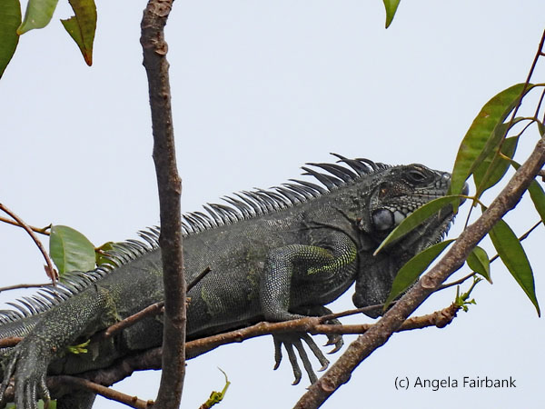   There were also large, grey iguanas sitting up in the branches of trees here. We then crossed over to Independence Square with its statue of Johan Adolf Pengel, a former Prime Minister, around which were the Ministry of Finance building and the Presidential Palace. I was told that whenever the current president arrives at work, he comes in a long cavalcade of vehicles with sirens blaring, and sure enough he arrived while we were in the area, which, looking at my watch was about 10:20 a.m. We were then returning to the car via the Palm Garden, but it came on to rain just at that moment, so we sought refuge beneath a bus stop shelter until it lessened. In this garden was a monument to the Amerindians, figures of which were wearing headdresses similar to those we find in North America.
 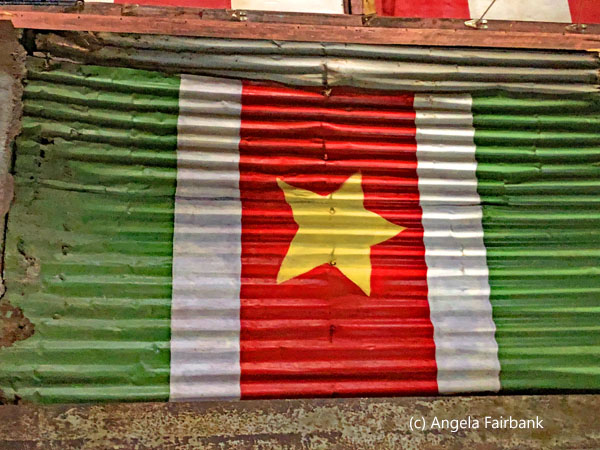     Our next stop was the market while it was still drizzling but it was not possible to take photos of individuals. I wondered around where various plants were pointed out to me and ended up outside on the river where a number of herons and egrets were standing on wooden stakes in the water, on roofs, etc. We then got back into the car and drove through flooded streets to Peperpot, an old colonial coffee and coca plantation with a trail that cuts straight through it with interpretive signs. Unfortunately, it was still raining heavily so we waited a good half hour in the central building waiting for it to stop but finally gave in and walked the trail halfway. Given the rain, most of the birds were hiding, but we were lucky enough to spot a couple of sloths up high in the trees, as well as the back (but unfortunately not the rather unusual face) of a great potoo, and a snail kite.
     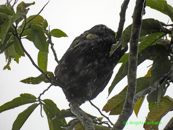 Our next stop was down at the Suriname River and its meeting point with the Commewijne River, essentially to see pink dolphins. The long wooden boat with its put-put engine tried its best and a few of these creatures we did see though they were of course very difficult to photograph, although I was lucky to see a couple of them with my bare eyes leap across the bow of the boat. There were also flocks of vultures by the riverside here. But the best sighting, since Kenneth realized I liked photographing birds, was when he saw a flash of red and stopped and backed up to a bird with a red breast singing on a telephone wire. I looked it up later and learned that it was a red-breasted meadowlark. A good day despite the disappointing time at Peperpot, where unfortunately we were attacked by clouds of mosquitos following us and biting us as we walked. I was lucky I had brought some mosquito repellent with me, but they still managed to bite my hands and face.
         Wednesday, April 2, 2025: Paramaribo, Suriname to Panama City, Panama
On my way to breakfast this morning, I noticed and photographed this tiny yellow frog on the path. It was not moving because to all appearances someone had stepped on it and killed it. After breakfast, as my flight leaving Paramaribo was not until the late afternoon, I walked around the dry and sunny city on my own, essentially to find the souvenir shop Kenneth had told me about but also to visit places he had pointed out from the vehicle yesterday. After finding the souvenir shop and its adjacent art gallery, and buying a few things from the former, my camera covered all this time, I finally uncovered it to photograph a large bush (and clearly garbage-dumping site) where various large water birds, such as herons and others, were nesting with their young. Next I dropped into the St. Peter and Paul Cathedral, elevated to the status of a basilica by Pope Francis in 2014, though I did not visit the mosque and synagogue standing side by side a few blocks further. They wanted a donation in exchange for visiting the basilica, so I dropped my remaining Surinamese coins into a choice of three charity boxes, one for the sick, one for the poor, and one for the basilica's upkeep. 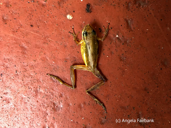         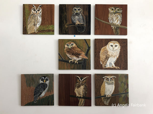      Returning to the hotel, I continued photographing birds and finally saw the Golden Tegu (Tupinambis teguixin) I had noticed a few days ago but had not had the chance to photograph at that time.
               I checked out of the hotel and was picked up at 1:00 by another young Indian-heritage origin driver called Shiwam, whose English was limited but comprehensible. He seemed to have no parents, having been brought up by his grandmother, guessed my age as 70(!), and had started out at the agency by washing cars and then had learned to drive under Amrish's tutelage and had finally become a daytime driver for the agency. He did not finish high school. I arrived at the airport in the rain and was able to check into my flight immediately. Completing all the usual formalities and there being no airport wifi, I was able to get the QR code to exit the country on a phone leant by the kind customs officer. Wandering through the airport after security, I noticed several souvenir shops with items similar to those I had seen in town but at much higher prices, so my walk into town for souvenirs had clearly been worth the effort. I continued wandering around the airport for a while and not knowing where or when my next meals might be coming, I bought some expensive banana chips and healthy fruit biscuits at Parbo airport. During the flight, as we were travelling west, I saw several sunsets as well as fascinating storm clouds with frequent lightening.
          Thursday, April 3, 2025: Panama City, Panama to Lima, Peru
After changing planes in Panama and mostly sleeping on both Copa flights, given that there was no entertainment and they kept the lights off for most of the duration so I was not encouraged to read my book, I arrived in Lima airport just after midnight, delighted to see that my checked in bag had made it here too. After booking and prepaying in Euros an official taxi at the official taxi stand inside the airport and being accompanied by the stand's hostess so as to make sure I had the right driver and car, I arrived at my rather gloomy, 3-star hotel safe and sound and went straight to bed. After the included breakfast in the hotel breakfast room, about six hours later with a time change of two hours between Paramaribo and Lima, today was a catch-up day so as to write up my adventures from the past week or so and I have no photos to display for today. I stayed in my hotel room working, disappointed to find out that this particular hotel does not offer any laundry service. I was directed to a launderette across the street but not having any local money, I will no doubt have to wait until Cusco. The hotel is a little beneath the level I have been used to, but I am making do. I was interested to note that it is also the hotel used by Intrepid. One important missing element is a bottle of complimentary mineral water in the room; a minimum surely when Lima does not have potable water. At least my room has a desk on which to work, and I sure am happy I thought to buy some snacks at the Paramaribo airport yesterday to keep me fueled until tomorrow's breakfast, which here too is rather paltry compared to what I have become used to. On the bright side, they do have a very good breakfast coffee. Friday, April 4, 2025: Lima, Peru Today too there are no photos as I stayed in my room and worked on my travelogue. I was happy to find out that I did not have to change rooms and could keep the one I had because I would not be sharing with anyone else. This is all because my G Adventure tour from Peru to Chile starts today officially and we had our first meeting and dinner all together this evening. We will be 15 passengers in all: 4 Canadians, a Mexican, a Norwegian/Swede, 2 Colombians, an Irishman, a Scottish woman and 5 British and led by a former Inca Trail guide, Edwar Pacheco Rosas. It was interesting that during the room cleaning today, I was provided with a bathmat and an extra hand towel, items that had not been provided the other two days.  Saturday, April 5, 2025: Lima to Cusco, Peru
Our flight to Cusco was at noon today so we got onto a private bus at about 9:00 after breakfast with our bags and left for the airport where we checked in as a group for the one-and-a-half-hour flight. Arriving at 3,400 meters (11,200 feet) above sea level from Lima at 161 meters (528 feet) above sea level, we were all wondering which of us, if any, would start feeling the effects of being at a higher altitude but apart from a couple of headaches and noticeably heavier breathing, none of us succumbed seriously to the difference. Taking a bus from Cusco airport then into the town, we checked into our hotel and went out to lunch together at Mistura on the main square, where we were served our first complimentary pisco sours. This restaurant has a rooftop section which provides an excellent view of the square and all the buildings around. I tried the local beer, Cusqueña, and risked eating an Alpaca burger, despite not being a fan of red meat. It was a bit tough but palatable. Some of my fellow passengers tried the local tea of coca leaves, but as one of its many ingredients is cocaine, I, of course, refused. Wandering back to the hotel on my own, I went to a local money changer to change some Euros into local soles so as to have enough for future meals and incidentals in Peru. I also photographed a few murals and this group of women who were protesting the forced sterilization of females. I was also surprised to see a grown man urinating onto a tree in the middle of the sidewalk on a main street. Clearly Cusco does not have enough public toilets. However, the women vendors around him didn't seem phased by his action.             Sunday, April 6, 2025: Cusco, Peru
As we had a full day in Cusco and this was Edwar's hometown, he took us on a long walk and climb around various neighbourhoods, starting with the San Pedro market, outside of which there were several vendors selling raw, skinned guinea pigs. There were quite a few women in traditional costume, and I photographed as much as I could. We also saw stalls selling cheese, tea, chocolate, and tons of handicrafts, masks from carnival, and various dwarf figures, which seems to be popular here, in addition to many species of potato, quinoa, cactus, corn, candy, pisco, and coca leaves. A cornucopia of produce. We then turned toward the main plaza again where there was a display of soldiers marching in celebration of some anniversary if I understood correctly. We then started climbing up narrow pedestrian streets past more shops, artist stalls, and up above the city of Cusco in a picturesque neighbourhood called San Blas. We finally reached a square outside a church where we had another overview of Cusco for some panoramic photos. Then we turned back down to the main square for lunch, this time at a restaurant called Don Pancho.             In the afternoon most of us decided to do a tour of four ancient Inca sites, though personally I found it a bit boring, or perhaps I was just tired and suffering from the higher altitude. Our first stop was Saqsayhuaman, which I had visited before, in January 2009 if my records are correct, where some type of camelids were grazing in the fields. Our second stop was at Q'Enqo, our third, Tambomachay, and our fourth, Puka Pukara. I distracted myself by photographing flowers and birds. Coming to the end of the visits, our guide for the day asked us if we were interested in seeing llamas and weaving. As this was more to my liking than ancient stone buildings, I said yes, and a few other women did too and then all the men came along as well. In fact, this final improvised visit ended up being for some of us the most interesting of the tour as it was a community that had four or five varieties of camelids including llamas, alpacas, guanacos and vicuñas. Regarding the difference among these four types, AI explains as follows: “Llamas are domesticated camelids known for their use as pack animals and for their wool; Alpacas are also domesticated and valued for their soft, fine wool, used to make various products; Guanacos are wild camelids, larger than llamas and alpacas, with a reddish-brown coat and found in the high Andes; Lastly, vicuñas are also wild, smaller than guanacos, and known for their exceptionally soft, high-quality wool. They are considered an endangered species.”
            Within the compound was also a large cage containing a male and a female condor, as well as a much smaller cage containing live guinea pigs. We were encouraged to feed the camelids and after we had had our fill of photography, we were taken to a room where women were weaving and then, the pièce de résistance, their show room cum sales room. Some passengers bought woolen wear, but I was more fascinated by the wall hangings which I was permitted to photograph, and you will see one of them here.
                Monday, April 7, 2025: Cusco to Ollantaytambo, Peru
We checked out of our hotel in Cusco knowing that we would be back in a couple of days and got into a private bus that would be driving us to Ollantaytambo from where we would catch a train to Machu Picchu. It was a beautiful drive over the hills and valleys with several photo stops. Our first was to the large Cristo Blanco (White Christ) statue of Jesus Christ, 8 meters (26 feet) high, a gift from Palestinians who sought refuge in Cusco after World War II and based on Christ the Redeemer Statue on Corcovado Mountain in Rio de Janeiro, Brazil. We next stopped on a hilltop to photograph tiered farming land and then drove on to the Ccaccaccollo community, a G Adventures initiative, for weaving. Here we had an explanation of how wool is dyed and then woven into patterns using looms. There were a lot more women here than men and when I asked where all the men were was told they were out working in the fields. They too had stalls of camelids to feed and photograph as it was their wool they were using for their production. However, there were no wall hangings here. Only clothing: sweaters, hats, gloves, ponchos, and shawls. Again, I bought nothing, but other passengers did. I merely helped interpret where needed. The woman holding her grandson in one photo is 67.             Next, we stopped at the town of Cuyo Chico, where a group of families has created a small business based on traditional ceramic crafts. Using clay from their surroundings, they mold bowls, plates, and other decorations. We attended a presentation on the ceramics process using moulds, as well as a demonstration on adobe brickmaking for their houses and walls. Then of course there was time to peruse their wares and buy one or two. On our way to lunch at Huchuy Qosqo, at the Parwa Community Restaurant, we passed through a village that specialized in roast guinea pig. Those of us who were interested pooled our money to purchase one roasted critter and it was divided into 10 pieces so that we could each have a bit to try at lunch. I was late to the table and managed to grab the last piece, which was a scrawny leg. There wasn't much meat on it, and well, it tasted similar to rabbit, I suppose. A plaque at the restaurant provides even more information. “Cuy (guinea pig) has its roots in the communities of the Andes of Peru, where they have used guinea pig for their food for about 5,000 years. In fact, before the Spanish brought other forms of meat, such as cows, sheep, and pigs in Peru, the guinea pig was an important source of protein for native people. These animals require little space, eat only grass, and reproduce quickly, ensuring a constant supply of meat. The guinea pig was so important to the Incas that the remains of these animals have been found buried with Inca mummies. The Incas not only ate the guinea pig, but they also used the intestines of the animals for divination and bones to diagnose diseases. In Peru, about 65 million guinea pigs are eaten per year. The animals are raised commercially, and many native families still breed them in their kitchens. They consider guinea pig a delicacy, eating it as part of their history. The dish is such an important part of the Peruvian culture, that currently in the Cathedral of Cusco there is a painting [representing] the last supper with Jesus Christ and his disciples [where] guinea pig [is] the main dish.” We were also served a nice quinoa soup, as well as something vegetarian with quinoa and an unmemorable dessert.
            For those of you unfamiliar with the history of quinoa in Peru, it is thousands of years old, originated in the Andean highlands, and was a staple food for pre-Columbian civilizations such as the Inca. Initially used to feed livestock, quinoa became a dietary staple for humans around 3,000-4,000 years ago. The Spanish colonization devalued quinoa, replacing it with European grains, but it remained a subsistence crop in isolated Andean communities until its recent resurgence as a superfood. A plaque at the restaurant explains further as follows: “Quinoa is an Andean plant from the surroundings of Lake Titicaca, located in Peru and Bolivia. According to archaeological evidence, quinoa would have been used 5,000 years before Christ. Quinoa was cultivated and used by pre-Hispanic civilizations and replaced by cereals at the arrival of the Spanish, despite being a staple food of the population of that time. Along with the rise of Peruvian cuisine worldwide, and the cuisine of the Andes, quinoa again became the true gold of the table. Quinoa contains more proteins than any other grain besides amino acids similar to milk, and is an important source of starch, sugar, minerals, and vitamins, due to its unusual composition and the exceptional balance [among] oils, proteins, and fats. According to the experts who have studied it, with barely half a cup a day of quinoa, children obtain all the necessary proteins, the carbohydrate content is lower than in normal cereal and their fat profile is excellent. [It also contains] fibre and minerals such as calcium, magnesium, phosphorus, potassium, and iron, although it lacks cholesterol and gluten, making it a perfect food for celiacs and those who follow vegetarian diets.” One of the photos below is of a quinoa plant growing wild in the yard of the ceramics place we visited. There was also a lovely garden of flowers at the lunch place.
 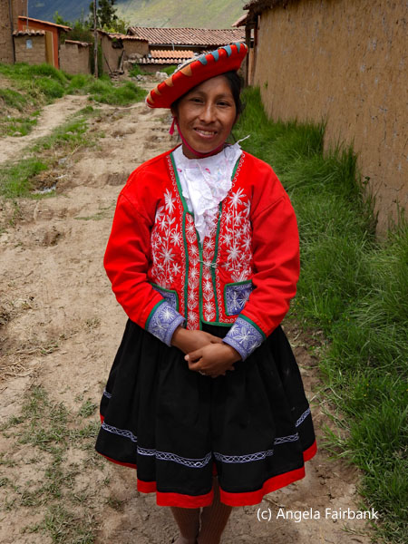 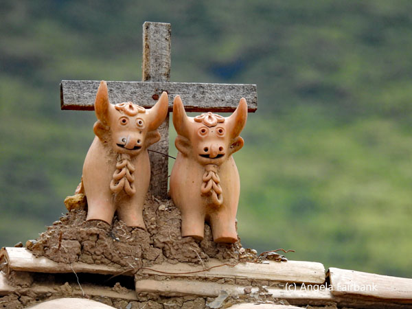          Another stop we made on the way to Ollamtaytambo, where our hotel for the night was located, was a hotel called Skylodge, which contained pods of hotel rooms hanging off a cliff face. Not for the faint-hearted, access is via a zipline, and we were told passengers paying the more expensive level of G Adventure tours stay there! We finally arrived at our destination town, another Inca hillside site, but too late in the day to visit it. Nonetheless, after checking into our hotel, we all walked down to the main square to get an idea of our surroundings and then were left to our own devices. I went off photographing and changed some more money, then had a look at souvenirs and bought a painting from one artist. There were a number of children who had dressed up in traditional garb and were asking for money to photograph them. When I asked Edwar, he said that it was not a good idea because a lot of these children skipped school to pander to tourist photos and the money they earned was given to their parents who would just spend it on alcohol. Consequently, paying them would only encourage them to continue when really they should stay in school to eventually earn a proper wage in a proper job.
    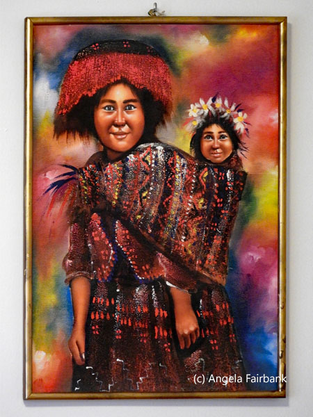       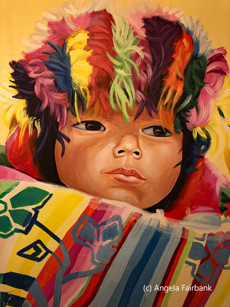   Tuesday, April 8, 2025: Ollantaytambo to Aguas Calientes, Peru
With an early start to our morning, we walked down to the train station with our bags to board at 7:15. As you will see from the photos, we were in Expedition Class and had windows on the ceiling. The weather was clear, but the ride itself was unexciting. I remembered when I had travelled to Aguas Calientes in 2009 it had been in a level above on the Hiram Bingham luxury train, which I saw pass while I was in Aguas Calientes later in the day. I don't remember much from that experience, however. This time, being a public train, our carriage also contained the National Geographic/G Adventures group and overhearing one couple talk about British Columbia I went over to talk to them. Their trip was just in Peru so was shorter than ours. 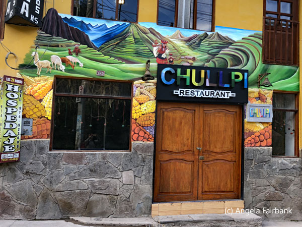      Arriving in Aguas Calientes, we walked uphill to our hotel passing Paddington Bear on a bench and then lockets on a bridge over a torrential river on the way and checked in. We had dropped off some of our party one station before Aguas Calientes so that they could walk the last few kilometres of the Inca Trail (for over $400!). Then Edwar took us on a long walk downhill to the museum containing the history of the discovery of Machu Picchu after which we had to walk all the way uphill again. On the way back up we passed this man in green who was an Inca Trail porter. He looked exhausted! I spent the rest of the afternoon in my room uploading photos and resting from all that walking, while others tried out the aguas calientes (hot springs). In the evening, we went out to a restaurant adjacent to the train station and watched the trains passing outside, which was an eerie experience.
         Wednesday, April 9, 2025: Aguas Calientes to Cusco, Peru
After it had rained pretty solidly all night, (I could hear it beating against the corrugated roofs beneath my window), we took a public bus up Machu Picchu--a UNESCO World Heritage site and voted one of the new Seven Wonders of the World in a worldwide internet poll--in the drizzle and waited in vain for it to subside somewhat before heading out onto the site. We were unlucky though and could do nothing but don our waterproof ponchos and head out. Unlike the time I had visited in 2009, it was very much controlled as to which route we were allowed to take and always had to be in our group with our guide. (I remember wandering around alone the last time sans guide.) Moreover, today's tour guide went on and on with his explanations, long past my saturation point. The highlight for me was spotting a rather damp chinchilla among some rocks. We finally got to the end of the route down through the site and took a public bus back down to the town, meeting up with Edwar at a restaurant called Munaycha for lunch, where I unfortunately got food poisoning and spent a very unpleasant few hours in the train back to Ollantaytambo and then in our private bus back to Cusco. 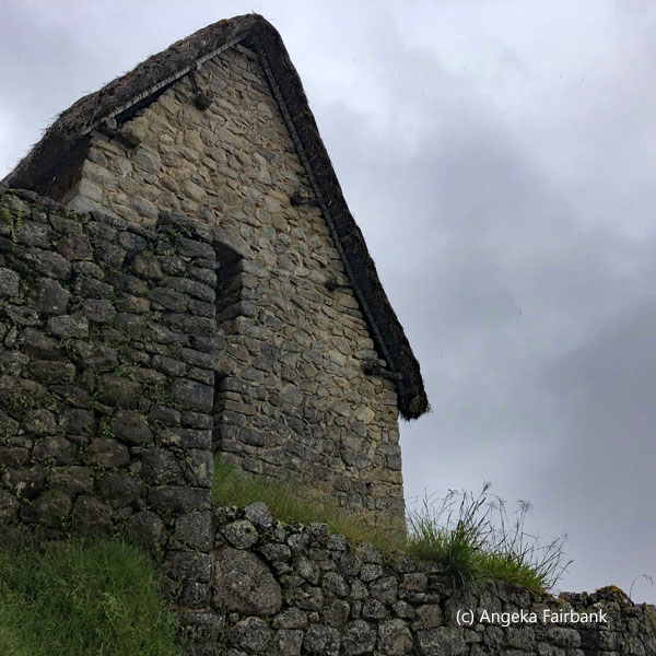 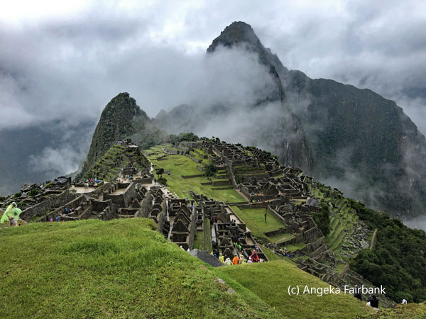       Thursday, April 10, 2025: Cusco, Peru
No photos today I'm afraid, as I stayed in bed the whole day missing breakfast, trying to sleep as much as I could to get rid of this food poisoning. One of my fellow passengers kindly brought me some white bread from breakfast and some boiling water, which I had to wait to cool down before I could drink it, and later on our tour guide brought me some Gatorade, water, ritz crackers, and bananas at my request. Their offerings were very welcome indeed. No doubt my body needed to recuperate the sleep too from all the early mornings of getting up to catch various forms of transportation. I was supposed to be hiking up Rainbow Mountain today and had prepaid for it. Clearly that was a mistake and will teach me not to prepay for tours in the future. Friday, April 11, 2025: Cusco to Puno, Lake Titicaca, Peru
We took a public, long-distance bus today, which was comfortable but had a smelly toilet and I was glad I only had to visit it once as it was a 7:30 hour ride. I think I had been seated strategically near the toilets, but it also meant I had an aisle seat, so I missed a lot of the window views I could have had. What I saw, however, was beautiful as we travelled in the sunshine with scenes of mountains--some snow capped--and bucolic fields with multicoloured crops, sheep, cattle, and llamas. Just before arriving in Puno, we travelled through a large city called Juliaca, which apparently contains an airport, although Puno does not. We arrived at our hotel, settled in, and then took a short walk into town to see the central square and eat at another restaurant, this one called La Tulipana. Although it offered many choices, I had trouble choosing something that would not upset my stomach and made a wrong choice of tomato soup on the advice of the nurse travelling with us, although the coca cola I ordered to accompany it probably helped my digestion somewhat.   Saturday, April 12, 2025: Puno, Lake Titicaca, Peru
It was a great day today. The expected highlight of my trip as far as Peru was concerned did not disappoint. We started out from our hotel in hired bicycle rickshaws and because the route was all downhill we did not feel a burden to the cyclist. We then boarded a largish boat with an engine that travelled out of Puno and into the middle of Titicaca, meaning Grey Puma, one of South America's largest lakes and the world's highest navigable body of water, with a surface area of 8,372 km2 (3,232 sq mi) and an elevation of 3,812 m (12,507 ft) . It is said to be the birthplace of the Incas. Although we had been meeting Quechua speakers during our time in Peru, here were Aymara speakers. The people living on the reed islands are called Uros, however, and the last person to speak Uro died in 1920. These islands were originally made from reed boats but later the people decided to concentrate on the roots, which, like cork, float in water. Uro children have been going to school since 1995 when they became recognized as Peruvian citizens. The lake contains about 150 reed islands and about 7 to 8 families live on each. A claim to fame for Canada is that rainbow trout were brought to breed in Lake Titicaca by the Canadian government.       Wikipedia tells us: “The Floating Islands are small, human-made islands constructed by the Uros (or Uru) people from layers of cut totora, a thick, buoyant sedge that grows abundantly in the shallows of Lake Titicaca. The Uros harvest the sedges that naturally grow on the lake's banks to make the islands by continuously adding sedges to the surface. According to legend, the Uru people originated in the Amazon and migrated to the area of Lake Titicaca in the pre-Columbian era, where they were oppressed by the local population and were unable to secure land of their own. They built the sedge islands, which could be moved into deep water or to different parts of the lake, as necessary, for greater safety from their hostile neighbors on land. Golden in colour, many of the islands measure about 15 by 15 m (50 by 50 ft), and the largest are roughly half the size of a football field. Each island contains several thatched houses, typically belonging to members of a single extended family.”
   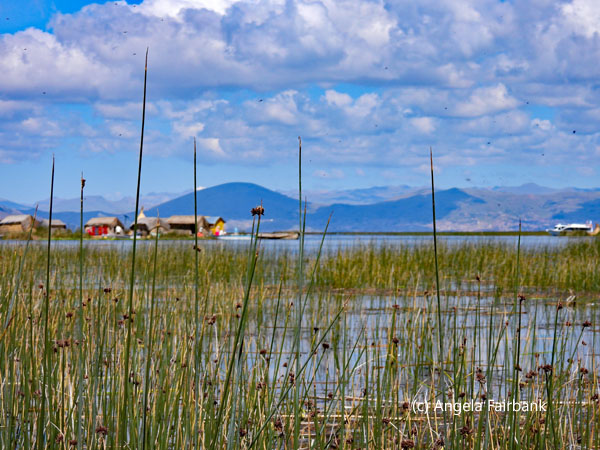 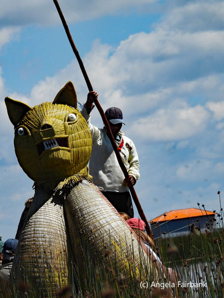 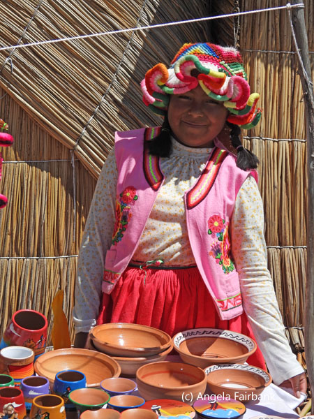 We pulled up to one of these reed islands and were given a presentation about how it had been constructed. There were about four houses in all selling various handicrafts including reed objects, patchwork fabric pictures, and clay items. I did not buy anything. We were then offered a ride in their reed boat whose figurehead was the head of a puma. We all piled in, and the reed boat captain rowed us away with a paddle. We had been told we would circumnavigate the island but instead he pulled us into the middle of some reeds where the sun was beating down on us and, although we had been told we would pay when we got back to the island, the boat captain then and there held us ransom, demanding payment then and there before he would take us back. Naturally, I complained to him in Spanish and said it was extorsion. Some of the passengers did pay up to appease him so he would take us back but as soon as I stepped back onto the island, I complained to our guide, and he immediately took issue with the reed boat captain. He told me that it was against G Adventure's policy to extort (of course) but then explained that the captain sometimes took passengers out and they never paid him after, so I can understand why he did it but surely those passengers who did not pay were not G Adventure tourists. The guide assured me that G Adventures would not go to that island again, which is a bit of a pity for the island because otherwise everything else had gone very well and all the ladies we met were very nice. I still had my payment for the reed boat captain in my hand, but the guide told me not to bother so instead I visited one of the houses at the invitation of one of the young women and met her two daughters inside. The beds of the parents and children were perpendicular to each other, and all their clothes and crochet projects were hanging on the reed walls. I took a panorama since it was such a wide expanse, not realizing just how much it would distort the children's faces and then a video but the youngest of the two girls chose to pick her nose at that point, which rather spoiled it! I then gave the mother the money I had prepared for the reed boat captain to thank her for allowing me to visit.
   We then continued in our large motorboat to Taquile (not to be confused with Tequila), “a hilly island [that] ... was used as a prison during the Spanish Colony and into the 20th century. In 1970, it became property of the Taquile people, who have inhabited the island [ever] since... The highest point of the island is 4,050 m (13,290 ft) above sea level, and the main village is at 3,950 m (12,960 ft)...The inhabitants, known as Taquileños, are southern Quechua speakers...Taquile is especially known for its handicraft tradition, which is regarded as being of the highest quality ... Knitting is exclusively performed by males, starting at age eight. The women exclusively make yarn and weave...The people in Taquile run their society based on community collectivism and on the Inca moral code ama sua, ama llulla, ama qhilla, (do not steal, do not lie, do not be lazy).” Its setting reminded me somewhat of somewhere in Greece.
  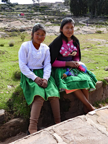    We had our lunch here at a restaurant and received an explanation of the clothing worn by the men and women (married and unmarried) here. All very traditional. One young man, who had been one of our waiters, modelled the clothing for us as he knitted. We had heard music up the hill a ways and after lunch were offered two options: either to climb to the top of the island (4,050 m) or go to the place we could see on the hill to watch a dancing demonstration and possibly shop for souvenirs. Well, I hadn't seen any dancing so far, so I opted for the latter as did everyone else, so up the hill we climbed to an area the size of a soccer field. All the locals were in costume and a group of them played panpipes and drums while running slowly in a circle while wearing elaborate hats with feathers, including one woman. They then asked us to join in, but I sat and photographed the dancing instead. Finally, it was time to visit the stalls of knitting and knowing how the weather was cooler up in the higher lands, I ended up purchasing a pair of colourful alpaca-mixed-with-other-wool gloves, knitted by the man who sold them to me, seen in one of the photos here. We had a quieter ride in the motorboat back to Puno and a private bus took us up the hill back to our hotel.
      Sunday, April 13, 2025: Puno, Peru to La Paz, Bolivia
An extremely early start this morning as our public bus from the Puno bus station left at 6:00 a.m. It was slightly more comfortable than our previous public bus in that I had a window seat in a single seat by myself so was able to watch the scenery go by and never needed the (malodorous) toilet, thankfully. We had been told on previous days that we might have problems crossing the border into Bolivia because there had been a blockade of gasoline trucks protesting the unavailability of gasoline, which I believe is heavily subsidized by the Bolivian government. Nevertheless, the problem had been resolved by this morning so our entry into Bolivia (country number 160, and UN country number 126 for me) was relatively smooth. It was only odd in that the formalities to exit Peru and the formalities to enter Bolivia were held in the exact same room in the building at the border, the line to the left being the former and the line to the right being the latter. All the same, I received the coveted entry stamp for Bolivia without any problem, thus completing my goal to finish off the continent of South America by visiting each of its 12 sovereign countries plus French Guiana, although I learned later that there are two more dependent territories belonging to South America: 1) the Falkland Islands and 2) South Georgia and the South Sandwich Islands, which I will still need to visit if I really want to do it all. These are in fact British Overseas Territories, despite Argentina's claim that “las Malvinas son Argentinas!” and are on my bucket list, but I won't be able to fit them in this year. The Plurinational State of Bolivia, “is a constitutionally unitary state divided into nine departments. Its geography varies as the elevation fluctuates, from the western snow-capped peaks of the Andes to the eastern lowlands, situated within the Amazon basin. One-third of the country is within the Andean Mountain range. With an area of 1,098,581 km2 (424,164 sq mi), Bolivia is the fifth-largest country in South America after Brazil, Argentina, Peru, and Colombia, and, alongside Paraguay, is one of two landlocked countries in the Americas. It is the largest landlocked country in the Southern Hemisphere. The country's population, estimated at 12 million, is multiethnic, including Amerindians, Mestizos, Asians, Arabs, Jews, and the descendants of Europeans and Africans. Spanish is the official and predominant language, although 36 Indigenous languages also have official status, of which the most commonly spoken are Guaraní, Aymara, and Quechua.”    We arrived in La Paz, the so-called highest capital city in the world at 3,650 m (11,975 ft) above sea level, around noon, and got a private bus to our hotel not far from the centre of town. It is a pity I will not be able to explore this city tomorrow as I am booked on the Death Road Mountain Bike Ride. We headed off to a late lunch as a group, passing through the witches' market on the way with its suspended dried llama foetuses among other delights, and after lunch, I went to change some money in a nearby souvenir shop. We then wandered with Edwar down to the central square where women were selling palm fronds, and we realized it was in fact Palm Sunday. Some of our group went off to an additional activity in the evening, one definitely not to my taste: a female wrestling show called Cholitas. Dressed in elaborate costumes, these bowler-hat-wearing Indigenous women perform acrobatic moves and dramatic wrestling similar to Mexican Lucha Libre, which is described as 'a fun and entertaining experience for families!' I told my fellow passengers that I was dead against any type of violence, whether real or fake. Apparently, to get there, they used the elaborate cable car system over La Paz and got some amazing views of the city under the full moon on the way back. I skipped dinner, arranged to have my laundry done, transferred photos to my laptop, and then turned in early after our early morning departure from Peru and in view of another early departure tomorrow morning. I really liked what I saw of La Paz and consider it worth revisiting some day, despite its hilly terrain. I never did get to visit the souvenir stalls, whose wares looked fantastic, and there was so much talented art on the walls. We were told that there are dodgy bits to the city, however, and that when we exited out hotel we could walk safely to the right but not to the left!
    Monday, April 14, 2025: La Paz, Bolivia
Today was the day set aside for the Death Road mountain bicycle ride. For context, Wikipedia tells us “the Yungas Road, popularly known as the Death Road, is a 64-kilometre (40 mi) long cycle route linking the city of La Paz with the Yungas region of Bolivia. It was conceived in the 1930s by the Bolivian government to connect the capital city of La Paz with the Amazon Rainforest in the north[ern] part of the country. Large parts of it were built by Paraguayan prisoners during the Chaco War. Several sections of the road are less than 3 metres (9.8 ft) wide, and due to [the] presence of rain, fog, landslides, [waterfalls], steep slopes, and cliffs that drop more than 610 meters or 2000 feet, it is largely considered the most dangerous road in the world. Unlike in the rest of the country, the Yungas Road is a left-hand traffic road, which allowed drivers to better gauge the distance between their vehicles and the edge of the road. ...Known for its extreme danger with 3,500 metres (11,500 ft) of descent, the Death Road draws about 25,000 tourists per year and has become a popular destination for adventure tourism, particularly mountain biking. At least 18 cyclists have died on the road since 1998. A new alternative route, now part of Route 3, was built during a 20-year period ending in 2006. The modernization included enlarging the carriageway from one to two lanes; asphalt paving; bridges, drainage, guardrails, and the building of a new section between Chusquipata and Yolosa, bypassing the most dangerous sections of the original road. As the result, North Yungas Road is now mainly used for bicycles, motorcycles, and walking. Up until 2006, the North Yungas Road was the sole route for traveling from Coroico to La Paz...Because of the steep slopes, the lack of guardrails, and the narrow width of the road ... the road was especially dangerous for vehicular traffic. Weather conditions further increased the danger; rain and fog would reduce visibility, while muddy terrain and loose stones could impair traction. It was famous for its dangerous conditions and deaths from traffic accidents, averaging around 209 accidents and 96 deaths per year. In 1995, the Inter-American Development Bank dubbed it as the most dangerous road in the world. In July 1983, a bus fell from the Yungas Road into a canyon, killing more than one hundred passengers in one of the worst road accidents in Bolivia. [As an aside, we were shown the remains of this bus deep down in the valley.] Until the mid-1990s, the accident rate was even worse, with 200 to 300 drivers falling off the cliff each year. In 2011, the total number of accidents was around 114, the second most in Bolivia after the road between La Paz and Oruro. Of these accidents, 42 people died.”    So why was I doing this, you ask? To prove a point that one is never too old as long as one is healthy enough. And I later learned that a nephew of mine had done it previously so that in itself was a challenge for me, being twice as old as him! The two passengers from our group who were as brave as me were both younger than me, a British man in his mid forties, who had mountain biked before, and an Irish man in his thirties, who, like me, had not. We also had a guide, Abel, on another bike and a driver, Nestor, in an accompanying van, who followed behind us in case of any accidents. First of all, our guide met us on his motorcycle at our hotel around 7:30 a.m. after we had breakfasted in the hotel. Then as traffic was chaotic at that time of the morning, he hired a taxi for us to take us uphill to the outfit's office where we were offered another breakfast of coffee and bread, though none of us partook. It was here where we were issued our gear: knee pads, elbow pads, waterproof trousers, a waterproof jacket, biking gloves, and a sturdy helmet with mouth guard. We also tried out the bikes we were offered, and the seats were adjusted for our height. I should add that the young lads, as I shall refer to them, were both well over 6 feet tall. We then piled into the van and were driven 40 minutes up into the mountains because the road climbs to La Cumbre Pass at an altitude of 4,650 meters (15,260 ft) and then descends dramatically to Coroico, located in the rainforest at 1,200 meters (3,900 ft). We reached a lovely calm lake at the summit and got out to try our bikes again and then headed off down the first part of the road, which was paved, two lanes, cycling just to the left of the right side line, dodging intermittent, regular bumps. For the most part, the right side was the cliff side, and we also had to put up with the traffic of large trucks driving to the left of us. It was all downhill at that point, so no peddling was involved, but you had to have your wits about you. I was of course being cautious and using the brakes constantly so that I got way behind the others and wasn't able to overtake one truck when they did. Instead, I stayed cautiously behind the truck until I saw the others had stopped on the side. I knew in advance that I would being going more slowly than the lads, so at this point, the guide let the guys precede us and he descended more slowly in front of me at my pace. Still, I think I was going pretty quickly, yet at no time felt afraid. We finally reached a tunnel where the guide had told the lads to stop. Bicycles were not allowed inside the tunnel for obvious reasons. Instead, there was an unpaved track to the right side of the tunnel for bicyclists, and this tested our ability to mountain bike on the rough stoney path ... next to a sheer cliff face, I'll add.
  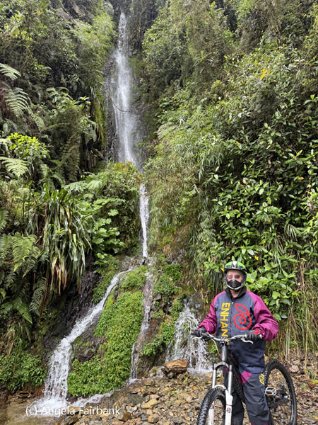 Before we realized it, we had completed the initial 20 kilometres on the paved section of death road successfully. We felt pumped and ready to take on the real death road section of 30 kilometres, according to our guide. Well things started out fine, and I was extra cautious and therefore once again slower than the others, but given the more dangerous terrain, the guide went in front with the two lads, while I was at the back, though could hear the accompanying van driving behind me, making me feel safe and protected. The first part went well, and we took several stops for photographs, finally reaching a sign where we stopped for a welcome snack around mid morning of a warm fried egg sandwich, chips, a banana, a power bar, and some coca cola. It was about here where we were told we were in the jungle and were in the section of waterfalls pouring down the cliff face. This meant we had also come into the humid section, and it was at this point when I started having difficulty because the water was not repelling from my glasses and they steamed up, so my visibility was compromised. I was also starting to feel tired due to the strain of trying to see the path and the sheer concentration required as I biked through opaque puddles and over rocks. Long story short, at one point I hit a stone the wrong way and fell off my bike, albeit slowly and fully cognizant of what was happening. Luckily, I fell on the right, protected side and not on the cliff side, now on our left. The van driver saw immediately and rushed out to see if I was OK. I got back on the bike and completed the descent to where the others had stopped but of course they had seen me fall off too. Anyway, I decided that due to my visibility issues, I would travel for a bit in the van. My bike was put on its roof, and we continued our descent through this humid section, with, I will point out, some very difficult 'technical sections' as our guide called them. My position in the front seat of the van now enabled me to appreciate the scenery, and the flora and fauna, as I saw several birds, including a possible Crested Oropendola (Psarocolius decumanus), a pair of black vultures with their grey heads, butterflies, and flowers during this section that I had previously been unable to appreciate, having had my eyes fixed firmly to the path over which I was wielding my steed. A bit further on, we found the Irish man waiting by the road with his bike. He too had fallen off due to a puncture in his back tire, but he was able to switch his bike with the spare that had been carried on top of the van in case. We noted that they had brought only one spare bike, although probably they should have brought four spares, in case all of our initial bikes had encountered difficulties. A bit further on, we found the Irish man stuck again as his chain had come off, so they gave him my bike to ride. Lower down the route, we all stopped again as now we had an opportunity to do a 500 metre zipline (for an extra fee) across the valley. We all said yes and decided to go superman style, which means we were suspended from the zipline by our backs and were flying parallel to the line as opposed to ziplining in a sitting position. I took my glasses off to do it yet was still able to appreciate the flight and the tops of the trees beneath me in their greens and purples. I then finished the death road on my bike, once the technical issues were behind us and the guide had fixed the Irishman's initial bike, and consequently managed to complete 16 of the 30 kilometres of the real death road on the mountain bike for a total of 36 kilometres out of the total of 50 km plus 500 metres of zipline.
  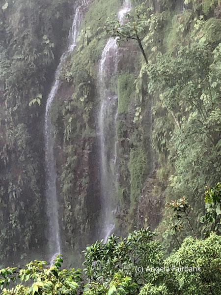 After removing our gear and enjoying a celebratory large can of beer among the three of us, as the guide and driver washed the van, the bikes, and the gear, we were then driven to a hotel with swimming pool for an included buffet lunch. At the buffet lunch, I noticed an older gentleman in a white beard, who, as part of another group, had finished the death road bike ride at the same time as we had. I noticed he was speaking English and wearing glasses, so, curious, I went up to him to ask his age and how he had done. He replied in an Irish accent that he was 74 and “By the grace of God, I managed to do the whole t'ing.” He agreed that he had also had difficulty with his glasses steaming up but had managed nonetheless ... clearly. Then none of us wanting to go for a swim, yet anxious to get back to wash the dirt off, we headed back to La Paz at 4:00 p.m., but due to the terrible traffic didn't arrive at our hotel until about 7:30 p.m. My laundry was promised back by 8:00 p.m. but didn't arrive until 8:30 p.m., also due to the terrible traffic, by which time I had had a hot shower and felt a lot better. We were flying the next day, early again, so once more I turned in early without dinner.
     Tuesday, April 15, 2025: La Paz to Sucre, Bolivia
Our early morning flight today was in two sections from La Paz, the so-called capital of Bolivia, to Sucre, the actual capital of Bolivia, according to Bolivians living in Sucre, via two flights as I suppose our group was unable to get onto the direct flight. We had to change planes in Cochabamba, the hometown of the author of my first published Spanish to English translation, the Bolivian Monograph of the Labour Law Tome of the International Encyclopaedia of Laws, published in 1993. To clarify, Wikipedia says that Bolivia has two national capitals: La Paz is the administrative capital city, as it contains the executive, legislative, and electoral branches of government, while Sucre is the constitutional capital. Sucre also contains the Casa de la Libertad, where Bolivia's Declaration of Independence was signed. I did want to comment here that my fellow G Adventurers and I were struck at how disciplined Bolivian Airlines passengers were. Instead of people standing up immediately as soon as the fasten-seatbelt sign went off (a phenomenon that is pretty standard on all other airlines I have travelled on thus far), these airline travellers sat patiently until their rows were called, from the front to the back by sections of 10 rows. Perhaps this was due to Bolivia being a socialist country(?) Arriving at the airport for Sucre, located far from the metropolis, we took a bus ride into the charming, white-washed colonial town founded in 1540 and containing a current population of about 390,000 and an area of 1,768 km2 at an elevation of 2,790 m. Arriving at probably the nicest hotel we have been booked at so far this trip, a former house, we had to wait a bit to check in and were introduced to our local tour guide, Patty, who offered us several local tours. I chose to go on the city tour today whilst shunning the dinosaur tour of tomorrow, touted as the largest fossilized dinosaur footprint site in the world, with traces of the more than 200 prehistoric species that inhabited the area: Tyrannosaurs, Carnotaurus, and Ankylosaurs. We met for lunch at a restaurant called Joy Ride Cafe, and then five of us met for the tour in English because although four of us passengers spoke Spanish, the fifth did not. However, unfortunately, the last-minute guide arranged for the tour was inexperienced, made several mistakes in her spiel and her English was not at the level it should be. She took us to a number of places, including a pedestrian area called Recoleta, a large cemetery containing incidentally flocks of white, green and yellow parrots--possibly Monk Parakeets (Myiopsitta monachus)--where she told us the motto over the front gate was Greek when it was clearly Latin (Hodie mihi, cras tibi, which translates as today is my turn, tomorrow is yours), and then to the Cultural Centre to learn about the town's liquor called Ajenjo. Next we headed to Bolivar Park and through the children's section of the park with fake dinosaur prints and a so-called (very short) replica of the Eiffel Tower, which we learned later was false information and instead was built by the commission of the Medical Institute of Sucre to fulfill the function of a meteorological observatory. Our final visit was to a church tower from where we had views over the city. A smaller group of us met for dinner at a forgotten restaurant and some of us then went over to the place where we had had lunch to join the salsa and bachata lesson and 2-for-1 cocktails, which were heavily watered down. It was an enjoyable time although clearly some of the participants were already proficient salsa dancers.       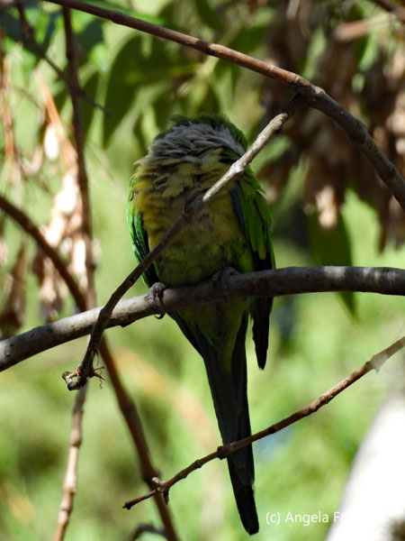      Wednesday, April 16, 2025: Sucre, Bolivia
To compensate for the inexperienced tour guide yesterday, Patty offered to take us on a different tour for photography, which started at a street where it was rumoured that the offspring of nuns and priests had been buried and which was haunted so that even nightshift police officers were loath to walk down it at night. How true the story is doubtful; one of us on the tour was a doctor and she argued that the bones that could be seen in a cross on the ground every 30 steps were not the bones of human children. The others left at this point, and I remained with Patty to visit the market and photograph to my heart's content as long as people didn't mind of course. Most of the vendors here were once again women, and I was intrigued to see two children sitting with their mothers in their respective stalls doing their school homework. It was a Wednesday morning, so I asked myself why they weren't in school. Arriving at a large church, with a view over the city, she apologized for the middle-aged man urinating into the flowers in the square beside it and then took us inside to show us a scale model of said church. For a laugh, I pointed out that in the scale model they had forgotten to include the urinating man.       Patty then stayed with me while I visited a few souvenir shops near by. She pointed out to me all seven or so shops with souvenirs in the area and I ended up visiting all of them and bought one or two things. Arriving at the assigned restaurant too late for lunch, I instead turned up at the Casa de la Libertador, as arranged, to learn about the history of Bolivia and this time had an excellent guide in Henry, who had arrived after delivering the others to the hotel after their tour to the dinosaur park. He gave us an excellent idea of the history of Bolivia and the men and women involved. I took photos of course and two here are of a painting and a wooden bust of Simon Bolivar, after whom Bolivia was named, despite his being a Venezuelan. Wikipedia describes him thusly: “Simón José Antonio de la Santísima Trinidad Bolívar Palacios Ponte y Blanco was a Venezuelan statesman and military officer, who led what are currently the countries of Colombia, Venezuela, Ecuador, Peru, Panama, and Bolivia to independence from the Spanish Empire.” Pretty impressive name and CV, huh?
      We then all met for cocktails [and dinner for some of us] at the rooftop bar, Terraza 625, inside one of the top hotels in town, and watched an unimpressive sunset due to it being too cloudy. Afterwards, we headed over to the main cathedral for a free early-music concert of what was called 'rescued' 16th century music from Spanish colonial times. The musicians were four singers and three instrumentalists playing viol, drum, and mandolin. Some of the pieces sounded very much the same but the ones that stood out were the more energetic ones, which reminded me of music from Missa Criolla by Ariel Ramirez, although of course that is with full choir and not merely soloists and is by a modern Argentinian. What I mean is that I was unused to hearing 16th century music contain a percussion instrument. It might be added here that the music was not to everybody's taste among our passengers, and I was the last of our group to leave the cathedral together with Patty after about an hour.
        Thursday, April 17, 2025: Sucre to Potosí, Bolivia
This morning we drove by private bus about three hours from Sucre to Potosí, where its Cerro Rico (Rich Hill) is the world's largest silver deposit and has been mined since the sixteenth century, producing up to 60,000 tonnes by 1996. My 2024 Rough Guide to South America states that it is the highest city in the world at 4,090m (13,420 ft) above sea level. Founded in 1545 as a mining town, it soon produced fabulous wealth, and the population eventually exceeded 200,000 people. The city gave rise to a Spanish expression, still in use: valer un Potosí = to be worth a Potosí, meaning to be of great value. Cerro Rico produced an estimated 60% of all silver mined in the world during the second half of the 16th century. Unfortunately, this was not without sacrifice. Wikipedia tells us that “Indigenous labourers were required to work in Potosí's silver mines through the Spanish mita system of forced labour, based on a [traditional system in] pre-Hispanic Andean society...Labourers were drawn from the native population of an area that encompassed almost 200,000 square miles. Thirteen thousand men were conscripted each year, constituting about one out of every seven adult males in the Indigenous population. These men faced harsh conditions in the mines, where they were often given the least desirable jobs. While more skilled laborers extracted the ore, mitayos were tasked with carrying it back to the surface in baskets, leather bags, or cloth sacks. These loads often weighed between 100 and 300 lbs, and workers had to carry them up rickety ladders in steep, narrow shafts, lit only by a candle tied to their foreheads. Many of them died or were seriously injured due to falls, accidents, and the harsh conditions of ... mine life. Illness was another danger: at such a high altitude, pneumonia was always a concern, especially given the extreme and rapid changes of temperature experienced by workers climbing from the heat of the deep shafts to the freezing elements of the surface at 16,000 feet, and mercury poisoning took the lives of many involved in the refining process.”    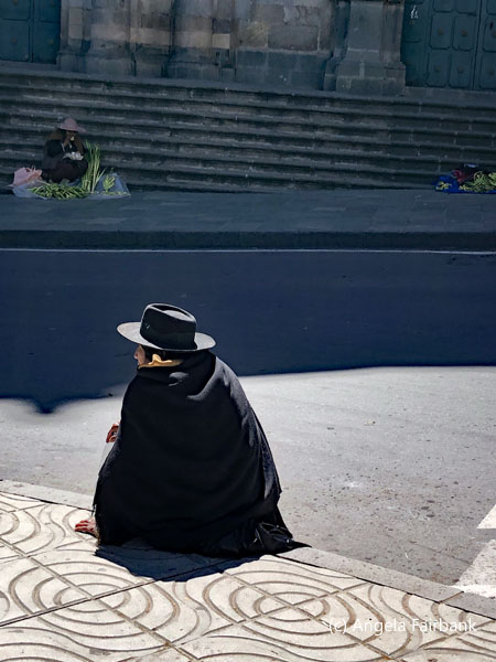   Arriving in this town around noon we went for lunch downhill from the main square after checking into our hotel. Here, I tried the local beer called Potosina and had a nice vegetarian omelette. Service was slow as the restaurant wasn't used to serving such a large group. Nevertheless, we all got back to the bus to take us to the tour guide, who was to give us a tour of the mine. We changed into mining gear: waterproof pants, an orange waterproof jacket, a helmet complete with headlamp, and an ordinary face mask such as used during COVID times to guard against the many poisons in the mine, including silicosis. After we were finished getting dressed, our bus took us to the market where we bought things like coca leaves and ethyl alcohol to give to the miners, and some type of cereal treats to feed to the dogs and children! Apparently, they appreciated such gifts from tourists. We then bussed up to the mine itself. Well, given the fact that it was Maundy Thursday and therefore a religious holiday, it appeared that the guardians of each mine pit were not around, although there were plenty of dogs, including this cute puppy, to welcome us and our treats. We finally found one woman and child in charge of one mine entrance and after handing over our gifts, we were granted the right to enter. As we stood in front of the low, narrow hole we had duck down to enter, two real miners emerged after a 16-hour shift and were certainly glad of the coca leaves, although I'm not sure who got the ethyl alcohol I had bought. After their emergence, we entered, our headlights and masks on, and it was difficult for some of us to breathe. We stopped in a couple of places where our guide pointed out veins of tin, silver, lead, and zinc, etc. and showed us other holes down which miners went to mine. Finally, we reached a sort of cave at the end of which sat a figure called el Tío, which we were told is a deity of the mountain itself. Labourers within the mines offer it coca leaves and alcohol to protect them from the dangerous conditions. Our guide lit a cigarette and put it between the lips of this deity, whose head was surrounded by coloured strings of paper. To my mind, this el Tío at least looked a lot like Paddington Bear, but that's just my own humble opinion.
      Finally, on our way back to the mine entrance, in a particularly dark area, we were all asked to turn off our headlamps and to hold hands. It was true, we could see nothing and were glad we were holding onto our fellow passengers to keep upright. We couldn't even see our hands in front of our faces. It was a sobering moment. I was told, when I asked, that minors (i.e. teenagers under the age of 18) do work at Potosí's Cerro Rico, but they are usually only used as messengers. I was also told that women also work at the mines, not as miners, which is a male dominated sector, but in ore selection, sieving, and milling. They might also be employed as guards at tunnel entrances. Another article I read says that eight million Andean Indians died while mining in Cerro Rico in service to the Spanish Crown. Even today, two miners every week of die of silicosis in Potosí, and this is apart from deaths due to other mining-related illnesses and accidents.
  Friday, April 18, 2025: Potosi to Uyuni, Bolivia
As today is Good Friday and an official holiday in Bolivia, the driver asked if he could transport his family (consisting of a young wife and four daughters ranging from ages six to sixteen) in the bus with us. No one objected and I was privileged to be sitting in the seat across from them so got to talk with the mother in Spanish and tried speaking English to the two older daughters, who told me they were learning it in high school. The third daughter, who was eight, was still in primary school and had also been introduced to English, but so far only knew the alphabet, numbers, and simple phrases. However, the older girls were not used to practicing it outside of the classroom, so I wasn't able to get much out of them. The mother told me they were traveling to their second home in the countryside and that all four daughters were going to private schools. I guess this means a bus driver can earn a good wage, though she confirmed when I asked that her husband was frequently away working, although he only transported people inside Bolivia and not across its borders. She also confirmed that the Bolivian government subsidizes water, gas, and electricity and although health care is free if they want to get an appointment right away it is better to go private. We dropped off the driver's family about an hour into our drive and carried on to Uyuni arriving around noon and checking into our hotel. We were then suggested a few places for lunch, but they were a long walk away in a bare town, which, to my mind, only exists because of the Salt Flats. I lost the group at one point and ended up at a grocery store, which only sold snacks and frozen food, so I ended up buying empty calories and taking them back to my hotel room to consume.    The Salar de Uyuni, 3,656 meters (11,995 feet) above sea level and covering some 10,582 square kilometres (4,086 sq mi) of the Altiplano west of the city, is by far the largest salt lake in the world. Our afternoon tour was advertised as a photoshoot under the responsibility of a sole photographer and one assistant. Thirteen of us had signed up for it and Edwar came too, so we were fourteen models. It was intriguing the way they organized things. None of us, apart from Edwar, had been to the Salt Flats before, so we didn't really know what to expect. It was a bit of a way out of town to reach the salt flats, and we were provided with boots as part of the photoshoot package. At one point, our four jeeps stopped, we were told to don our boots and get back into the 4 x 4s. Then we were handed black face masks and requested to put them over our eyes because we would be given a surprise. We then drove over what seemed to me like bumpy terrain for a few minutes until the jeeps finally stopped, our doors were opened, and we were led out into the water, which came up to about 3 inches up our boots, to line up facing the photographer. Finally, we were told to remove our masks, and she photographed our surprise at seeing practically no horizon except for what was delineated by distant islands, which appeared in mirror image. It was quite spectacular and nothing like anything I had seen before.
   She then began the photoshoot of each model in turn. I was second and chose to model with some of the props she had brought - a gold cape and then a purple fan with fabric extending from it. I never did find out the name of the photographer, otherwise I would have acknowledged her here, but due to the fact that I paid for the photoshoot and she has not affixed her copyright, I figure the copyright is mine as I also improved them. After the photographer had finished with all 14 of us, it was sunset and her assistant and the drivers had set up a long table with chairs and served red wine and snacks such as nuts, raisons, grapes, cheese, and processed meats for us to nibble on as we watched the sun set into orange and then black. After the sun had gone down, the photographer started on a second series of photos featuring the stars and the milky way, though I personally don't think they are as successful. The stars are clear but as she only shone a light source very briefly on the models, they are faint. Apparently, she held the shutter open for 29 seconds for these images.
      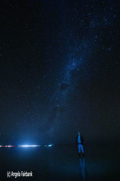 Saturday, April 19, 2025: Uyuni to Jukil Community Lodge, Santiago de Agencia, Bolivia
Today was the beginning of a three-day overland tour via four 4 x 4s through the southern Bolivian desert. I and three other passengers were in the lead car with our driver, Hernán, a thirty-year old with two young daughters, who'd be doing this for two years. At one point, I was a little wary of his driving as his eyes seemed to be wondering and he was chewing on something. When I asked if it was coca leaves, he said no, just gum, and as for his wandering eyes, well, I realized that as lead driver he was constantly checking his mirrors to make sure the other three vehicles were with him. For a lot of the track today, we were on an unpaved two-way route, and we could tell when vehicles were coming towards us from the dust blowing out from the contact of the tires with the dusty road. In fact, the dust was so bad, three of us caught colds. But I digress because our adventure started by returning to the salt flats this morning, not blindfolded this time. The water where the vehicles parked was quite muddy this morning, so it was not as dazzling an effect as it had been yesterday. They also took photos for us, but these were centred on those amusing photos you see where with the white of the salt flats and by positioning people just right, it looked like the people positioned further back were miniature versions of themselves. Unfortunately, due to all the photos on my phone, it was refusing to allow me to add any more, so any photos I took or was involved in were taken on the phones of other passengers, which they graciously shared on our WhatsApp group. The drivers also took some funny videos of us, which I will not display here but which involved a 360-degree of us in a line posing, and another of us jumping out of a Pringles chips can, dancing, and then running back inside it.  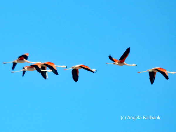                   Sunday, April 20, 2025: Jukil Community Lodge, Santiago de Agencia to Laguna Colorado, Juntacha, Bolivia
Today's journey was, for me, all about nature and wildlife. Retracing part of the way we had come last night around the salt flats, we saw copious fields of white, red, and black quinoa, and photographed torch cactuses (Trichocereus bridgesii), or perhaps they were San Pedro cactuses (Echinopsis pachanoi or Trichocereus pachanoi), wild vicuñas (Vicugna vicugna), farmed (and branded) llamas, snow-capped mountains, volcanos, flamingos (Phoenicopterus andinus) in lagoons, an Andean fox (Lycalopex culpaeus), chinchillas (Abrocoma boliviensis) on rocks, and a number of unidentifiable birds, in addition to a variety of browns on the desert sand and in the mountains. We finally arrived at our hostel for the night, located in a bleak and cold area, where we had to pay for wifi, and once more I shared a room with the Scottish woman. My cold (or was it a dust allergy?) wasn't getting any better and I wore a mask for most of the day. At the place where I photographed the vicuñas, one of the jeeps punctured a tire so we had a rest stop while our driver went back to help change it for a new one.    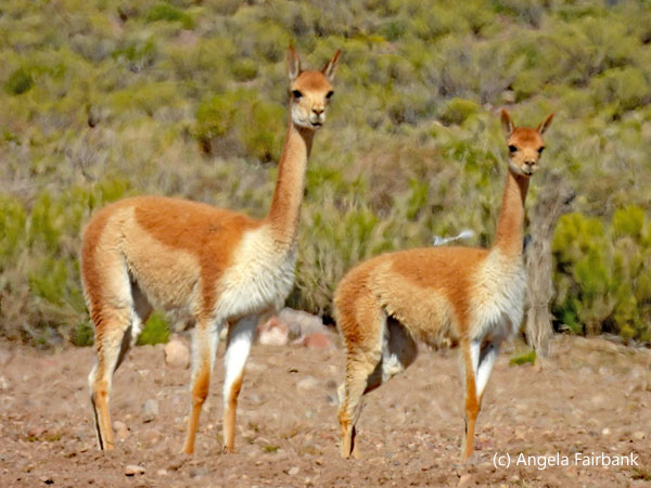       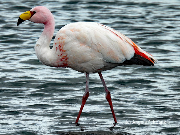 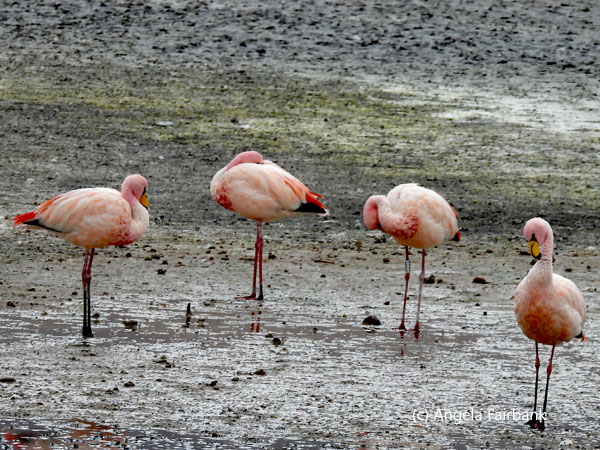 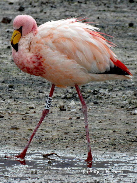     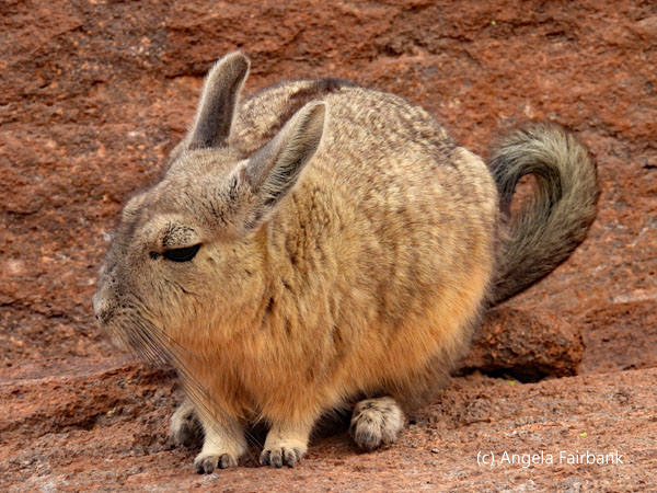    Monday, April 21, 2025: Laguna Colorado, Juntacha, Bolivia to San Pedro de Atacama, Chile
Today's crossing of the desert including geysers, more coloured mountains, a variety of gulls on lagoons, one of which contained hot springs, and then it began to snow, (perhaps around the time Pope Francis died) and worried that the snow would get too thick and that we might not be able to cross the border, which was our ultimate goal today, we drove through Salvador Dali desert at 4,750 meters above sea level, where it was snowing so hard that visibility was practically zero. We made it to the border with Chile and had our lunch there but then there was a long wait to leave Bolivia, because apparently, despite signs to the contrary, the officials were asking Edwar for a bribe to expedite our exit stamps, which he refused to do as it was not the policy of G Adventures. Two other groups - one from Thailand and another from Quebec - were not so ethical and got rushed through before us, even though we had arrived at the border before them. Finally through, we said good-bye to our 4 x 4 drivers and entered a Chilean bus with a local guide which then drove us to San Pedro de Atacama in Chile's Atacama Desert. However, we were held up again at the Chilean customs and immigration under similar circumstances and similar consequences. Through at last, we were delivered to our hotel on the main street, assigned rooms on our own again, and met for dinner at a restaurant called La Casona, which provided Bossa Nova musical accompaniment by a guitarist and singer.           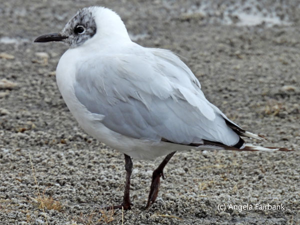           Tuesday, April 22, 2025: San Pedro de Atacama, Chile
After a plethora of early mornings, we finally had nothing pressing, so were able to have a lie in until 9:00 at which time some of us agreed to meet and walk over to a French café, called La Franchuteria, where we ordered large croissants, pains au chocolat and baguette sandwiches as well as fresh juices and various types of coffees and hot chocolate among us; to my mind at least, the best breakfast we've had all trip. I enjoyed it so much, I vowed to come back for lunch and dinner. As it was, I never made it to lunch, but we went to its other location on the main street for dinner, where the menu was very different, and where I ordered sole on a bed of spinach and risotto, which was accompanied by a Chilean wine.    Between these two meals, I explored this town in the middle of the desert. It is described in my Rough Guide as “a little oasis town of single-story adobe houses and unpaved streets, situated 100km southeast of Calama, the nearest city... One of the oldest settlements in Chile, San Pedro was originally a stop on a pre-Columbian trade route between the highland and coastal communities; in 1547, the Spanish established their first mission here and subjugated the locals. The town later became an important rest stop for cattle drives from Salta, Argentina, when the nitrate industry took off in Chile and fresh meat was needed for workers.”
  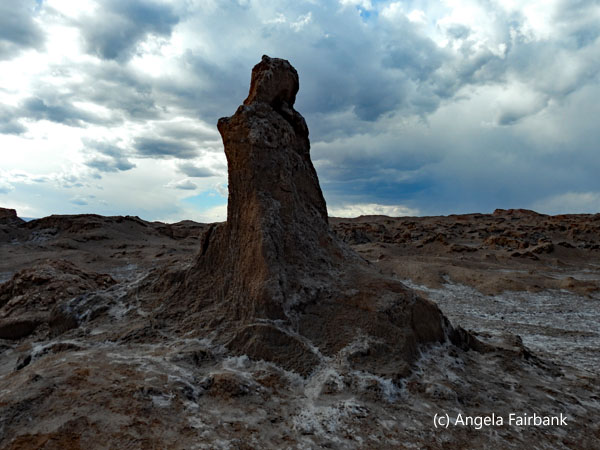 I dutifully visited all the many souvenir shops finding this painting of flamingos in one shop. It was over my budget, but the shop owner allowed me to photograph it instead. In the afternoon, we were offered a tour to the Valle de la Muerte (valley of death) and the Valle de la Luna (valley of the moon), both of which I found underwhelming. We were also supposed to watch the sunset here, but unfortunately it came on to rain, as well as thunder and lightening. (Snow yesterday and rain in the desert today. Oh, ye deniers of climate change, what more proof do you need?) Despite the rain, the local tour guide who was with us produced Chilean Pisco sours for us and snacks such as olives, rice cakes, cream cheese, smoked salmon, and crackers. In light of the dismal weather, we decided not to wait for the disappointment of a non-existent sunset and returned to our hotel so as to eat dinner at La Franchuteria, as mentioned above.
      Wednesday, April 23, 2025: San Pedro de Atacama to Santiago, Chile
We had yet another early start, arising just before sunrise so as to take a hired bus to the airport an hour or so away in Calama. Our 9:00 a.m. flight got us into Santiago, the capital of Chile, around noon and it was a forty-minute hired bus ride into Santiago proper and to our Ibis budget hotel in the Providencia section of town. Our rooms weren't ready until 3:00 p.m., so we left our bags in the hotel storage room and walked down the street to find a sandwich restaurant. The servings were copious, so I took some of it back to my room in a box but then never did have a chance to eat it. After dealing with a number of emails, I met the others for our last group dinner at 7:00 p.m. at a Peruvian restaurant called Barandiaran, which had a lovely display of paintings by a Peruvian artist named Amenero. I contemplated buying a painting or two but on second thought realized they would be too large for my suitcase, so I just had to admire them instead. I never got around to asking about prices. I then joined a couple of my male travel companions for a last beer in the hotel bar just as it was closing. Thursday, April 24, 2025: Santiago, Chile Today was purely a working day so that I could catch up with processing my photos for the last eight days. From 12:00 to 3:00 p.m. I had to vacate my hotel room and work in the bar in the lobby as there is some internal rule that does not allow guests in their rooms between those times as they are cleaned and then reassigned to guests at the end of one reservation and the beginning of another. It is a rather annoying rule as it meant that for those three hours, I was working in not-so-quiet conditions with the occasional waft of cigarette smoke across my nostrils coming from somewhere. I also answered emails and contracted some work for next week. I then had a sandwich in the hotel bar as my dinner. Friday, April 25 - 27, 2025: Santiago, Chile to Vancouver, B.C. Canada via Bogota, Colombia and Montreal, Quebec After repacking my bags and working an hour or so on my travelogue, I checked out of my room before noon and a Canadian man from our group on a tour to Valparaiso for the day leant me his room so I could continue to work on my travelogue in peace and in a smoke-free environment. In the evening after his return from his tour, I took him out to dinner to thank him at the Peruvian restaurant where we'd had our final group dinner two evenings ago. The artist of the paintings I had admired was at the restaurant and hearing I had asked about his work two evenings ago came up to me to ask which one or ones I was interested in. He said they were all the same size: 60mcm by 80cm, which was still too large for my backpack even if he had rolled them up into a tube, which I would have had to go out and buy somewhere else. The price he quoted was too high for my budget too. After dinner, I brought my bags down to the lobby and the taxi driver was there to deliver me to the airport. We chatted in Spanish during the 20-minute ride, and he told me his version of the Pinochet years, which was different from what I'd been taught. Arriving a bit too early to check into my flight, I waited for a bit and then like previous journeys on this site, I will not bore you with my return journey, which was quite uneventful, via Bogota, Colombia and then on to Montreal, where I overnighted, and back to Vancouver, arriving in the mid morning of Sunday April 27, 2025. |
All rights reserved. Website © Angela Fairbank 2005-2026.
|